LiDAR as a tool for estimating seabird flight heights Aonghais Cook - - PowerPoint PPT Presentation

lidar as a tool for estimating seabird flight heights
SMART_READER_LITE
LIVE PREVIEW

LiDAR as a tool for estimating seabird flight heights Aonghais Cook - - PowerPoint PPT Presentation

LiDAR as a tool for estimating seabird flight heights Aonghais Cook 1 , Robin Ward 2 , William Sandvej Hansen 3 , Laurids Rolighed Larsen 3 , Tom Evans 4 1 BTO, 2 NIRAS Consulting UK , 3 NIRAS Consulting Denmark, 4 Marine Scotland Science 29 TH


slide-1
SLIDE 1

LiDAR as a tool for estimating seabird flight heights

Aonghais Cook1, Robin Ward2, William Sandvej Hansen3, Laurids Rolighed Larsen3, Tom Evans4

1BTO, 2NIRAS Consulting UK , 3NIRAS Consulting Denmark, 4Marine

Scotland Science

29TH SEPTEMBER 2019

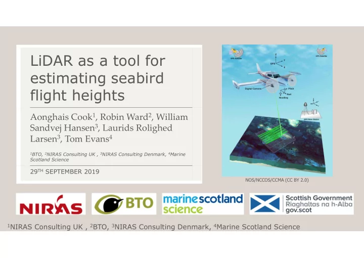
NOS/NCCOS/CCMA (CC BY 2.0) 1NIRAS Consulting UK , 2BTO, 3NIRAS Consulting Denmark, 4Marine Scotland Science

slide-2
SLIDE 2

Seabird flight heights

2

Ross-Smith et al. 2014 Johnston & Cook 2016 Johnston et al. 2014

  • Understanding height at which seabirds fly key part of assessing collision risk
  • Can be assessed using boat/digital aerial surveys, or GPS tags
  • Significant uncertainty surrounding estimates from these platforms
  • Patterns vary in both space & time

Digital aerial survey GPS BOAT

slide-3
SLIDE 3

LiDAR

3

  • Light Detection and Ranging (light based

Radar)

  • Very precise measurements
  • Widely used tool for ecology
  • Habitat mapping
  • Airborne insects
  • Aerial obstructions to aircraft
  • Can we use it to measure the heights of

seabirds in flight?

  • Validation
  • Field based survey

Photo by Andrew Ngeow, courtesy of Oregon State University (CC BY-SA 2.0) NOS/NCCOS/CCMA (CC BY 2.0)

slide-4
SLIDE 4

Validation

4

  • Key question – can LiDAR accurately

measure heights of moving objects?

  • 3 Drones flown at known heights
  • Drones detected on every flight
  • LiDAR flight height estimates

compared to those obtained using drones onboard GPS & photogrammetry techniques

  • All estimates within 1 m, minimum

difference 17 cm

slide-5
SLIDE 5

Surveys

5

  • Aim for minimum 100 birds per

species

  • 300 m above sea-level & speed of 240

km/h

  • LiDAR point density 11 points / m2
  • Camera GSD 3.5 cm
  • Surveys 20th & 22nd September 2017
  • N-S transects covered once each, E-W

transects 3 times each

slide-6
SLIDE 6

Image processing

6

  • Height of every point in the LiDAR cloud measured in relation to European

Terrestrial Reference System 89

  • Sea surface clutter meant it was necessary to filter out points <1-2 m above sea

level, potential for +ve bias to mean flight height estimates

  • Points above 2 m identified as birds
  • Height estimates independent of

height of aircraft

slide-7
SLIDE 7

Image processing

7

Points matched to photograph & passed to ornithologist for ID Speed of aircraft meant each set of points referred to a single bird

slide-8
SLIDE 8

Species detected

8

  • Over 2,200 birds identified
  • Most common gannets (377) &

kittiwakes (806)

  • Also, large gulls, auks, terns &

great skua

  • Issue with vibration in camera

images (not sufficiently secured?) meant identifying gulls difficult

slide-9
SLIDE 9

Flight heights

9

  • Potential for birds flying at higher altitudes not to be detected when further

from transect line

  • Limit analyses to birds within 125 m of transect line
slide-10
SLIDE 10

Comparing flight height distributions

10

Kittiwake Gannet

  • LiDAR – this

study

  • Digital Aerial

– Johnston et

  • al. 2014, J.

Applied Ecology 51:31-41

  • Boat –

Johnston and Cook 2016, BTO Research Report No. 676

slide-11
SLIDE 11

Spatial distribution of flight heights

11

Collision risk height Below CRH

slide-12
SLIDE 12

Spatial distribution of flight heights

12

Gannet Kittiwake

slide-13
SLIDE 13

Combining distribution and flight height

Gannet Kittiwake Unidentified gulls Bird density Flight height Flight height with bird density

  • verlaid
slide-14
SLIDE 14

Conclusion

14

  • LiDAR is an accurate & precise method for measuring seabird flight

heights

  • Sea clutter means data must be filtered – can detect birds > 2 m or

lower depending on conditions – may be possible to refine this

  • More important for auks etc. than gulls
  • Still precautionary (% birds at CRH will be overestimated)
  • Can use data to produce continuous flight height distributions
  • Can also look at spatial patterns in bird flight heights
slide-15
SLIDE 15

Thanks!

15

  • Thanks to Helica S. R. L. for supplying LiDAR equipment & Fugro for advice
  • Thanks to Airtask Group for carrying out surveys
  • BTO & NIRAS colleagues for support & advice on this project

Funding:

slide-16
SLIDE 16

Estimating Seabird Flight Height Using LiDAR

Cook, A.S.C.P., Ward, R.M., Hansen, W.S. and Larsen, L. (2018) Scottish Marine and Freshwater Science Vol 9 no 14

16

https://data.marine.gov.scot/dataset/ estimating-seabird-flight-height- using-lidar