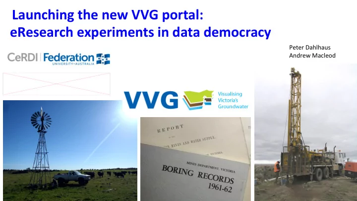
SLIDE 1 Launching the new VVG portal: eResearch experiments in data democracy
Peter Dahlhaus Andrew Macleod
SLIDE 2 A collaboration of 17 partner organisations
An interoperative spatial information portal that federates groundwater data from disparate sources. Primarily for research and investigation. Non-government portal (unique?).
July 2011 granted a Broadband Enabled Innovation Program $320k BEIP cash + $160k partner cash + $1.745M in-kind Soft launch June 2012
SLIDE 3
Depth to watertable www.vvg.org.au Federates around 80 groundwater data sets from 8 custodians. Some data are real-time, some are scheduled updates, some are linked data
SLIDE 4
Bore parameters Information on over 400,000 bores accessed from the source databases
SLIDE 5
Predicted depth to watertable and groundwater quality
SLIDE 6
3d model of aquifers
SLIDE 7
EPA audit sites, GQRUZ sites and priority sites
SLIDE 8
Primary impact
Analytics
The VVG portal is frequently used by a wide cross-section of society
SLIDE 9
Practice impact
The portal has changed the way people find groundwater data
SLIDE 10
The provision of multiple groundwater datasets from disparate sources within a single internet portal has changed practices in the Victorian groundwater industry.
Sector impact
Journal of Hydroinformatics: 18/2 March 2016 (open access)
SLIDE 11
www.cerdi.edu.au
The VVG has spawned around 30 spatial data portals
SLIDE 12
SLIDE 13
Full interoperability requires adopting common: systems - communication protocols (e.g. for web services); syntax - representation language (e.g. Extensible Markup Language (XML), JavaScript Object Notation (JSON) or others); structure - data schema (e.g. GWML1); semantics - content vocabulary (e.g. for water quality parameters); and pragmatics - best practices in the collection and use of the data
Data interoperability
SLIDE 14 14
http://external.opengis.org/twiki_public/HydrologyDWG/GroundwaterInteroperabilityExperiment2
Groundwater Interoperability Experiment 2 (GW2IE)
Open Geospatial Consortium: an international consortium of companies, government agencies and universities that develops publically available international spatial data standards for data interoperability. OGC(R) standards are technical documents that detail interfaces or encodings used by software developers.
SLIDE 15 Aims:
- Develop an international groundwater information model
- Develop a GML application schema, for groundwater data
- Harmonize existing models (GWML, INSPIRE)
Regions: North America Europe Australasia
GWML2 interoperability experiment
5 years, 57 meetings
SLIDE 16
Agreed entities Conceptual Schema Logical Schema Physical Schema Use Cases
GWML2 interoperability experiment
SLIDE 17 Entities: HydrogeoUnits, Voids, Fluid Bodies
GW_Basin GW_ManagementArea Unconfined aquifer Confining bed Confined aquifer Bedrock aquifer GW_Aquifer GW_Aquifer Aquifer Confining bed GW_ConfiningBed Wellfield Well Groundwater filling the pore space GW_FluidBody GW_HydrogeoVoid GW_AquiferUnit GW_MonitoringSite Fractured rock aquifer Particulate rock aquifer G W _ C
f i n i n g B e d GW_Aquifer Observation well GW_ChemicalConstituent GW_MaterialConstituent GW_BiologicConstituent Solutes, suspended solids, and organisms in groundwater Groundwater basin GW_AquiferSystem
SLIDE 18 Entities: Flow, Well
GW_Spring GW_Divide GW_IntraFlow GW_InterFlow Land surface GW_Aquifer GW_ConfiningBed GW_BodySurface GW_FlowSystem GW_Well Confining bed Confined aquifer Bedrock aquifer GW_Discharge Pumping well Unconfined aquifer GW_FlowSystem GW_FlowSystem Vadose zone Groundwater basin GW_Flow f l
Ground water Watertable GW_Recharge GW_Discharge
SLIDE 19 simplified UML representation of the GWML2 conceptual schema. Colours denote distinct packages within the logical schema
SLIDE 20
International data interoperability standards
OGC WaterML 2: Part 4 – GroundWaterML 2 (GWML2)
Is maintained by a Groundwater Standards Working Group
Google OGC GW SWG to find it!
SLIDE 21 So what constitutes groundwater data?
Geology Lithology Stratigraphy Hydrostratigraphy Aquifers Aquifer parameters Geomorphology Terrain Landscape Environmental History Land use Soils Salinity Bore construction Extraction Water levels Storage Discharge Springs GDEs Baseflow River flows Lake levels Climate Rainfall Runoff Infiltration Recharge Flow systems Chemistry Age (dating) Management Beneficial uses Licences Contamination Geophysics Hydrobiology Phreatophytes Stygofauna Microbiology Risk
SLIDE 22 But what about the qualitative data?
Data often overlooked by scientists (hydrogeologists), but it can be critically important.
Examples include observations about landscape features, soil colours, vegetation types, seeps, springs, wetland ecosystems, and anecdotal information from long-term occupiers of the land.
Redoximorphic features in saprolite, Dundas Tableland, Vic
SLIDE 23 Original data sources are valuable
Archival boring records are particularly important sources
SLIDE 24 1970 1990 2010 2020
Data volumes
Trends in data custodianship
Does not include social data
SLIDE 25
Data Dictatorship: Data is controlled and its use restricted. Distribution of data is based on perceived necessity. Data Aristocracy: Data analysts and scientists are required to provide meaning, and they have the power. Data Anarchy: Users feel underserved and create their own datasets from available sources. Data sharing is ad-hoc. Data Democracy: Everybody gets timey and equitable access to data. Users are empowered and they often own some of the data.
DATA REGIMES
SLIDE 26 Antle, J.M., Basso, B., Conant, R.T., Godfray, H.C.J., Jones, J.W., Herrero, M., Howitt, R.E., Keating, B.A., Munoz-Carpena, R., Rosenzweig, C., Tittonell, P. and Wheeler, T.R. (2017). Towards a new generation of agricultural system data, models and knowledge products: Design and
- improvement. Agricultural Systems. DOI:http://dx.doi.org/10.1016/j.agsy.2016.10.002.
SLIDE 27
Data Democracy can interoperably federate: ✓ Public and private data ✓ Big data, sensors, internet of things ✓ Legacy data ✓ Crowdsourced data To answer the frequently asked hydrogeological questions To dynamically generate conceptual and predictive models To make new discoveries and avoid repeating past mistakes To reduce time wasted in litigious conflicts
SLIDE 28
beta.vvg.org.au