Lakewood Southeast Project Lakewood/Laona Ranger District - - PowerPoint PPT Presentation
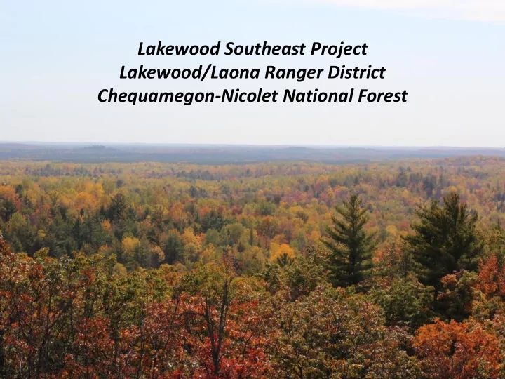
Lakewood Southeast Project Lakewood/Laona Ranger District Chequamegon-Nicolet National Forest Northeast Sands Ecological Landscape * Large sand outwash plains and outwash heads * Synonymous with Athelstane Outwash and Moraines Ecological
Northeast Sands Ecological Landscape*
Large sand outwash plains and outwash heads
* Synonymous with Athelstane Outwash and Moraines Ecological Subsection
Lakewood Southeast Project Area = Butler Plains Land Type Association
(Glacial Lake Oconto)
Waupee Barrens
Lakewood Southeast Project Area
- 46,000 acres gross acres
- 37,000 acres National Forest lands
- 27,000 acres upland NF lands suitable for timber harvest/active management
- Forest Plan Management Area 4 – Pine Emphasis
- 95% upland composition in 6 types (highlighted below).
26% 3% 1% 7% 33% 16% 7% 6% 1%
Lakewood Southeast Area-wide Upland Composition
Aspen Balsam Fir Paper Birch Jack Pine Red Pine/White Pine Northern Hardwoods Oak Permanent Openings Other
Area-wide Composition
Uplands Acres % Upland Aspen 6,987 25.7% Balsam Fir 819 3.0% Paper Birch 179 0.7% Jack Pine 1,928 7.1% Red Pine/White Pine 8,949 32.9% Northern Hardwoods 4,237 15.6% Oak 2,027 7.5% Permanent Openings 1,774 6.5% Other 284 1.0% Subtotal 27,183 100.0%
Excerpt of 1853 Public Land Survey System Notes
Fire Scar Research
Principal Researchers Mike Stambaugh and Rich Guyette, University of Missouri Tree Ring Laboratory Funded by the Joint Fire Science Program and the USFS Northern Research Station 3 study areas in/around project area 2009-2011
Fire Scar Research Findings
- Fire History from 1650 - 2010
- Fires occurred 1655-1948
Major early fire years
- 1664, 1756, 1774, 1780, 1794, 1805, 1820
Major fire years in common with other sites
- 1664, 1756, 1780
- Mean fire interval and range
- Pre-Euro-American period (1655 to 1855): 20.0 years (5 to 54 years)
- Depopulated period (1655 to 1756): 34.7 years (9 to 54 years)
- Native American period (1756-1855): 14.1 years (6 to 18 years)
- Euro Agriculture period (1855 to 1948): 7.7 years
- All periods excluding fire suppression: 13.3 (2-54 years)
- Burns about evenly split between early and late-season periods
http://dnr.wi.gov/files/PDF/pubs/lf/LF0040nesands.pdf
Wisconsin DNR Land Legacy Report (2006)
Pine barrens covered 2.3 million acres – or 7%- of Wisconsin’s presettlement landscape. Currently, about 16,000 acres – or 0.05% of our landscape. Pine barrens are described by Natural Heritage Inventory as: S2 (State Imperiled) = Imperiled in Wisconsin due to a restricted range, few populations or occurrences, steep declines, severe threats, or other factors. G2 (Globally Imperiled) = At high risk of extinction or elimination due to restricted range, few populations or
- ccurrences, steep declines, severe threats, or other
factors.
Pine Barrens
Natural Heritage Inventory designations:
- S3 (State Vulnerable) = Vulnerable in Wisconsin due to a fairly restricted range,
relatively few populations or occurrences, recent and widespread declines, threats,
- r other factors.
- G3 (Globally Vulnerable) = At moderate risk of extinction or elimination due to a
fairly restricted range, relatively few populations or occurrences, recent and widespread declines, threats, or other factors.
Northern Dry Forests
- Typified by xeric sites.
- Red pine, jack pine (white pine)-dominated.
- Relatively open conditions maintained by fire.
- Large areas cut and burned during Pine Logging Era.
- Many former sites were converted to aspen and
scrub oak.
- Many former sites were reforested as red pine
plantations.
- Fire exclusion has resulted in mesification.
- Considered a major restoration opportunity by Wisconsin DNR Bureau of
Endangered Resources.
Natural Heritage Inventory designations:
- S3 (State Vulnerable) = Vulnerable in Wisconsin due to a fairly restricted range,
relatively few populations or occurrences, recent and widespread declines, threats,
- r other factors.
- G4 (Globally, Apparently Secure) = At fairly low risk of extinction or elimination due
to an extensive range and/or many populations or occurrences, but with possible cause for some concern as a result of local recent declines, threats, or other factors.
Northern Dry – Mesic Forests
- Typified by xeric-mesic sites, often on with outwash
heads and glacial mixes.
- Red pine, white pine-dominated.
- Highly variable conditions maintained by periodic wind
and fire.
- Large areas cut and burned during Pine Logging Era.
- Many former sites were converted to aspen, oak, and
red maple.
- Many former sites were reforested as red pine
plantations.
- Considered a major restoration opportunity by Wisconsin DNR Bureau of
Endangered Resources.
Wildland Urban Interface
Planning
Necedah National Wildlife Refuge - USFWS
Quincy Bluff SNA – The Nature Conservancy
Quincy Bluff SNA – Wisconsin DNR
Spread Eagle Barrens SNA – Wisconsin DNR
Moquah Barrens – USFS
Purpose and Need for Action
- 1. Move upland forest composition closer to desired conditions.
- Increase pines, decrease aspen.
- 2. Move age class distributions closer to desired conditions.
- Increase young, decrease old in most types.
- 3. Improve conditions in stream management zones.
- Encourage long-lived and shade-producing species.
- 4. Increase within-stand species diversity.
- Introduce white pine component in oak, red pine stands.
- 5. Improve stocking levels.
- 6. Restore Northern Dry (Mesic) Forests and Barrens habitats.
- 7. Improve habitat conditions for selected wildlife species.
- e.g., wood turtle, red-shouldered hawks.
- 8. Reduce hazardous fuels in wildland-urban interface.
- 9. Manage transportation system.
- New construction/reconstruction in some areas,
closures/decommissioning in others.
Proposed Action
In response to Purpose of and Needs for Action and Forest Plan land management direction
- 10,750 acres timber harvests
- 2,185 acres prescribed fire
- 1,100 acres of pine barrens/savanna restoration
- 1,768 acres underplanting
- 850 acres timber stand improvement (TSI)
- 100 mechanical site preparation (natural regeneration)
- Mechanical fuel treatments
- Fuel break construction
- Snag removal (along fire lines)
- Timber sale unit slash removal
- Road Construction/ decommissioning
- Monitoring
Scoping/Public Involvement
Other agencies/organizations
- Wisconsin DNR
- Local Townships
- Menominee Tribe of Indians
- Trans Canada Corporation
- Great Lakes Fire Science Consortium
- UWSP
Internal
- FS Interdisciplinary Team of specialists
- Northern Research Station
Other groups
- Adjacent landowners
- U.S. Congress
Design/Mitigation
- ATV and snowmobile trails
- Urban interface issues
- Slash removal
- Treatment of stumps
- Oak wilt timing restrictions
- Reserve trees/islands
- Fuel breaks
- Natural gas pipeline
- Visual retention areas (in response to landowner concerns)
Monitoring
- USFS Northern Research Station (& UWSP)
Pre and post
- Fuel loads and fire risk
- Vegetation structure and composition
- Seed bank
- Ground flora
- Invertebrates
- Birds
- Social response
- Intent is to document results and findings to be used by managers.
- Long-term design with 10 year time horizon.
Implementation
Lakewood Southeast Project Timeline
- 2006 Initial idea conceived.
- 2008–2010 Inventory, survey data gathered.
- 2010 Proposal developed.
- 2011-2013 Public involvement and analysis.
- 2013 Record of Decision signed.
- 2014 Monitoring effort with researchers initiated, Sale prep commenced on
first two sales.
- 2015 Baseline monitoring data collected, sale prep on barrens sales
completed.
- 2016- 2020 Additional 25 sales (~500 ac) prepped and awarded.
- 2015-? Prescribed burning and mechanical fuel treatments ongoing.
Questions?
John Lampereur Silviculturist jlampereur@fs.fed.us (715) 276-6333 Jay Saunders Fire Management Officer jsaunders@fs.fed.us (715) 674-4481