
SLIDE 1
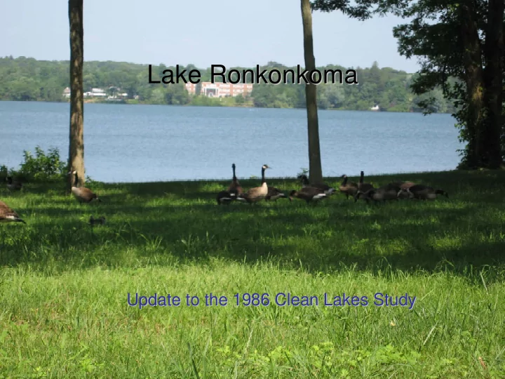
Lake Ronkonkoma Ronkonkoma Update to the 1986 Clean Lakes Study - - PowerPoint PPT Presentation
Lake Ronkonkoma Ronkonkoma Update to the 1986 Clean Lakes Study Update to the 1986 Clean Lakes Study Update to the1986 Clean Lakes Study for Lake Ronkonkoma Lake Ronkonkoma The Legend of the Lady of the Lake Source: based on the version
Update to the1986 Clean Lakes Study for Lake Ronkonkoma
Source: based on the version found at http://www.geocities.com/timmlimm/princess.htm
Update to the1986 Clean Lakes Study for Lake Ronkonkoma
There are several legends surrounding the lady of the lake with a common theme. Here is one version. There is a lake called Lake Ronkonkoma that is very deep; in fact, it is believed to be
this tribe there was a princess named Ronkonkoma. She was in love with an Indian Poospatuck prince from an area that is now Bayport, located on the other side of Brown's River where she was forbidden to go. One day they snuck off together to the lake in Ronkonkoma and took their canoe to a romantic spot after dark to make love. The spirits did not approve of this, as people
So the boat sunk, and their bodies fell forever and ever down into the bottomless lake. So every year the angry Indian princess kills two lovers and pulls their souls to the bottom of the lake. And every year at least one young couple dies.
Source: based on the version found at http://www.geocities.com/timmlimm/princess.htm
Update to the1986 Clean Lakes Study for Lake Ronkonkoma
– Suffolk County Planning and Health Departments, as well as the New York State Department of Environmental Conservation
– Bacteria (affecting lake activities) – Algae blooms (indicating a potential imbalance in the ecosystem as well as an aesthetic issue) – Elevated phosphorus levels – Elevated nitrogen loading – Incompatible land use – Degraded shoreline – Illegal dumping
primary source of pollution and conveyance of nutrient loads.
many recommendations to achieve water quality improvements.
Update to the1986 Clean Lakes Study for Lake Ronkonkoma
Update to the1986 Clean Lakes Study for Lake Ronkonkoma
Update to the1986 Clean Lakes Study for Lake Ronkonkoma
Update to the1986 Clean Lakes Study for Lake Ronkonkoma
Update to the1986 Clean Lakes Study for Lake Ronkonkoma
Update to the1986 Clean Lakes Study for Lake Ronkonkoma
Update to the1986 Clean Lakes Study for Lake Ronkonkoma
Update to the1986 Clean Lakes Study for Lake Ronkonkoma
Update to the1986 Clean Lakes Study for Lake Ronkonkoma
Update to the1986 Clean Lakes Study for Lake Ronkonkoma
Sources: 2004 NYS Orthoimagery Program, USGS DEM
Update to the1986 Clean Lakes Study for Lake Ronkonkoma
Source: NYS DEC Bureau of Fisheries
Update to the1986 Clean Lakes Study for Lake Ronkonkoma
Lake elevation 17 meters asl Primary Subdrainage Area – 17 to 20 meters asl
Lake Proximate Area
Digital Elevation Model
17 17.01 - 18 18.01 - 19 19.01 - 22 22.01 - 23 23.01 - 25 25.01 - 27 27.01 - 30 30.01 - 33 33.01 - 34 34.01 - 35 35.01 - 36 36.01 - 38 38.01 - 40 40.01 - 44 44.01 - 48 48.01 - 51 51.01 - 56 56.01 - 64 64.01 - 70 Lake Ronkonkoma Drainage Area
Source: USGS DEM
Update to the1986 Clean Lakes Study for Lake Ronkonkoma
Lake Ronkonkoma Drainage Area Lake Proximate Area
SLOPE
Percent Slope
0 - 1.4 1.5 - 3.6 3.7 - 6.5 6.6 - 10 11 - 15 16 - 21 Lake and ponds
Source: USGS DEM
Update to the1986 Clean Lakes Study for Lake Ronkonkoma
Legend
Lake and Ponds S.C.Water Authority properties Sewer Districts Lake Ronkonkoma Drainage Area Lake Proximate Area Residential tax map properties
Source: Town parcel files, SCDPW
Update to the1986 Clean Lakes Study for Lake Ronkonkoma
Legend
Lake Ronkonkoma drainage area Parks_reserve_basins SubDrainage Areas Lake and ponds
Digital Elevation Model
meters
High : 70 Low : 17
Source: USGS DEM
Update to the1986 Clean Lakes Study for Lake Ronkonkoma
Update to the1986 Clean Lakes Study for Lake Ronkonkoma
ACREAGE Tax-map-number ADDRESS LAST_NAME TAX ASSESSOR LANDUSE 0.196 0500021000300063000 4 LAKE CREST LANE LAKE CREST BEACH CLUB 311 0.257 0500022000100009000 152 ROSE DRIVE NAME 311 0.459 0500022000100007001 143 LAKE SHORE DRINAME 312 0.195 0500022000200004001 95 STILLWATERS ROA NAME 311 0.135 0500022000100050000 129 LAKE SHORE DRINAME 311 0.081 0500022000200009000 PO BOX 411 NAME 311 0.207 0800171000400037000 10 KAPPLER CT NAME 311 0.361 0800171000400043000 PO BOX 573 DEERA HOMES INC 330 0.048 0800171000400036002 77 BENSON AVE HUGH C HACKETT INC 330 0.118 0800171000600008000 432 SMITHTOWN BLV NAME 330 0.099 0800171000600010000 432 SMITHTOWN BLV NAME 311 0.515 0200688000100028000 LK RONKONKOMA NAME 330 0.813 0500010000300107002 310
Update to the1986 Clean Lakes Study for Lake Ronkonkoma
Legend
2000 Census Blocks
adjusted population
1 - 8 9 - 18 19 - 27 28 - 37 38 - 50 51 - 65 66 - 90 91 - 125 126 - 172 173 - 570 streets
Source: US Census
Update to the1986 Clean Lakes Study for Lake Ronkonkoma
Lake Ronkonkoma Drainage Area
USGS Land Cover 1992 ID
11 open water 21 Low density residential 22 High density residential 23 commercial/industrial/transportation 41 deciduous forest 42 evergreen forest 43 mixed forest 85 urban/recreational grasses 91 woody wetlands 92 emergent herbaceous wetlands Roads Lake Proximate Area
Source: USGS, 1992
Update to the1986 Clean Lakes Study for Lake Ronkonkoma
Source: 1998 Suffolk County Tax Map Parcel
Update to the1986 Clean Lakes Study for Lake Ronkonkoma
Groundwater Divide
Update to the1986 Clean Lakes Study for Lake Ronkonkoma
Update to the1986 Clean Lakes Study for Lake Ronkonkoma
Legend
Lake Ronkonkoma Drainage Area Water Supply Wells with S number 2_year capture zone 5_year capture zone 25_year capture zone 50_year capture zone 75_year capture zone 100_year capture zone
Source: Suffolk County Department of Health Services
Update to the1986 Clean Lakes Study for Lake Ronkonkoma
Legend
F SCDHS_wells
USGS_wells Lake Ronkonkoma drainage area Lake Proximate Area Lake and ponds
Ground-water levels are quite variable, eight feet differences between highs and lows have been recorded. There are 8 wells in general area of lake and watershed with a few samples taken between 1968 - 1994
Update to the1986 Clean Lakes Study for Lake Ronkonkoma
Update to the1986 Clean Lakes Study for Lake Ronkonkoma
Update to the1986 Clean Lakes Study for Lake Ronkonkoma
Streets street flow directions Lake and ponds puddles - P sheetflow - Flow Lake Proximate Area Lake Ronkonkoma Drainage Area
recorded on 10/14/05 (with a total
and a total of 22.14” for October)
Update to the1986 Clean Lakes Study for Lake Ronkonkoma
Update to the1986 Clean Lakes Study for Lake Ronkonkoma
Update to the1986 Clean Lakes Study for Lake Ronkonkoma
Update to the1986 Clean Lakes Study for Lake Ronkonkoma
Update to the1986 Clean Lakes Study for Lake Ronkonkoma
indicators which occur in the intestinal track of warm-blooded animals.
primary indicator
between swimming-associated gastrointestinal illness and E. coli/enterococci in fresh waters than total coliform and fecal coliform used previously.
are considered when two successive results exceed the single sample criteria of 61 per 100 ml for enterococci or when the log-average
period exceeds the multiple sample criteria of 33 per 100 ml. Beach Sampling Sites
Source: USGS DEM, SCDHS
Update to the1986 Clean Lakes Study for Lake Ronkonkoma
25 190 228 72 530 24 294 86 320 136 548 60 150 28 320 32 11 160 14 374 4 10 1 22 20 80 204 92 154 40 5071 1 484 4 92 84 112 636 16 400 20 20 408 80 24 220 32 112 100 24 32 320 56 44 28 48 12 4 28 12 52 564 172 104 680 212 112 76 84 196 388 16 8 8 260 320 24 32 96 12 16 20 28 88 40
100 200 300 400 500 600 700
COLLECTION 6/2/03 6/18/03 5/25/04 6/11/04 7/10/04 7/26/04 8/5/04 8/12/04 8/19/04 8/26/04 9/21/04 5/27/05 6/6/05 6/10/05 6/14/05 6/17/05 6/24/05 7/1/05 7/7/05 5/19/06 5/31/06 6/6/06 6/9/06 6/15/06 6/22/06 7/5/06 7/17/06 7/27/06
Update to the1986 Clean Lakes Study for Lake Ronkonkoma
10 20 122 12 10 75 160 56 36 18 2 15 13 5 29 7 44 18 30 82 24 170 42 128 296 20 276 34 40 15 3 211 11 6 56 5 30 160 39 77 2 160 14 8 234 4 16 2 24 60 24 86 6 174 182 22 10 15 44 68 32 12 3246 80 52 120 56 32 292 64 16 112 20 132 816 40 96 88 68 12 72 40 2440 72 20 8 44 20 16 12 16 100 76 4 44 52 28 76 192 52 60 60 44 224 372 40 16 44 36 36 60 40 48 24 16 8 320 36 20 44 156 204 20 4 40 16
50 100 150 200 250 300 350 400 COLLECTION 6/9/2003 6/30/2003 7/22/2003 8/7/2003 5/19/2004 6/3/2004 6/14/2004 6/22/2004 6/30/2004 7/10/2004 7/26/2004 8/5/2004 8/13/2004 8/21/2004 9/1/2004 5/31/2005 6/9/2005 6/13/2005 6/17/2005 6/27/2005 7/4/2005 7/12/2005 7/16/2005 7/21/2005 8/2/2005 5/19/06 6/2/06 6/8/06 6/15/06 6/23/06 7/7/06 7/20/06 8/3/06
Update to the1986 Clean Lakes Study for Lake Ronkonkoma
Summary of Lake Ronkonkoma Bathing Beach Closures 1988 - 2005
23 27 2 21 67 11 27 25 104 23 12 5 21 3 21 13 12 3 5 40 * * *
20 40 60 80 100 120 140 160 180 200 1988 1989 1990 1991 1992 1996 1997 1998 2000 2001 2002 2003 2004 2005
Brookhaven Islip
* The Town of Brookhaven Beach did not open in 2003-2005 due to continued presence of resident population of Canada Geese and other waterfowl.
Update to the1986 Clean Lakes Study for Lake Ronkonkoma
2000 2001 2002 2003 2004 2005 2006 8 Beaches/Coastal Areas Monitored 82 124 71 108 218 4 206 174 Samples Collected 560 522 479 2,364 2 4,754 4,109 1975 Beaches Affected By Advisories 1 3 2 38 3 76 5 38 6 57 9 Total Days Advisories in Effect 5 13 11 162 303 114 209 Precipitation (Jun, Jul, Aug) at BNL (inches) 16.9 14.6 9.7 19.9 8.7 4.5 10.3 10 Beaches Closed Due to Water Quality Exceedances 2 2 3 11 12 16 6 Total Closure Days 54 44 114 1 40 91 152 7 21 Total Closure + Advisory Days 59 57 125 202 394 266 230
Update to the1986 Clean Lakes Study for Lake Ronkonkoma
Precipitation (Jun, Jul, Aug) at BNL (inches) 16.9 14.6 9.7 19.9 8.7 4.5 10.3 5 10 15 20 25 2000 2001 2002 2003 2004 2005 2006 (through mid-July)
54/59 44/57 114/125 40/202 91/394 152/266 21/230 #/# - closure days/closure + advisory days per year
Update to the1986 Clean Lakes Study for Lake Ronkonkoma
Date of sample Dissolved
water, unfiltered, milligrams per liter pH, water, unfiltered, field, standard units Organic nitrogen, water, unfiltered, milligrams per liter Total nitrogen, water, unfiltered, milligrams per liter Chloride, water, filtered, milligrams per liter
5/6/1966 5.8 13 4/22/1971 11.8 6.6 0.43 13 7/6/1973 7:12 13 9/20/1973 5.1 18 1/3/1974 8.4 7.3 0.4 1 17 4/3/1974 6.4 0.21 1.5 18 6/18/1974 1.7 6 0.57 0.92 22 9/8/1974 5.7 0.09 1.3 20 1/2/1975 7.1 6.7 1.8 16 3/24/1975 6.3 6.2 0.15 1.1 19 6/25/1975 6 0.4 0.84 19 10/1/1975 2.4 6.4 0.46 1.4 18 12/30/1975 4.9 5.5 0.34 2.2 24 3/24/1976 12.2 6.9 0.4 0.62 16 6/24/1976 10.4 6.7 0.92 0.95 17 9/24/1976 8.4 7.1 0.78 1.1 18 12/28/1994 8/16/2002 2.7 6.3 8/16/2002 2.7 6.3 8/19/2002 3.8 6.4 Date of sam ple pH, w ater, unfiltered , field, standard units O rganic nitrogen, w ater, unfiltered , m illigram s per liter Am m onia plus
nitrogen, w ater, unfiltered , m illigram s per liter as nitrogen Chloride, w ater, filtered, m illigram s per liter 7/6/1973 6.3 0.68 1.6 13
Source: USGS
Update to the1986 Clean Lakes Study for Lake Ronkonkoma
Update to the1986 Clean Lakes Study for Lake Ronkonkoma
surrounding area which is adopted by the three townships to prohibit intensification of land use, targets stormwater management improvement projects and incorporates public outreach, water quality monitoring and watershed modeling to better understand the hydrology.
create a product with little to no phosphorus (the Chesapeake Bay program is driving this initiative).
formal Management Plan for control of resident Canada goose population consistent with the new F&WS program.
and wetlands. Current improvement initiatives recommended in the 1986 Study include: – Parking lot reconstruction on the Town of Brookhaven Beach scheduled to begin in fall 2006 – Improvements to parking area at the Suffolk County Beach (Smithtown) – Implementation of Lake Shore Road Drainage Improvement Project.
Update to the1986 Clean Lakes Study for Lake Ronkonkoma
routinely clean catch basins and clear storm basins of debris.
the area. This includes volume of water moving between the Great Bog and Lake Ronkonkoma, volume of water into and out of treatment basins as well as general water quality measurements (not just bacterial values).
watershed area that water quality of the lake can be directly impacted by fertilization and other actions on their properties.
educational signage.
11755) asking for extra cooperation to prevent wastes from entering stormwater or groundwater.
Rhode Island
Update to the1986 Clean Lakes Study for Lake Ronkonkoma
Update to the1986 Clean Lakes Study for Lake Ronkonkoma