
SLIDE 1
Kingman Park Historic District (Proposed) Historic Preservation - - PowerPoint PPT Presentation
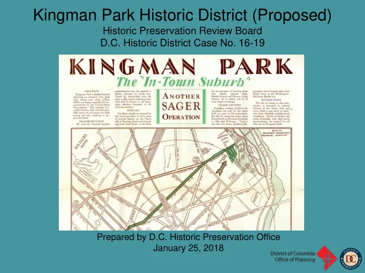
Kingman Park Historic District (Proposed) Historic Preservation Review Board D.C. Historic District Case No. 16-19 Prepared by D.C. Historic Preservation Office January 25, 2018 LEnfant Plan - The area that would become Kingman Park was
Park was located just outside the
“notch” at the plan’s northeast corner. The notch was created at the request
Stoddert (a friend of George Washington) who did not want his land, Cool Spring, included within the city limits.
Cool Spring came under the ownership
farmed much of the land making up east Capitol Hill. Young began construction of a two-story brick house
“Rosedale.”
Cool Spring property was
subdivided into the residential subdivision of “Rosedale and Isherwood.”
and city-wide civic improvements did not extend east of 11th Street.
Anacostia Flats discouraged development in the area.
increased, and raw sewage was deposited directly into the river.
housed on Reservation 13; a city dump; a slaughterhouse; brickworks; and cemeteries.
advantage of.
2000 Block Gales, NE (1893) 635-653 20th Street NE (1892)
subdivision were constructed in the 1880s and 1890s.
were modest two-story frame houses occupied in the first decades by working-class residents.
immigrants (German, Irish) and most rented rather than owned their houses.
white residents dominated in the subdivision in the initial years, African American residents were interspersed throughout, and in some cases
2000 block of Gales Street and the 600 block of 20th Street were almost entirely white-occupied according to the 1920 Census, but by the 1930 census, Gales Street was more mixed, while 20th Street had become entirely African American.
reclaim the Anacostia River by dredging and filling and in 1901, the McMillan Plan introduced the idea of creating a lake and recreational facilities to make the area desirable for development.
as conceived, took decades to realize. By 1927, the Army Corps of Engineers had filled the flats about halfway, making progress on an extensive park with a half-mile-long lake named after the head of the Corps, Brigadier General Dan Christie Kingman.
extension of city infrastructure helped
a major period of population growth in the city’s history.
East Side Park Subdivision, Baist Map Bennet Street, East Side Park,1925
along Bennett Place, H Street and 19th Street within the eastern confines of the subdivision.
intended for white purchasers as many of the
the sale of houses to of color.
capitalize on the reclamation of the Anacostia Flats in this area was East Side Park, just north of Benning Road, across from Rosedale-Isherwood.
Charles Sager Ad for Kingman Park houses, April 14, 1928 Charles Sager Ad for Kingman Park houses “For Colored”, April 22, 1928
single-family residences along the 400 and 500 blocks of 24th Street NE.
24th Street.
after the lake on the edge of his development.
his new development.
project with the wholesale development of adjacent streets, building several hundred solid, brick rowhouses which he targeted exclusively to blacks.
nearby East Side Park, were closed to them through racial restrictions.
builders capitalized on Sager’s real estate success.
similar rows of solid brick residences which they then sold to African Americans.
Benning Road, became a stable residential neighborhood of African-American homeowners and was the nucleus of today’s Kingman Park.
residents established the Kingman Park Civic Association to address the educational, economic and public safety concerns of the community.
Citizens Association which had formed decades earlier advocated for the “interests of residents living east of the U.S. Capitol,” the Kingman Park Civic Association (KPCA) focused specifically on the needs of the area’s African- American residents.
built an active membership, published a monthly newsletter, pushed for construction of educational facilities and street improvements in Kingman Park, and formed a neighborhood cooperative grocery store to serve residents.
much of it focused on the de-segregation of the city’s public schools and playgrounds, the lifting of racial restrictions and covenants in real estate, and
served the Kingman Park community and protected the character and livability of the neighborhood.
and other northeast neighborhoods, and to fill a longstanding need for more schools for the city’s African-American families, the District’s Board of Education purchased a 42-acre site north of Benning Road to build a complex of schools.
School, opened in October 1931; it was followed by Browne in 1931-32, and Phelps in 1932-34.
Rosedale, built in 1898, and Henry T. Blow School at 19th and Benning Road, built in 1906, were open only to the area’s white residents.
interest in the area’s real estate.
Americans, many of whom held federal government jobs.
quality of education at the campus.
embarked upon a plan to build one of the nation’s earliest federally funded housing projects for lower-income, African American residents.
Americans an opportunity to improve their sub- standard living situation and enjoy the benefits of community, modern housing and outdoor space.
built by the Public Works Administration on an 85-acre site north of Benning Road, adjacent to the recently finished school complex.
architect Hilyard Robinson, was architecturally innovative, with two-story duplexes sited around significant open spaces.
institutions.
recreational facilities such as Langston Golf Course, emerged to serve the primarily African-American neighborhood.
they wrote to the Department of the Navy requesting that a public facility for African-American golfers be included in the proposed parkland along the Anacostia River.
section of the city that was recognized for its concentrated population of African-American residents.
Photo of golf pro and students at Langston Golf Course, 1979 Langston Theater, Wymer 1950
Based upon this history, staff finds that the core area
D.C. Designation Criteria B and C. Kingman Park compellingly presents through place, a story of imposed segregation and of those oppressed coping with and rising above it. The intact and cohesive collection of single-family rowhouses constructed during the 1920s and 30s offered African Americans the opportunity of home ownership and quality housing at a time when other neighborhoods and adequate housing were not available to them. Similarly, Langston Terrace provided housing in the post-Depression years for low income African Americans in cutting-edge style. Yet, the federal government’s decision to place this public housing for black residents, and later a golf course, next to the existing Kingman Park neighborhood and its schools further reinforced segregation in the city and perpetuated the “separate but equal” premise. Kingman Park provides an excellent example of a community that developed for and was nourished by African Americans during the segregation era.
HPO Proposed Boundaries for Kingman Park Historic District