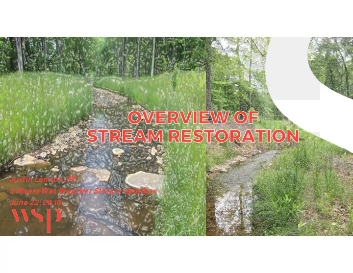
SLIDE 1
Justin Lennon, PE 3 Rivers Wet W eather Stream Sem inar June 22, 20 18
SLIDE 2
— WSP Water & Environm ent
— Baltim ore, MD
— National Technical Leader
— Stream & Ecosystem Restoration — River and Bridge H ydraulics — Sustainability & Clim ate Change
— 1 6-Years of experience — Over 20 m iles of stream restoration design
—Maryland, Delaw are, New York, Virginia, Pennsylvania, North Carolina, Florida, Washington, and Haw aii
— Over $1 2 m illion of restoration designs under construction in 20 1 8
Justin Lennon, PE
SLIDE 3 3
Understanding streams
— What is a stable channel?
— Sustainability — Sedim ent balance — Floodplain connectivity
Source: Rosgen, D. (1 996) Applied River Morphology, Wildland Hydrology.
SLIDE 4
Stream Classification
— Most w idely used system for defining stream condition and function — Defines a range of stable and unstable stream types — Bankfull based classification system
— Bankfull discharge ~ channel form ing flow
— Differentiates stream types based upon geom orphic characteristics
— Bankfull w idth, depth, entrenchm ent, sinuosity, and slope
Source: Rosgen, D. (1 996) Applied River Morphology, Wildland Hydrology.
SLIDE 5 Stream impairm ent and evolution
— What happens w hen a channel destabilizes?
— Schum m evolution m odel (1984)
— Loss of bed level control
— Incision / entrenchm ent
— Widening
— Bank erosion & m ass w asting — General w idening versus m eandering
— Quazi-equilibrium
Source: Rosgen, D. (2006) Watershed Assessm ent
- f River Stability and Sedim ent Supply (WARSSS),
Wildland Hydrology
.
SLIDE 6
Rosgen Stream Evolution Models
Source: Rosgen, D. (20 0 6) Watershed Assessm ent of River Stability and Sedim ent Supply (WARSSS), Wildland Hydrology .
SLIDE 7 W hy are our stream s im paired?
— Changing hydrology
— Developm ent im pacts
— Loss of balance between sedim ent m obility and Channel form
— Man-m ade alteration
— Straightening — Floodplain fill — Levees
— Legacy sedim ent
— Colonial era m ill dam s
Western Run, Baltim ore, MD Im age Source: Google Earth
SLIDE 8
Pre-Industrial Mill Dams
— Research pioneered by Merritts and Walter (F&M College) — ~1 ,70 0 m ill dam s by 1 840
— Allegheny, Beaver, Butler, Westm oreland, Fayette, Greene, and Washington Counties
Density of w ater-pow ered m ill in eastern U.S. by 1 840 . Source: Walter, R. and Merritts, D. (20 08) “Natural Stream s and the Legacy of Water-Pow ered Mills”, Science
SLIDE 9
Mill Dam influence on River Valleys
Left: Typical m ill dam w ith sedim entation patterns. Low er: Lancaster County m ill dam location m ap (1 840 ). Source: Walter, R. and Merritts, D. (20 0 8) “Natural Stream s and the Legacy of Water-Powered Mills”, Science
SLIDE 10
What happened to the m ill dam s?
Upper: Profile of Little Conestoga Creek and West Branch w ith Mill Dam locations. Lower: Conceptual m odel of legacy sedim ent stratified stream . Source: Walter, R. and Merritts, D. (20 0 8) “Natural Stream s and the Legacy of Water- Pow ered Mills”, Science
SLIDE 11
Legacy Sediment Stream Valleys
SLIDE 12 — Stabilization
— broadly defined as any activity targeted at protection / hardening
— Restoration
— stream construction activity targeted at achieving one or m ore levels of functional uplift
W hat are our options?
SLIDE 13
Functional uplift
— Stream function pyram id — Developed by RiverMechanics and USFWS — Basis for defining functional uplift
Source: Harm an, W., Starr, R. et al (20 1 2) “A Function-based Fram ew ork for Stream Assessm ent and Restoration Projects”, US EPA
SLIDE 14
Hydrologic Uplift
— Processes that transport w ater from the w atershed to the channel — Base of the pyram id as it strongly effects higher level functions — Without surface flow there w ould be no aquatic ecosystem
Param eter Channel-form ing discharges Rainfall/Runoff relationship Flood frequency Flow duration
SLIDE 15
Hydraulic Uplift
— Transport of w ater in the channel, on the floodplain and through the ground — Supported by hydrologic function — Closely related to geom orphologic functions
Parameter Metric Floodplain connectivity Bank height ratio Entrenchm ent ratio Flow dynam ics Stream velocity Shear stress Groundw ater / surface w ater interchange GW level Hyporheic interaction
SLIDE 16
Geom orphic Uplift
Param eter Metric Sedim ent Com petency Mobility of bedload and riffle arm or Sedim ent Transport Capacity Transport supply versus capacity Bank Migration / Lateral Stability BANCS Surveys Riparian Vegetation Buffer w idth and com position Bed Form Diversity Percentage of riffles and pools Bed Material Stability Riffle arm or stability
— The transport of sedim ent to create and m aintain diverse bed form s — Dynam ic equilibrium — Direct support of upper level functions
— Habitat diversity — Creation and transport of w ater quality contam inants
SLIDE 17
Physio-chem ical Uplift
Param eter Metric Water Quality Tem perature, DO, pH, Turbidity Nutrients TN, TP Organic Carbon
— Water quality — Designs targeted at Level 3 –geom orphology in order to provide Level 4 uplift
SLIDE 18
Biological Uplift
Param eter Microbial Com m unities Macrophyte Com m unities Benthic Macroinvertebrate Com m unities Fish Com m unities Landscape Connectivity
— Dependent on all underlying functions
— Im pairm ent at any level w ill im pair Level 5
— Biodiversity of aquatic and riparian organism s
SLIDE 19
— Natural Channel Design — Valley Restoration / Legacy Sedim ent Design — Regenerative Storm w ater Conveyance (RSC) — Hybrid Design Approaches
Stream Restoration Design m ethods
SLIDE 20
— Pioneered by Dave Rosgen — Bankfull discharge based design technique — Reference reach / natural analog based design
— Channel sizing based on bankfull scaling of reference reach
— Reference reach identified as an undisturbed naturally sustainable system — Sedim ent transport evaluations based upon non- dim ensionalized curves
Natural Channel Design
SLIDE 21 — Pros:
— Widely accepted / perm ittable m ethodology — Track record of successful projects across the Country
— Cons:
— Difficulty in identifying appropriate reference reach — Methodology is too focused on a singular discharge — Methodology is too cook-book, m ay not be w ell understood by practitioners — May not properly address the source of im pairm ent — Degree of riparian root zone reconnection is m ore lim ited than
Natural Channel Design
SLIDE 22 — Method pioneered based upon research and observation into the role of colonial era developm ent
- n valley landform s and attendant
stream interaction — Mill dam s, legacy sedim ents and stream evolution — Design approach generally involves excavation and rem oval
- f legacy sedim ents from valley
bottom — Channel sizing target is << bankfull — Channel sizing largely based upon threshold transport of historic gravels
Valley Restoration / Legacy Sediment Design
SLIDE 23
— Pros:
— Addressed the source of im pairm ent — Greatly decreases in-channel velocity and erosive stresses — Highest degree of phreatic zone connection — Highest degree of floodplain connection
— Cons:
— Very high per LF project cost — May have significant natural resource im pacts — May have bedload transport lim itations in high yield system s
Legacy Sediment Design
Im age source: w ww .landstudies.com
SLIDE 24
— Coastal plain outfalls or regenerative step pool storm conveyance — Developed in Anne Arundle County, MD — Channel and pool sizing driven to capture up to the 1 0 -year flow in pool areas for infiltration — Sandfilter or bio m edia sub-base along channel
Regenerative Storm water Conveyance
Source: Anne Arundel County (20 1 2) “Design Guidelines for Step Pool Storm Conveyance”.
SLIDE 25 25
— Pros
— Hydrologic function uplift — Water quality treatm ent — Can w ork w ith im paired landscape
— Cons
— Lim ited applicability — Space lim itations m ay lim it treatm ent effectiveness — Specialized construction m aterials
—Sandstone
Regenerative Stormwater Conveyance
Im age source: Anne Arundel County (20 1 2) “Design Guidelines for Step Pool Storm Conveyance”.
SLIDE 26
— Borrow concepts from other m ethodologies to adapt to context of any situation — Generally m ore heavily reliant on sedim ent transport role in the design of the channel — Frequently sub-bankfull design, but not exclusively so — Design typically considers a w ide range of flow conditions
Hybrid Design Approaches
SLIDE 27
— Developed by Dave Rosgen (1 997) — Sim ple descriptive classification system for restoration approaches — Priority levels 1 through 4
Priority levels of Restoration
Im age Source: North Carolina Stream Restoration Institute; Stream Restoration –A Natural Channel Design Handbook
SLIDE 28 28
Priority 1
— Construct channel to reconnect to the upper terrace floodplain — Preserves natural resources — Floodplain Im pacts
— CLOMR?
— Net fill
SLIDE 29
Peachwood Park Tributary
— BEFORE — AFTER
SLIDE 30 30
Priority 2 & 3
— Balanced construction, raising of channel bed / grading of in-set floodplain benches — Potential for cut / fill balance
— Not likely though
— Priority 2 vs 3 — Balance or im prove floodplain m anagem ent
SLIDE 31
Foster Branch
— Before — After
SLIDE 32 32
Priority 4
— Hardening of stream banks in situ — Stream stabilization — No reconnection of riparian root zone — High m aterial costs — Highest expected m aintenance needs
SLIDE 33
Western Run
— Im bricated Rock Wall — Constructed Riffle & Rock Sill
SLIDE 34
Design Process
Watershed assessm ent / Site Selection Visual assessm ent / project lim its and goals Geom orphic survey & natural resources Classification & characterization Horizontal and vertical alignm ent Channel design / sizing Sedim ent transport evaluation Hydraulic evaluation Site grading In-stream structure designs Material selection Project delivery
SLIDE 35
Dead Run Stream Restoration Catonsville, MD
SLIDE 36
— Baltim ore County Dept. Environm ental Protection and Sustainability — 4,70 0 lf of 1
st and 2nd order stream channel
— Included an off-line wet pond SWM facility
— Channel system ically im paired
— Entrenched F Type channel
— Priority 2 / 3 Restoration Design — Hybrid design approach — $2.2 Million Low Bid — Environm ental Quality Resources LLC — 6 m onth in-stream construction period
Dead Run Stream Restoration
SLIDE 37 Construction Com pleted
7
37
SLIDE 38
May 27, 20 1 8 –3pm to 6pm
Ellicott City, MD Left Im age Source: Washington Post Right Source: National Weather Service
SLIDE 39 39
Dead Run - May 27, 20 1 8
— Gauge failed at 3:30 pm — Gauge is located 1 ,50 0 l.f. dow nstream of project area
SLIDE 40 Dead Run May 28, 20 1 8
40
SLIDE 41
Not perfect, but not bad…
SLIDE 42
— Rosgen - Wildland Hydrology
— Short Courses, Applied River Morphology, and Watershed Assessm ent of River Stability and Sedim ent Supply (WARSSS)
— NRCS Stream Restoration Handbook (NEH 654) — Regenerative Step Pool Conveyance –Design Guidelines
— Anne Arundel County, MD
— A Function-based Fram ew ork for Stream Assessm ent & Restoration Projects (EPA 843-K-1 2-0 0 6)
Design Resources
SLIDE 43
QUESTIONS?
w sp.com
Justin Lennon, PE Justin.Lennon@w sp.com (410 )-752-9632