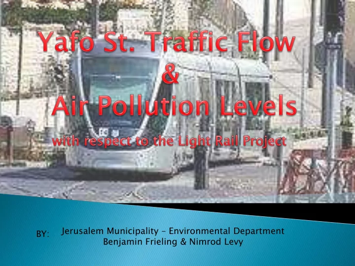
SLIDE 1
Jerusalem Municipality – Environmental Department Benjamin Frieling & Nimrod Levy BY:
SLIDE 2
- Main east-west artery of Jerusalem
- Connected the Old City to Port of Yafo-Tel Aviv under
the Ottoman rule
- Central Business District (CBS) of Jerusalem
- Served as business & government center under British
Mandate
- Continues to be a booming commercial zone, for
residents and tourists alike
SLIDE 3 Expansion of Jerusalem (post Six Day War)
- New neighborhoods such as Gilo & Ramot with their
- wn shopping centers (especially Malcha Mall) draw
Jerusalemites away from the downtown area
Congestion / Lack of Capacity
- Yafo St. is overflowing with buses, taxis, and private
vehicles
- Air & noise pollution levels rose significantly,
decreasing quality of life
SLIDE 4 Goals
- Less vehicular traffic
- Less pollution
New public transit
- ptions
- Light Rail
- Bus Rapid Transit
aka BRT
SLIDE 5 Derech Chevron BRT
- Old Train Station to Givat
HaMatos (3 km)
- Completed in stages over the
past decade
Gilo & Har Homa to Ramot & Har Nof
- Additional bus lines utilize
the route too
Yafo St. / Red Line Light
Rail
- Har Herzel to Pisgat Ze’ev
(over 13 km), via Yafo St.
began in 2002
2011
2011
SLIDE 6
Traffic Flow Before, During, & After Construction
Yafo St. Light Rail
SLIDE 7 Extreme Congestion Lessening Congestion
Before
Construction (circa 2007)
vehicular traffic
flow
types
During
Construction (2008-2010)
lanes for vehicles
ways
east to west
taxis
Post- Construction (2011 & on)
No vehicular access Pedestrian walkway Active light rail line
NO CONGESTION
SLIDE 8 Reliable Indicators of Air Pollution:
- Annual average levels (ppb)
Readings every half-hour
- Number of times daily legal maximum exceeded
- Number of times half-hour legal maximum exceeded
By 2011, all indicators have shown significant
reductions in air pollution levels
However, during construction (2008-2010),
the half-hour legal limit was exceeded more frequently, due to the heavy equipment used
SLIDE 9 Annual Average NOx Levels at Davidka Square
Decrease of 80%, from a high of 151 ppb in 2002 to a low of 32 ppb in 2011
151 136 107 145 144 137 140 126 71 32 20 40 60 80 100 120 140 160 2002 2003 2004 2005 2006 2007 2008 2009 2010 2011 N O x L e v l s ( p p b ) Year
Annual al Average rage NOx Leve vels
Annual Average
SLIDE 10 190 93 79 82 46 33 141 153 170 20 40 60 80 100 120 140 160 180 200 2002 2003 2004 2005 2006 2007 2008 2009 2010 2011 # o
rences es per Annum Year
Number mber of Times mes Half-hou hour r Lega gal l Max of NOx Exceed ceeded ed
Number of Times Half-hour Max Exceeded 9 5 3 5 2 1 1 2 3 4 5 6 7 8 9 10 2002 2003 2004 2005 2006 2007 2008 2009 2010 2011 # Days owe Annum Year
Number er of Times es Daily Legal gal Max of NOx x Exceeded ded
Number of Times Daily Max Exceeded
SLIDE 11 CALRoads is a computer program that creates a model
- f air pollutant dispersion from vehicular traffic
Inputs required:
- Vehicle count per direction on street/intersection
- Pollutant emission (gram per mile per vehicle)
- Area of travel (of the vehicles)
Output in a contour map of the area
- Different color for each pollution levels
- Allows for reading of general patterns, instead of only
numbers from a few receptors
SLIDE 12 Four models in total were created, each with
the same basic components, as noted previously
The focus of the model was of the “rush
hour”, the hour of maximum traffic levels, of each intersection
The four models were:
- Pre Light Rail (traffic data ~ 2004)
- Post Light Rail (traffic data ~ 2008-2010, with 2011
traffic flow directions)
- Each time had two pollutant types:
Nitrous Oxide (NOx) Particulate Matter [10 microns] (PM10)
SLIDE 13 Wind conditions obtained from the
Municipality monitoring station at the Kikar Safra
- Most common speed & direction utilized –
3 m/s at 288 degrees
GIS map obtained from the Municipality
website
Vehicle speed, for pollution dispersion
purposes, was estimated at 20 km/hr
All vehicle pathways running
perpendicular/across Yafo St. radiate 50 meters outwards
SLIDE 14
SLIDE 15
NOx Levels (Pre Light Rail) Note the maximum concentrations above 65 ug/m3, near Rav Kook & Halani
SLIDE 16
NOx Levels (Post Light Rail) Note the severe drop – the maximum now is less than half, at approximately 30 ug/m3 & covers a much smaller area
SLIDE 17
PM10 Levels (Pre Light Rail) Average contour zones ranging between .50-1.00 ug/m3
SLIDE 18
PM Levels (Post Light Rail) Simply dropped to zero nearly everywhere, besides the region between HaTurim & Sarei Yisroel, where the max is still less than 1 ug/m3
SLIDE 19 Some of the traffic data was only from 2004 or
before the current traffic flow was enacted (i.e. Kiach-Niviyim)
Thus, for those intersections, only the relevant
directions were included in the Post Light Rail model
However, this is not entirely accurate, since traffic
flow has changed significantly since then (i.e. buses rerouted from Yafo to Niviyim-Kiach)
- Note – the Davidka Square monitoring station’s results still
show that even with the rerouted traffic, the change was successful & air pollution has dropped significantly
Additionally, some minor one-way streets did not
have traffic data (ie Beit Ya’akov, HaGesher)
SLIDE 20 Model only utilized the worst-case scenario
(hour of most heavy traffic by each intersection)
- Future models can take a survey of every hour of
the day & have a series of results
More up-to-date traffic data Traffic data was only vehicle type & quantity
- Future models can integrate the real-time flow
(via the timing of the traffic lights in each direction)
SLIDE 21 Thanks to:
- Nimrod Levy (Environmental Dept.)
- Allowing me to intern under him this summer
- Building the models, applying the data, + general issues
- Gil Reichman (Environmental Dept.)
- Installation of the CALRoads Software
- Dr. Danny Giveon (Transportation Dept.)
- Providing traffic data of Yafo St. & its intersection
- Dr. Chaim Luria (Independent Consultant)
- Interpretation of the data + technical issues
- LAKES Environmental
- Providing the software (but no technical assistance…)