SLIDE 1
Importance of Open Geospatial Science Suchith Anand
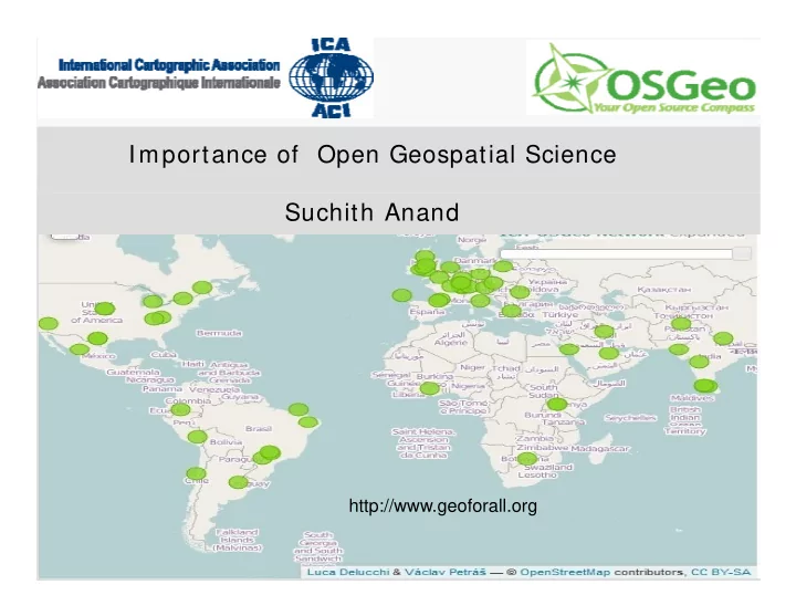
http://www.geoforall.org http://www.geoforall.org
SLIDE 2
Oxera 2013
SLIDE 3
Very few universities/ educational institutions in developing/ poor countries currently are in developing/ poor countries currently are able to teach Geospatial Science courses High cost of software Lack of skilled staff Lack of skilled staff Lack of freely available training materials
SLIDE 4
SLIDE 5 IC A- OS Geo MoU
- Prof. Georg Gartner (ICA President) and
Arnulf Christl (OSGeo President) shake Arnulf Christl (OSGeo President) shake hands after signing the MoU at Intergeo 2011 in Germany (Sep 2011)
SLIDE 6
ICA is the world authoritative body for cartography and Geographic Information Science
SLIDE 7
Open Source Geospatial Foundation (OSGeo)
SLIDE 8
Open Source Geospatial Foundation (OSGeo) established in Feb 2006 OSGeo is the leader of Open Source Geospatial and high impact community OS Geo Product development statistics 2008
SLIDE 9 Making resources including software and data openly available offers an opportunity data openly available offers an opportunity for knowledge to be shared widely so as to increase learning opportunities.
Example – Collaborating with educational initiatives like gvSIG Batoví
For details contact: Sergio Acosta y Lara sacosta@dntopografia.gub.uy Alvaro Anguix aanguix@gvsig.com
SLIDE 10 For details contact: Sergio Acosta y Lara sacosta@dntopografia.gub.uy Alvaro Anguix aanguix@gvsig.com
https://gvsig.org/web/home/projects/gvsig-educa
SLIDE 11 Aim s of I CA-OSGeo Labs I nitiative I nitiative
- Establishing research and training
- pportunities in open source GIS
- pportunities in open source GIS
- Build teaching and research infrastructure
worldwide worldwide
- Provide worldwide learning platform
- Provide worldwide learning platform
SLIDE 12 “Geo for All” E ducation Initiative “Geo for All” E ducation Initiative
ICA-OSGeo MoU in Sep 2011 ICA-OSGeo MoU in Sep 2011
Over 75 labs es tablis hed worldwide as
worldwide as
North America – 13 labs
Distribution ICA-OS
Geo labs established in E urope
Image : OSGeoREL @NCSU (6 months back)
North America – 13 labs Europe – 31 labs South America – 9 labs Africa – 4 labs
Asia – 15 labs Asia – 15 labs
Australia - 1 lab
Will be establishing over 100 labs in universities worldwide by Sep 2014 universities worldwide by Sep 2014
SLIDE 13
Why having a framework for Open Why having a framework for Open Geospatial Science important for the future? future? Strategic level Strategic level Research Teaching Teaching Attracting research funding Attracting research funding / sustainability Social Responsibility Social Responsibility
SLIDE 14 Open Geospatial Research Big Picture - Open GIS is key for innovation in GIS
Ability for showing the
is fundamental for
Geospatial Standards (for
Maturity of open
Open Data
is fundamental for scientific research
Standards (for
Maturity of open source software (for
SLIDE 15
Government level initiatives - Key for interoperability and lower costs and lower costs
SLIDE 16
Open Data – key for innovation and transparency
SLIDE 17
Research importance - Increasing software quality Increasing software quality
SLIDE 18 Increasing innovation
Internet backbone is powered by OSS Since April 1996 Apache has been the Since April 1996 Apache has been the most popular HTTP server software in use. As of May 2011 Apache was estimated to serve 63% of all websites and 66% of the serve 63% of all websites and 66% of the million busiest
"May 2011 Web Server Survey". Netcraft. May 17, 2011
http: / / ec.europa.eu/ enterprise/ ict/ policy/ doc/ 2006-11-20-flossimpact.pdf
SLIDE 19
Reuse big enabler for Research and Teaching Research and Teaching
SLIDE 20
Reuse big enabler for Research and Teaching
SLIDE 21 Aim 1 Establishing open Establishing open source GIS research and training
SLIDE 22
SLIDE 23
Strategic Training Programs
SLIDE 24
Aim 2 – Scale up research and teaching
Open Geospatial Labs are being established worldwide to scale up research and teaching in this theme globally (ICA-OSGeo MoU) University of Pretoria, South Africa University of Pretoria, South Africa
SLIDE 25
Build teaching and research infrastructure worldwide June 2010 Open Source Geospatial Lab founding meeting at UoN
SLIDE 26 University of Southampton OSGL
"applied" research and Spatial Data
Infrastructure
– delivery of real world Open Source geospatial and – delivery of real world Open Source geospatial and data management applications for research infrastructure, government and industry, e.g.: –
- Channel Coastal Observatory
–
- Channel Coastal Observatory
- MEDIN UK Marine metadata portal
development and dissemination of software:
– Web – OpenLayers, Leaflet, OSM, PostGIS, MapServer… – Web – OpenLayers, Leaflet, OSM, PostGIS, MapServer… – Quantum (custom plugins)
delivery of specialist CPD and GIS training delivery of specialist CPD and GIS training
– Quantum, etc.
www.osgl.soton.ac.uk osgl@geodata.soton.ac.uk www.osgl.soton.ac.uk osgl@geodata.soton.ac.uk
SLIDE 27 Research topics & collaborators
Current projects
- Disaster recovery monitoring
- Activities
- Disaster recovery monitoring
- Crowd-sourcing data quality
assessment
- Unmanned Aerial Vehicle
- Unmanned Aerial Vehicle
intercropping mapping system
- Remote sensing data fusion
- Remote sensing monitoring of
- large-scale construction
projects Contact:
School of Geography School of Geography University of Nottingham, Malaysia campus tuongthuy.vu at nottingham.edu.my
SLIDE 28 Launch in October 2012 Launch in October 2012
ICA-OSGeo Lab at the University of Pretoria ICA-OSGeo Lab at the University of Pretoria
First in Africa
Jeff M cKenna (OSGeo President) visited us for the launch
Back: Jeff McKenna (OSGeo President), Gavin Fleming (OSGeo South Africa) Front: Prof Elri Liebenberg (Former ICA vice-resident), Dr Serena Coetzee, Prof Hannes Rautenbach
SLIDE 29 Centre for Geoinformation Science Research focus groups Research focus groups
Forensic geography
Dr Peter Schmitz Dr Peter Schmitz
GISc Education and Training
Sanet Eksteen Sanet Eksteen
Open source and data for geospatial / ICA-OSGeo Lab
Dr Serena Coetzee Dr Serena Coetzee
Space geodesy, earth and atm
Dr Joel Botai
Spatial data infrastructures
Dr Serena Coetzee
SLIDE 30
Education and training Education and training
Undergraduate BSc Geoinformatics
Students from Geology, Zoology, Geography, Spatial planning,
Computer Science, …
Computer Science, …
Practicals and assignm ents in PostGIS, QGIS, SAGA, … Postgraduate
Postgraduate BSc (Hons) Geoinformatics, BSc (Hons) Computer Science
Spatial databases: practicals and assignm ents in PostGIS Internet GIS: practicals and assignm ents in OpenLayers, Internet GIS: practicals and assignm ents in OpenLayers,
GeoServer…
SLIDE 31
Education and training Education and training
Continued Education at UP (CE at UP) Continued Education at UP (CE at UP) Short courses, CPD points for registered professionals
Introduction to Quantum GIS
Spatial databases with PostGIS
Spatial databases with PostGIS The Basics of GIS with QGIS
NFP Alumni Course in Nambia, Windhoek, Oct/Nov 2013 With ITC and Polytechnic of Namibia With ITC and Polytechnic of Namibia
The use of social media, crowdsourcing and webmapping to enable spatial web presence for the private sector in Southern Africa private sector in Southern Africa
SLIDE 32 The Geomatics Lab of Politecnico di Milano has been active in Como Campus since '95 and is now composed
- f two full professors, three assistant professors, one
- f two full professors, three assistant professors, one
technician, 13 PhD and PostDoc Students, many Master Students ...
Laboratorio di Geomatica
Students ...
SLIDE 33
Open Geospatial Labs are being established worldwide to scale up research and teaching in this theme globally (ICA-OSGeo MoU) North Carolina State University, USA
SLIDE 34
Free webinars
SLIDE 35
Example of an excellent Example of an excellent Initiative led by Prof. Maria Brovelli and colleagues http://eurochallenge.como.polimi.it
SLIDE 36
SLIDE 37
Aim 3 - Providing Global learning platform and training opportunities
SLIDE 38
Geospatial I G
The Research Data Alliance is supported by the European Commission, the U.S. Government and the Australian Government.
SLIDE 39
SLIDE 40
Open Science 2014 sessions planned at OSGIS 2014. We look forward to welcoming you to Nottingham.
SLIDE 41 Building an open source, open standards, open data research framework through OpenGIS framework through OpenGIS
Key advantages
- Scalable
- Scalable
- Interoperability
- Low costs
- Low costs
- No proprietary lockin
- Benefits wider community
Represents the individual content creator on the World Wide Web
SLIDE 42
Building Open Geospatial Science -“Geo for All”
http://www.geoforall.org http://www.geoforall.org
SLIDE 43
Acknowledgements
To all colleagues in the “Geo for All” initiative initiative