SLIDE 1
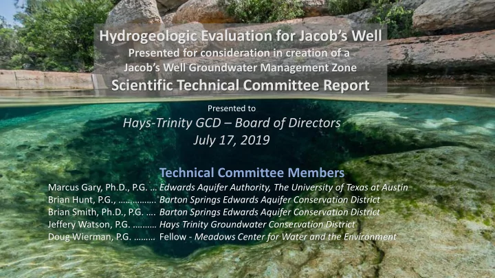
Technical Committee Members
Marcus Gary, Ph.D., P.G. … Edwards Aquifer Authority, The University of Texas at Austin Brian Hunt, P.G., ……………. Barton Springs Edwards Aquifer Conservation District Brian Smith, Ph.D., P.G. …. Barton Springs Edwards Aquifer Conservation District Jeffery Watson, P.G. .……… Hays Trinity Groundwater Conservation District Doug Wierman, P.G. ……… Fellow - Meadows Center for Water and the Environment
Hydrogeologic Evaluation for Jacob’s Well
Presented for consideration in creation of a Jacob’s Well Groundwater Management Zone
Scientific Technical Committee Report
Presented to
Hays-Trinity GCD – Board of Directors July 17, 2019
SLIDE 2 Charge of the Scientific Technical Committee
- 1. Define the spatial extent (springshed) of the JWGMZ based on
hydrogeologic observations, data, and related information.
- 2. Work with Stakeholder Group to update drought indicators and
identify flow rate triggers for the JWGMZ.
- 3. Evaluation of pumping volume (permitted and exempt) within the
JWGMZ.
- 4. Conduct a hydrologic analysis of the water budget to determine
cumulative effects of pumping on springflow at Jacob’s Well, particularly during drought conditions.
- 5. Develop a set of possible strategies to minimize negative
anthropogenic influences on Jacob’s Well springflow.
- 6. Identify any gaps in data and determine what future studies would
improve the GCD’s ability to manage groundwater resources in the JWGMZ.
SLIDE 3
SLIDE 4 Datasets used in evaluation for this process.
- 1. Hydrogeologic setting
- 2. Geologic structure
- 3. Recharge area for JW
- 4. Well pumping data
- 5. Spring flow data
- 6. Groundwater level data
SLIDE 5 Suggested JWGMZ Area v 1.0
(presented December 6, 2018)
around Dry Cypress Creek watershed upstream of Tom Creek Fault Zone.
– wells in this area respond similarly to wells in upstream watershed.
SLIDE 6
areas that each influence flow at Jacob’s Well are identified.
catchment area (springshed)
area.
recharge area.
JWS Areas of Hydrogeologic Influence
SLIDE 7 JW Regional Recharge Area
County line to the west, Region K-L boundary to the north, Dry Cypress Creek to the east, and Tom Creek Fault to the south.
into the JWS springshed area.
Blanco Rv springs.
SLIDE 8 Regional Groundwater Surface
Middle Trinity aquifer in this portion of the Hill Country are generally from the west to east.
surface tends to “flatten out” in areas where extensive karst exists, such as JWS
SLIDE 9 Regional cross-section
produced a regional cross- section through JWS running from west to east from the Hays Co. line through the Wimberley area.
SLIDE 10
SLIDE 11
Pleasant Valley Spring (PVS) is a single spring that provides all the flow to the Blanco River in Wimberley under drought conditions.
SLIDE 12 Tom Creek Fault Zone Area
Regional Recharge Area and JW Catchment to the west.
wide fault zone southeast from the Tom Creek Fault as mapped by the BEG.
SLIDE 13 Middle Trinity Aquifer Lower Trinity Aquifer
Modified from Wierman, et al., 2010
SLIDE 14
Wells located in the Tom Creek Fault Area and the Jacob’s Well Spring Catchment Area (updip) respond differently than wells to the southeast (downdip) where the Middle Trinity aquifer is deeper in the subsurface
Downdip Area
SLIDE 15
Wells located in the Tom Creek Fault Area and the Jacob’s Well Spring Catchment Area (updip) respond differently than wells to the southeast (downdip) where the Middle Trinity aquifer is deeper in the subsurface
Downdip Area
SLIDE 16
SLIDE 17 Jacob’s Well Spring Catchment Area
primary recharge area for JW.
the Middle Trinity aquifer are directly tied to spring flow.
feeding JW developed in this area.
SLIDE 18
Multiple recharge analyses were conducted to evaluate area of greatest influence to spring flow
Springshed is estimated by integrating hydrologic data with methods published by Lanini et al., 2016 and Bonacci and Andric, 2015. Springshed of Dry Cypress Creek (~31 mi2, or less) is sufficient for all recharge estimates. Estimated average annual effective recharge is about 30% of rainfall. Hunt et. al, in prep
SLIDE 19
Jacob’s Well Spring emerges from the underwater cave system that has developed along fractures in the limestone running from the spring to the northwest.
SLIDE 20
SLIDE 21
Observed effects of pumping on spring flow
SLIDE 22 JWS Areas of Hydrogeologic Influence
shown as large triangles
registered in HTGCD database shown as small dots.
as colored polygons.
SLIDE 23
SLIDE 24
Two suggested areas for potential GMZs
SLIDE 25
SLIDE 26
SLIDE 27
SLIDE 28
The Stakeholder Task Force recommended the following drought trigger levels for permitted pumping reductions based on a flow index directly from Jacob’s Well. 6 cfs – 10% reduction 5 cfs – 20% reduction 3 cfs – 30% reduction 2 cfs – 40% reduction
SLIDE 29 5 10 15 20 25 30 35 40 January February March April May June July August September October November December
Millions of Gallons Pumped (actual reported)
Drought vs. No-Drought Average Monthly Pumping: Aqua Texas, WWSC, WSP
No Drought Declared Drought Declared Average Drought Curtailment (26%)
SLIDE 30 Strategy Description Drought curtailments Implementation of a simple, representative drought declaration methodology using Jacob’s Well as one of the triggers. Education Effective communication to the public related to water resources, drought, and conservation efforts the public can take. Conservation Measures and actions taken to reduce the use of
- water. These could include watering schedules.
Permit reductions and restrictions Right-sizing and placing ceilings
permitted pumping during non-drought periods. Infrastructure and efficiency Reduce line loss and fix other water infrastructure problems that may waste groundwater.
Demand Reduction Tools for Maintaining Sustainable Base Flow at Jacob’s Well Spring
SLIDE 31 Strategy Description Conjunctive use Use of surface water and groundwater sources Aquifer storage and recovery (ASR) Injection of surface or other water supplies into the Lower Trinity Aquifer for withdrawal during drought periods. Lower Trinity Development of the Lower Trinity Aquifer to (1) temporarily
- r permanently replace pumping from the Middle Trinity and
(2) use as a sole-source for future permitted pumping. Rainwater Promotion of the use of rainwater for commercial and domestic uses. Alternative Water Supplies Importing water from more distant sources. Temporary interconnections and pipelines These could alleviate pumping in certain areas.
Alternative Water Supply Tools for Maintaining Sustainable Base Flow at Jacob’s Well Spring
SLIDE 32
SLIDE 33