
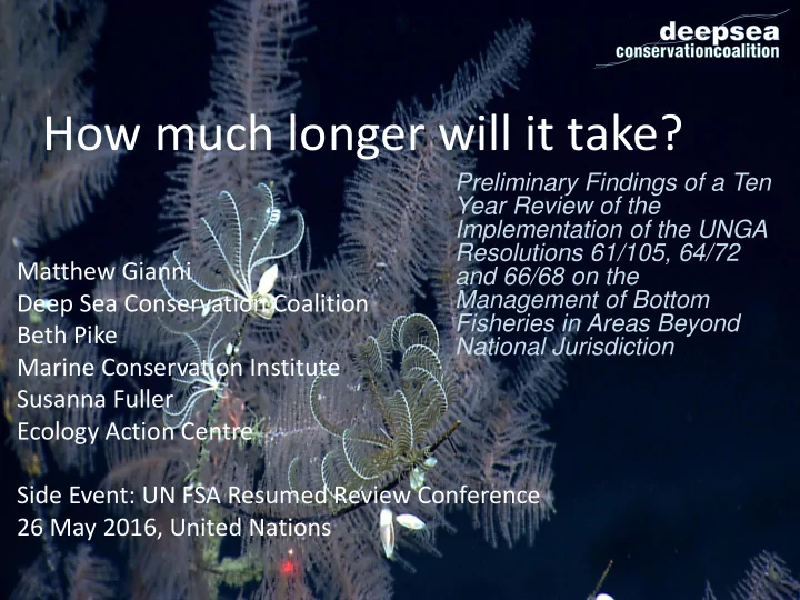
SLIDE 1
Preliminary Findings of a Ten Year Review of the Implementation of the UNGA Resolutions 61/105, 64/72 and 66/68 on the Management of Bottom Fisheries in Areas Beyond National Jurisdiction
How much longer will it take? Preliminary Findings of a Ten Year - - PowerPoint PPT Presentation
How much longer will it take? Preliminary Findings of a Ten Year Review of the Implementation of the UNGA Resolutions 61/105, 64/72 Matthew Gianni and 66/68 on the Management of Bottom Deep Sea Conservation Coalition Fisheries in Areas
Preliminary Findings of a Ten Year Review of the Implementation of the UNGA Resolutions 61/105, 64/72 and 66/68 on the Management of Bottom Fisheries in Areas Beyond National Jurisdiction
fishing on the high seas
UNFAO, CBD)
through RFMOs since UNGA 61/106 in 2006
UNGA reviews 2009, 2011 and FAO workshops (2010; 2015)
towards conservation of the high seas
Southern Indian Oceans
RFMO/As (Exceptions: Indian Ocean/SIOFA and Mediterranean/GFCM)
and South Pacific RFMOs
information becomes available in NE, NW, and SE Atlantic RFMOs
Atlantic).
NEAFC, NAFO, SEAFO, NPFC; imposing restrictions on fishing in ‘new’ fishing areas
NAFO, NEAFC, CCAMLR, GFCM, NPFC, SPRFMO, SEAFO
SEAFO, CCAMLR)
North Pacific)
400m to bottom fishing based on extensive impact assessment
Black Coral Locations & Predicted Habitat: NAFO
CCAMLR
% "Fishable" Seamounts % "Fishable" Area
CCAMLR
% Predicted Coral Habitat - Octocorals % Predicted Coral Habitat - Scleractinian 2200m Areas closed to bottom trawling 100.0% 100.0% Areas closed to bottom trawling 100.0% 100.0% Areas closed to bottom fishing 2.4% 0.7% Areas closed to bottom fishing 1.5% 0.0% Areas where bottom fishing is permitted 97.6% 99.3% Areas where bottom fishing is permitted 98.5% 100.0% 1,047 5,302,522 1,774,402 2,024 seamounts km2 km2 km2
GFCM
% "Fishable" Seamounts % "Fishable" Area
GFCM
% Predicted Coral Habitat - Octocorals % Predicted Coral Habitat - Scleractinian 1500m Areas closed to bottom trawling 39.7% 18.7% Areas closed to bottom trawling 23.6% 0.0% Areas closed to bottom fishing 0.0% 0.0% Areas closed to bottom fishing 0.0% 0.0% Areas where bottom fishing is permitted 60.3% 81.9% Areas where bottom fishing is permitted 76.8% 0.0% 136 1,496,929 790,094 seamounts km2 km2 km2
NAFO
% "Fishable" Seamounts % "Fishable" Area
NAFO
% Predicted Coral Habitat - Octocorals % Predicted Coral Habitat - Scleractinian 2000m Areas closed to bottom fishing 57.6% 12.9% Areas closed to bottom fishing 12.9% 10.1% Areas where bottom fishing is permitted 0.0% 79.0% Areas where bottom fishing is permitted 78.9% 86.4% Areas where prior impact assessment required before bottom fishing can occur 42.4% 8.1% Areas where prior impact assessment required before bottom fishing can occur 8.1% 3.5% 33 140,368 139,431 60,482 seamounts km2 km2 km2
NEAFC
% "Fishable" Seamounts % "Fishable" Area
NEAFC
% Predicted Coral Habitat - Octocorals % Predicted Coral Habitat - Scleractinian 1500m Areas closed to bottom fishing 33.1% 16.7% Areas closed to bottom fishing 22.6% 25.0% Areas where bottom fishing is permitted 8.6% 37.3% Areas where bottom fishing is permitted 25.9% 29.9% Areas where prior impact assessment required before bottom fishing can occur 58.3% 46.0% Areas where prior impact assessment required before bottom fishing can occur 51.5% 45.2% 139 300,646 222,512 189,897 seamounts km2 km2 km2 TOTAL TOTAL TOTAL TOTAL TOTAL TOTAL TOTAL TOTAL
NPFC
% "Fishable" Seamounts % "Fishable" Area
NPFC
% Predicted Coral Habitat - Octocorals % Predicted Coral Habitat - Scleractinian 1500m Areas closed to bottom fishing 0.3% 0.5% Areas closed to bottom fishing 0.5% 1.0% Areas where bottom fishing is permitted 12.1% 38.9% Areas where bottom fishing is permitted 38.9% 69.8% 398 49,823 49,778 7,820 seamounts km2 km2 km2
SEAFO
% "Fishable" Seamounts % "Fishable" Area
SEAFO
% Predicted Coral Habitat - Octocorals % Predicted Coral Habitat - Scleractinian 2000m Areas closed to bottom trawl 1.8% 5.1% Areas closed to bottom trawl 4.8% 6.9% Areas closed to bottom fishing 21.5% 16.1% Areas closed to bottom fishing 16.3% 13.6% Areas where bottom fishing is permitted 25.5% 42.9% Areas where bottom fishing is permitted 42.7% 44.9% Areas where prior impact assessment required before bottom fishing can occur 53.0% 41.0% Areas where prior impact assessment required before bottom fishing can occur 41.0% 41.5% 502 175,943 170,756 104,992 seamounts km2 km2 km2
SIOFA
% "Fishable" Seamounts % "Fishable" Area
SIOFA
% Predicted Coral Habitat - Octocorals % Predicted Coral Habitat - Scleractinian 1500m Areas closed to bottom fishing 0.0% 0.0% Areas closed to bottom fishing 0.0% 0.0% Areas voluntarily closed to bottom fishing 6.3% 6.9% Areas voluntarily closed to bottom fishing 7.1% 5.8% Areas where bottom fishing is permitted by Australia 36.0% 19.8% Areas where bottom fishing is permitted by Australia 20.4% 26.1% 253 205,260 199,647 139,468 seamounts km2 km2 km2 TOTAL TOTAL TOTAL TOTAL TOTAL TOTAL
SPRFMO
% "Fishable" Seamounts % "Fishable" Area
SPRFMO
% Predicted Coral Habitat - Octocorals % Predicted Coral Habitat - Scleractinian 1500m Areas closed to bottom fishing by New Zealand 3.3% 15.6% Areas closed to bottom fishing by New Zealand 15.6% 18.7% Areas closed to bottom fishing by Australia 0.0% 0.0% Areas closed to bottom fishing by Australia 0.0% 0.0% Areas where bottom fishing is permitted by New Zealand 3.1% 7.5% Areas where bottom fishing is permitted by New Zealand 7.5% 7.8% Areas where bottom fishing is permitted by Australia 3.1% 14.9% Areas where bottom fishing is permitted by Australia 14.9% 17.0% Areas where prior impact assessment required before bottom fishing can occur for New Zealand vessels 93.6% 76.9% Areas where prior impact assessment required before bottom fishing can occur for New Zealand vessels 76.9% 73.5% Areas where prior impact assessment required before bottom fishing can occur for Australian vessels 96.9% 85.1% Areas where prior impact assessment required before bottom fishing can occur for Australian vessels 85.1% 83.0% 880 371,117 370,620 289,730 seamounts km2 km2 km2 TOTAL TOTAL
Guidelines – collect sufficient baseline information; – mapping of VME areas; – use low/non benthic impact technology/methods (avoid/prohibit high impact technology, e,g. bottom trawl gear in research trawl surveys or ‘exploratory’ bottom fisheries)
should be closed unless an impact assessment is conducted science based determination that SAIs not likely to occur.
assessed - impacts on infaunal biodiversity and the capacity of these ecosystems to act as carbon sinks.
criteria outlined in the FAO Guidelines, not only on basis of one or a few of the criteria (e.g. significant concentrations of VME indicator species only).
function of VME species at appropriate bioregional scales is essential for determining the temporal, spatial and ecological extent of impacts and their significance (criteria in paragraphs 17-20 of the FAO Guidelines).
needed to determine extent to which VMEs impacted/degraded over time (e.g. only remnant populations of VMEs?) and/or are under threat from other stressors (e.g. ocean acidification) and protected accordingly.
where they previously occurred should be set aside for regeneration or recovery.
should be prohibited unless or until scientific understanding of the risk to/impact on all affected species can be determined. Selective deep- sea fisheries permitted on the basis of good stock assessments, sustainable catch limits, and rebuilding depleted stocks (UNGA 64/72, paragraph 119(d). Eliminate catch/bycatch of highly vulnerable and endangered species (e.g. deep-sea sharks Indian Ocean; NE Atlantic). 9: Reaffirm Full Implementation of UNGA Resolutions: Finally, the UN General Assembly should reaffirm, in no uncertain terms, the call in paragraph 120 of resolution 64/72 to not authorize bottom fishing activities until such measures have been adopted and implemented.
DSCC www.savethehighseas.org
And thanks to the Adessium Foundation, Synchronicity Earth, Pew Charitable Trusts, Kaplan Fund, Oceans 5, DSCC member organizations and the many scientists working on deep-sea fisheries and biology