High Peaks Trails Plan Conservation = Recreation = Economic - - PowerPoint PPT Presentation

high peaks trails plan
SMART_READER_LITE
LIVE PREVIEW

High Peaks Trails Plan Conservation = Recreation = Economic - - PowerPoint PPT Presentation

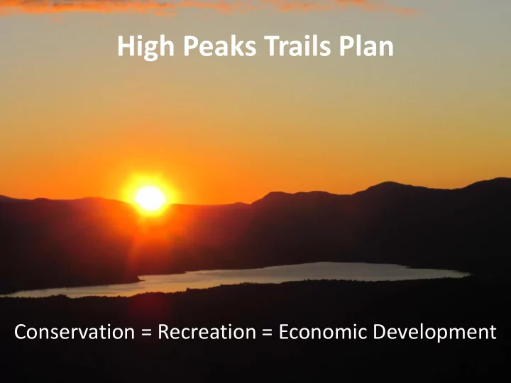
High Peaks Trails Plan Conservation = Recreation = Economic Development Thanks to all who have helped, and continue to help develop the plan! Trails Plan Purpose The High Peaks Trails Plan will: Be a regional approach to planning


slide-1
SLIDE 1

High Peaks Trails Plan

Conservation = Recreation = Economic Development

slide-2
SLIDE 2

Thanks to all who have helped, and continue to help develop the plan!

slide-3
SLIDE 3

Trails Plan Purpose

The High Peaks Trails Plan will:

– Be a regional approach to planning back-country trails in the High Peaks, – Maximize the economic & social benefits of trails and recreation to High Peaks communities, and – Facilitate land conservation which features permanent public access to recreation.

Picture of Orbeton Stream courtesy of Jo Josephson ATVs parked at Edmunds Market in Phillips

slide-4
SLIDE 4

Existing Regional Winter Trails

  • ITS Snowmobile

System

  • Black Fly Loop
  • Maine Huts & Trails
  • Sugarloaf
  • Saddleback
slide-5
SLIDE 5

Existing Regional Summer Trails

  • Appalachian Trail
  • Maine Huts and

Trails

  • Moose Loop ATV

System

  • Northern Forest

Canoe Trail

  • Carrabassett Region

Mountain Bike Trails

  • Fly Rod Crosby Trail
slide-6
SLIDE 6

Land Ownership

500 1,000 1,500 2,000 2,500 Total Housing Units Recreational/Seasonal Use

Source: US Census, American Fact Finder

slide-7
SLIDE 7

Existing Conditions All Seasons

Mode Miles of Trail Hiking 55 Snowmobile 525 Appalachian Trail 47 ATV 434 MHT 69 NFCT 56 FRC 20 Mt Biking 40 xc Skiing 140

Hiking 4% Snowmobile 38% Appalachian Trail 3% ATV 31% MHT 5% NFCT 4% FRC 2% MTBiking 3% xc Skiing 10%

Miles of Trail

slide-8
SLIDE 8

A Regional Vision

Back-country Trails in the High Peaks deliver “Big Mountain Experiences” such as:

  • Remoteness and a sense of solitude,
  • Closeness to the natural environment,
  • A variety of mountain experiences from high

speed & technical, to cross-country touring & camping, and

  • A rural way of life.
slide-9
SLIDE 9

A well balanced, interconnected, single, multi, and shared-use network of back-country trail systems which complement existing habitat, the industrial forest, and quality of life in the High Peaks.

A Regional Balance

slide-10
SLIDE 10

Successful, Collaborative Regional Trail Projects

If we can agree on 80% of what we have in common, the 20% which divides us can be overcome.

slide-11
SLIDE 11

Regional Recreational Planning = Successful Land Conservation

slide-12
SLIDE 12

Future Regional Trails Planning and Land Conservation Project: Caribou Valley

slide-13
SLIDE 13

Strategies for Moving Forward

  • 1. Enhance regional connectivity for all trail

Systems by working together.

  • 2. Enhance the capacity of all trail systems through

both a shared investment in the regional trails network, and by working together to resolve our differences.

  • 3. Increase youth engagement by working together

to create and sustain opportunities for kids to get outside and enjoy all kinds of recreation.

  • 4. Creation of a Trails Council or Network to

collaboratively continue development of the regional vision.

slide-14
SLIDE 14

Winter Trail Connectivity

Snowmobile Route

  • Creates more efficient

loop system,

  • North/South Connector

between Carrabassett Valley and Sandy River Valley. Maine Huts and Trails Route

  • Point-to-Point System

(N/S connection)

  • User Safety, experience
slide-15
SLIDE 15

Summer Trail Connectivity

Hiking System

  • Multiple Loops, improving

the hiking experience,

  • Connects Regional High

School to AT ATV System

  • Stacked Loop System

Maine Huts and Trails Route

  • N/S Non-Motorized Trail

Western Mountains People Powered Trail

  • Completes a 350+ mile

international hiking loop