
SLIDE 1
RECENT ARCHAEOLOGY IN AND AROUND HANNEY
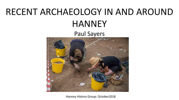
Paul Sayers
Hanney History Group: October2018
HANNEY Paul Sayers Hanney History Group: October2018 WHAT IS - - PowerPoint PPT Presentation
RECENT ARCHAEOLOGY IN AND AROUND HANNEY Paul Sayers Hanney History Group: October2018 WHAT IS DEVELOPER FUNDED ARCHAEOLOGY? National Planning Policy Framework (NPPF) March 2012 Reinforced by VWH DC own policies To simplify Desk based
Hanney History Group: October2018
National Planning Policy Framework (NPPF) March 2012 Reinforced by VWH DC own policies To simplify Desk based assessment Excavation as directed by the County Archaeologist Report written up Planners must take account of County Archaeologist’s view Growth of commercial archaeology units, now the majority of excavations- ‘rescue digs’, site evaluations
Worcestershire Archaeology for Lagan Homes
Start of farming: domesticated animals, crops, settlement Chambered tombs, stone circles, polished stone axes Pottery Wayland’s Smithy Polished stone axe Avebury
Worcestershire Archaeology for Lagan Homes
Fieldwork May 2016, 6 trenches, 3.7% of area Neolithic : pit with three Peterborough Ware bowl rims (an unusual find) gully suggesting field system Roman: gully and ditch with pottery fragments suggesting field system but no settlement nearby Undated post-holes related to settlement Fragments of animal bone
Worcestershire Archaeology for Lagan Homes
Peterborough Ware bowl rims
whole bowl of a similar type
Thames Valley Archaeological Services for Linden Homes Trench locations
Thames Valley Archaeological Services for Linden Homes
ROMAN CHRONOLOGY: BC 55 & 54 Caesar’s Raids AD 43 Successful invasion under Claudius AD 60/61 Boudicca freedom campaign AD 286-296 UDI under Carausius ( The first Hard Brexit?) AD 410 End of Roman rule
Thames Valley Archaeological Services for Linden Homes
Fieldwork 17 August-10 September 2015, 82 trenches 25m X 2m OBJECTIVES:
*to determine if archaeological deposits of any period are present; *to determine if any Roman roadside settlement or even the Roman road itself are present in the eastern portion of the site; *to determine if any occupation deposits of Saxon or medieval date are present; and *to determine if any medieval manorial remains are present. These objectives reflect information provided by Hanney History Group
Thames Valley Archaeological Services for Linden Homes No wonder that rumours spread in the village that development had started!
Thames Valley Archaeological Services for Linden Homes Possible cremation burial Burial
Thames Valley Archaeological Services for Linden Homes
FEATURES: Ditches, gullies, furrows and pits in almost every trench FINDS: Pottery : 1220 sherds, some Bronze/Iron Age , mostly Roman (2nd and 3rd C), 54 Medieval Metalwork: 53 items including 4 coins, a copper alloy oyster spoon, assorted ironwork, mainly nails Animal bone fragments: mainly cattle and sheep/goat Human burials: 5 including a baby + a possible cremation Wall daub: 1 definite fragment
Thames Valley Archaeological Services for Linden Homes
CONCLUSIONS: “Archaeological interest in almost every trench” Some activity in Bronze/ Iron Age Extensive spread of Roman occupation, several clusters of habitation surrounded by paddocks and enclosures Modest status, no elaborate stone structures, moderately well off not high status No clustering of burials so no formal cemetery No Roman road Medieval ridge and furrow, pits and ditches on eastern part of site but no manorial remains
Fieldwork 2013, 5 areas total 0.7 ha, 16% of total area
Oxford Archaeology for CgMs Consulting on behalf of Gallagher Estates and Gleeson Homes Bellingers
Flint, 38 worked pieces mainly Mesolithic, a few Neolithic Middle Bronze Age, enclosure and field system 2 pits with cremation burials Roman, 2 cremation burials 1 inhumation burial
Oxford Archaeology for CgMs Consulting on behalf of Gallagher Estates and Gleeson Homes Results published in Oxoniensia 2017 (Vol 82) Roman/Romano-British 43BC-410AD Iron Age 800BC-43AD Bronze Age 2300-800BC Neolithic 4000-2300BC Mesolithic 9600-4000BC
(Grove Wick Farm) Fieldwork July 2018 , 37 trenches 30m x 2m FEATURES DITCHES: Bronze Age, Iron Age, Roman, Medieval IRON AGE SETTLEMENT: roundhouses , post-holes, pits FINDS Mesolithic (9,600 – 4000BC) flint knapping waste (rare find in Oxfordshire)
Oxford Archaeology for Williams Grand Prix Engineering
Wessex Archaeology for CgMs Consulting
Oxford Archaeology for Williams Grand Prix Engineering
Aerial photograph Sept 1947 Google Earth Oct 2012 ‘Substantial bank with ridge and furrow going over it, looks like an agger to me.’ EH Landscape Archaeologist November 2006
LIDAR (Light Detection and Ranging)
Images and information by courtesy of Patrick Karney Listed (Grade II) chest tomb in need of repair
Images and information by courtesy of Patrick Karney The inscription
Images and information by courtesy of Patrick Karney Dismantling the superstructure
Images and information by courtesy of Patrick Karney Removing the superstructure reveals the barrel roof of a brick built vault. A damaged area provided a small hole.
Images and information by courtesy of Patrick Karney Patrick inserts a mobile phone on a selfie stick to take pictures
Images and information by courtesy of Patrick Karney The camera shows a substantially built vault with a barrel roof and a bricked up doorway
Images and information by courtesy of Patrick Karney Stonemason’s sketch plan The vault is approximately 2 metres x 2 metres and 1.4 metres high
Inside, any coffins had decayed away but there were the remains of two skeletons, one had a badly broken femur which had healed.
Respect for human remains Need for licenses and permissions Cost Bio-hazard Images and information by courtesy of Patrick Karney
Images and information by courtesy of Patrick Karney
Research by Hanney History Group shows that the Woodwards were a dynasty of local carpenters living in East Hanney. It is likely that Thomas had been sent as an apprentice to London. Once qualified he prospered. As a ‘local boy made good’, when his beloved son died in 1725 he wanted to bring him home to Hanney and also show his own achievement in becoming a Citizen of London. If one of the skeletons was William, it is possible that the other is his father Thomas, who we believe was buried in Hanney in 1747. But there is no inscription on the tomb to commemorate this.
Images and information by courtesy of Patrick Karney
Before the restoration was completed a stainless steel plaque was placed inside.
Images and information by courtesy of Patrick Karney
Images and information by courtesy of Patrick Karney
Restoration completed
Images and information by courtesy of Patrick Karney
and landscaped