Glendale Niagara District Plan Study - Phase 2 Public Information - - PowerPoint PPT Presentation

glendale niagara district plan study phase 2
SMART_READER_LITE
LIVE PREVIEW

Glendale Niagara District Plan Study - Phase 2 Public Information - - PowerPoint PPT Presentation

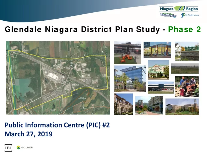
Glendale Niagara District Plan Study - Phase 2 Public Information Centre (PIC) #2 March 27, 2019 Purpose of PIC #2 Present Draft Land Use Options Format of PIC #2 and Built Form Precedents 6:00 - 6:30 pm Review of Display Panels 6:30


slide-1
SLIDE 1

Glendale Niagara District Plan Study - Phase 2

Public Information Centre (PIC) #2 March 27, 2019

slide-2
SLIDE 2

Glendale Niagara District Plan Study - Phase 2 PIC #2, March 27, 2019

Purpose of PIC #2

1

  • Present Draft Land Use Options

and Built Form Precedents

  • Present preliminary insights

from on-going urban design, transportation and commercial market component studies

  • Detail next steps, including
  • pportunities for input and

participation

  • Answer questions and receive

feedback

Format of PIC #2 6:00 - 6:30 pm Review of Display Panels 6:30 - 6:50 pm Presentation 6:50 - 7:20 pm Question & Answer Period 7:20 - 8:00 pm Review of Display Panels

slide-3
SLIDE 3

Recap on District Plan Study Purpose & Scope

  • District Plans are proactive planning strategies

for priority areas of Niagara Region that help will implement provincial policies and inform future local planning initiatives, such as updates to Official Plans and Secondary Plans.

  • Phase 1 - Vision Exercise and Concept Plan
  • Completed by The Planning Partnership and endorsed by Regional

Council in October 2018

  • Phase 2 - District Plan and Component Studies
  • Underway by IBI Group, anticipated to be complete by July 2019

Glendale Niagara District Plan Study - Phase 2 PIC #2, March 27, 2019

  • A District Plan is required for Glendale to help co-ordinate interests of

multiple jurisdictions and to establish a framework to transform the area into a compact, complete and iconic community.

  • A two-phase District Plan Study was initiated by the Region:

2

slide-4
SLIDE 4
  • 400 hectares are

within the Urban Boundary, where growth is intended to occur

  • Mix of land uses are

permitted, but a more traditional, suburban approach to community planning:

  • Discrete land uses
  • Large amounts of

land for industrial

  • Low densities

Existing Planning Permissions

Glendale Niagara District Plan Study - Phase 2 PIC #2, March 27, 2019

3

slide-5
SLIDE 5

Existing Land Use and Built Form Conditions

  • Mix of rural, suburban and

urban conditions, with extensive natural open space

  • Built Form:
  • Mostly 1 and 2 storey buildings, a

few mid-rise (3 to 7 storeys)

  • Predominantly low density
  • Mix of age, condition and

architectural styles

  • Automobile-oriented
  • Key anchors and attractions
  • Vacant and underutilized lands

Glendale Niagara District Plan Study - Phase 2 PIC #2, March 27, 2019

4

slide-6
SLIDE 6

Phase 1 Preferred Vision

  • Complete community

with a more integrated mix of land uses

  • Defined nodes
  • Improved mobility
  • Positive urban

experience, still protecting the natural environment

  • High quality design
  • Regional economic

drivers

Glendale Niagara District Plan Study - Phase 2 PIC #2, March 27, 2019

5

slide-7
SLIDE 7

Phase 2 Preparation of Two Draft Land Use Plans

  • Using a set of guiding principles/frameworks, two draft land use plans

have been prepared

  • Both options show minor adjustments to the Phase 1 land use plan and

vision, based on:

  • Review of existing Environmental Conservation Area designations
  • Draft findings of on-going technical analysis (i.e. transportation, urban design and

commercial market)

  • New development plans/proposals
  • Additional stakeholder consultation
  • Other policy / regulatory considerations
  • The pros and cons of each option are being evaluated and the ultimate

preferred / recommended land use plan will likely be a compilation of the two draft options

Glendale Niagara District Plan Study - Phase 2 PIC #2, March 27, 2019

6

slide-8
SLIDE 8

Key Differences Betw een Draft Options A & B

  • Non-Urban land:
  • Option A proposes redesignating some lands to reflect current uses while Option B

maintains the existing designations, as current uses are permitted

  • Alternative locations for:
  • Potential Transit/Tourism Hub
  • Potential schools
  • Community Focus node
  • Employment areas
  • Mixed-Use vs. Single-Use
  • Option A provides more specific lands for specific uses, such as hospitality and

commercial retail and Option B provides more opportunities for mixed-use

  • Variation in height and density:
  • Option A proposes greater height and densities in four Districts and Option B proposes

greater heights in one district

Glendale Niagara District Plan Study - Phase 2 PIC #2, March 27, 2019

7

slide-9
SLIDE 9

Draft Land Use Plan - Option A (Phase 1 Vision w ith Minor Adjustments)

Glendale Niagara District Plan Study - Phase 2 PIC #2, March 27, 2019

8

slide-10
SLIDE 10

Draft Land Use Plan - Option B (Phase 1 Vision w ith Alternate Land Uses)

Glendale Niagara District Plan Study - Phase 2 PIC #2, March 27, 2019

9

slide-11
SLIDE 11
  • Appropriate building

heights will be determined with consideration to:

  • Existing height permissions
  • Federal height restrictions

associated with the Niagara District Airport

  • Protection of views/vistas
  • Providing appropriate

transitions and interface

  • Opportunities for gateway or

landmark features

Building Height Considerations

Glendale Niagara District Plan Study - Phase 2 PIC #2, March 27, 2019

10

slide-12
SLIDE 12

Existing Building Height Permissions

Glendale Niagara District Plan Study - Phase 2 PIC #2, March 27, 2019

11

slide-13
SLIDE 13

Draft Proposed Building Heights

  • Both options propose:
  • Low-Rise: minimum building heights of generally 3 storeys
  • Mid-Rise: 3 to 8 storeys
  • Tall: up to 16 storeys, with some permissions for up to 20 storeys
  • Heights permissions will be fully determined through future local planning

reviews

Glendale Niagara District Plan Study - Phase 2 PIC #2, March 27, 2019

12

slide-14
SLIDE 14

Examples of Low -rise, Low Density Residential

Glendale Niagara District Plan Study - Phase 2 PIC #2, March 27, 2019

13

Sources of photos: IBI Group, mexhouse.com, builderonline.com, calgaryhomeboys.com, realestate.charlottevillehome.com, contemporist.com, google earth maarchitects.com and daft.ie
slide-15
SLIDE 15

Examples of Mid-Rise, Medium Density Residential

Glendale Niagara District Plan Study - Phase 2 PIC #2, March 27, 2019

14

Sources of photos: IBI Group
slide-16
SLIDE 16

Examples of High-Rise, High Density Residential

Glendale Niagara District Plan Study - Phase 2 PIC #2, March 27, 2019

15

Sources of photos: IBI Group
slide-17
SLIDE 17

Examples of Medium Density Mixed-Use

Glendale Niagara District Plan Study - Phase 2 PIC #2, March 27, 2019

16

Sources of photos: IBI Group and Google Earth
slide-18
SLIDE 18

Example of High-Density Mixed-Use

Glendale Niagara District Plan Study - Phase 2 PIC #2, March 27, 2019

17

Sources of photos: IBI Group
slide-19
SLIDE 19

Next Steps for Phase 2

  • Collect stakeholder and public input!
  • Finalize Transportation, Urban Design and Commercial Market

Component Studies

  • Finalize Draft Demonstration Plans for the two Draft Land Use

Options and Option Analysis

  • Prepare District Plan with Preferred Land Use and Demonstration

Plans, policy recommendations, guidelines and implementation strategies

  • Draft Regional Official Plan Amendment (ROPA)

Glendale Niagara District Plan Study - Phase 2 PIC #2, March 27, 2019

18

slide-20
SLIDE 20

How to Continue to Participate in Phase 2

Glendale Niagara District Plan Study - Phase 2 PIC #2, March 27, 2019

19

slide-21
SLIDE 21

Interactive Web-based Platform - Coming!

  • Crowdsource Polling Mapping
  • Online map-based engagement platform that can be embedded

into a host website and capture personal data of respondents

  • Allows the public to review plans and obtain more detailed

information by clicking on a specific area and then either cast a vote or leave a comment.

  • Comments are automatically saved to a database that can be

later exported to Excel

Glendale Niagara District Plan Study - Phase 2 PIC #2, March 27, 2019

20

slide-22
SLIDE 22

Interactive Web-based Platform - example of w hat’s coming

  • Glendale Niagara District

Plan page:

https://www.niagararegion.ca /projects/district-plans/

  • glendale. aspx

Or enter Glendale Niagara District Plan into your search engine

  • Separate links will be

provided for Draft Option A and Draft Option B

  • The link will be embedded into the Niagara Region’s website:

Glendale Niagara District Plan Study - Phase 2 PIC #2, March 27, 2019

21

Provide input on the Option A & B Draft Land Use Plans https://www.glendaleniagaradistrictplan.com/ crowdsource/craftlanduseplan_optionA https://www.glendaleniagaradistrictplan.com/ crowdsource/craftlanduseplan_optionB

slide-23
SLIDE 23

Glendale Niagara District Plan Study - Phase 2 PIC #2, March 27, 2019

22

Interactive Web-based Platform - example of w hat’s coming

Example

slide-24
SLIDE 24

Glendale Niagara District Plan Study - Phase 2 PIC #2, March 27, 2019

23

Interactive Web-based Platform - example of w hat’s coming

slide-25
SLIDE 25

Questions or Comments?

Thank you for participating in PIC #2

Glendale Niagara District Plan Study - Phase 2 PIC #2, March 27, 2019

24