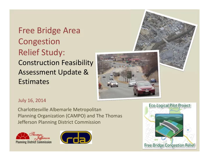
SLIDE 1
Free Bridge Area Congestion Relief Study:
Construction Feasibility Assessment Update & Estimates
July 16, 2014 Charlottesville Albemarle Metropolitan Planning Organization (CAMPO) and The Thomas Jefferson Planning District Commission
SLIDE 2 Feasibility Assessment Update
Process
- Refinement of alternatives through collaboration between RDA,
TJPDC staff, and stakeholders
- Stakeholder input solicited via e‐mail and online survey forms
- Concept drawings and Feasibility Analysis update to reflect the
refined alternatives
2
SLIDE 3
Alternative A‐1
Free Bridge Overpass/Expressway The original Alternative A was split into A‐1 and A‐2. Alternative A‐1 only includes construction of an elevated structure that would route two lanes of US 250 east and west bound traffic over the intersections of US 250/20 and US 250/High Street. The existing intersections and bridge will remain below the flyover structure.
SLIDE 4
Alternative A‐1
SLIDE 5 Alternative A‐1 Evaluation Matrix
Free Bridge Overpass/Expressway
LOW MODERATE HIGH Property Impacts X Access Impacts X Utility Impacts X Park Impacts X Trail Impacts X Railroad Impacts X Maintenance of Traffic Impacts X Bridges X Floodway Influence X Drainage Structures i.e. Box Culvert, Stormwater Management Facilities X Earthwork/Terrain X Retaining Walls X Construction Feasibility X Expected Congestion Relief @ Free Bridge X Expected Cost X
SLIDE 6
Alternative A‐2
Jug Handle/ Left turn elimination at US250 W and High Street Alternative A‐2 includes reconfiguring the US 250 and High Street intersection to eliminate left turn movements from west bound US 250. In this configuration traffic wanting to make a left turn would pass through the intersection and make a right at Landonia Circle. A new connector road would then join Landonia Circle to River Road where a traffic light would be installed.
SLIDE 7
Alternative A‐2
SLIDE 8 Alternative A‐2 Evaluation Matrix
Jug Handle/ Left turn elimination at US250 W and High Street
LOW MODERATE HIGH Property Impacts X Access Impacts X Utility Impacts X Park Impacts X Trail Impacts X Railroad Impacts X Maintenance of Traffic Impacts X Bridges X Floodway Influence X Drainage Structures i.e. Box Culvert, Stormwater Management Facilities X Earthwork/Terrain X Retaining Walls X Construction Feasibility X Expected Congestion Relief @ Free Bridge X Expected Cost X
SLIDE 9 Alternative B
Park and Ride, and Bike/Pedestrian Connections This alternative includes a new park and ride lot located at the VDOT offices (VDOT way and Richmond Road) and a hard surface trail. The trail will run parallel to the Rivanna River and then cross the river on a new bike and pedestrian bridge in the vicinity of Riverview Park. The trail will provide the
- pportunity for making connections further downstream along the river.
SLIDE 10
Alternative B
SLIDE 11
Alternative B
SLIDE 12 Alternative B Evaluation Matrix
Park and Ride, and Bike/Pedestrian Connections
LOW MODERATE HIGH Property Impacts X Access Impacts X Utility Impacts X Park Impacts X Trail Impacts X Railroad Impacts X Maintenance of Traffic Impacts X Bridges X Floodway Influence X Drainage Structures i.e. Box Culvert, Stormwater Management Facilities X Earthwork X Retaining Walls X Construction Feasibility X Expected Congestion Relief @ Free Bridge X Expected Cost X
SLIDE 13 Alternative D‐1 & D‐2
Rivanna River Parkway Alternative D‐1 includes construction of a new road linking Route 20 with Rio
- Road. This new road would have two vehicle travel lanes with two bike lanes
(similar to the John Warner Parkway). The intersection with Route 20 would be aligned with an extension of Olympia Drive. In addition to adding a new 2 lane connection from Route 20 to Rio Road the project would also include widening Rio Road to 4 lanes from Pen Park Lane to the John Warner Parkway intersection. Alternative D‐2 is the same as D‐1 but considers improving Elk Drive through Darden Towe Park rather than constructing a road west of the Elks Lodge and the slated development for the land parcel south of the Lodge.
SLIDE 14
Alternative D‐1 & D‐2
SLIDE 15
Alternative D‐1 & D‐2
SLIDE 16
Alternative D‐1
SLIDE 17
Alternative D‐2
SLIDE 18 Alternative D‐1 & D‐2 Evaluation Matrix
Rivanna River Parkway
LOW MODERATE HIGH Property Impacts X Access Impacts X Utility Impacts X Park Impacts X Trail Impacts X Railroad Impacts X Maintenance of Traffic Impacts X Bridges X Floodway Influence X Drainage Structures i.e. Box Culvert, Stormwater Management Facilities X Earthwork/Terrain X Retaining Walls X Construction Feasibility X Expected Congestion Relief @ Free Bridge X X Expected Cost X
SLIDE 19
Alternative F
Increased Lane Capacity on Free Bridge This alternative increases the number of through traffic lanes between High Street and Route 20 to three lanes in each direction. Increasing the number of lanes requires removal of existing sidewalks on Free Bridge and relocating them to a dedicated bike and pedestrian crossing immediately down river of the existing span.
SLIDE 20
Alternative F
SLIDE 21 Alternative F Evaluation Matrix
Increased Lane Capacity on Free Bridge
LOW MODERATE HIGH Property Impacts X Access Impacts X Utility Impacts X Park Impacts X Trail Impacts X Railroad Impacts X Maintenance of Traffic Impacts X Bridges X Floodway Influence X Drainage Structures i.e. Box Culvert, Stormwater Management Facilities X Earthwork/Terrain X Retaining Walls X Construction Feasibility X Expected Congestion Relief @ Free Bridge X Expected Cost X
SLIDE 22 Alternative G
South Pantops Drive Connector Bridge This alternative includes a new bridge connection between New House Drive/South Pantops Drive and East High Street. The bridge would be a two lane urban style bridge with appropriate bike and pedestrian facility
- accommodations. Additional considerations include a new intersection at High
Street aligned with Willow Drive, a new intersection at New House Drive/South Pantops Drive, and improvements to South Pantops Drive through the shopping center.
SLIDE 23
Alternative G
SLIDE 24 Alternative G Evaluation Matrix
South Pantops Drive Connector Bridge
LOW MODERATE HIGH Property Impacts X Access Impacts X Utility Impacts X Park Impacts X Trail Impacts X Railroad Impacts X Maintenance of Traffic Impacts X Bridges X Floodway Influence X Drainage Structures i.e. Box Culvert, Stormwater Management Facilities X Earthwork/Terrain X Retaining Walls X Construction Feasibility X Expected Congestion Relief @ Free Bridge X Expected Cost X
SLIDE 25
Alternative I
Intersection Improvements at US 250/Route 20 & High Street This alternative consists of intersection improvements that would improve side street turning movements in addition to a west bound right turn lane from US 250 to Route 20. Additional side street lanes would be added to allow the implementation of split phase light timing. These changes have the potential to reduce collisions and improve intersection efficiency.
SLIDE 26
Alternative I
SLIDE 27 Alternative I Evaluation Matrix
Intersection Improvements at US 250/Route 20 & High Street
LOW MODERATE HIGH Property Impacts X Access Impacts X Utility Impacts X Park Impacts X Trail Impacts X Railroad Impacts X Maintenance of Traffic Impacts X Bridges X Floodway Influence X Drainage Structures i.e. Box Culvert, Stormwater Management Facilities X Earthwork/Terrain X Retaining Walls X Construction Feasibility X Expected Congestion Relief @ Free Bridge X Expected Cost X
SLIDE 28
Construction Feasibility Summary
LOW MODERATE HIGH Alternative A‐1
X
Alternative A‐2
X
Alternative B
X
Alternative D
X
Alternative F
X
Alternative G
X
Alternative I
X
SLIDE 29
Expected Congestion Relief Summary
LOW MODERATE HIGH Alternative A‐1
X
Alternative A‐2
X
Alternative B
X
Alternative D
X X
Alternative F
X X
Alternative G
X
Alternative I
X
SLIDE 30
Expected Cost Summary
LOW MODERATE HIGH Alternative A‐1
X
Alternative A‐2
X
Alternative B
X
Alternative D
X
Alternative F
X
Alternative G
X
Alternative I
X
SLIDE 31
Summary
Construction Feasibility Congestion Relief Cost Alternative A‐1
LOW HIGH HIGH
Alternative A‐2
HIGH LOW LOW
Alternative B
MOD LOW LOW
Alternative D
MOD LOW/MOD HIGH
Alternative F
MOD MOD/HIGH MOD
Alternative G
HIGH LOW MOD
Alternative I
HIGH LOW LOW
SLIDE 32
Questions?
SLIDE 33 Estimates
Preliminary Engineering
- Estimated as a percentage of the Construction Cost using a
sliding scale from 20% for a $5 million project to 10% for a $400 million project
33
SLIDE 34 Estimates
Right of Way and Utilities
- RDA Right of Way Staff researched assessed real estate values to
develop a price per square foot cost
- The square feet of right of way required was measured off of the
concept drawings based on GIS information
- A multiplier of 2.75 was used to account for temporary easements,
permanent easements, damages, and administrative costs.
- Individual cost assessment was performed for parcels requiring
relocation/total take.
- RDA Utility Staff used the VDOT Project Cost Estimating System (PCES)
to estimate utility relocation costs based on field reconnaissance and utility records research
34
SLIDE 35 Estimates
Construction
- RDA Engineering Staff determined whether VDOT’s PCES tool or
performing a quantity take‐off was the most appropriate method for each alternative
- PCES is a parametric estimating tool developed by VDOT that estimates
construction cost using historical price data based on certain project characteristics and measurement inputs. It’s best suited for typical roadway widening projects or new roadway construction
- On projects not deemed suitable for PCES, RDA staff calculated quantities
- f major construction items and used unit prices from VDOT Construction
Division’s District Wide Averages published online. Percentages for incidentals (smaller items not able to be quantified with this level of design) and contingencies were added to arrive at a final construction estimate
35
SLIDE 36
Alternative A‐1 Estimate
Free Bridge Overpass/Expressway Preliminary Engineering $13,791,000 Right of Way $7,000,344 Construction $120,453,482 Total $141,244,826
SLIDE 37
Alternative A‐2 Estimate
Jug Handle/ Left turn elimination at US250 W and High Street Preliminary Engineering $823,855 Right of Way $4,508,527 Construction $3,744,793 Total $9,077,175
SLIDE 38
Alternative B Estimate
Park and Ride, and Bike/Pedestrian Connections Stone Dust Trail Option Preliminary Engineering $1,337,635 Right of Way $487,226 Construction $7,565,070 Total $9,389,931
SLIDE 39
Alternative B Estimate
Park and Ride, and Bike/Pedestrian Connections Asphalt Trail Option Preliminary Engineering $1,461,401 Right of Way $487,226 Construction $8,265,033 Total $10,213,660
SLIDE 40
Alternative D‐1 Estimate
Rivanna River Parkway Preliminary Engineering $6,950,000 Right of Way $9,646,828 Construction $53,424,076 Total $70,020,904
SLIDE 41
Alternative D‐2 Estimate
Rivanna River Parkway (using Elk Drive) Preliminary Engineering $6,750,000 Right of Way $9,386,604 Construction $51,905,393 Total $68,041,997
SLIDE 42
Alternative F Estimate
Increased Lane Capacity on Free Bridge Preliminary Engineering $1,850,000 Right of Way $7,820,216 Construction $10,874,119 Total $20,544,335
SLIDE 43
Alternative G Estimate
South Pantops Drive Connector Bridge Preliminary Engineering $2,740,000 Right of Way $6,098,514 Construction $18,267,565 Total $27,106,079
SLIDE 44
Alternative I Estimate
Intersection Improvements at US 250/Route 20 & High Street Preliminary Engineering $1,063,712 Right of Way $942,437 Construction $5,414,294 Total $7,420,443
SLIDE 45 Cost Summary
PE RW CN TOTAL Alternative A‐1
$13,791,000 $7,000,344 $120,453,482
$141,244,826
Alternative D‐1
$6,950,000 $9,646,828 $53,424,076
$70,020,904
Alternative D‐2
$6,750,000 $9,386,604 $51,905,393
$68,041,997
Alternative G
$2,740,000 $6,098,514 $18,267,565
$27,106,079
Alternative F
$1,850,000 $7,820,216 $10,874,119
$20,544,335
Alternative B ‐ Paved
$1,461,401 $487,226 $8,265,033
$10,213,660
Alternative B‐ Stone Dust
$1,337,635 $487,226 $7,565,070
$9,389,931
Alternative A‐2
$823,855 $4,508,527 $3,744,793
$9,077,175
Alternative I
$1,063,712 $942,437 $5,414,294
$7,420,443
SLIDE 46 Next Steps
- 1. TJPDC Staff will begin the process of running alternatives
through the Regional Ecological Framework tool and Travel Demand model
- 2. Results of this process will be discussed at the next meeting in
September
- 3. Stakeholders can expect information about how alternatives
would impact the natural environment and regional traffic conditions
- 4. Final Report to be completed October 31, 2014
46
SLIDE 47
Contact Information:
Wood Hudson Senior Environmental Planner Thomas Jefferson Planning District Commission (434) 979‐7310 whudson@tjpdc.org
Questions?