
SLIDE 1
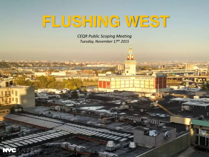
FLUSHING WEST
CEQR Public Scoping Meeting
Tuesday, November 17th 2015
FLUSHING WEST CEQR Public Scoping Meeting Tuesday, November 17 th - - PowerPoint PPT Presentation
FLUSHING WEST CEQR Public Scoping Meeting Tuesday, November 17 th 2015 AGENDA Welcome & Introductions Presentation Flushing West Rezoning Proposal Environmental Review / Draft Scope of Work Comments from Elected Officials,
CEQR Public Scoping Meeting
Tuesday, November 17th 2015
AGENDA
Builds upon a long history of previous planning work in Downtown Flushing Create a Comprehensive Neighborhood Plan to improve quality
incorporate mandatory affordable housing and preservation strategies
current business and workforce needs & future growth
contribute to achieving a more livable neighborhood
FLUSHING WEST NEIGHBORHOOD PLANNING STUDY
3
FLUSHING AREA CONTEXT
4
FLUSHING NEIGHBORHOOD AREAS
5
FLUSHING WEST FOCUS AREAS
6
FLUSHING WEST GOALS & OBJECTIVES
support policy changes that will shape a more livable neighborhood
affordable component, and preserve existing affordable housing.
downtown area to the waterfront, and create
small business culture by providing economic
to support current demands and future growth
Image: NYC DCP
7
FLUSHING BROWN FIELD OPORTUNITY AREA NOMINATION PROCESS
(2011 - Present)
DEVELOP FLUSHING WEST NEIGHBORHOOD PLAN
(Fall 2014- Spring 2016)
PUBLIC REVIEW (ULURP)
NEIGHBORHOOD PLAN APPROVAL
REPORT-BACK VISIONING FEEDBACK ON PROPOSED PLAN SHARE DRAFT PLAN COMPONENTS January 2016 COMMUNITY BOARD REVIEW BOROUGH PRESIDENT REVIEW CITY PLANNING COMMISSION CITY COUNCIL PUBLIC SCOPING MEETING PUBLIC COMMENT PERIOD ON DRAFT SCOPE OF WORK- 10 days ENVIRONMENTAL ANALYSIS DRAFT ENVIRONMENTAL IMPACT STATEMENT (DEIS) FINAL ENVIRONMENTAL IMPACT STATEMENT PUBLIC COMMENT PERIOD ON DEIS
ENVIRONMENTAL REVIEW
We are here
STUDY TIMELINE
8
Fall 2016 Spring 2016
WHAT WE HAVE HEARD FROM THE COMMUNITY
HOUSING
TRANSPORTATION
PUBLIC REALM
COMMUNITY RESOURCES
PARKS AND OPEN SPACE
Flushing Meadows-Corona Park
9
CURRENT ZONING AND RECENT DEVELOPMENTS
One Fulton Square - 2014 (9-story, 168-room Hyatt Hotel; 3-story retail complex,
12-story condo complex; 300 parking spaces) Prince Plaza - 2012 (14-story building with 72 units; 2-story retail complex, 2-story community facility complex including senior care & day care; 126 parking spaces 10
CURRENT ZONING AND LAND USE
Commercial/Residential/Community Facility uses (C4-2)
(2.43 floor area ratio)
most density (4.8 FAR)
Light Manufacturing uses (M1-1)
(1.0 FAR)
Heavy Manufacturing uses (M3-1)
and asphalt plants allowed; limited commercial uses (2.0 FAR)
11
CURRENT ZONING ISSUES
Study Area and may produce towers set back from the street on low base portions
currently favors select commercial development– such as hotels– over housing
types of commercial development
length rules on waterfront lots make new development here very complicated
uses are permitted
Parc Hotel
Image: NYC DCP Zoning Handbook Image: NYC DCP
12
EXISTING WATERFRONT ACCESS PLAN (WAP)
13
EXISTING STREETS & WAP REQUIREMENTS
Visual corridors & upland connections do not effectively support public circulation throughout the waterfront area Very narrow sidewalk
*Graphic for illustrative purposes only
14
AIRPORT ZONING HEIGHT LIMITS & AREA TOPOGRAPHY
based upon guidance by the FAA
range from 150’-170’ above mean sea level
combined with the area’s varied topography (15’-45’), means that buildings can’t go higher than ~13 stories within the Study Area without seeking a special permit from the BSA
*Map for illustrative purposes only
15
POTENTIAL DEVELOPMENT UNDER CURRENT ZONING
16
POTENTIAL STREETSCAPE WITH CURRENT ZONING
17
POTENTIAL DEVELOPMENT WITH CURRENT ZONING
18
LAND USE FRAMEWORK
GOALS & OBJECTIVES
affordable component, and preserve existing affordable housing
increase the amount of open space
into the waterfront blocks
STRATEGIC AREAS
with Improved Public Waterfront Access
19
a condition of new housing development within Flushing West
taking into consideration neighborhood conditions and affordability needs, and increases ratio of affordable to market-rate units
Option 1: 25% of housing floor area at an average of 60% Area Median Income (AMI) ($46,620 annually for a family of three) or Option 2: 30% of housing floor area at an average of 80% AMI ($62,150 annually for a family of three)
will establish the MIH program for use in current and future neighborhood study areas
LANDUSE FRAMEWORK
21
RECOMMENDED ZONING APPROACH
Draft Recommendations
across the C4-4A and MX M1-2/R7A Districts
requirements to allow for buildings similar in form to those in the downtown area, but take airport flight path into account
sites are developed that extend the road network from Downtown Flushing to the waterfront
increase public paths to the waterfront and increase the amount of open space
community facility spaces to support the neighborhood
located and sized mixed-use bus transit center
21
WATERFRONT AND UPLAND AREA
Strategies and Draft Recommendations
including new affordable housing
development to create vibrant streets.
facility spaces to support the neighborhood
allowed if 0.2 FAR of a certain CF uses are provided.
those in the downtown area, but take airport flight path into account:
14 stories
review and approvals
C4-4 district. Generally one per 1,000 sf of space.
22
CONCEPTUAL WATERFRONT SITE PLAN
Strategies and Draft Recommendations
to the waterfront and increase the amount
waterfront sites are developed that extend the road network from Downtown Flushing to the waterfront
allow for more practical building envelopes.
designed publicly accessible areas.
ensure that amenities divided between property owners are developed in a cohesive fashion
allowed to ensure adequate access to individual sites whose neighbors have yet to construct their required segments of the private street network.
23
POTENTIAL MASSINGS UNDER LAND USE FRAMEWORK
24
LAND USE FRAMEWORK ELEMENTS
25
LAND USE FRAMEWORK ELEMENTS
ILLUSTRATIVE VIEW LOOKING WEST FROM 39th AVE. TO FLUSHING CREEK
26
LAND USE FRAMEWORK ELEMENTS
ILLUSTRATIVE VIEW OF COLLEGE POINT BLVD & 37th AVE. LOOKING SOUTH
27
LAND USE FRAMEWORK ELEMENTS
ILLUSTRATIVE VIEW OF NEW WATERFRONT OPEN SPACE & WALKWAY LOOKING NORTH
28
LAND USE FRAMEWORK ELEMENTS
ILLUSTRATIVE VIEW OF WATERFRONT FROM #7 TRAIN LOOKING NORTHEAST
29
MIXED-USE AREA
Strategies and Draft Recommendations
uses and ensure they will be compatible with residential uses
including affordable housing
facility spaces to support the neighborhood
allowed if 0.2 FAR of a certain CF uses are provided
those in the downtown area, but take airport flight path into account:
14 stories
review and approvals
C4-4 district. Generally one per 1,000 sf of space.
30
COMMERCIAL AND LIGHT INUSTRIAL AREA
Strategies and Draft Recommendations
manufacturing uses to the north and the mixed-use & more residential areas to the south
commercial uses in this area
Retain existing M1-1 on upland blocks.
those of a C4-4 district. Generally one per 1,000 sf
31
BUS TRANSIT CENTER (ALTERNATIVE)
Strategies and Draft Recommendations
the downtown
appropriate location within the rezoning area
development of a BTC and related mixed-use development
vision for the area
32
FLUSHING WEST REZONING
33
FLUSHING WEST REZONING
34
Environmental Review
Discretionary land use actions considered by the City Planning Commission (CPC) are subject to the City Environmental Quality Review (CEQR) process. Pursuant to state and local law, CEQR identifies any potential adverse environmental effects of proposed actions, assesses their significance, and proposes measures to eliminate or mitigate significant impacts. When DCP proposes a zoning map or text amendment, DCP must disclose and analyze its potential environmental impacts which the CPC, as lead agency, must take into consideration when it votes to approve or disapprove the proposal.
Reasonable Worst-Case Development Scenario (RWCDS)
In order to assess the possible effects of the proposed actions, a reasonable worst case development scenario has been developed for both the current (Future No-Action) and proposed (Future With-Action) conditions for a ten-year period (analysis year 2025) to represent the foreseeable future for the area-wide rezoning. The incremental difference between the Future No- Action and Future With-Action conditions on identified development sites will serve as the basis for the impact analyses of the environmental review.
Development Site Criteria
Generally, for area-wide rezonings that create a broad range of development opportunities, new development can be expected to occur on selected, rather than all, sites within the rezoning area. The first step in establishing the development scenario was to identify those sites where new development could be reasonably expected to occur.
Projected Development Sites
Projected development sites are considered more likely to be developed within the analysis period and are assessed for both density‐related and site‐specific environmental impacts.
Potential Development Sites
Potential sites are considered less likely to be developed
impacts in order to ensure a conservative analysis.
FLUSHING WEST RWCDS
Development Scenario
alternative.
* The number of affordable dwelling units would depend
selected– either the 25% or 30% ratio.
35
FLUSHING WEST REZONING
(Schools, Libraries, Child Care)
(Traffic, Transit, Pedestrians, Parking)
36
FLUSHING WEST REZONING
37