
SLIDE 1
Floodplain Remapping Why remap the regulatory floodplain? More - - PowerPoint PPT Presentation
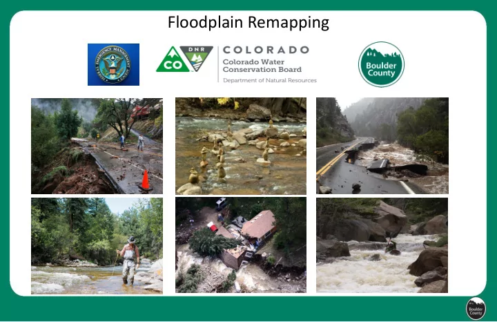
Floodplain Remapping Floodplain Remapping Why remap the regulatory floodplain? More accurate maps means more effective floodplain management and safer communities. Who is remapping the regulatory floodplain? The Federal Emergency Management
More accurate maps means more effective floodplain management and safer communities.
The Federal Emergency Management Agency (FEMA) requires the maps. The Colorado Water Conservation Board (CWCB) is managing the remapping project. AECOM (engineering consultancy) is preparing the draft maps. Boulder County supports the project and will conduct outreach and technical review to ensure accuracy.
Green
Red
Streams are being remapped in two phases that are off-set by 1 year. Each phase is estimated to take approximately 3 to 4 years to complete. There are two opportunities for public comment. The new floodplain maps will be considered for regulatory purposes once locally adopted by Boulder County in early 2017 (Phase I) or early 2018 (Phase II) The new floodplain maps will influence flood insurance requirements once they become effective FEMA floodplain maps in late 2018 (Phase I) or early 2020 (Phase II).
CWCB Phase I waterways CWCB Phase II waterways
Floodplain Remapping Timeline
* Assumes that a regulatory update is funded in FY 2017
CWCB/ AECOM develops Floodplain Maps Community Review: BoCo technical review and public
FEMA approves floodplain maps Preliminary FIRMs FEMA receives and incorporate appeals: public
Floodplains Made Effective; Insurance mandatory early 2017 mid 2017 early 2018 late 2018 mid/late 2017 Fall 2017 early 2018 late 2018 * mid 2019 * early 2020* June–Aug 2016 Sept/Oct 2016
Disclaimer: this is to be used for coordination purposes only. The dates are tentative and subject to change.
Boulder County Revised Floodplain Code Adoption (August 2016) Boulder County adopts DRAFT Maps (January) Boulder County adopts Preliminary Maps
Flood insurance is mandatory for insurable structures in the 100-year regulatory floodplain (if mortgage is federally backed). Flood insurance requirements are enforced once regulatory floodplain maps become effective (late-2018 for Phase I streams; early 2020 for Phase II). Some streams will be newly mapped as regulatory floodplains. Some dwellings will be newly mapped into the regulatory floodplain. New floodplain maps may increase or decrease the predicted 100-year flood elevation
Obtaining flood insurance sooner if your flood zone is changing will ensure lower flood insurance rates for a longer period.
The risk of flooding will not change. The new maps will be a more accurate prediction of what floodwaters are expected to inundate. Boulder County is not producing the draft floodplain maps but will keep residents and property owners informed and involved in the process. Boulder County will notify property owners if the regulatory floodplain is likely to change on their property. The opportunity to comment on Phase I draft maps will happen in Oct/Nov
consideration.
Residents and property owners will again have an opportunity to comment (and appeal) the draft floodplain maps during the FEMA determination phase (mid- 2018 for Phase I streams; mid-2019 for Phase II). Maps will be available (Fall 2016 for Phase I and Fall 2017 for Phase II) on the Boulder County website showing the new floodplain maps in relation to your property. The flood maps are not optional; they are a FEMA requirement. Maps will not necessarily reflect what happened in the 2013 flood.
Next Public Study Session Focusing on Proposed Floodplain Code Revisions
Tuesday July 26 6 to 8 p.m. Boulder County Transportation 2nd Floor 2525 13th Street in Boulder
Floodplain Remapping Website: www.bocofloodplainremapping.com Sign up for the Floodplain Remapping Listserv: http://www.bouldercounty.org/roads/plans/pages/floodplaininformed.aspx Proposed Floodplain Code Updates Information: http://www.bouldercounty.org/roads/plans/pages/floodplaincodeamend.aspx Colorado Hazard Mapping Project: http://coloradohazardmapping.com Boulder County Contact: Christian Martin 720 564 2866 floodplainregsmapscomment@bouldercounty.org
Public Comment Planning Commission Hearing(s) Public Comment Board of County Commissioners Hearing(s)
Unchanged: County Engineer authority to use best available data to regulate floodplain development. Proposed Change: Adopt best available data on to ‘County Floodplain’ overlay through a transparent public process. Anticipated Future Application: Adoption of updated floodplain mapping , including maps produced by CHAMP remapping program, several years before FEMA final adoption.
Boulder County Floodplain
FEMA Floodplain Floodplain Overlay District
Creation of the Boulder County Floodplain allows users to see other data used by Boulder County to administer its code requirements
Clarification of policy:
retrofitted) for structures located in the floodway.
renovations, residential and non-residential structures, and floodway and non-floodway locations.
Existing code All development in the floodplain requires an individual FDP. Proposed code Introduce a general permit that identifies certain minimal impact activities that will not require an individual permit.
and maintenance
drainage system infrastructure
Uses/Activities that may be covered by the General FDP
Proposed code:
elevation in both floodway and flood fringe.
Critical Facilities Include:
Topics not addressed tonight: Clarification of siting requirements on septic and propane, proposed protocol for evaluation of alternatives for Substantially- Damaged/Substantially-Improved structures in the floodway, alignment of floodplain regulations on nonconforming structures and uses with the rest of the Land Use Code…….
Next Public Study Session Focusing on Proposed Floodplain Code Revisions
Tuesday July 26 6 to 8 p.m. Boulder County Transportation 2nd Floor 2525 13th Street in Boulder
Proposed Floodplain Code Updates and Information: http://www.bouldercounty.org/roads/plans/pages/floodplaincodeamend.aspx Boulder County Contact: Christian Martin 720-564-2866 floodplainregsmapscomment@bouldercounty.org