Fall 2010 Update David A. Paterson Governor Todays Agenda 1. The - - PowerPoint PPT Presentation

fall 2010 update
SMART_READER_LITE
LIVE PREVIEW

Fall 2010 Update David A. Paterson Governor Todays Agenda 1. The - - PowerPoint PPT Presentation

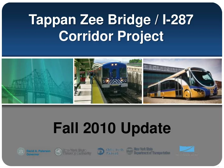
Tappan Zee Bridge / I-287 Corridor Project Fall 2010 Update David A. Paterson Governor Todays Agenda 1. The need for the project 2. Bridge Option Recommendations 3. Transit Alignment Option Recommendations 4. Highway Improvement


slide-1
SLIDE 1

David A. Paterson Governor

Tappan Zee Bridge / I-287 Corridor Project

Fall 2010 Update

slide-2
SLIDE 2

Today’s Agenda

  • 1. The need for the project
  • 2. Bridge Option Recommendations
  • 3. Transit Alignment Option

Recommendations

  • 4. Highway Improvement

Recommendations

  • 5. Status of Financing
slide-3
SLIDE 3

Existing Bridge vs. Required Bridge

Existing Bridge:

7 Lanes Movable Barrier

Required Bridge:

8 Lanes 2 BRT Lanes Safety Shoulders Pedestrian / Bike Lanes

slide-4
SLIDE 4

The Bridge Must Be Replaced

The Causeway is over Half the Length of the Bridge The Causeway Must be Replaced in all Cases

slide-5
SLIDE 5

The Bridge Must Be Replaced

The Superstructure Requires Extensive Modifications While Significant Vulnerabilities are Retained

slide-6
SLIDE 6

The Bridge Must Be Replaced

Rehabilitation Options Require Extensive New Construction Retaining Serious Vulnerabilities in the Remaining Superstructure

slide-7
SLIDE 7

The Bridge Must Be Replaced

  • 1. Rehabilitation of existing bridge in-kind is not viable
  • Does not meet project purpose and need
  • Retains serious vulnerabilities
  • 2. Rehabilitation options require extensive new work
  • Costs are comparable to replacement options
  • River impacts comparable in all options
  • 3. Rehabilitation options retain serious vulnerabilities
  • Existing main span retained is non-redundant
  • Retained structure will continue to deteriorate
  • 4. Replacement options have high life cycle (150 yrs)
slide-8
SLIDE 8

Possible Single-Level Configuration Possible Dual-Level Configuration

Replacement Bridge Capacity / Need for Transit

Both options provide:

  • 4 Traffic Lanes
  • 2 Lanes for BRT (HOV)
  • 2 Tracks for CRT
  • Safety Shoulders
  • Pedestrian and Bicycle Path
  • Capacity of 8 lane bridge is limited
  • Traffic demand will exceed 160,000
  • Impractical to provide more lanes
  • Would need to widen I-87 and I-287
  • Adding capacity for cars not feasible

New Transit is only way to relieve congestion and improve mobility in the corridor

slide-9
SLIDE 9

New Transit is Essential for the Future

  • Congestion in the Corridor is already significant and will

continue to worsen.

  • The replacement bridge will not provide additional relief.
  • Only new transit systems will help improve mobility by

affording alternative transportation choices in the future.

  • Transit can also help promote and control smart growth.
slide-10
SLIDE 10
slide-11
SLIDE 11

Commuter Rail Transit

slide-12
SLIDE 12

A B C D E

Possible Single-Level Configuration Possible Dual-Level Configuration

Scoping Results - June 2009

Replace the Tappan Zee Bridge Transit for Future Mobility

Full-Corridor BRT and CRT from Suffern to Grand Central Terminal

slide-13
SLIDE 13

Alternatives Development Roadmap

slide-14
SLIDE 14

Public Outreach

  • Bridge/transit reports available on www.tzbsite.com
  • Open houses/working meetings for general public in Ramapo,

Clarkstown, Orangetown, Greenburgh, White Plains, and Rye

  • Working Meetings targeted to Environmental Justice populations
  • Ongoing SAWG meetings

Transit-Related Outreach

  • 20 transit-related meetings with towns/villages across corridor
  • Coordination with County Planning Departments
  • Input from Participating Agencies
  • Transit Oriented Development Training Initiative

Bridge-Related Outreach

  • Series of meetings with villages and towns adjacent to bridge
  • Input from Cooperating Agencies on Hudson River ecology issues
  • Input from Consulting Parties and National Historic Landmark properties
slide-15
SLIDE 15

David A. Paterson Governor

Bridge Configurations

slide-16
SLIDE 16

Transit below (CRT and BRT )

Single Level Options Bridge Options Definition Report: Bridge Options

CRT Center Two-Columns per Pier Stacked CRT in North Bay CRT Center Three- Columns CRT South Three-Columns

Dual Level Options

1 6 5 4 3 2

slide-17
SLIDE 17

Feasible Alternatives for DEIS – Evaluation Criteria

Engineering Environmental (Operating) Environmental (Construction) Transportation Cost

Structural Integrity Land Use Displacements and Acquisitions Roadway Congestion Capital Cost (Fully Built) Operations and Risk Assessment Displacements and Acquisitions Historic Resources Alternative Modes in Mixed Traffic Capital Cost (Initial Construction) Seismic Historic Resources Archeological Resources Mode Split Operating and Maintenance Cost Redundancy Archeological Resources Parklands & Section 4(f)/6(f) Transit Ridership Life Cycle cost Emergency Response Parklands & Section 4(f)/6(f) River Ecology Non-Vehicular Travel Navigation River Ecology Community Noise Reserve Capacity Construction Avifauna Transportation System Integration Life Span Visual Resources & Aesthetics Criteria not evaluated as common to all options Differentiating Criteria

slide-18
SLIDE 18

Single Level Options Feasible Alternatives for DEIS: Consultants’ Recommendations on Options

CRT Center Two-Columns CRT Center Three-Columns CRT South Three-Columns

1 3 2

slide-19
SLIDE 19

Option 1 – Single level Recommended for Elimination

  • Option 1 has 180 columns

compared to 120 in Option 3 resulting in greater impacts to river ecology, longer construction duration and larger total cost

  • Because of restricted access, the

center CRT structure would have to be constructed as part of the initial construction but would remain unused for a number of years pending the full introduction of CRT

  • Separation of CRT and Highway

structures is structurally inefficient, reduces the flexibility of highway

  • perations, and limits access for

emergency services

CRT Center Three-Columns

1

Reasons for recommendation

slide-20
SLIDE 20

Option 2 – Single level Recommended for Elimination

  • Option 2 has 180 columns compared to

120 in Option 3 resulting in greater impacts to river ecology, longer construction duration and larger total cost

  • Separation of CRT and Highway

structures is structurally inefficient particularly at the Main Spans, reduces the flexibility of highway operations, and limits access for emergency services

  • Option 2 has the potential to provide the

least amount of transit accommodation required by the Project’s Purpose and Need statement as the entire, separate CRT structure could be deferred to a future date. Deferment would substantial increase property and aquatic impacts.

CRT South Three-Columns

2

Reasons for recommendation

slide-21
SLIDE 21

Option 3 – Single level Recommended to be further evaluated in DEIS

Single Level Option CRT Center with Two-Columns

3

Reasons for recommendation

  • Two lines of columns reduce potential

aquatic impacts to Hudson River compared to both Options 1 and 2

  • Efficient and fully integrated

substructure that supports all modes

  • Safest emergency access for all modes
  • Maximum future transportation flexibility

and significant transit accommodation

  • Minimum impact at landings for single

level options as no gaps between structures

  • Allows for deferment of CRT while

avoiding up front construction of unused structural components required in Option 1

  • Future implementation of CRT is from

the highway decks without the property

  • r aquatic impacts required in Option 2
slide-22
SLIDE 22

Feasible Alternatives for DEIS: Consultants’ Recommendations on Options

Stacked CRT below in North Bay Transit below (CRT and BRT )

Dual Level Options

6 5 4

slide-23
SLIDE 23

Stacked

Option 4 – Dual level Recommended for Elimination

4

  • Option 4 has 120 columns compared

to 66 in Options 5 and 6 resulting in greater impacts to river ecology, longer construction duration and larger total costs

  • Because a central tower is not

possible at the Main Spans, the resulting structural form is difficult to construct and lacks redundancy

  • Because it is necessary to build the

north highway deck first at the landings access to construct the CRT deck below is difficult

  • Because of restricted access, the

lower CRT structure would have to be constructed as part of the initial construction but would remain unused for a number of years pending the full introduction of CRT

Reasons for recommendation

slide-24
SLIDE 24

Option 5 – Dual level Recommended to be further evaluated in DEIS

Dual Level Option CRT North on Two-Columns

5

  • Deep deck structure results in long

spans minimizing the number of columns required (66) compared to Option 4 (120)

  • Minimum number of columns

shortens construction duration and minimizes river ecology impacts

  • Fully integrated substructure

supports all modes on common columns

  • Superstructure form inherently has

the structural stiffness required to meet CRT displacement limitations

  • Maximizes future transportation

flexibility and redundancy as all highway lanes are on the same level

Reasons for recommendation

slide-25
SLIDE 25

Option 6 – Dual level Recommended for Elimination

6

  • BRT on lower level limits flexibility

for highway operations compared to Option 5 where all highway lanes are on one level.

  • Vulnerable to intentional events

facilitated by BRT on the lower level with potential for disproportionate consequences to full bridge operations

Transit below (CRT and BRT ) Reasons for recommendation

slide-26
SLIDE 26

Replacement TZB – DEIS Configuration Consultants’ Recommended Options

Single Level Option Dual Level Option

slide-27
SLIDE 27

Replacement TZB Options – Horizontal Location

Both recommended options include:

  • Replacement TZB is on the north of the existing TZB
  • At the landings the Replacement TZB is in the same location as

that of the Existing TZB

Existing TZB Replacement TZB South Nyack Tarrytown

Replacement TZB Existing TZB

slide-28
SLIDE 28

Replacement TZB Options – Vertical Profile

  • Both recommended options include a flatter profile than the existing TZB
  • Flatter profile is advantageous for traffic flow and safety

Hudson River Existing TZB Profile

  • Rec. Replacement TZB Profile

Main Span (Not Shown)

slide-29
SLIDE 29

David A. Paterson Governor

Transit Alignment Options

slide-30
SLIDE 30

CRT and BRT Service Plans

slide-31
SLIDE 31

Transit Alignment Options Evaluated

slide-32
SLIDE 32

Hillburn to Airmont Recommended: CRT in Piermont Line Right-of-Way

Options Evaluated: CRT in Piermont Line ROW CRT on Wayne Avenue

slide-33
SLIDE 33
  • Piermont Line Option takes three structures (2 businesses and 1 dwelling unit)
  • Wayne Avenue Options takes 16 structures (6 businesses and 64 dwelling units)
  • Piermont Line Option is $170 M less costly
  • Piermont Line Option has flatter CRT profile

Hillburn to Airmont Recommended: CRT in Piermont Line Right-of-Way

slide-34
SLIDE 34

Airmont to Monsey Recommended: CRT Over Airmont Road

Options Evaluated: CRT over Airmont Road CRT under Airmont Road

  • Under Option requires a tunnel

beneath Airmont Rd and deep cuts and a long tunnel to Route 59 in Monsey

  • Over Option is close to Thruway

grade; has 1 year shorter construction duration and less costly by $1.0 billion

slide-35
SLIDE 35

Monsey to West Nyack Recommended: CRT on South Side

Options Evaluated: CRT in Thruway Median CRT on South Side of Thruway

slide-36
SLIDE 36
  • CRT stations on south side are simpler to construct with simpler passenger access.
  • BRT access ramps from HOV/HOT lanes are split and doubled to clear Median CRT
  • Thruway relocation and reconstruction is required for Median, not for South Side
  • Thruway/CRT operations, maintenance and access favor the South Side

Monsey to West Nyack Recommended: CRT on South Side

  • South side construction duration is up to 3 years shorter
  • South side construction cost is $1.0 to $1.7 billion less
slide-37
SLIDE 37

Under WSL negative impacts include:

  • Long 2-mile tunnel to the west; longer tunnel to the east
  • Strawtown Road to be lowered 10 to 15 feet
  • Tunnel to the west intersects two major water courses
  • Interchange 14 CRT station not feasible at preferred location
  • Construction one year longer
  • Costs an extra $680 million

Clarkstown/Orangetown Recommended: CRT Over CSX West Shore Line

Options Evaluated: CRT Over West Shore Line CRT Under West Shore Line

slide-38
SLIDE 38

Rockland County Recommended: Busway on North Side of Thruway

Busway on North advantages include: Thruway relocation not required BRT Airmont, Monsey and Interchange Stations are preferable on north side Palisades Mall and Nyack Stations are

  • n south side for all options

Shortest construction duration and $500 million less costly Options Evaluated: North side, south side and median

slide-39
SLIDE 39

Tarrytown Recommended: CRT Hudson Line Connector in Tunnel

Tunnel has:

  • Minimal visual impacts
  • Fewer in-river impacts
  • Less noise impacts

Options Evaluated: CRT Connector in Tunnel CRT Connector on Trestle

slide-40
SLIDE 40

Tarrytown Recommended: South Cross BRT Connector

South Cross :

  • Incorporates integrated access
  • Avoids area of tight ROW
  • Reduces construction complexity

North Direct :

  • Reduces flexibility for bridge pier

locations

  • More visual impact at Tappan Landing

Options Evaluated: North Direct BRT Connector South Cross BRT Connector

slide-41
SLIDE 41

Tarrytown Busway

Recommended: Benedict Avenue near Interchange 8

  • Benedict Avenue Station

more easily accessible in center of office parks

  • Along Interchange 8 there

is limited area for alignment and poor station location. Hotel rear access impacted Options Evaluated: Benedict Avenue I-287 ROW

slide-42
SLIDE 42

White Plains Recommended: Bi-directional bus lanes on Hamilton Ave

  • Bus lanes on Hamilton Avenue and Main Street create severe traffic impacts on Main Street
  • Bus lanes on Hamilton Avenue (bi-directional) have less impacts to downtown traffic
  • Project will assume bi-directional on Hamilton Avenue for EIS, but will be refined in Tier 2 transit analyses

Bus Lanes Alternative will access downtown from the west using Main Street and Hamilton Avenue. Busway Alternative will evaluate an underpass beneath the Harlem Line to WP Transportation Center

Options Evaluated: Bi-directional Bus Lanes on Hamilton Avenue Bus Lanes on Hamilton Avenue and Main Street

Dedicated lanes on Main Street and Hamilton Avenue and bi-directional on Hamilton Avenue were evaluated:

Bus Lane Alternative Busway Alternative

slide-43
SLIDE 43

Elmsford and Greenburgh Recommended: BRT Bus Lanes Alignment

  • Through Elmsford and Greenburgh Route 119 is too

congested for dedicated bus lanes

  • Busway alignment provided adjacent to south side of I-287

and then to the north side for the Hillside Station

slide-44
SLIDE 44

Elmsford and Greenburgh

Recommended: BRT Bus Lanes Alignment - Typical Cross Sections

Bus Lanes Alignment in Elmsford at Winthrop Avenue Bus Lanes Alignment in Greenburgh at Yosemite Park

slide-45
SLIDE 45

Elmsford and Greenburgh Recommended: BRT Busway Alignment

East of the Benedict Avenue alignment the busway continues adjacent to the north side of I-287 through Elmsford and Greenburgh.

Cross-Section at Knollwood Road

slide-46
SLIDE 46

East of Downtown White Plains Recommended: BRT Bus Lane Alignment

East of White Plains BRT is in dedicated bus lanes on Westchester Avenue to Exit 10. BRT then becomes a busway adjacent to the north side of I-287, and north along the west side of the Metro-North New Haven Line to the Port Chester Station.

slide-47
SLIDE 47

East of Downtown White Plains

Recommended: BRT Bus Lane Alignment – Typical Cross Sections

Bus Lanes on Westchester Avenue at Butcher Avenue (eastbound) Bus Lanes (as a Busway) along North Side I-287 at South Ridge Street

slide-48
SLIDE 48

East of Downtown White Plains Recommended: BRT Busway Alignment

BRT in a busway adjacent to south side of I-287, then crosses to the north side near Exit 10. Busway continues to Metro-North Port Chester Station, similar to the Bus Lane alignment.

slide-49
SLIDE 49

East of Downtown White Plains

Recommended: BRT in Busway Alignment – Typical Cross Sections

Busway at Butcher Avenue Busway along west side of Metro-North New Haven Line (View Looking North)

slide-50
SLIDE 50

David A. Paterson Governor

Highway Improvement Options

slide-51
SLIDE 51

Highway Improvement Options Evaluated

slide-52
SLIDE 52

Westbound and Eastbound Climbing Lanes

Reduction in truck speeds greater than 10 mph would occur at:

  • WB highway between TZB and Route 59 in Monsey
  • EB between Interchange 14B and Route 59-Monsey, and

Interchanges 11 and 12 Projected high volumes and poor operating conditions would occur:

  • WB PM peak period between the Bridge and Interchange 14A
  • EB AM peak period between Interchange 14A and the bridge

Accident rate is higher than Statewide Average

Analysis of Warrants (Standards) considers:

  • Reduction in truck speed on

a steep grades

  • High vehicle volumes and

congestion levels

  • Accident rates above the

Statewide Average

slide-53
SLIDE 53

Recommendations for Interchange 10 Reconfiguration

slide-54
SLIDE 54

Recommended Relocated Eastbound Ramps

Recommend 2 Receiving Lanes Eliminates 5th Leg at Mountain View Intersection Recommend 2 EB Left Turn Lanes

N

Recommend 2 Receiving Lanes Eliminates 5th Leg At Mountain View Intersection Recommend 2 Left Turn Lanes

Existing & Future Conditions:

  • Eastbound ramps meet Rt 59 at five-leg

intersection creating long delays on Rt 59 and Mountain View Ave.

  • Projected traffic on ramp spills backs
  • nto the Thruway, and the intersection

fails operationally.

  • Westbound ramp intersection at High

Avenue functions adequately Recommended Eastbound Improvement:

  • Eastbound ramps relocated 600 ft to West

Broadway Street intersection.

  • Intersections operate at acceptable levels and

traffic flow improves on ramps, along Rte 59 and Mountain View Ave.

  • Improvements require property acquisition and

modifications to Rte 59.

Existing Interchange 11

Recommended Improvements to Interchange 11

slide-55
SLIDE 55

Recommended Interchange 13 Auxiliary Lanes

Auxiliary lanes separate the weave/merge operations in a separate roadway parallel to the highway. Traffic analyses show their effectiveness:

  • Weaving area separated from mainline traffic creating

smoother, safer traffic flow

  • Requires interchange ramps to be reconstructed and entry

and exit lanes to be lengthened Properties adjacent to the interchange are acquired/impacted

slide-56
SLIDE 56

Interchange 14X Evaluation: Not recommended to be advanced

Justification

FHWA Policy for new Interchanges:

  • Improve conditions on the interstate
  • Not added to alleviate local congestion

Results of traffic analyses :

  • Worse conditions at Interchange 14B from

higher volumes exiting in the AM and PM

  • Slower speeds and longer delays on WB

Thruway during PM peak period

  • Many vehicles would enter 14X WB and exit

at 14B using Thruway to bypass Route 59

  • Minimal change in speed and travel times
  • n Route 59
slide-57
SLIDE 57

Planning for the Future

  • The bridge must be replaced - there is no other

viable solution.

  • New transit services are essential to help reduce

congestion and provide mobility choices.

  • It is imperative that a workable Financial Plan be

developed to make this plan a reality.

slide-58
SLIDE 58

David A. Paterson Governor

Finance Status

slide-59
SLIDE 59

We remain on track

  • Recent developments with ARC does not impede

this Project. (And we will learn from this!)

  • We are steadily working through:

– The environmental process – Assessment of options for financing – Narrowing our range of options

  • Maintaining momentum through “tiering”
  • Environmental process / financing / construction

59

slide-60
SLIDE 60

“Tiering”

Transit-Ready Bridge & Highway Followed by Bus Rapid Transit Followed by Commuter Rail Transit Financing to be addressed in parallel:

  • focus on funding for the Transit-Ready Bridge and

Highway first followed closely by funding for BRT

  • Goal of having BRT operational when bridge
  • pens

60

slide-61
SLIDE 61

Estimating the Project Cost

$ 8.3 billion Transit-Ready Bridge & Highways 1.0 BRT 6.7 CRT $16.0 billion (in current costs) Depending on schedule, cost elements increase due to inflation. Timing of project – especially for each major phase – is yet to be determined.

61

slide-62
SLIDE 62

First Phase: Transit-Ready Bridge & Highway

As described earlier in this presentation, this includes: – Replacement bridge designed to accommodate BRT and CRT – Rockland County highway improvements to the Thruway

62

slide-63
SLIDE 63

Focus on Transit-Ready Bridge & Highway Financing

  • Current cost estimate is $8.3 billion
  • Will explore opportunities for cost savings
  • Assess traditional and innovative financing options
  • Investigate “extraordinary” financing solutions
  • Determine feasibility of tackling financing through

further breakdown of the tiered elements

63

slide-64
SLIDE 64
slide-65
SLIDE 65

We Know

This is an extraordinary challenge An extraordinary solution will be required Multiple funding sources are needed We continue to explore financing strategies

65

slide-66
SLIDE 66

Finding The Money

  • Explore traditional and innovative ideas
  • Complete the EIS process
  • Get ready for any and all opportunities

– Federal reauthorization – Innovative programs like ARRA ($760B in 2009)

  • Keep narrowing the focus
  • Full court press developing partnerships

– Federal, other states, local support

66

slide-67
SLIDE 67

IDEAS: Engage Washington

67

Federal funding is the single most important revenue source. Support possibilities for significant new grants and loans

  • Direct Aid

– Member items or specific earmarks

  • Reauthorization

– Advocate / prepare for new mega-project funding – Pursue “Project of National Significance” status – Pursue project grants – Pursue low cost loans (TIFIA, etc) – Support National Infrastructure Bank

slide-68
SLIDE 68

IDEAS: Develop National Support

68

Partner with : Transportation officials from neighboring states

(Massachusetts, Connecticut, New Jersey, Pennsylvania)

Coalition of Northeast Governors (CONEG) American Association of State Highway and Transportation Officials (AASHTO) Northeast Association of Transportation Officials (NASTO) Support in Washington for : Federal Transportation Reauthorization Issues “Project of National Significance” Program And other mutually beneficial initiatives

slide-69
SLIDE 69

69

IDEAS: Expand / Align Regional Support

Engage State and Local Officials Engage Business and Industry Representatives Invite Organizations and Concerned Citizens, such as:

AAA Mid-Hudson Pattern for Progress Regional Plan Association Rockland Business Association Rockland Economic Development Corporation Scenic Hudson The Business Council of New York State, Inc. Tri-State Transportation Campaign Westchester Business Council Westchester County Association

slide-70
SLIDE 70

Questions?

70