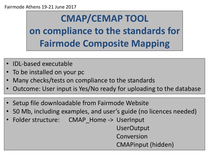
Fairmode Composite Mapping IDL-based executable To be installed on - - PowerPoint PPT Presentation

fairmode composite mapping
SMART_READER_LITE
LIVE PREVIEW

Fairmode Composite Mapping IDL-based executable To be installed on - - PowerPoint PPT Presentation

Fairmode Athens 19-21 June 2017 CMAP/CEMAP TOOL on compliance to the standards for Fairmode Composite Mapping IDL-based executable To be installed on your pc Many checks/tests on compliance to the standards Outcome: User input is


slide-1
SLIDE 1

CMAP/CEMAP TOOL

  • n compliance to the standards for

Fairmode Composite Mapping

  • IDL-based executable
  • To be installed on your pc
  • Many checks/tests on compliance to the standards
  • Outcome: User input is Yes/No ready for uploading to the database

Fairmode Athens 19-21 June 2017

  • Setup file downloadable from Fairmode Website
  • 50 Mb, including examples, and user’s guide (no licences needed)
  • Folder structure:

CMAP_Home -> UserInput UserOutput Conversion CMAPinput (hidden)

slide-2
SLIDE 2

Openings window

Concentration Mapping Emission Mapping Zoom to Country/Europe User Input File Format:

  • CMAP_Model_CountryCode_Pollutant_EPSGxxx_info.extension

Pollutants: NO2, PM10, PM2.5, O3 [µg/m3]

  • CEMAP_InvName_CountryCode_Pollutant_Sector_EPSGxxx_info.extension

Pollutants: CO, NH3, NMVOC, NOx, PM10, PM2.5, SO2, CH4 [Ton/km2/year] Sectors: S1, S2, …, S10

slide-3
SLIDE 3

Examples

  • CMAP_CHIM_ESP_NO2_EPSG4326_annual_mean_2012.asc
  • CMAP_CHIM_PRT_NO2_EPSG3763_info.asc
  • CMAP_CAMX_SVK_PM10_EPSG2065_2011.asc
  • CMAP_ADMS_GBR_NO2_EPSG4258_info.tif
  • CMAP_GRAL_AUT_NO2_EPSG31255_linz_total.tif
  • CEMAP_MACC1_ESP_NO2_S3_EPSG4326_annual_mean_2012.asc
  • CEMAP_ EC4MACS _SVK_PM10_S4_EPSG2065_2011.asc
  • CEMAP_ myInventory _BEL_PM10_S7_EPSG3447_2012_raster.asc
  • CEMAP_ JRCinv _GBR_NO2_S1_EPSG4258_info.tif
  • CEMAP_ anyName _BEL_PM10_S10_EPSG3447_2012.tif

=> Test on the FileName structure

2 extensions: asc (ascii) tif (tagged image format)

slide-4
SLIDE 4

Type 1: asc

Example 1 ncols 161 nrows 90 xllcorner

  • 10.5

yllcorner 35.500056179775 cellsize 0.099887640449438 NODATA_value -9999 Example 2 ncols 287 nrows 251 xllcenter

  • 2331198

yllcenter

  • 2682412

cellsize 24000 24000 NODATA_value -9999

  • --251 rows with each 287 numbers---

Domain: square with dx and dy If noValue then NODATA

  • 9999 -9999 -9999 -9999 -9999 -9999 -9999 -9999 -9999 -9999 -9999 -9999 -9999 -9999 -9999 -9999 -9999 -9999 -9999 -9999 -9999 -

9999 -9999 -9999 -9999 -9999 -9999 -9999 -9999 -9999 -9999 -9999 -9999 -9999 -9999 -9999 -9999 -9999 -9999 -9999 -9999 -9999 -9999

  • 9999 -9999 -9999 -9999 -9999 -9999 -9999 -9999 -9999 -9999 -9999 -9999 -9999 -9999 -9999 -9999 -9999 -9999 -9999 -9999 -9999 -

9999 -9999 -9999 -9999 -9999 -9999 -9999 -9999 -9999 -9999 -9999 -9999 -9999 -9999 -9999 -9999 -9999 -9999 -9999 -9999 -9999 -9999

  • 9999 -9999 -9999 -9999 -9999 -9999 -9999 -9999 -9999 -9999 -9999 -9999 -9999 -9999 -9999 -9999 -9999 -9999 -9999 -9999 -9999 -

9999 -9999 -9999 -9999 -9999 -9999 -9999 -9999 -9999 -9999 -9999 -9999 -9999 -9999 -9999 -9999 -9999 -9999 -9999 -9999 -9999 -9999

  • 9999 -9999 -9999 -9999 -9999 -9999 -9999 -9999 -9999 -9999 -9999 -9999 -9999 -9999 -9999 -9999 -9999 -9999 -9999 -9999 -9999 -

9999 -9999 -9999 -9999 -9999 -9999 -9999 -9999 -9999 -9999 -9999

  • 9999 -9999 -9999 -9999 -9999 -9999 -9999 -9999 -9999 -9999 -9999 -9999 -9999 -9999 -9999 -9999 -9999 -9999 -9999 -9999 -9999 -

9999 -9999 -9999 -9999 -9999 -9999 -9999 -9999 -9999 – …….

  • --90 rows with each 161 numbers-
slide-5
SLIDE 5

The checks

  • Does the name of the input file start with CMAP? (CEMAP)
  • Is the extension asc or tif?
  • Format of the file name ok?
  • Is the Country code correct?
  • Is the Pollutant and accepted one?
  • Is the EPSG code (coordinate/projection system) an existing one?
  • Is the line for NCOLS correct?
  • Is the line for NROWS correct?
  • Is the line for XLLCORNER / XLLCENTER correct?
  • Is the line for YLLCORNER / YLLCENTER correct?
  • Note: XLL and YLL are given in the EPSG CS
  • Is the line for CELLSIZE correct?
  • Note: CELLSIZE is in EPSG CS.

If one value is given, then dx is equal to dy, otherwise different.

  • Is the line for NODATA_value correct?
  • Are all pollutant values >= 0, or equal to NODATA_value?
  • Using the GDAL cs2cs application (spawn command in IDL) the user EPSGxxx CS is

converted in EPSG4326, which is the standard (global lat-lon) WGS84 CS.

  • Is the centre of the domain in Europe / Country?
  • Min, Max, and Mean values of the pollutant are calculated. Are they in the expected range?
  • Bounds of the map are calculated. Do they fall within the bounds of the Country?
  • Finally, a map is produced, and the user has to decide about the correctness of the results.
slide-6
SLIDE 6

Home_Directory: C:\CMapping\ Tue Jan 24 11:44:05 2017 ************************************************************************************* ***************************** Please select an ASC or GeoTIFF file... FILE: CMAP_CHIM_ESP_PM10_EPSG4326_annual-mean-2012.asc FOLDER: C:\CMapping\UserInput\Examples_ASC FILE_TYPE: ASC MODEL: CHIM COUNTRY: SPAIN ESP POLLUTANT: PM10 EPSG: EPSG4326 EPSG info: # WGS 84: <4326> +proj=longlat +datum=WGS84 +no_defs <> NCOLS: 161 NROWS: 90 DIMENSIONS: 161 90 CELLSIZE: 0.099887640449438 0.099887640449438 NODATA_value: -9999 All Values >= 0. or equal to -9999 => ok Domain (EPSG4326) cell corners saved in Conversion\tmpInputCoord.dat LL_CORNER: Lon=-10.5499 Lat=35.4501 in EPSG4326 Start cs2cs Done cs2cs Domain (EPSG4326) cell corners saved in Conversion\tmpOutputCoord.dat LL_CORNER: Lon=-10.5499 Lat=35.4501 in EPSG4326 POLLUTANT: Min Max Mean = 10.2240 36.5906 16.0481 Is this within the expected range ?? Yes Map Bounds: UL= [-10.5499,44.3901] UR= [5.48200,44.3901] LL= [-10.5499,35.4501] LR= [5.48200,35.4501] Country Bounds: UL= [-11.0000, 45.0000] UR= [6.00000, 45.0000] LL= [-11.0000, 34.0000] LR= [6.00000, 34.0000] The map is saved as ... C:\CMapping\\UserOutput\PICT_CMAP_1.tif QUESTION !!, , IS THIS OK ?? YES ... Input Data => OK !! *********************************************************************************

Example: SPAIN

slide-7
SLIDE 7
slide-8
SLIDE 8

Example: EMR -ITA

Home_Directory: C:\CMapping\ Tue Jan 24 11:50:07 2017 ****************************************************************************************************************** Please select an ASC or GeoTIFF file... FILE: CMAP_NINFA_ITA_PM10_EPSG32632_mean.asc FOLDER: C:\CMapping\UserInput\Examples_ASC FILE_TYPE: ASC MODEL: NINFA COUNTRY: ITALY ITA POLLUTANT: PM10 EPSG: EPSG32632 EPSG info: # WGS 84 / UTM zone 32N: <32632> +proj=utm +zone=32 +datum=WGS84 +units=m +no_defs <> NCOLS: 297 NROWS: 161 DIMENSIONS: 297 161 CELLSIZE: 1000 1000 NODATA_value: -9999 All Values >= 0. or equal to -9999 => ok Domain (EPSG32632) cell corners saved in Conversion\tmpInputCoord.dat LL_CORNER: Lon=509500. Lat=4.84250e+006 in EPSG32632 Start cs2cs Done cs2cs Domain (EPSG4326) cell corners saved in Conversion\tmpOutputCoord.dat LL_CORNER: Lon=9.11800 Lat=43.7355 in EPSG4326 POLLUTANT: Min Max Mean = 6.30427 36.2127 22.9524 Is this within the expected range ?? Yes Map Bounds: UL= [9.12090,45.1804] UR= [12.8902,45.1142] LL= [9.11800,43.7355] LR= [12.7957,43.6725] Country Bounds: UL= [2.66109, 47.2000] UR= [20.4474, 47.2000] LL= [2.66109, 36.4000] LR= [20.4474, 36.4000] The map is saved as ... C:\CMapping\\UserOutput\PICT_CMAP_3.tif QUESTION !!, , IS THIS OK ?? YES ... Input Data => OK !! ********************************************************************************************

slide-9
SLIDE 9

Is this ok ??

slide-10
SLIDE 10
slide-11
SLIDE 11

Type 2: tif The checks

  • Check on the existence of the *.tif file.
  • Extraction of ‘tiff_info’ and geotiff_info information.
  • The number of tif channels must be equal to 1. If the value is equal to 3 then data is stored

as colour band. Data must be stored in the grey band as actual values.

  • Check on the array dimensions of the map (similar to NCOLS and NROWS above)
  • Check on the number of images, must be 1. Only one pollutant per file is allowed
  • Check on the orientation of the map (top, bottom, left, right), this is used to make the

correct plot of the map, and not up-side down.

  • Determine the position of the origin of the domain in the EPSG CS.

The origin is the centre of the upper-left cell of the domain.

  • Resolution in X and Y direction (similar to CELLSIZE above).
  • Using the GDAL cs2cs application (spawn command in IDL) the user EPSGxxx CS is

converted in EPSG4326, which is the standard WGS84 CS.

  • Min, Max, and Mean values of the pollutant are calculated. Are they in the expected range?
  • Bounds of the map are calculated. Do they fall within the bounds of the Country?
  • Finally, a map is produced, and the user has to decide about the correctness of the results.
slide-12
SLIDE 12

Example: Linz - AUT

Home_Directory: C:\CMapping\ Tue Jan 24 11:53:23 2017 Please select an ASC or GeoTIFF file... FILE: CMAP_GRAL_AUT_NO2_EPSG31255_linz-total.tif FOLDER: C:\CMapping\UserInput\Examples_TIF FILE_TYPE: TIF MODEL: GRAL COUNTRY: AUSTRIA AUT POLLUTANT: NO2 EPSG: EPSG31255 EPSG info: # MGI / Austria GK Central: <31255> +proj=tmerc +lat_0=0 +lon_0=13.33333333333333 +k=1 +x_0=0 +y_0=-5000000 +datum=h CHANNELS: 1 DIMENSIONS: 1165 1416 (Warning: More than 5M gridcells !!) NUM_IMAGES: 1 ORIENTATION: 1 UL-ORIGIN cell centre in EPSG31255: 66675.0 357035. RESOLUTION: 10.0000 -10.0000 Wait ... 100% done Domain (EPSG31255) cell corners saved in Conversion\tmpInputCoord.dat LL_CORNER: Lon=66670.0 Lat=342880. in EPSG31255 Start cs2cs Wait ... cs2cs Done cs2cs Wait ... 100% done Domain (epsg4326) cell corners saved in Conversion\tmpOutputCoord.dat LL_CORNER: Lon=14.2298 Lat=48.2207 in EPSG4326 POLLUTANT: Min Max Mean = 12.6774 218.563 20.6904 Is this within the expected range ?? Yes Map Bounds: UL= [14.2320,48.3480] UR= [14.3891,48.3467] LL= [14.2298,48.2207] LR= [14.3865,48.2194] Country Bounds: UL= [8.63474, 49.5000] UR= [17.4327, 49.5000] LL= [8.63474, 45.0000] LR= [17.4327, 45.0000] Wait ... 100% done The map is saved as ... C:\CMapping\\UserOutput\PICT_CMAP_4.tif QUESTION !!, , IS THIS OK ?? YES ... Input Data => OK !!

slide-13
SLIDE 13

Zoom out Original map

slide-14
SLIDE 14

Final Question: Is the map ready for uploading to the database?

slide-15
SLIDE 15

User guides in the Help folder:

  • CMAP
  • CEMAP
slide-16
SLIDE 16
slide-17
SLIDE 17
  • Idl based executable – local pc – compliance to the standards
  • Size executable – installation – examples of user input files
  • Folder structure
  • CMAP*, CEMAP*

concentrations NO2, PM10, PM2.5, O3 [µg/m3] emissions CO, NH3, NMVOC, NOx, PM10, PM2.5, SO2, CH4 [Ton/km2/year]

  • File format CMAP, CEMAP
  • Run, openings window
  • File structure test – examples
  • Type 1: asc
  • Examples
  • The tests
  • Report: cs2cs transforms to 4326 (lon-lat)
  • ld and new saved in Conversion

min max mean (is this ok) map bounds, Country bounds Map is saved in UserOutput

  • Example Spain
  • Example NINFA – zoom out
  • Type 2: tif
  • Similar
  • Example Linz – Austria
  • Final Question: Is the map ready for upload to the database?
  • Y/N: Try inversion of N-S and/or E-W
  • Two user guides (CMAP, CEMAP)