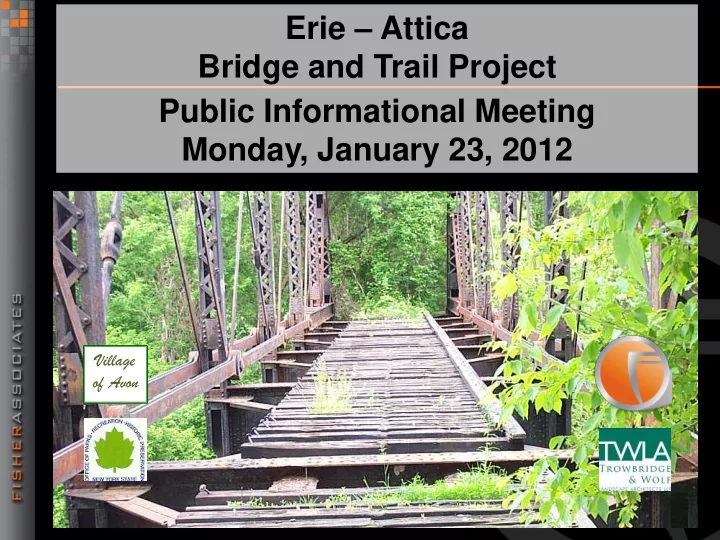

Erie – Attica Bridge and Trail Project Public Informational Meeting Monday, January 23, 2012 Village of Avon
Introductions Village of Avon NYS Office of Parks, Recreation & Historic Preservation (NYSOPRHP) NYS Department of Transportation Project Advisory Committee Consultant – Fisher Associates
Public Informational Meeting Goals Present the Trail and Bridge Project Scope Obtain Public Input – Objectives of the Project – Design Alternatives – Alignment Alternatives Input received will be considered and will serve to revise the Design Report
Project Objectives Provide a recreational trail link between the Genesee Valley Greenway & Village of Avon Preserve the abandoned railroad corridor for public transportation Utilize the historic RR bridge over the Genesee River as part of the trail system
Project Objectives Provide an ADA compliant trail surface Construct a new span over Farmers Road Provide parking and trailhead access for trail users. Construct all trail components and amenities in the most cost-effective manner
Limits of Project Horseshoe Boulevard Genesee Valley Greenway Western limit – Genesee Valley Greenway Eastern limit – Horseshoe Boulevard
Trail Users Railroad Corridor Pedestrians Bicycles Horses Snowmobiles Livingston Industrial Complex Pedestrians Bicycles
Project Scope Former railroad Railroad Corridor corridor begins at the Greenway Provide 10’ wide trail with 2’ shoulders Approximate length of 5,600’ Surface needs to be ADA compliant – firm, stable, slip resistant
Project Scope Ramp up from Genesee Valley Greenway Begin 10’ Wide Trail
Project Scope Continue 10’ Wide Trail
Project Scope The trail will be routed around abutments of three former bridges
Project Scope A new culvert will be installed for the stream crossing
Project Scope Continue 10’ Wide Trail
Project Scope Existing Truss Bridge The existing railroad truss bridge over the Genesee River is eligible for listing on the National Register. The span is approx. 220’ including a short approach span at the west end.
Project Scope A new timber Existing Truss Bridge deck and rail are proposed. The timber deck will be 10’ or 11’ wide depending on project cost.
Existing Truss Bridge
Existing Truss Bridge
Project Scope New Bridge over The new bridge Farmers Road over Farmers Road is a span of approx. 35’.
Project Scope New Bridge over A new timber Farmers Road deck and rail are proposed. The timber deck will be 10’ or 11’ wide depending on project cost.
Farmers road Bridge
Farmers road Bridge
Project Scope Trail from Bridges The trail ramps down east of Farmers Road bridge to Trail from the parking area Bridges
Project Scope Parking Area The parking area will serve vehicles and horse trailers. Surface will be Trail from Bridges gravel or asphalt depending on project costs
Project Scope Two options for trail alignment connecting to Horseshoe Boulevard in the Livingston Industrial Complex North of the Pond and South of the Pond
Project Scope Trail North of Pond The trail begins at the parking area and travels along the northerly edge of the pond and is about 1,100’ in length .
Project Scope The trail will be 10’ Trail North of Pond wide with 2’ shoulders. The trail surface will be either asphalt or stone dust depending on project cost.
Project Scope Trail South of Pond The trail begins at the parking area and travels along the northerly edge of the pond and is about 1,400 ’ in length . Spillway
Project Scope The trail will be 8’ Trail South of Pond wide with 2’ shoulders due to constraints. The trail surface will be either asphalt or stone dust. The trail will span the pond spillway with a system of drainage pipes.
Project Cost Bridge Estimate → $ 450,000 Parking Lot Estimate → $ 112,000 Trail Estimate → $ 400,000 $ 962,000
Schedule Project Initiation → August 2011 Submit Draft Design Report → December 2011 Public Info Meeting No. 1 → January 23, 2012 Revise Draft Design Report for Public Comment → February 2012 Final Design Report → March 2012 Design Approval → April 2012 Final Design → April 2012-August 2012 Bid & Award Project→ October 2012 Construction Complete → October 2013
Questions/Comments Comment Sheet Contact Fisher Associates – Roseann Schmid, Project Manager – rschmid@fisherassoc.com – (585) 334-1310 ext. 295 – Carl Ast, Assistant Project Manager – cast@fisherassoc.com – (585) 334-1310 ext. 259 Contact Village: Chris Quinlan, Village Treasurer – quinlan@frontiernet.net – (585) 226-8118
End Of Presentation
Recommend
More recommend