
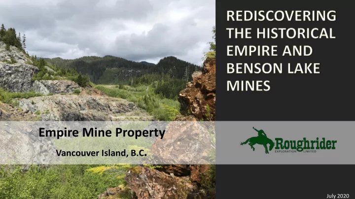
SLIDE 1
Empire Mine Property
Vancouver Island, B.C.
July 2020
Empire Mine Property Vancouver Island, B.C . July 2020 Cautionary - - PowerPoint PPT Presentation
Empire Mine Property Vancouver Island, B.C . July 2020 Cautionary Note Forward Looking Statement Certain information regarding the Company contained herein may constitute forward-looking statements within the meaning of applicable securities
July 2020
www.roughriderexploration.com | TSX.V: REL | 2
Forward Looking Statement Certain information regarding the Company contained herein may constitute forward-looking statements within the meaning of applicable securities laws. Forward-looking statements may include estimates, plans, expectations, opinions, forecasts, projections, guidance or other statements that are not statements of fact. Although the Company believes that the expectations reflected in such forward-looking statements are reasonable, it can give no assurance that such expectations will prove to have been correct. The Company cautions that actual performance will be affected by a number of factors, many of which are beyond the Company’s control, and that future events and results may vary substantially and materially from what the Company currently foresees. This presentation does not constitute or form part of any offer for sale or solicitation of any offer to buy or subscribe for any securities in Roughrider Exploration Limited, nor shall it or any part of it form the basis of or be relied on in connection with or act as any inducement to enter into any contract or commitment whatsoever. No reliance may be placed for any purpose whatsoever on the information or opinions contained in this presentation or on any
warranty or other assurance express or implied is made or given by or on behalf of Roughrider Exploration Limited or any of its directors, employees or advisors, as to the accuracy or completeness of the information or opinions contained in this presentation and, save in the case of fraud, no responsibility or liability is accepted by any of them for any such information or opinions or for any errors, omissions, misstatements, negligence or otherwise contained or referred to in this presentation. Historical information provided in this presentation regarding the Company’s projects or adjacent properties (in which Roughrider has no ownership interest and thus no right to explore or mine) cannot be relied upon as the Company’s QP as defined under NI-43-101 has not prepared nor verified the historical information. A Qualified Person has not done sufficient work to classify any historical mineral resource estimate(s) referenced herein as a current estimate and Roughrider is not treating such as current mineral resource(s). Qualified Persons The Qualified Person responsible for the technical information in this presentation is David Tupper, P. Geo., Company Vice President of Exploration, who has approved the technical information included herein. Any reference to adjacent properties, historical estimates and resources should not be relied upon. Adjacent Properties This presentation contains information about adjacent properties on which Roughrider has no right to explore or mine. Investors are cautioned that mineral deposits on adjacent properties are not indicative of mineral deposits on the Company's properties.
www.roughriderexploration.com | TSX.V: REL | 3
31.73 M Issued and Outstanding, 2.0 M options at 18 cents and 108,600 broker warrants at 10 cents , Current share price ~$.0.20 cents = $6.35 M market cap
PEOPLE KEY ASSET ACQUIRED STRATEGY TIGHT SHARE STRUCTURE EMPIRE MINE ACQUISITION
Strong Technical Emphasis with Good Marketing Connections. Directors: Adam Travis, Scott Gibson, Fletcher Morgan, Jay Sujir and Dale Wallster. Empire Mine Project Acquired: “Historical mine camp on Northern Vancouver Island; historical 2008 resource with lots of exploration upside”.
On June 21, 2020 Roughrider ( “REL”) entered into a Binding Letter of Intent on with Mirva Properties Ltd to earn a 100 % interest in the Empire Mine Property. REL will make Initial payments
commitment in Year 1 of $200,000. Total consideration over 5 years includes an aggregate $1,250,000 cash payments, the issuance of 3,000,000 common shares and work commitments of $2,000,000 Mirva will retain a 2% NSR on the Property of which 1% may be purchased for $1,000,000.
Constantly Pursuing Other Opportunities, Emphasis on Projects with Gold Resources with Room to Grow and Accretive Acquisitions that plays to our strengths. 52% 27% 21%
Shareholders
Directors,Officiers & Related Party Institutional Other
Additional Assets in BC’s Golden Triangle Gin & Eldorado Properties: “ ‘Book Ends’ to the Red Chris Mine” Scottie West Property: “Adjacent to Scottie Gold Project”.
Empire Mine Kingfisher Pit, 1966 (UBC Master's Thesis, John Lund 1966)
www.roughriderexploration.com | TSX.V: REL | 4
Under Explored Area with Good Infrastructure
Northern Vancouver Island has had a rich history of mineral production and resource development (logging, sawmills, pulp and paper mills, fishing, gravel pits, rock quarries) over the last hundred years but has been far less explored than other prolific mineral belts in B.C; especially with modern exploration techniques. Extensive network of logging roads and port facilities throughout the region. Recent government initiatives including airborne surveys and detailed geological surveys. Mineral potential is starting to be recognized again by major mining companies like Teck Resources and Freeport with their recent acquisitions in a region that can be worked all year round.
Experienced Leadership & Management Team
Hundreds of years of technical, corporate, marketing and financial experience
Smart Deal & Strong Consolidated Land Position
Signed Binding L.O.I to acquire a 100 % interest in Mirva Properties Empire Mine Property; who consolidated ownership over the last five years and Roughrider then immediately doubled land position to >15,000 hectares covering a 11 km x 22 km belt. Deal is structured to have low upfront costs with $50k cash, 200 k shares & $200 k work commitment in Year 1.
Historic Resources & District Scale Potential
Leveraging millions of dollars in past exploration: including 134 diamond drillholes (13,563.3m) completed between 1989-2007, a 2008 N.I 43 101 Resource of 960,000 tonnes at 2.03 g/t gold, 5.64 g/t silver, 0.34% copper, 0.013% cobalt and 16.1% iron using a 0.50 g/t gold cut-off ¹ ¹º that is open to depth but was never finished drilling due to the financial crisis and later other corporate priorities. The Property covers 22 mineral occurrences, including 3 past producing open pit and two underground past producing mines for magnetite, copper, gold, and silver.
Tight Share Structure
Interests Aligned - Directors & Related Parties own > 50% of the shares
June 2020 Q3 2020 Q3-Q4 2020 Update Resource, Plan 2021 Work Programs Q4 2020 – Q1 2021 Commence 2021 Field Programs & Drilling Q1-Q2 2021
Gold & Copper Grades with Cobalt & Silver Credits
Previous underground and open pit mining between 1916-1973 was focussed on the iron ore (magnetite and copper potential) and it was not until the 1980's that the gold potential of the area was recognized. Exploration drill results such as 2006 drillhole MW06-17 which returned 6.51 g/t gold and 1.38% copper over 50.32 m attest to the exploration potential. Drill results such as MW07-72 which returned 5.82 g/t gold and 0.405% cobalt over 8.16m from 5.18-13.34 m also highlight underappreciated cobalt potential.
Time is Right
First time for this large consolidated land position, improving financing market and record high gold prices along with government initiatives have come together at same time.
Peer Comparisons
Current Market Cap $6.35 M with geological analogues include Sunmetals (market cap - $30M) Stardust Project and discovery timing includes Scottie Resources rediscovering the Scottie Gold Mine ($20 M market cap to $50 M market cap) Property Exam, Due Diligence, Binding L.O.I Signed $200 k Geology, Geochemistry & Geophysics, Permitting, Consultations, Definitive Agreement Signed Confirmation & Step Out Diamond Drill Program (>3000 m) , Prioritize Regional Targets
www.roughriderexploration.com | TSX.V: REL | 5
Empire Mine Property Acquisition Highlights
3 past producing open pit and two underground past producing mines for magnetite, copper, gold, and silver.
drillhole MW06-17 ² which returned 6.51 g/t gold and 1.38% copper over 50.32 m .
tonnes at 2.03 g/t gold, 5.64 g/t silver, 0.34% copper, 0.013% cobalt and 16.1% iron using a 0.50 g/t gold cut-off completed November 30, 2008 by Gary Giroux ¹ ¹º. The resource was noted as open to depth and no further work on the resource has been completed since 2008.
hectares ("ha") to over 15,000 ha by Roughrider staking.
2005-2008 geophysical work and drilling.
due to logging, active limestone quarrying, power lines and power generation operations in the area as well as easy access to ports at both Port McNeil and Port Alice.
www.roughriderexploration.com | TSX.V: REL | 6
Benefits of working on Northern Vancouver Island
studies, including a 2019 study examining the magma-carbonate contacts in the Merry Widow mountain area to create a predictive tool to aid in future exploration for copper-gold-cobalt-silver skarn deposits.
bordering property and port facilities located within 1 hours' drive at Port Alice and Port McNeil.
Merry Widow Iron Ore Pit, Copper Gold zone in pit wall at back of image (June 2020)
Merry Widow Pit Kingfisher Pits Victoria Lake Port Alice Limestone Quarry
(not on property)
Benson Lake Mine Old Sport Mine
(not on property)
Benson Lake View to West
www.roughriderexploration.com | TSX.V: REL | 7
discovered in 1897 along the Old Sport horizon near the Benson River on the east slope of Merry Widow Mountain.
1931 and 1957-1972. Mining and exploration has been mainly focused on two areas at either the base of the Quatsino limestone (Old Sport Horizon) or near the top
Widow intrusion (Empire Mine).
Property, clustered around iron
copper mineralization skarns zones developed at the margin of the Merry Widow pluton where it contacts the Upper Quatsino limestone, Parsons Bay formation and Bonanza formation.
mining along a favourable > 6 km long airborne magnetic and geological trend with at least 22 documented mineral occurrences attest to the exploration potential of the area for copper-gold skarn deposits with interesting silver, cobalt and magnetite credits.
Eagle Shamrock Blackjack Ajax Summit Whisky Jack North Notch Rambler Keystone Snowline Radio Dry Hill Benson Lake Mine Happy Jack 1 km
Inset Map
www.roughriderexploration.com | TSX.V: REL | 8
Airborne Magnetics Tilt Derivative Magnetics, 2006-2007 ⁹
Survey totaled 3,219-line km; highlights include:
anomalies throughout the Property to be prioritized based on underlying geology, geochemistry and previously noted mineralization.
Aeroquest Limited AeroTEM II Electromagenetic & Magnetometer Survey
Inset Map
See Inset Map
www.roughriderexploration.com | TSX.V: REL | 9
Old Sport Mine Benson Lake Mine
Southwestern Conductive Anomalies
Z-1 off Time EM (conductors), 2006-2007 ⁹
Survey totaled 3,219-line km; highlights include:
with conductor anomalies.
mineralzation along the Old Sport Horizon (Old Sport Mine and Benson Lake Mine) appears not anomalous.
EM conductors, such as the Southwestern Conductive Anomalies, are present throughout the Property and require systematic field examinations.
expected from copper and iron sulphide mineralization, but also from clays in lakes, rivers and swamps.
Inset Map
See Inset Map
www.roughriderexploration.com | TSX.V: REL | 10
Large historical database (>1,400 silt, soils and rocks from Grande Portage alone) - initial compilation already showing anomalous areas
areas. Examples include:
anomaly (> 100 ppm) noted at Happy Jack (green outline) ³.
ppb) and Cobalt (> 20 ppm) soil anomaly off southwest corner of crown grants (blue outline) ⁴.
anomaly in southwestern portion
Southwestern Conductive Anomalies.
western contact of Merry Widow pluton; requires follow up.
www.roughriderexploration.com | TSX.V: REL | 11
Old Sport or Coast Copper and Benson Lake Underground Mines ⁵
immediate area of Merry Widow Mountain. During 1916-1931, Cominco completed approximately 8 km of underground development along the Old Sport horizon.
Sport/Coast Copper Mine. Cominco mined 2.6 mt of material between 1962-1972 from the Old Sport/Coast Copper Mine (a portion of this mine not on the current Property) and the Benson Lake Mine which produced 90,184,161 lbs. of copper, 377,165 oz of silver and 126,386 oz of gold. Material grades averaged 1.57% copper, 4.48 g/t silver and 1.48 g/t gold. These mines were exploiting the stratigraphically controlled Old Sport Horizon, characterized by magnetite and chalcopyrite bodies in widths varying from 0.6 to 30m associated with a dioritic sill near the base of the Quatsino Limestone Formation In December 1972, after closing down operations at the Benson Lake Mine, Cominco reported remaining developed reserves of 454,449 metric tonnes (501,000 tons) averaging 1.3% copper, 0.6 grams (0.02 oz/ton gold) and 33% iron. Although credibly reported by Cominco, these figures predate current 43-101 standards.
2007 indicates that the Old Sport Trend continues for at total length of 6 km and up to 3 km south of historical workings. Grande Portage drilled 7 drillholes totaling 3,870m testing this horizon of which 5 holes reached the targeted depth. Drillhole MW07-54 was collared 900m south of the Benson Lake mine workings along a prominent magnetic high and it intersected 0.63m of 1.20 g/t gold, 31.00 g/t silver, 5.25% copper and 11.30% iron at a depth of 711m below surface. Although this previous drill intercept is not considered economic it attests to the continuity of mineralization at significant distances outside of historical underground workings.
intrusive contact, especially since it appears to be less than half mined by previous workers.
Coast Copper Mine/Old Sport Mine (circa 1916)
Vancouver Public Library Image
2007 airborne magnetic survey
www.roughriderexploration.com | TSX.V: REL | 12
Merry Widow, Kingfisher and Raven Open Pits and Kingfisher Adit
Empire Mine extracted 3.37 mt of magnetite material from the Merry Widow, Kingfisher, and Raven magnetite material bodies between 1957-1967. Mineralization is localized near the top of the Quatsino limestone formation near its contact with the Merry Widow Intrusion ⁶.
were encountered they were considered a detriment to producing a clean magnetite concentrate and were purposely avoided. One small pit (Raven) was abandoned and later backfilled with waste due to the presence of abundant pyrite and chalcopyrite contaminating the magnetite material. Later studies have shown an intimate association of gold with late phase chalcopyrite, and preliminary metallurgical studies indicate favourable recoveries for gold, copper and silver.
the margins of the old iron ore mines (see selected drill result table). Exploration up to 1992 included the drilling of 42 diamond drillholes (2,850m), 120 short reverse circulation drillholes and the completion of a pre-feasibility study with the goal to process material at BHP-Utah's Island Copper Mine near Port Hardy. By 1993 Taywin changed focus with new leadership and moved its corporate office to Ontario.
1989 Taywin Resources select drill results
Geological Cross Section, Empire Mine: Ray, BCGS Open File 2013-08 Source: George Cross Newsletter No. 207, October 27, 1989 Geological Cross Section, Benson Lake Mines BCGS Property File 12494 Empire & Benson Lake Mines ⁵
www.roughriderexploration.com | TSX.V: REL | 13
Grande Portage Drilling
1993 to when Grande Portage acquired the Property in 2005.
Note: reported intercepts are intercept lengths and not true widths
2006, Grande Portage completed 47 drill holes (4,448.0m) of which 43 drillholes were in the vicinity of the Merry Widow open pit (see table). Including intercepts such as drillhole MW06-17 which returned 6.51 g/t gold and 1.38% copper over 50.32 m ².
2007, Grande Portage completed 45 diamond drillholes (6,265.3m) of which 30 drillholes tested targets outside of the Merry Widow pit. These included 23 drillholes at the Marten Zone, which included intercepts such as drillhole MW07-72 which returned 5.82 g/t gold and 0.405% cobalt over 8.16m from 5.18-13.34m ⁷.
Au
www.roughriderexploration.com | TSX.V: REL | 14
resource estimate and calculated a measured and indicated resource of 960,000 tonnes at 2.03 g/t gold, 5.64 g/t silver, 0.34% copper, 0.013% cobalt and 16.1% iron using a 0.50 g/t gold cut-off ¹ ¹º. This resource was noted to be open to depth where further drilling was recommended, no additional work
resource estimate (see table).
sample that was collected from the Copper Knob area (north edge of Merry Widow Pit) and was sent to West Coast Mineral Testing Inc. This sample averaged 9.9 g/t gold, 74.9 g/t silver and 5.9% copper and recovered 95.1%, 88.9% and 88.0% respectively ⁸.
Glacier high grade gold project in Alaska.
parties conduct modest initial studies on the magnetite and limestone potential.
completed modest remote sensing and lidar (air photo) studies and compilation reports while awaiting the resolution of a 2016 legal dispute between Grand Portage and the original crown grant owner which was eventually settled in September 2019 in Grande Portage’s favor.
Grande Portage Historical Resource Estimate and Recent Work
2008 Merry Widow Measured and Indicated Resource Isometric view looking NE of mineralized Solid in Orange and Surface Topography in Grey (note the position of the current open pit ~ 150 m wide x 250 m long) ¹
www.roughriderexploration.com | TSX.V: REL | 15
friendly and good infrastructure Northern Vancouver Island.
underground past producing mines for magnetite, copper, gold, and silver.
iron ore and copper.
diamond drillholes, including results of 56.0m of 3.43 g/t gold and 0.99% copper in drillhole 89-17 and 14.0m of 13.37 g/t gold and 0.21% copper in drillhole 89-7 ³. Even though significant results were returned, this program was cut short due to political events in 1993.
diamond drillholes, confirming and extending the gold and copper potential first identified by
2.03 g/t gold, 5.64 g/t silver, 0.34% copper, 0.013% cobalt and 16.1% iron using a 0.50 g/t gold cut-off ¹ ¹º.
substantial programs have been completed on the Property.
compiling and acquiring extensive historical records while awaiting better markets and a strong technical team to advance the property and share their strong belief in the exploration upside.
results from 1989-1992 and 2006-2008 that were not fully explored.
Polished thin section from the Merry Widow pit showing gold (Au) hosted in late phase chalcopyrite (CPY), 2019 Geological plan with geology and target areas, Empire Mine, 2018
www.roughriderexploration.com | TSX.V: REL | 16
Phase 1 ($200,000 to be completed July/August 2020)
workings and their immediate strike potential.
required to complete Property wide coverage.
Phase 2 (> $1,000,000 to be completed in fall 2020 depending on permitting)
favorable trends.
Massive chalcopyrite from the Copper Knob showing, edge of Merry Widow Iron Ore Pit (June 2020) Kingfisher portal (June 2020)
www.roughriderexploration.com | TSX.V: REL | 18
1. Historical NI43-1010 Technical Report: Giroux, G. H., & Raven, W. (November 30, 2008). Technical Report on the Copper Gold Resources for the Merry Widow Property. Filed on Sedar January 22, 2009. The 2008 Grande Portage historical resource estimate was completed by Gary H. Giroux, P.Eng, MASc,
holes, 2,290 assays, with 104 down hole surveys collected between June and December 2006. The historical estimate was reported utilizing gold cut-off grades ranging from 0.10 g/t to 3.00 g/t gold, as more particularly set out in the report. A complete copy of the report is available on Grande Portage's public filings on SEDAR. A gold cut-off grade of 0.50 g/t gold was selected as representing one possible mining scenario. For the purposes of the calculations, lognormal cumulative frequency plots were used to assess grade distribution to see if capping of high values was required and if so at what levels. For all elements capping levels were established based on the individual grade distributions as follows: Gold- a total of 18 gold assays were capped at 32.0 g/t gold, Silver- a total of 9 silver assays were capped at 165 g/t silver, Copper- a total of 7 assays were capped at 11.7% copper, Cobalt - a total of 5 assays were capped at 0.48 % cobalt, Iron- all iron assays were capped at 50% iron (the analytical detection limit). 2. Assessment Report on the Diamond Drilling on the Merry Widow Property, G. Nicholson, December 15, 2006. BC Assessment Report 28863 3. Report on Geochemical and Geological Surveys on the Good Sport 1 Claim of the Good Sport Group, T. Clarke, January 25, 1989, BC Assessment Report 18619 4. Geological and Geochemical Report Rainier-Widow Property, M Caron, W. Harris, September 18, 1990, BC Assessment Report 20327 5. 2017 Prepatory/Physical Report for the Blue Gold Property, D. Berkshire, J.Hume, April 15, 2018, BC Assessment Report 37471 6. Minfile Record Summary, Minfile No 092L 044, found on https://minfile.gov.bc.ca/Summary.aspx?minfilno=092L++044 7. Diamond Drilling, Geochemical and Geophysical Assessment Report for the 2007 Program at the Merry Widow Property, W. Raven, M. Nelson, April 14, 2008, BC Assessment Report 30002 8. Grande Portage News Release dated March 1, 2010 found on Sedar.com 9. Geophysical Assessment Report on the Merry Widow Property, M. Pozza, 2006. BC Assessment Report 28802 10. Historical information provided in this presentation regarding the Company’s projects or adjacent properties (in which Roughrider has no ownership interest and thus no right to explore or mine) cannot be relied upon as the Company’s QP as defined under NI-43-101 has not prepared nor verified the historical
and Roughrider is not treating such as current mineral resource(s).