SLIDE 1
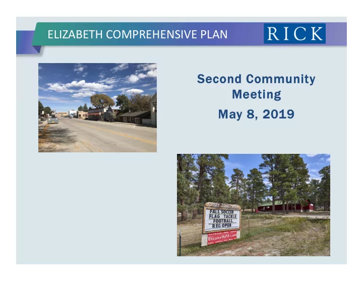
ELIZABETH COMPREHENSIVE PLAN Second Community Second Community Mee Meeting ing Ma May 8, 20 y 8, 2019 19
SLIDE 2
TYPICAL COMPREHENSIVE PLAN COMPONENTS
Land Use Recreation and Tourism Parks, Trails, and Open Space Housing Transportation / Streets Utilities & Infrastructure Historic Preservation Resiliency Implementation Plans
SLIDE 3
COMMUNITY OPEN HOUSE #1 – SOME KEY TAKEAWAYS
Concern over how new development
may impact water supplies, existing water wells & systems
Concerns about traffic Concern that Elizabeth will become
just another suburb
Interest in maintaining the rural
character & small town feel
Realization that growth is coming.
How to deal with it?
SLIDE 4
COMMUNITY ONLINE SURVEY #1
Ke Key T Takeaway ays:
Top reasons why people live here: Small town setting Natural beauty of the area Proximity to other communities Cost of housing Top changes people want to see: Improve parks, trails, rec
facilities
Improve street / road network Protect & restore historic
properties / areas
SLIDE 5
COMMUNITY ONLINE SURVEY #1
Ke Key T Takeaway ays:
Improvements needed in: Walkability The aesthetic quality of new
development
The aesthetic quality of local
streets
Top desires - parks & rec
improvements:
Walking & biking trails Swimming pools or splash parks Fitness centers Playgrounds
SLIDE 6 COMMUNITY ONLINE SURVEY #1
Ke Key T Takeaway ays:
Housing – Need more: Apartments Starter homes Single family housing Senior living housing Retail – Need more: Fast food restaurants Gift stores / smaller retailers Sit-down restaurants Entertainment / night life Main Street viewed as the “heart”
SLIDE 7
COMMUNITY ONLINE SURVEY #1
Ke Key T Takeaway ays:
Long Term Vision of Elizabeth A growing small town that
retains its rural character, OR
A growing community that
retains its small town flavor
How to manage growth: Carefully manage design of new
development, even if this means slower growth (55%)
Balance economic growth with
having high quality, well- designed new development (43%)
SLIDE 8
PLANNING FOR A GREAT SMALL TOWN….
“Comprehensive Planning for Small Towns and Villages” – John Nolen, 1911
Plan ahead and preserve areas for
parks, open spaces, recreation
Plan for the orderly design of
streets, roads, and utilities
The use of greenbelts, natural
space to transition from town to rural areas
Plans will need to be revisited,
revised over time as things change
Learn the lessons of mistakes of
towns that grew before you.
SLIDE 9
PLANNING FOR A GREAT SMALL TOWN….
Preservation of Areas for Parks, Open Spaces, Recreation – Foundation of Elizabeth’s Plan
Preserve creek corridors: Foundation for trail network Great locations for future
neighborhood parks & community parks
Link different parts of Elizabeth
& Elbert County together
Help to differentiate areas
around Elizabeth
SLIDE 10
PLANNING FOR A GREAT SMALL TOWN….
Preservation of Areas for Parks, Open Spaces, Recreation – Foundation of Elizabeth’s Plan
Explore preserving remaining pine
forested areas and viewsheds:
A key piece of the identity of
the Elizabeth area
Once developed, the forests are
no longer intact
Potential locations for future
regional parks serving all of Elbert County
Key corridors for trails &
recreation
SLIDE 11
PLANNING FOR A GREAT SMALL TOWN….
Plan Ahead for Streets and Transportation Connections
Improve the Highway 86 corridor Establish corridors for future road
connections (north-south, east- west):
CR 132 (alternate east-west
access to Hwy 86)
CR 118 & 122 (farther south) Delbert, CR 13, CR 17, CR 21
(north-south connectivity)
Main Street – Extension to
south
SLIDE 12
PLANNING FOR A GREAT SMALL TOWN….
Plan Ahead for Streets and Transportation Connections
Potential signature transportation
connections:
Parkway orientation along
CR17-21 corridor
Main Street as a destination
street / parkway, extending to the south
CR 13 as a key arterial serving
Old Town, schools, Confluence Park to the north
Delbert Rd – potential
significant north-south connector
SLIDE 13
PLANNING FOR A GREAT SMALL TOWN….
Multi-Modal Connections
Multi-use trails, bike routes, bike
parking & storage
Locating employment centers & key
destinations along multi-modal routes
Eventual connections to regional
transit system
A local shuttle service
SLIDE 14 TRANSPORTATION PLAN
A vision for the Town’s
transportation system
Guides transportation-related
decisions and policy
Enables implementation to
Helps preserve future
transportation opportunities
Identifies right-of-way and
infrastructure requirements The Town’s current Street Plan was adopted in 2008
SLIDE 15
TRANSPORTATION PRINCIPLES
Continue to provide a safe and efficient transportation system Provide a well-balanced hierarchy of streets Seek opportunities to enhance regional mobility connections Accommodate appropriate access to and within development
areas
Encourage use of alternate modes, helping to minimize the need
for new or expanded roadway facilities
Preserve the character of the Town while pursing opportunities to
modernize transportation facilities
SLIDE 16
REGIONAL TRANSPORTATION INFLUENCES
SLIDE 17
TRANSPORTATION PLAN TOPICS
Functional classifications Typical sections Roadway alignments Trails Ped / bike facilities Transit
SLIDE 18
FUNCTIONAL CLASSIFICATIONS
Increasing Mobility Increasing Access
Freeway Major Arterial Minor Arterial Major Collector Minor Collector Local Street
SLIDE 19 ROADWAY ALIGNMENTS
CR 132 CR 122
Anderson Ave
CR 25
CR 21
Elbert St
CR 146
CR 154 Hilltop Rd CR 17 CR 17/21 Delbert Rd Flintwood Rd
CR 150 CR 142
CR 21 CR 33
Grant Ave
CR 3 CR 9
SLIDE 20 ROADWAY ALIGNMENTS
Elm St CR 3 CR 13 CR 136
SLIDE 21
TRAILS
SLIDE 22
TRAILS
SLIDE 23
TRANSIT
RTD’s Route P at Pinery
Park-and-Ride
Outback Express Town-funded transit service
is not viable
Ride-hailing services ($50
fare to DTC)
SLIDE 24
PLANNING FOR A GREAT SMALL TOWN
Sewer: Town has the ability to
expand existing facilities to serve approximately 20,000 residents
Sewer: Lift stations and
extensions of trunk lines will be necessary with new development
Infrastructure extensions are
not a notable constraint on new development Planning for Sewer / Water Infrastructure
SLIDE 25
PLANNING FOR A GREAT SMALL TOWN
Underlying assumptions: Plan for a 300-year supply,
versus a 100-year supply
Evaluate additional water
supplies from the existing drainage basins
Importing of outside water
may not be practical (due to cost)
Interference with existing
residential wells is not desirable
Sustainable water supply
for the Town Planning for Water Resources
SLIDE 26
PLANNING FOR A GREAT SMALL TOWN
Water – Planning for future
supply:
Xeriscaping, other
conservation measures to carefully manage water
Water reuse significantly
increases available water supply
Obtain water rights in
“buffer” areas, through:
Annexations Purchase of water
rights (by the Town or developers)
SLIDE 27
PLANNING FOR A GREAT SMALL TOWN
Greenbelts, open space - help
preserve small town identity:
“Rural buffer” to separate
Elizabeth from surrounding areas
Maintain distinction of
Elizabeth as one travels through the area
Buffer areas – a source of
water to serve growth of the town
Conserve land as
undeveloped for future generations
SLIDE 28
FUTURE LAND USE CATEGORIES
Low Density Residential
SLIDE 29
FUTURE LAND USE CATEGORIES
Medium Density Residential
SLIDE 30
FUTURE LAND USE CATEGORIES
Mixed Use
SLIDE 31
FUTURE LAND USE CATEGORIES
Old Town
SLIDE 32
FUTURE LAND USE CATEGORIES
Retail / Commercial
SLIDE 33
FUTURE LAND USE CATEGORIES
Business Park / Employment
Areas
SLIDE 34 LAND USE ALTERNATIVE # 1
Preservation of pine belt
east of town
More concentrated
development, both to north & south of Old Town
Potential larger mixed-
use node to west, near Hwy 86 & CR-3
Potential mixed-use
node along CR-17, at the south end of town
Potential business parks
east and west of town
SLIDE 35 LAND USE ALTERNATIVE # 2
Preservation of pine belt
east of town
More concentrated
development, focused more to the north of Old Town
Potential retail /
commercial node, near Hwy 86 & Flintwood
Potential mixed-use
nodes to the north & south, on CR-17
Potential business parks
east and west of town
SLIDE 36
LAND USE ALTERNATIVE # 3
Assumes less
preservation of pine belts (more development as estate residential)
Lower density
residential development, more spread to the west and south
Preservation of areas on
Hwy 86 (at CR-3, at Flintwood) as retail / commercial areas
Potential business park
& commercial east of town on Hwy 86
SLIDE 37
IMPLEMENTATION – DESIGN GUIDELINES / CODE UPDATES
Landscaping & Street Design Relationships between
buildings and public realm (streets & plazas)
Design of neighborhood parks Fencing, gateways, &
monumentation standards
Lighting standards Conservation guidance Historic preservation
SLIDE 38
BREAKOUT GROUPS & OPEN HOUSE
BREAK OUT GROUPS
Break into Groups around
Tables
Nominate one person to take
notes
Discuss the pros & cons of
each Alternative on the table OPEN HOUSE OPEN HOUSE
Visit the presentation boards
in back
“Dot exercises” for Historic
Preservation and Downtown Elizabeth – Tell us what you like and don’t like
SLIDE 39
NEXT STEPS
Online Survey – Evaluating Key
Alternatives – Open Through June 30th
All materials from this evening: On
project webpage: www.townofelizabeth.org/compplan
Development of Preferred Plan: May –
July
Third Public Meeting to Review
Preferred Plan: Early August
Finalize Plan: August – October
SLIDE 40
ELIZABETH COMPREHENSIVE PLAN THANK Y THANK YOU! U!