
SLIDE 1
Disease Prevention vs Data Privacy: using landcover maps to inform - - PowerPoint PPT Presentation
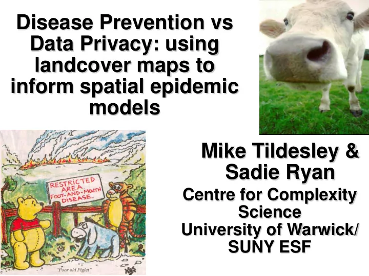
Disease Prevention vs Data Privacy: using landcover maps to inform spatial epidemic models Mike Tildesley & Sadie Ryan Centre for Complexity Science University of Warwick/ SUNY ESF Foot-and-Mouth Disease Foot-and-Mouth Disease - How
For the UK we have demographic information
For the UK we have epidemic information
routes
Ring vaccination –
control outbreak?
20km 15km 10km 5km
Cumbria – lots of cattle, high vaccination radius. West Lothian – moderate vaccination. The South – no vaccination.
For USA we have limited demographic information:
For USA there is no epidemic information.
Region United States Alabama Alaska Arizona Arkansas California Colorado INVENTORY (2002) Cattle and calves farms 1018359 27094 113 2838 29925 17379 13311 number 95497994 1437795 12609 841277 1842273 5234177 2656351 Farms by inventory: 1 t
farms 211030 5031 43 915 4278 5348 3252 number 1104588 28642 172 4100 24631 25038 15353 10 t
farms 189193 6244 15 455 5845 3014 1926 number 2607827 87623 217 5905 81634 40285 26249 20 t
farms 271202 8541 23 535 9702 3209 2997 number 8480012 265152 748 16920 304473 96961 94112 50 t
farms 153618 4036 10 278 5412 1426 1741 number 10648669 274879 703 18556 370887 97596 121413 100 t
farms 103513 2040 12 253 3023 1092 1479 number 14078261 270680 1679 34796 400159 149773 203188 200 t
farms 62774 915 5 190 1367 1215 1120 number 18563597 262901 1177 57884 389844 386061 338206 500 or more farms 27029 287 5 212 298 2075 796 number 40015040 247918 7913 703116 270645 4438463 1857830
Number of farms and cattle in Alabama Number of farms in Colorado with between 10 and 19 cattle
Data
No XY locations or animals numbers at the individual farm level are given.
Model developed during 2001 to investigate optimal control strategies for FMD in the UK.
Infected j
Probability of infection for every susceptible farm for each day of the epidemic is calculated using the formula:
Prob = 1 - exp - [ScNc,i
pc+ SsNs,i ps]
qc + TsNs,j qs]K(dij)
i
Prob = 1 - exp - [ScNc,i
pc+ SsNs,i ps]
[TcNc,j
qc + TsNs,j qs]K(dij)
Infected j
i
Sc
N c,i
Tc - transmissibility of cows (or how much a cow “transmits” infection). K(dij) - the distance kernel. A parameter which weights the probability of infection based on the distance between farm i and farm j.
Transmission Risk Distance from source
Kernel Tc, Ts and Sc (and associated powers) are estimated using the 2001 UK epidemic data. Wales Mixture of long and short range transmission
In many countries, precise locations of farms are not available. It may be possible to capture farm demography using other data in the public domain. We use land cover in the UK to determine whether we can accurately predict farm locations.
We use Land Cover Map 2000 to obtain surrogate farm locations for UK livestock farms (to compare with the 2000 UK Agricultural Census). Land Cover Map 2000 defines land use in one of 10 aggregate classes: 1-2. Woodland.
4-5. Grassland.
8-10. Water/Coastal. Our aim is to determine land cover classes that will potentially correlate with livestock farm locations. YES! SHEEP FARMS? Land use data is available in parcels
This gives us two sets of surrogate farm databases: LC1 – farms are only located within land cover classes 4 and 5. Aggregate Class Sub class
LC2 – farms are only located within land cover classes 4, 5 and 6.
This gives us two sets of surrogate farm databases: LC1 – farms are only located within land cover classes 4 and 5.
Aggregate Class Sub class
LC2 – farms are only located within land cover classes 4, 5 and 6.
This gives us four sets of surrogate farm databases: LC1 – farms are only located within land cover classes 4 and 5.
Aggregate Class Sub class
LC2 – farms are only located within land cover classes 4, 5 and 6.
LC3 – farms are only located within sub classes 14 and 15. LC4 – farms are only located within sub classes 9, 10, 11, 14 and 15.
We generate surrogate farm databases assuming the same number of farms in a county as in the recorded data. Farms are only located in accepted land cover types. We generate surrogate data for three counties in the UK. Cumbria Clwyd Devon 100 surrogate farm databases are generated for each land cover type (LC1-LC4) and epidemics are simulated. Epidemic sizes and optimal control policies are determined and compared with that predicted by the “truth data”.
2320 (100-2908) 480 (15-1891) 700 (12-1181)
2320 (100-2908) 480 (15-1891) 700 (12-1181)
196 (11-841) 168 (15-649) 63 (10-209)
2320 (100-2908) 480 (15-1891) 700 (12-1181)
196 (11-841) 168 (15-649) 63 (10-209)
608 (15-1544) 566 (19-1889) 106 (11-383)
2320 (100-2908) 480 (15-1891) 700 (12-1181)
196 (11-841) 168 (15-649) 63 (10-209)
608 (15-1544) 566 (19-1889) 106 (11-383)
481 (16-1489) 479 (17-1584) 90 (10-323)
2320 (100-2908) 480 (15-1891) 700 (12-1181)
196 (11-841) 168 (15-649) 63 (10-209)
608 (15-1544) 566 (19-1889) 106 (11-383)
481 (16-1489) 479 (17-1584) 90 (10-323)
1880 (17-2908) 509 (18-1882) 481 (13-1164)
2320 (100-2908) 480 (15-1891) 700 (12-1181)
196 (11-841) 168 (15-649) 63 (10-209)
608 (15-1544) 566 (19-1889) 106 (11-383)
481 (16-1489) 479 (17-1584) 90 (10-323)
1880 (17-2908) 509 (18-1882) 481 (13-1164)
1563 (15-2669) 419 (17-1565) 246 (11-799)
ΔEmax is the maximum increase in epidemic size if we applied the optimal ring cull as predicted by the surrogate database.
3.6 2.8 3.6
ΔEmax is the maximum increase in epidemic size if we applied the optimal ring cull as predicted by the surrogate database.
3.6 2.8 3.6
1.6 [1358] 1.2 [595] 0.8 [291]
ΔEmax is the maximum increase in epidemic size if we applied the optimal ring cull as predicted by the surrogate database.
3.6 2.8 3.6
1.6 [1358] 1.2 [595] 0.8 [291]
2.8 [199] 2.0 [181] 1.3 [232]
ΔEmax is the maximum increase in epidemic size if we applied the optimal ring cull as predicted by the surrogate database.
3.6 2.8 3.6
1.6 [1358] 1.2 [595] 0.8 [291]
2.8 [199] 2.0 [181] 1.3 [232]
2.8 [199] 1.8 [227] 1.4 [221]
ΔEmax is the maximum increase in epidemic size if we applied the optimal ring cull as predicted by the surrogate database.
3.6 2.8 3.6
1.6 [1358] 1.2 [595] 0.8 [291]
2.8 [199] 2.0 [181] 1.3 [232]
2.8 [199] 1.8 [227] 1.4 [221]
3.5 [17] 2.8 [0] 3.5 [12]
ΔEmax is the maximum increase in epidemic size if we applied the optimal ring cull as predicted by the surrogate database.
3.6 2.8 3.6
1.6 [1358] 1.2 [595] 0.8 [291]
2.8 [199] 2.0 [181] 1.3 [232]
2.8 [199] 1.8 [227] 1.4 [221]
3.5 [17] 2.8 [0] 3.5 [12]
3.5 [17] 2.9 [6] 3.1 [69]
ΔEmax is the maximum increase in epidemic size if we applied the optimal ring cull as predicted by the surrogate database.
LC1 – Aggregate Classes 4 (Improved Grassland) and 5 (Semi- Natural Grass). LC2 – Aggregate Classes 4, 5 and 6 (Mountain/Heath/Bog). LC3 – Subclasses 14 (Improved Grassland) and 15 (Neutral Grass). LC4 – Subclasses 14, 15, 9 (Dense Heath), 10 (Open Heath) and 11 (Mountain). Aggregate class data are not sufficiently resolved to predict epidemic sizes and optimal control policies.
Truth Data Random LC3
So what are we capturing in the sub-class data that we are missing in less well-resolved data sets? Lake District
True Data Random LC4 Dartmoor National Park
AC Aberdeen Clwyd Cumbria Devon All 1 0.01 0.02 0.02 0.04 0.02 2 0.10 0.05 0.03 0.01 0.05 3 0.42 0.02 0.04 0.21 0.20 4 0.15 0.41 0.48 0.60 0.41 5 0.04 0.38 0.33 0.07 0.18 6 0.25 0.06 0.06 0.03 0.11 7 0.02 0.04 0.01 0.03 0.02 8 0.00 0.00 0.01 0.00 0.00 9 0.00 0.01 0.01 0.00 0.01 10 0.01 0.00 0.00 0.01 0.00
DHS NIMBIOS University of Warwick Matt Keeling Marleen Werkman Colorado State/USDA Colleen Webb Michael Buhnerkempe Ryan Miller Linkøpings University Uno Wennergren Tom Lindström SUNY ESF Sadie Ryan