
SLIDE 1
1
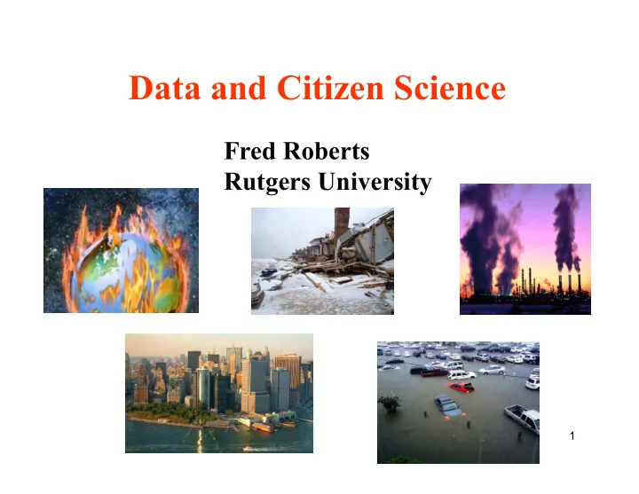
Data and Citizen Science
Fred Roberts Rutgers University
Data and Citizen Science Fred Roberts Rutgers University 1 - - PowerPoint PPT Presentation
Data and Citizen Science Fred Roberts Rutgers University 1 Putting this Workshop in Context: Mathematics of Planet Earth 2013 A joint effort initiated by North American Math Institutes: MPE2013 More than 100 partner institutes,
1
Fred Roberts Rutgers University
2
Math Institutes: MPE2013
and organizations in UK, France, South Africa, Japan, and all over the world
3
distinguished lectures, educational programs
4
year.
beyond 2013.
especially partnership with LAMSADE.
5
Goals of MPE2013+
the problems of the planet
mathematical scientists and other scientists
effort
working between disciplines to solve the problems of society
6
involve students and junior faculty: Arizona State University, Jan. 7-10, 2014
Sustainable Human Environments (Rutgers U.), April 23-25, 2014 Global Change (UC Berkeley), May 19-21, 2014 Data-aware Energy Use (UC San Diego), Sept. 29 – Oct. 1, 2014 Natural Disasters (GA Tech), May 13-15, 2015 Management of Natural Resources (Howard University), June 4-6, 2015
7
Follow-up cluster activities:
Pre-workshop: Urban Planning for Climate Events Sept. 2012; Post-workshop: This workshop Cluster activities of various kinds
potential partners in Mexico and Colombia.
event at the National Center for Atmospheric Research (NCAR) and one at Old Dominion U.
8
Follow-up cluster activities:
Expecting a follow up in Africa (Ebola and lessons learned)
Looking into possibility of research groups (“squares”) at American Inst. of Mathematics (AIM)
9
sustainability effort – Workforce development – Public literacy
with K-12.
Planet Earth of Tomorrow
10
Tim Killeen, Assistant Director, NSF
do we live sustainably on the planet? We all have to contribute.”
11
Sustainable Human Environments: Engaging “ordinary” citizens can help with the development of science and the development
quality of the data citizens provide and the implications of data quality for scientific advances and/or leading to public policy.
12
from other data sets
to make it most useful (and error-free)
citizens’ training needs while keeping data useful?
questions in the context of one class of applications: natural disasters.
13
disasters
Epidemics Earthquakes Floods Hurricanes Tornadoes Wildfires Tsunamis Extreme temperatures Drought Oil spills
and responding to such events, and mitigating their effects.
Nepal 2015: www.circleofblue.org
14
drought, floods – all could be increasing in number and severity.
Rutgers University, Sept. 2013
Dust storm in Mali
15
arrival
Dust storm in Mali
ambafrance-nz.org foei.org
16
Planning for Climate Change, Sept. 2013, at DIMACS-Rutgers University
changes due to climate and in particular the effect of future climate events?
17
extreme events due to global warming.
18
Irene hits NYC – August 2011
19
Irene hits NYC – August 2011
20
Irene hits NYC – August 2011
21
Sandy Hits NJ Oct. 29, 2013 My backyard My block
22
Sandy Hits NJ Oct. 29, 2013 My neighborhood My block
23
Sandy Hits NJ Oct. 29, 2013 NJ Shore – from Jon Miller
24
event, what do we need to do?
Rutgers University.
applications.
25
loss of power
situations that could lead to loss of power during a major storm?
Michael Sherman, and Janne Lindqvist at Rutgers University.
*Thanks to Janne Lindqvist for this example
26
bartstreeservice.com cleveland.com
27
serious problems during a storm
senior citizens) in a small community in New Jersey, USA, in this effort.
consuming manual labor.
kind of thing – involving professional maintenance staff and even police officers.
involved and coordination of efforts.
28
salaries of professionals to do the work
that could make the process of documenting and reporting hazards relatively easy.
report hazards to a central server.
data collected.
29
Shot of the smartphone app used in the project. Image from article by Yang, Sherman, and Lindqvist in Proccedings of 2014 IEEE Global Humanitarian Technology Conference
30
lots of hazards
found good number of hazards
31
much setup or training
ü Only training was to identify hazards
ü Photo of hazard ü When: Date/time ü Who: Volunteer’s ID ü Where: Hazard location
32
information about nearest pole is important.
the ID tag on the pole
allowed extra information to be provided by volunteer.
From Yang, Sherman, Lindqvist
33
before
34
map with pushpins.
hazard found
photo, street address.
identification (passwords) could access the site. Key: township committee members.
35
errors:
ü Easy to learn ü Easy to use ü Many things automated ü Easy corrections ü Considerable attention to needs of citizen scientists
server
36
small interactive area on touchscreen. Tablets might work better
coverage – and not necessarily uploaded later.
ü Leads to omitted data ü Easy to fix by caching data and uploading periodically when in the presence of a good network.
37
suffers from occasional severe flooding.
at how citizens’ reports of severity of flooding matched up with reports from trained experts.
*Thanks to Ryan Whytlaw for this example
betterwaterfront.org
38
combines sewage from homes with rainwater runoff.
into people’s basements or into the streets.
Management Plan” for Hoboken.
Analysis”: What is the effect on people’s health
39
gastro-intestinal infections (GI) (and other health effects)
which is part of National Oceanic & Atmospheric Administration (NOAA)
description of flooding severity.
particular local area
40
have a great deal of data. (The State Climatologist is a professor at Rutgers.)
41
Community Collaborative Rain, Hail and Snow Network.
citizens to report rainfall, snowfall, hail, flooding, and
schoolyards, etc.
“Because every drop counts”
Precipitation is important and highly variable Data sources are few and rain gauges are far apart
PRISM: used by permission
Measurements from many sources are not always accurate (especially snow) There is almost no quantitative data being collected about hail Storm reports can save lives
“CoCoRaHS is a national grassroots, non-profit, community-based, high-density precipitation network made up of volunteers of all backgrounds and ages . . . . . . who take daily measurements of “just precipitation” right in their own backyards”
4-inch diameter high capacity rain gauges Aluminum foil-wrapped Styrofoam hail pads
Once trained, our volunteers collect data using low-cost measurement tools . . .
Training is important to assure accurate, high quality data
and report their daily observations on our interactive Web site: www.cocorahs.org
Volunteer’s observations are immediately available in map and table form for the public to view. Locally Nationally
Nashville, TN
Daily precipitation maps: Rainfall, Hail and Snowfall Daily data in table form Albuquerque, NM
This data allows CoCoRaHS to supplement existing networks and provide many useful results to scientists, resource managers, decision makers and other end users on a timely basis.
“Helping to provide the public with a better understanding of weather”
– Geoscience education tool – Taking measurements – Analyzing data – Organizing results – Conducting research – Helping the community
CoCoRaHS hopes to one day achieve a network of . . .
in urban areas
in rural areas
Simply sign-up on the CoCoRaHS web page www.cocorahs.org Obtain a 4” plastic rain gauge
(info available on web site)
Set-up the gauge in a “good” location in your backyard Start observing precipitation and report on-line daily
Five easy steps
View the “training slide show” or attend a training session
56
automated quality control mechanism that highlights “suspect” reports.
accurate
manual quality control
colostate.edu
57
Hoboken in the Health Impacts Analysis study failed.
in Hoboken was incomplete, so was CoCoRaHS data.
flooding in their reports.
58
some public threat or inconvenience
near streams. Some evacuations of people and/or transfer of property to higher elevations are necessary
Significant evacuations of people and/or transfer of property to higher elevations
59
developed with a focus on making the system user friendly (easy to understand)
fairly young ones
with the government used definitions.
60
hard to match up
problems with data
61
case of developing emergencies
and Metzer, Nelson & Pottenger) analyzed data from Twitter from Haitian Earthquake of 2010 & Japanese Earthquake and Tsunami of 2011 – over a billion tweets Thanks
*Thanks to Christie Nelson and others at CCICADA for this example
62
messages with various types of requests.
aid, etc.
Great diversity of communication Interesting characteristics of network spread People coordinate in different ways People follow typical sequences when
communicating in emergency situations
responders and others to identify “relapses,”,pick out anomalies, etc.
63
“topic signatures” that indicate when an event of a given type occurs
Discover ‘burst’ of topic-related words in timespan Identify relevant tweets Extract main ones to build a summary Monitor as event unfolds Pick out anomalies, etc.
Timespan ¡1: ¡Jan ¡18, ¡2010 ¡at ¡22 ¡UTC, ¡for ¡9 ¡hours ¡ Summary ¡tweets: ¡
Pakistan ¡h;p://bit.ly/guYOry ¡ ¡
southwestern ¡Pakistan ¡h;p://on.cnn.com/gQcnRa ¡ ¡
64
trendistic.com
earthquake ¡ Step 1: q’ = EXPAND (q) Query: q Step 2: TS = RANK_TIMESPAN(q’) Step 3: SUMMARIZE(TS)
Event ¡signature: ¡earthquake, ¡earthquake., ¡earthquake.., ¡ magnitude, ¡epicenter, ¡earthquake.., ¡foreshocks, ¡usgs, ¡ tsunami, ¡indonesia, ¡… ¡
Metzler ¡et ¡al. ¡2011 ¡ βT (w) = P (w|T )
P (w)
“Burs?ness” ¡of ¡term ¡w ¡in ¡?mespan ¡T: ¡
65
10 topics and 10 top words for each topic (generated by LDA)
topic0 topic1 topic2 topic3 topic4 topic5 topic6 topic7 topic8 topic9 stupid hate magnitude condolen ces tsunami donate depth feel large upgraded supermoon destroy damage bodies affected text epicenter felt crack triggering search teen weird islands people relief coast shit photo large total violence make found hit redcross offshore thought showing effects utter gangs started worst prayers victims miles shaking death unbelievable
protect rocked city thoughts red strikes tonight toll issued post depth hurricane sweeping news cross survey big raise flash bollocks thing news living massive support bst time police feed site stopped back slam coast record region scary earth suffered response fault snow pray strongest revised back unleashed larger event sympathy aid location emotion
– Earthquake:
activities
depending on relationship of tweeters to event
– It’s different if you are there than if you just heard about it
66
0 ¡ 0.1 ¡ 0.2 ¡ 0.3 ¡ 0.4 ¡ 0.5 ¡ 0.6 ¡ 0.7 ¡ 0.8 ¡ doc1 ¡ doc2 ¡ doc3 ¡ doc4 ¡ doc5 ¡ doc6 ¡ doc7 ¡ doc8 ¡ doc9 ¡ doc10 ¡ doc11 ¡ doc12 ¡ doc13 ¡ doc14 ¡ doc15 ¡ doc16 ¡ doc17 ¡ doc18 ¡ doc19 ¡ doc20 ¡ topic2 ¡ topic5 ¡ topic7 ¡
Each ¡‘document’ ¡is ¡a ¡bucket ¡of ¡ 100 ¡tweets, ¡sorted ¡in ¡?me ¡order. ¡ Ini?al ¡discussion ¡about ¡emo?ons, ¡ then ¡focus ¡shiQs ¡to ¡aid ¡ ¡
0 ¡ 0.1 ¡ 0.2 ¡ 0.3 ¡ 0.4 ¡ 0.5 ¡ 0.6 ¡ 0.7 ¡ 0.8 ¡ 0.9 ¡ 1 ¡ doc0 ¡ doc5 ¡ doc10 ¡ doc15 ¡ doc20 ¡ doc25 ¡ doc30 ¡ doc35 ¡ doc40 ¡ doc45 ¡ doc50 ¡ doc55 ¡ doc60 ¡ doc65 ¡ doc70 ¡ doc75 ¡ doc80 ¡ doc85 ¡ doc90 ¡ topic2 ¡ topic5 ¡ topic7 ¡
Less ¡about ¡emo?on: ¡English-‑language ¡ tweeters ¡were ¡not ¡so ¡present ¡in ¡
More ¡about ¡event: ¡implica?ons ¡for ¡ Dai-‑ichi ¡Nuclear ¡Plant ¡ ¡
event ¡
Japan, ¡Mar ¡2011 ¡ Need ¡to ¡determine ¡details ¡of ¡loca;on ¡and ¡par;cipants ¡of ¡events ¡ ¡
aid ¡ emo?on ¡ event ¡ aid ¡ emo?on ¡
important items requested during an emergency
Grouped messages by location (clustering) Determined top requests by location using machine learning (Higher Order Naïve Bayes – HONB – or Higher Order Latent Dirichlet Assn. – HO-LDA) Allocated aid based on integrated social media geolocations requests received
Haitian Earthquake
67
68
during the 2010 Haitian Earthquake.
visualization, and interactive mapping.
election in 2007.
accountability
Ushahidi volunteers manually determining aid requests remotely from the US
media messages for “help” of some kind
– Help may be requesting information or aid, etc. – Looked at Haitian Earthquake of 2010 – Ushahidi social media and text message dataset
ü 3,358 messages over 45 days (Jan 13, 2010 – Feb 26, 2010) ü Data included social media messages along with texts sent to an emergency number, and geolocation
69
Haiti after the earthquake Haiti earthquake intensity map
– Grouped messages by location (clustering) – Determined top requests by location (machine learning)
ü Potential “aid” requests (class labels): Hospital Clinics Operating; Services Available; Medical Emergency; Security Threats; People Trapped; Medical Supply; Water Shortage; Food Shortage; Help; Hygiene (water); Human Remains; Shelter; Vital Lines (Infrastructure); Fuel Shortage; Clothing; Damaged Structure; Power Outage; Persons News; Other
– Allocated aid based on traditional methods and pre-existing facility locations that integrated the social media geolocations and requests (resource allocation model)
70
Pre-existing Facilities (illustrative)
71
x ¡ x ¡ x ¡ x ¡ x ¡ x ¡ x ¡ x ¡ x ¡ x ¡ x ¡ x ¡ x ¡
WaterShortage ¡ Shelter ¡ FoodShortage ¡
x Social Media Message Resource requested
Hospital ¡or ¡Clinic ¡
Individual social media messages received
messages, along with their “need” requests
72
(loca?on, ¡ resource) ¡
S h e l t e r , ¡ W a t e r S h
t a g e , ¡ F
S h
t a g e ¡ M e d i c a l E m e r g e n c y , ¡ S e c u r i t y T h r e a t s , ¡ W a t e r S h
t a g e ¡
Summarizing the messages by location and top 3 requests. Locations must have 50+ messages
911 (cluster)
73
“we do not have water we are in Santo 15 thank you” Class: Water
Predict resource need
HO-LDA learned on the cluster HONB learned
cluster
Topic 1 (water, liquid, fluid, thirsty) Words matched to category
with xx% probability associated
Mixed integer programming resource allocation model
Messages ¡received; ¡Messages ¡CLUSTERED; ¡Model ¡learned ¡with ¡either ¡HO-‑LDA ¡or ¡HONB; ¡ ¡ ¡ ¡ ¡ ¡ ¡ ¡ ¡ ¡ ¡ ¡ ¡ ¡ ¡ ¡ ¡ ¡ ¡ ¡ ¡ ¡ ¡ ¡ ¡ ¡ ¡ ¡ ¡ ¡ ¡ ¡ ¡ ¡ ¡ ¡ ¡ ¡ ¡ ¡ ¡ ¡ ¡ then ¡predicted ¡need ¡put ¡into ¡RESOURCE ¡ALLOCATION ¡Model ¡
Shelter ¡a ¡needs ¡Water ¡
After several messages are received, first they are CLUSTERED
OR
– Data during emergencies is often inconsistent or conflicting – Could be due to noise or malicious intent – Not sure what you can trust
problem of trustworthiness in such contexts
claims made.
factors contributing to trust: accuracy, completeness, bias
74
awareness and for political activism (as by Ushahidi).
media.
messages, but also things like geolocation that are
provide it.
from sensors, news reports, etc.
75
used to make decisions during an emergency.
make policy based on what was discovered.
becomes a critical issue
more time to evaluate the trustworthiness of the data and to select subsets of it that are trustworthy.
76
77
– How can we get early warning to citizens that they need to evacuate? Social media clearly relevant – How can we plan such evacuations effectively? Citizen input could be gathered; information about where people have gone in past could be obtained
78
be implemented quickly; can we get information to people quickly? Social media.
quickly modifiable given data from evacuation centers, traffic management, flood reports, etc.? Citizens report in. Social media and other ways.
79
What subways will be flooded? If the question were “are being flooded,” citizen science clearly relevant. How can we protect against such flooding? Could citizen science be used to gather input from past storms to determine most vulnerable subways?
80
minimize down time? Could we use citizen science to gather information about downed lines during storms to gather data to plan ahead?
81
storm? Who gets priority?
your business on line. (Can’t pump gas without power.) Citizen science could help with information from previous storms.
given home. Citizen science could help even during a storm – using social media.
Bringing in help from out of state
82
reports from earlier storms or social media from current one.
Water, Food, Fuel, Generators, Chainsaws?
who need them in an efficient way?
work on MCAP
August 2012 83
during an emergency? This is Nelson-Pottenger.
in allocating the resources when needed? Use citizen reports from previous storms.
emergencies from CDC (Centers for Disease Control): how do we decide what medicines to include, how many doses, where to keep them? This is less likely to benefit from citizen science??
work on MCAP
August 2012 84
Source: cdc.gov
85
routing to avoid rising flood waters while still minimizing delay in provision of medical attention and still getting afflicted people to available hospital facilities? Citizen science from reporting where previous floods keep roads open
86