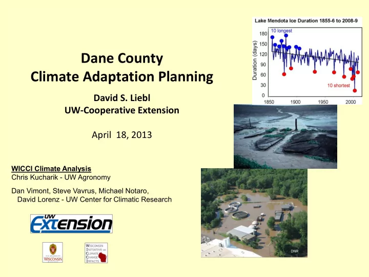
SLIDE 1 Dane County Climate Adaptation Planning
David S. Liebl UW-Cooperative Extension April 18, 2013
WICCI Climate Analysis Chris Kucharik - UW Agronomy Dan Vimont, Steve Vavrus, Michael Notaro, David Lorenz - UW Center for Climatic Research
SLIDE 2
Dane County Climate Planning
The Team Resource and infrastructure managers, public health and safety The Process 1) Understand climate impacts (today) 2) Assess vulnerability 3) Identify adaptation opportunities 4) Plan for adaptation:
– Range of strategies – Implementation plan – Public review and input
SLIDE 3
Humans experience climate as weather… …and weather can
take a human toll!
What about climate concerns us?
SLIDE 4 High Water
Storms of June 1-15, 2008
38 River gauges broke records 810 Square miles of land flooded 161 Communities overflowed 90 million gallons raw sewage 2,500 Drinking water wells tested - 28% contaminated $34M in damage claims paid
Source: FEMA, WEM
DNR
SLIDE 5 Your most notable extreme weather event
- You were in it
- You responded
- You will always remember
- You worry about
June 8, 1953
Cleveland, Ohio F-4 Tornado Path 118 miles Width 100 yards Injuries 379 Dead 17
SLIDE 6 Scientific consensus on climate change
“There is a strong, credible body of evidence, based
- n multiple lines of research, documenting that
climate is changing and that these changes are in large part caused by human activities.”
— US National Research Council, 2010
Wisconsin Initiative on Climate Change Impacts
- Understanding ways we can adapt to the
consequences of climate change.
www.wicci.wisc.edu
SLIDE 7
Historic Temperature Change
Wisconsin has warmed by 1°-1.5°F since 1950
SLIDE 8
Daytime High Temperature Change
Spring Winter Winter
Nighttime Low Temperature Change
Spring
SLIDE 9 Temperature Extremes
Sub-zero nights
much less frequent
Very hot days
little change
SLIDE 10 Dates of Spring and Fall Freeze
Wisconsin growing season
lengthened by 1-4 weeks since 1950
SLIDE 11
Annual Average Precipitation Change
Wisconsin rainfall has changed
↑7” - ↓4” since 1950
SLIDE 12 Statistical downscaling of climate projections across the East and Central Landscape Conservation Cooperatives (LCCs) Objective: To statistically downscale global climate model simulations to scales relevant for decision makers (around 10 km resolution)
WICCI Climate Assessments and Projections
UW-Center for Climatic Research
Downscaling Region
SLIDE 13
- More frequent hot days
- Significant increase in heat waves
- Warmer nighttime and winter temperatures
- Increased frequency and intensity of precipitation
- Significant increase in rain during winter
Impact on short term variability (weather)
Not projected
Summary of Wisconsin’s projected climate
SLIDE 14 10 ⁰F 8 ⁰F 6 ⁰F Co2 Emission Scenarios Using: A1B as mid-range
(not more likely)
Selecting Climate Data
Source: http://ccr.aos.wisc.edu/resources/data_scripts/LCC/
SLIDE 15 +6 ⁰F +8 ⁰F Mid 21st Late 21st Planning Horizons Budget 1-2 years Staffing 3-5 years Buildings 25-50 years Roads, Sewers, etc. >50 years
How far do we need to look ahead?
Source: http://ccr.aos.wisc.edu/resources/data_scripts/LCC/
Comparing: Late 20th to mid-21st
SLIDE 16 T annual +6 ⁰F
Mid-21st Temperature (A1B)
T max +6 ⁰F +20 Days >90⁰F +500 CDD
Source: http://ccr.aos.wisc.edu/resources/data_scripts/LCC/
SLIDE 17 Vulnerability to Heat
Since 1982, heat waves have caused more deaths (216) than all other natural disasters combined
SLIDE 18 Likelihood of the Warmest Day of the Year
Madison, WI
1976, 2012 record Projected
(A1B)
SLIDE 19 Increase in Heat Wave Number and Duration
1981-2000 vs. 2046-2065
More frequent and longer
Six 5-day events One 9-day event
SLIDE 20 Latest freeze 2 weeks earlier
Mid-21st Precipitation (A1B)
Seasonal shift
Suggests: More spring snow storms
More icing More groundwater recharge
Source: http://ccr.aos.wisc.edu/resources/data_scripts/LCC/
Spring +1”
SLIDE 21 Groundwater flooding from increased recharge
Madeline Gotkowitz
The community has built a diversion channel to carry water from future flooding. This Spring Green subdivision has been razed, with FEMA reimbursement.
SLIDE 22 Spring +1” Summer +6 ⁰F
Mid-21st Precipitation (A1B)
Seasonal shift
Suggests: More spring, less summer rainfall
Increased drought Increased irrigation demand
Source: http://ccr.aos.wisc.edu/resources/data_scripts/LCC/
SLIDE 23 Mid-21st Precipitation (A1B)
Annual +2” 2” rainfall +4/10yr
Source: http://ccr.aos.wisc.edu/resources/data_scripts/LCC/
Climatologist's “extreme rainfall” = 2” in 24 hours
(frequency = 1.3/ year)
SLIDE 24 1 2 3 4 5 6 7 1 year 5 years 10 years 25 years 50 years 100 years Historical NARCCAP
Inch Return Period Storm Intensity 1971-2000 vs. 2041-2070
Storm Intensity
Both are projected to increase
10 20 30 40 50 60 70 80 1.0" 2.5" 3.0" 3.5" 4.0" 5.0" Historical NARCCAP
Projected Return Period 1971-2000 vs. 2041-2070 Storm Intensity Year
Rainfall Frequency
SLIDE 25
Record 24-hour Rainfalls
World-wide: 72″ in 24 hours La Reunion, Indian Ocean (1966) Wisconsin : 11.75″ in 24 hours Stoddard, Vernon County (August 18, 2007) 4.05” La Crosse (same storm) NOAA 100-year(1%) rainfall = 7″
Record Rainfall (MSN) 4.5″ 1996 4.1″ 2008 3.9″ 1995 3.7″ 1993 3.6″ 2004, 2009 3.5″ 2010
SLIDE 26 Adapting to Extreme Rainfall
Resiliency
Today’s extreme events are consistent with projected precipitation trends If a system is prepared for current variability, it’s likely to be prepared for future trends
Liebl and Schuster
11.75”
We can learn from the experience of communities around us
SLIDE 27 “Build upon the experiences of communities that have experienced recent extreme rainfalls to guide a state-wide evaluation of vulnerabilities…..”
- WICCI Stormwater Working Group
Vulnerability assessment
Rainfall:
- Floodplains and surface flooding
- At-risk road-crossings
- Stormwater BMPs
- Hazardous materials storage
- Emergency response capacity
- Wells and septic systems
- Sanitary sewer inflow and infiltration
SLIDE 28
- NOAA Milwaukee Regional Climate Center
Reedsburg, WI Sewage Treatment Plant
Extreme Storm Transposition Study
NOAA CSI-SARP NA12OAR4310098
Rainfall Rise Stage* Outflow 2008 storm
10.7″ 2.3 ′ 852 ′ 632 cfs
Transposed storm
13.6″ 2.9 ′ 853 ′ 752 cfs
100yr flood
852 ′
*from 850.1
Impact downstream under analysis “What would happen if the 2008 rainfall was centered over the Yahara Lakes?” Lake Mendota
SLIDE 29
Long planning horizon - Climate change occurs over decades, what planning and management strategies are on the same time scale? Predictive uncertainty - Are management strategies flexible enough to respond to the range of climate impacts and uncertainty ? Sustainable alternatives – More of the same may not be the best long term solution? Win-Win strategies both protect society and reduce carbon
Challenges of Climate Adaptation
SLIDE 30
Climate Ready Communities
Climate Awareness Vulnerability Assessment : Extreme heat Drought Heavy rainfall Warm winters Windstorms Adaptation Capacity: Planning Resiliency
Communities should be prepared for today’s rare weather extremes, they will become more common - WICCI
SLIDE 31
Dane County Next Steps
Identifying climate vulnerabilities
How will projected changes in climate affect your work? e.g. More de-icing - MSN Prolonged heat waves – County Health High water – Lakes and Watershed Next steps: 1) Identify climate vulnerabilities in the systems you manage 2) Assess the feasibility of adaptation strategies 3) Look for commonalities 4) Prioritize 5) Draft a plan of public review and input 6) Implement adaptation strategies
SLIDE 32 Vulnerability Worksheet MSN
Changing Climate Conditions+A1:O17 Area of Responsibility or Activity Anticipated Impact Scope of Impact Time Frame of Change Consequence of Impact Vulnerability of Systems Use the following (WICCI A1B) scenarios for mid-21st century Name of department or other What exactly do you think will happen How widely will it affect your
Immediate or deferred Why is the impact a problem How will you recognize failure of the system Temperature Annual Average Temperature + 6⁰F Average Maximum Temperature + 6⁰F Annual Peak Temperature 110-112⁰F Twenty more Days over 90⁰F Five hundred more cooling degree days More frequent-longer heat waves Precipitation Annual Precipitation +2" Rainfall frequency and intensity increasing Extreme rainfall event (6" in 24hrs) Increased rainfall in winter and spring Dane County Regional Airport Increasing amount of winter rainfall Planes, runways, sidewalks, parking Immediate Safety of passengers; ability to operate Inability of existing de-icing systems to cope with Increased groundwater recharge
SLIDE 33 Vulnerability Worksheet MSN (pg2)
Estimated Risk to System Adaptation Opportunity Adaptation Goals Feasibility of Options Required Authority Potential Internal Partners Potential External Partners Time Frame of Implementation High - Medium - Low Anything that can be done in anticipation of the impact Objectives / Milestones Cost, physically possible, socially acceptable Who can make the decision to implement Who in County government should be involved Who else should be involved When should it begin (or when can it begin) Medium Upgrade de-icing systems; improve icing forecasting Maintain operations during icing events Feasible with current technology Director and FAA Lakes and Watershed City of Madison Begin analysis and planning now