CR NEMBA Proposed Birthday Hill Trail 1 CR NEMBA Proposal Allow - - PowerPoint PPT Presentation

cr nemba proposed birthday hill trail
SMART_READER_LITE
LIVE PREVIEW

CR NEMBA Proposed Birthday Hill Trail 1 CR NEMBA Proposal Allow - - PowerPoint PPT Presentation

CR NEMBA Proposed Birthday Hill Trail 1 CR NEMBA Proposal Allow bike use on 1.5 mile management road/ snowmobile trial segment along south Bigelow Preserve boundary Purpose: connector trail in existing network, challenging


slide-1
SLIDE 1

CR NEMBA Proposed “Birthday Hill Trail”

 CR NEMBA Proposal

 Allow bike use on 1.5 mile management road/ snowmobile trial

segment along south Bigelow Preserve boundary

 Purpose: “connector trail in existing network, challenging

climb/descent”

 Dominant Resource Allocation

 Bigelow Backcountry

1

slide-2
SLIDE 2

CR NEMBA Proposed “Birthday Hill Trail”

“Birthday Hill Trail”

Source: base map with numbered trails provided by CR-NEMBA; notation added by BPL.

2

slide-3
SLIDE 3

Dominant Resource Allocations in Vicinity of Proposed Trail

3

slide-4
SLIDE 4

Field Photos – “Birthday Hill Trail”

Slope on Birthday Hill Trail Level section of Birthday Hill Trail

4

slide-5
SLIDE 5

CR NEMBA Proposed “Birthday Hill Trail”

 Concerns/ Constraints

 Does not link directly to any other designated bike trails

(although existing snowmobile/ ATV route between the Carriage Road and Huston Brook Road is reportedly ridden now)

 Riders seeking challenge may be tempted to ride on “winter

roads” branching north (upslope) from this road

5

slide-6
SLIDE 6

CR NEMBA Proposed “Birthday Hill Trail”

 Justifications for Approval of Concept

 No new ground disturbance (existing management road used

informally by bike riders)

 Road links directly to snowmobile/ ATV routes on adjacent

lands that are used by mountain bike riders

 Road links indirectly to the 60s Road/ Esker Trail and regional

bike trail network via Huston Brook Road and the Carriage Road

 Provides gradual climb (most other bike trails and

management roads open to bikes in Preserve are generally flat) for riders seeking more physical challenge

6

slide-7
SLIDE 7

Proposed “Birthday Hill Trail”: Proposed Plan Amendment

 Allow mountain bike use of road/ snowmobile trail

segment as a connector trail by adding to list of management roads designated for mountain bike use

 BPL will block as needed any associated winter roads and

will monitor for unauthorized bike use of those roads

 Consistent with current policy on mountain bike use

within the Bigelow Preserve, road will not be formally designated as a “bike trail”

 BPL may use the road as a haul route during future

timber harvests, and log yards could be constructed along the road

7

slide-8
SLIDE 8

CR NEMBA Proposed “Esker Trail” Reroute

 CR NEMBA Proposal

 Reroute existing trail [~2.4 mile section of the “Esker Trail”

within Dead River Twp.] to mitigate for planned use of the road as a haul route during the next few years

 Purpose: “Trail to provide wilderness experience for users”

 Dominant Resource Allocation

 Bigelow Backcountry

8

slide-9
SLIDE 9

Dominant Resource Allocations in Vicinity of Proposed Trail Reroute

9

slide-10
SLIDE 10

CR NEMBA Proposed “Esker Trail” reroute

2.4 mile segment of trail to be rerouted Dead River Twp. Wyman Twp.

Source: base map with numbered trails provided by CR-NEMBA; notation added by BPL.

10

slide-11
SLIDE 11

Field Photos – “Esker Trail” within Dead River Twp

Bridge over small stream crossing Beaver flowage area crossed by trail

11

slide-12
SLIDE 12

CR NEMBA Proposed “Esker Trail” Reroute

 Concerns/ Constraints

 Rerouted trail would represent new recreational development

and require new ground disturbance in Bigelow Preserve

 Construction of single-track trail may be perceived as setting a

precedent for bike trails in the Bigelow Preserve on other than existing public use and management roads

 Availability of resources to construct rerouted trail ahead of

planned harvests

 Necessity to avoid potential impacts to Huston Brook Pond

and its buffer zone (allocated Special Protection)

12

slide-13
SLIDE 13

CR NEMBA Proposed “Esker Trail” Reroute

 Justification for Approval of Concept

 Trail is key East-West mtn. bike route in south part of Bigelow

Preserve, linking Huston Brook Road and Stratton Brook Road

 Timber harvesting activity will close bike route for 2 seasons,

possibly beginning in 2016

 Upgrade of road for planned harvest would substantially change the

riding experience when the trail is reopened

 Would no longer approximate single track riding  Would become similar to riding on other management roads in the

Preserve, with a wide cleared ROW and graveled surface

 Concept replaces rather than creates an additional route for

mountain bikes

 Concept does not open up a new area of the Preserve to bike riding  Single-track trail can be constructed sustainably and with minimal

ground disturbance

13

slide-14
SLIDE 14

Proposed “Esker Trail” Reroute: Proposed Plan Amendment

 Collaborate with CR NEMBA on specific route and

design for ~2.4 miles of rerouted trail, with intention

  • f providing a “single track” trail

 Trail will cross only areas allocated Bigelow

Backcountry and will avoid the Special Protection zone around Huston Brook Pond

 Trail to be constructed by CR NEMBA  If beaver flowage half mile east of township/ county

line is not avoided by reroute, consider improving crossing to facilitate trail use during occasional flooding

14

slide-15
SLIDE 15

CR NEMBA Proposed Reroute of “Jones Pond Trail”

 CR NEMBA Proposal

 Allow bike use on 5 miles of management road/ snowmobile

trail crossing SW Bigelow Preserve (Range TH to Stratton Brook Pond Road)

 Reroute existing trail to provide better experience  Purpose: “provide longer loop option for advanced rider

/secondary out and back for intermediate rider”

 Dominant Resource Allocation

 Bigelow Backcountry

15

slide-16
SLIDE 16

Stratton Brook Road to Range TH management road (aka “Jones Pond Trail”)

Range trailhead Stratton Brook Road

Source: base map with numbered trails provided by CR-NEMBA; notation added by BPL.

16 Existing “Jones Pond Trail”

slide-17
SLIDE 17

Dominant Resource Allocations in Vicinity of Proposed Trail Reroute

17

slide-18
SLIDE 18

CR NEMBA Proposed “Jones Pond Trail” Reroute

 Concerns/ Constraints

 Wet areas within westernmost mile of currently designated

trail (“winter road” section) are not in desired condition for bike use

 Entirely rerouted trail to provide alternative to management

road riding would entail 5 miles of new trail in Bigelow Preserve, raising concern about overdevelopment in “Bigelow Backcountry” and preservation of “overall natural character” of the Preserve

18

slide-19
SLIDE 19

CR NEMBA Proposed “Jones Pond Trail” Reroute

 Justification for Approval of Concept

 Road has already been designated for mountain bike use (page

126 of Plan)

 Eastern 4 miles of trail is “surfaced summer road” in good

condition for bike use

 Provides bike route connecting Carrabassett Valley to Stratton

community

19

slide-20
SLIDE 20

Field Photos – “Jones Pond Trail”

Snowmobile trail near Range TH: surface conditions suitable for bike use Snowmobile trail ~1 mile from Range TH: washout with logs across trail

20

slide-21
SLIDE 21

Proposed “Jones Pond Trail” Reroute: Proposed Plan Amendment

 Work with CR NEMBA to plan improvements on

existing management road/ snowmobile trail to facilitate bike use and improve riding experience, with limited reroutes in problem areas

 Improvements must be compatible with snowmobile

use of the trail corridor

 Improvements to be constructed by CR NEMBA

21

slide-22
SLIDE 22

CR NEMBA Proposed “Backside Trail”

Existing snowmobile trail & proposed bike trail route

Source: base map with numbered trails provided by CR-NEMBA; notation added by BPL.

22

slide-23
SLIDE 23

Dominant Resource Allocations in Vicinity of Proposed Trail

23

slide-24
SLIDE 24

Field Photos – “Backside Trail”

Wet area with drainage across trail (Bigelow Twp.) Beaver dam and flowage across trail (Bigelow Twp.)

24

slide-25
SLIDE 25

CR NEMBA Proposed “Backside Trail”

 No Plan Amendment is proposed

 Conflicts with Plan’s objective to minimize further summer

trail development on the northern slope and to locate mtn. bike trails “outside a core non-mechanized area” (p. 126), which includes the ecoreserve (Special Protection dominant use allocation)

 Conflicts with desire to limit additional recreation

development in the Preserve, in keeping with Vision: “trails and facilities proposed in this Plan…approach the limits

  • f...the maximum appropriate level” (p. 116)

25

slide-26
SLIDE 26

Proposed Redington Lot AT Crossing

 BPL & High Peaks Alliance Proposal

 Allow a perpendicular crossing of the AT corridor on the

Redington Lot by a new shared motorized/ non-motorized recreation trail

 Purpose: provide trail link (along with segments on abutter’s

lands) between Caribou Valley Road and Madrid Township

 Dominant Allocations

 Special Protection – 100 ft. buffer on each side of AT  Remote Recreation – additional 400 ft. buffer on each side  Timber Management – remainder of lot

26

slide-27
SLIDE 27

Redington Lot Resource Allocations and Roads

27

Connection to Carrabassett Valley via Caribou Valley Rd Connection to Madrid Twp

Close-up of allocations in vicinity of AT AT

slide-28
SLIDE 28

Proposed Redington Lot AT Crossing

 Concerns/ Constraints

 Current Plan does not allow new motorized recreation trails within 500

feet of the AT (within the Special Prot./ Remote Rec. buffer)

 IRP does not allow new motorized trails in “natural” or

“historic/cultural” Special Protection areas (page 12)

 IRP requires that adjacent landowner approval be sought and received

before planned trail connections are approved (page 64); Abutters = Sugarloaf Corp to north, Wagner to south

 Some organizations and members of local trails community oppose

development of motorized trails in core of High Peaks area

 Potential for impacts on AT and disturbance of AT hiker’s experience

associated with motorized/ mechanized activity (e.g., mountain bikes and ATVs during summer)

 New trail construction would likely be required on Redington Lot within

TM area, where separate motorized (ATV and snowmobile) and “mechanically assisted” (mtn. bike and groomed ski) trails are desired, which may conflict with timber management

28

slide-29
SLIDE 29

Proposed Redington Lot AT Crossing

 Justification for Approval of Concept

 Existing timber management road on lot could provide shared-

use trail crossing of AT (avoids a new motorized crossing of AT, although use of crossing would expand from timber management only to recreation)

 Provides a regional link for snowmobiles, ATVs, and groomed

ski trails to connect the Caribou Valley Road to trails south of the lot on Madrid Twp.

 A number of trail interests in the region consider this link to be

vital to the development of regional trail networks

 No other north-south motorized trail linkage routes in this

area appear viable

29

slide-30
SLIDE 30

Proposed Redington Lot AT Crossing: Proposed Plan Amendment*

 Dominant Resource allocations

 Reallocate 100-foot Special Protection buffer to Remote Recreation

in the immediate vicinity of management road crossing of AT

 Allow new motorized recreation trail within 500 feet of the AT

(within the Remote Recreation buffer); IRP allows if meet 3 criteria

 Management Recommendations

 Collaborate with regional trail organizations (e.g., snowmobile and

ATV clubs, CR-NEMBA, MH&T, MATC) to develop the best trail alignment on BPL and adjoining properties that would utilize a shared AT crossing on existing management road and shared or, potentially, separate motorized and non-motorized trails on and off the lot

 Develop plan with AT organizations to control and monitor

mountain bike and motorized use at AT crossing to ensure no trespass onto AT and to minimize potential conflicts with hikers

30

* Pending approval from abutters of motorized trail on their parcels

slide-31
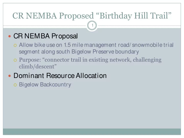
SLIDE 31

Proposed East Flagstaff Lake Boat Launch

 Brookfield Proposal

 To meet FERC license obligations, Brookfield has proposed to

“investigate potential locations…for alternate trailered boat access” due to lack of viable options for day parking at Bog Brook boat launch

 2 options have been discussed:

 develop basic trailered launch at Little Bigelow Gravel Pit trailhead  construct new launch ramp on Dead River Peninsula, in vicinity of

North Flagstaff Road (specific site TBD)

 Resource Allocations

 Gravel Pit site:

 Parking and campsites (former gravel pit) = Developed Recreation Class I  Shoreline zone (330 ft. buffer) – Dominant = Wildlife, Secondary = Remote

Recreation

 Dead River Peninsula site:

 Shoreline zone (330 ft. buffer) - Dominant=Wildlife, no secondary allocation  Outside buffer zone = Timber Management

31

slide-32
SLIDE 32

Gravel Pit Site and Vicinity

32

Existing carry-in trail Gravel Pit – parking and campsites AT AT

slide-33
SLIDE 33

Field Photos – Little Bigelow gravel pit TH

33

Parking area Carry-in boat access trail

slide-34
SLIDE 34

Dead River Peninsula (general area of proposed launch ramp, site TBD)

34

Long Falls Dam North Flagstaff Road

slide-35
SLIDE 35

Dominant Resource Allocations in Vicinity of Proposed Boat Launch – Gravel Pit Site

35

slide-36
SLIDE 36

Dominant Resource Allocations in Vicinity of Proposed Boat Launch – Dead River Peninsula Site

36

slide-37
SLIDE 37

Proposed East Flagstaff Lake Boat Launch

 Concerns/ Constraints

 Gravel Pit site:  Within Bigelow Preserve (some may consider a new boat launch to be

incompatible with maintaining “undeveloped character” of Preserve)

 Remote Recreation secondary allocation allows only carry-in boat

access

 Potential conflicts with existing uses (trailhead parking and primitive

campsites)

 AT routed on road and through woods adjacent to site  Dead River Peninsula site:  Development would likely involve more new ground disturbance and

would be more costly than Gravel Pit site

 Considerable distance (10+ miles) from existing Bog Brook launch

that new launch would replace and less accessible from nearby communities

 Remoteness of site may make it more vulnerable to abuse and other

management problems

37

slide-38
SLIDE 38

Proposed East Flagstaff Lake Boat Launch

 Justifications for Approval of Concept  General:

 No fully functional trailered boat access on east side of lake  The limited capacity and design of the intended facility and the large area and

shallow character of the lake would minimize potential impacts on non- motorized boating

 Facility would facilitate access by non-motorized as well as motorized boaters,

particularly large groups with multiple boats

 Gravel Pit site:

 Close to existing Bog Brook site, easily accessible from communities to south  Most of site already disturbed (new construction would be required for launch

ramp and turn-around that would replace existing 400 ft. carry-in foot trail, and expansion of parking area within former gravel pit)

 Dead River Peninsula site:

 outside of Bigelow Preserve  no conflict with existing uses

38

slide-39
SLIDE 39

Proposed East Flagstaff Lake Boat Launch: Proposed Plan Amendment

 Explore with Brookfield the development of one of two

potential new trailered boat launch sites on east Flagstaff Lake

 If Gravel Pit site selected:

 Consistent with 1981 Bigelow Preserve Policy and Guidelines

incorporated into the 2007 Plan (p. 117), allow for development of facility as “a basic facility necessary to provide access”

 Expand existing trailhead/ campsite parking to provide 4-6 vehicle

with trailer parking spaces

 Modify existing carry-in trail to a gravel trailered boat ramp with a

turnaround, and with a cement plank surface at the lower end

 Revise shore zone allocation from Wildlife/ Remote Recreation to

Developed Recreation Class I in area of launch ramp

 Collaborate with Boating Facilities Program and Brookfield on

design, permitting, and construction of facility

39

slide-40
SLIDE 40

Proposed East Flagstaff Lake Boat Launch: Proposed Plan Amendment

 If Dead River Peninsula site selected:

 Revise Dominant Allocation from Wildlife and Timber Management

(if applicable) to Developed Recreation Class I in area of launch ramp

 Construct a new gravel trailered boat launch ramp with

parking for 4-6 vehicles and trailers, with access via the North Flagstaff Road

 Collaborate with Boating Facilities Program and Brookfield on

siting, design, permitting, and construction of facility

 Consider site maintenance arrangement using Camp Host

volunteer stationed at Big Eddy

40

slide-41
SLIDE 41

Summary – Proposals Accepted

41

 Plan amendments would allow the following proposals to

move forward, with prescribed requirements and changes to concept as indicated:

 Non-motorized trail segments at Chain of Ponds  Non-motorized trail segment at Stratton area/ Bigelow

Preserve, without new trail construction

 Mountain bike use of 2 short management roads in Preserve  Minor reroutes of “Jones Pond” bike route in problem areas  Reroute of Dead River Twp. portion of Esker Trail  Connector trail from Stratton Brook Hut to Bigelow Preserve  Basic trailered boat launch on East Flagstaff Lake  Shared motorized/ non-motorized crossing of AT on Redington

Lot

slide-42
SLIDE 42

Summary – Proposals Rejected

42

 No Plan amendments have been proposed to allow

the following proposals , or portions of proposals

 4.5 miles of new non-motorized trail along Stratton Brook  Complete or substantial reroute of “Jones Pond” bike route  Mountain bike crossing of northern portion of Bigelow

Preserve

 BPL has judged these to be incompatible with the

2007 Plan and/ or the BPL Vision for the affected properties, and has proposed amendments to allow alternatives that require little or no new development on public lands