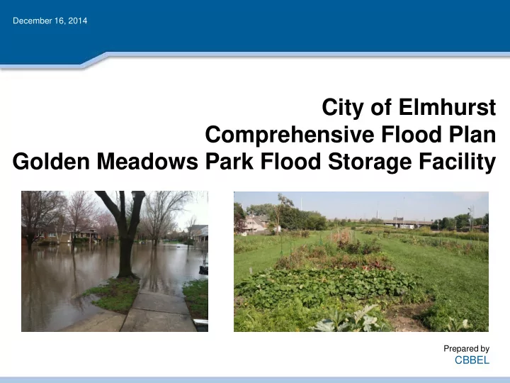
City of Elmhurst Comprehensive Flood Plan Golden Meadows Park Flood - - PowerPoint PPT Presentation

city of elmhurst comprehensive flood plan golden meadows
SMART_READER_LITE
LIVE PREVIEW

City of Elmhurst Comprehensive Flood Plan Golden Meadows Park Flood - - PowerPoint PPT Presentation

December 16, 2014 City of Elmhurst Comprehensive Flood Plan Golden Meadows Park Flood Storage Facility Prepared by CBBEL Project Background & Timeline June and July 2010 Severe storm events hit Elmhurst, resulting in widespread


slide-1
SLIDE 1

December 16, 2014

City of Elmhurst Comprehensive Flood Plan Golden Meadows Park Flood Storage Facility

Prepared by

CBBEL

slide-2
SLIDE 2

Project Background & Timeline

2

  • June and July 2010 – Severe storm events hit Elmhurst, resulting in widespread

flooding throughout the City

  • December 2010 – City hires CBBEL to develop Comprehensive Flood Plan
  • December 2011 – CBBEL presents conceptual flood solutions for flood problem
  • areas. Solution for Pine Street flooding involves using flood storage created at

Golden Meadows Park by dropping the elevation of the entire park several feet.

  • May 2013 – After receiving input from the Park District, CBBEL develops

conceptual improvement plans for each proposed flood storage site. The Golden Meadows Park focuses on just the eastern portion of the park (soccer field). The western portion of the park (garden plots) would remain undisturbed.

  • October 2014 – Park District approves the use of the western portion of the park

(garden plots) as a flood storage area.

  • December 2014 - Future – City and Park District will finalize details of land swap
  • agreement. A detailed survey, geotechnical investigation, and engineering will be

completed once the land agreement is in place.

slide-3
SLIDE 3

Existing Drainage Patterns – NE Elmhurst

3

GOLDEN MEADOWS PARK LOWER ELMHURST RESERVOIR PINE STREET

All stormwater from this area drains eastward to Addison Creek through two

  • utlets: (1) an 8-inch pipe near East End Park that discharges toward the North

Avenue, and (2) a 60-inch pipe that drains to the Lower Elmhurst Reservoir.

#1 #2

slide-4
SLIDE 4

Pine Street Study Area XP-SWMM Simulated Inundation Areas

4

slide-5
SLIDE 5

Creation of Flood Storage Volume

  • The objective is to create storage in Golden Meadows Park

to reduce the level of flooding that occurs on Pine Street and Avon Avenue.

  • For less frequent storm events (≥ 5-year frequency), pipes

would divert stormwater away from Pine Street and Avon Avenue and convey it to Golden Meadows Park.

  • The stormwater will be held temporarily at the site and then

drain by gravity to the existing storm sewer system following a storm. The period of inundation would be approximately 24 hours.

5

slide-6
SLIDE 6

Proposed Concept Plan (2011)

6

As shown in this conceptual drainage plan presented in 2011, the idea is to increase the pipe sizes from Pine Street and Avon Avenue to alleviate the flooding in those locations and provide storage to

  • ffset the increased flow due to the larger pipes sizes. This allows the stormwater to be safely held in

Golden Meadows Park instead of the streets, yards, and homes of Pine Street and Avon Avenue.

slide-7
SLIDE 7

Proposed Concept Plan– East Lobe (2013)

7

slide-8
SLIDE 8

Proposed Concept Plan– West Lobe (2014)

8

slide-9
SLIDE 9

Proposed Concept Plan– West Lobe (2014)

9

  • A total of 14 acre-feet of gravity-drained flood storage volume

can be provided in the west lobe of Golden Meadows Park. An even greater amount can be provided if the facility is made deeper and is drained by a pump.

  • The creation of flood storage in Golden Meadows Park also

presents an opportunity to improve the drainage along East

  • Court. A relief sewer can potentially be constructed to

alleviate the street flooding that occurs along East Court.

  • To alleviate the East Court flooding, the peak flood elevation
  • f the storage facility must kept below the elevation of East

Court, which is approximately 668 ft (shown in the next slide).

slide-10
SLIDE 10

100 200 300 400 658 660 662 664 666 668 670 672 674 676 678 680 Station (ft) Elevation (ft)

Proposed Flood Storage Area Typical Cross-Section

10

Property Boundary

Legend Existing Ground Proposed Ground Typical House on East Court 4 1

Outlet Pipe

UP Railroad Tracks

Emergency Overflow Structure

East Court

slide-11
SLIDE 11

Golden Meadows Park Flood Storage Facility

11

Frequently Asked Questions: Will the park be full of water every time it rains? Frequent storm events (≤5-year return interval) would bypass the park. It is only during significant storm events that stormwater is diverted into the

  • park. The facility is designed to completely fill for a

100-year magnitude storm event and would empty within 24 hours.

slide-12
SLIDE 12

Golden Meadows Park Flood Storage Facility

12

Frequently Asked Questions: What impact will the proposed facility have on the local groundwater levels? Prior to the engineering phase, a geotechnical investigation of the site will be performed to provide detailed information on the existing soils and

  • groundwater. The design of the facility will

incorporate this information to ensure that no adverse impacts occur for adjacent property

  • wners.
slide-13
SLIDE 13

Golden Meadows Park Flood Storage Facility

13

Frequently Asked Questions: Won’t there be constant standing water that will serve as a breeding ground for mosquitoes? The ground will be sufficiently sloped to minimize the standing water in this facility. The goal is to have small storm events bypass the facility so that the storage is only accessed during meaningful storm events.

slide-14
SLIDE 14

Golden Meadows Park Flood Storage Facility

14

Frequently Asked Questions: What happens when the facility fills to the top? An emergency

  • verflow

structure will be constructed to safely convey stormwater flows to the east during extreme storm events. This would protect the adjacent homes and maintain the current direction of stormwater flow in this area.

slide-15
SLIDE 15

Golden Meadows Park – Next Steps

15

  • Receive input from residents and other stakeholders

and incorporate into proposed plan

  • Finalize land agreement with Park District
  • Perform detailed survey and geotechnical

investigation of study area

  • Develop preliminary and final engineering design for

proposed drainage improvements

  • Construction commences