
SLIDE 1
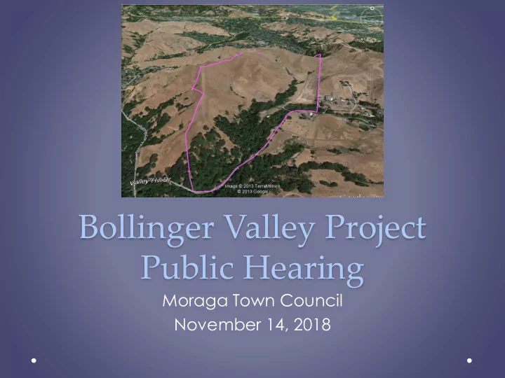
Bollinger Valley Project Public Hearing
Moraga Town Council November 14, 2018
Bollinger Valley Project Public Hearing Moraga Town Council - - PowerPoint PPT Presentation
Bollinger Valley Project Public Hearing Moraga Town Council November 14, 2018 2 3 4 Existing Site 5 Views north and west from upper ridgeline toward Lafayette and County 6 View south from central ridge 7 Mapped Landslides 8
Moraga Town Council November 14, 2018
2
3
4
5
Views north and west from upper ridgeline toward Lafayette and County
6
7
8
9
10
11
12
13
14
15
16
17
and Employment
18
purposes) (1 unit/5 ac) (Alternative 3)
EIR) Proposed project is 126 single-family lots.
19
85-Lot Alternative
20
21
22
23
24
25
26
27
28
request by applicant
1. Introduction 2. Comment Letters and Responses 3. DEIR Text Changes and Errata 4. Mitigation Monitoring and Reporting Program 5. Appendices:
B. 2014 Traffic Analysis
E. Special-Status Plant Survey F. Wetlands and Waters Assessment
29
alternative for consideration (Alternative 6)
evaluated and analyzed
appropriate
30
Project (126 lots), Alternative 4 (100 lots), and Alternative 5 (121 lots):
pollutants not currently in attainment
signalized intersections in Orinda without mitigation implemented by those jurisdictions
Alternative 6 (85 lots):
pollutants not currently in attainment
signalized intersections in Orinda without mitigation implemented by those jurisdictions
31
Alternative 3 (37 lots):
attainment
without mitigation implemented by those jurisdictions
Alternative 2 (8 lots):
attainment
access and safety protections
Alternative 1 (No Project):
persist and degrade downstream surface water quality
32
73 Impact Questions Analyzed
Project 1 2 3 4 5 6 No Impact 9 68 9 10 9 9 9 Less than Significant (LTS) 16 4 29 23 16 16 16 LTS with Mitigation 39 29 37 39 39 41 Significant and Unavoidable 9 1 6 3 9 9 7
33
Alternative 1 (No Project):
completed.
Alternative 2 (8 lots):
for both regular and emergency traffic.
Alternative 3 (37 lots):
impacts in neighboring cities.
economically infeasible
34
Alternative 4 (100 units):
extent as compared to the Project (26 fewer lots) and Alternative 5.
Alternative 5 (121 units):
extent as compared to the Project with 5 fewer lots.
Alternative 6 (85 units):
(41 fewer lots), and Alternatives 4 and 5.
35
The Project is not consistent with the General Plan
integrated, internally consistent and compatible statement of policies.
Guiding Principle 1 of the General Plan
undeveloped ridgelines and open space areas.
Community Design 1.1
sensitive in terms of environmental and visual resources.
drainage areas.
Community Design 1.5
to conform to the site’s natural setting, retaining the character of existing landforms, preserving significant native vegetation, and encourage building sites so that visual impacts are minimized.
36
Open Space 2.9
areas, especially with respect to their value as wildlife habitats, even if development in those areas is permitted.
Public Safety 1.3 and 1.4
prone to geologic hazards, and prohibit development of those areas defined as “high risk” and avoid building in “moderate risk” areas.
Public Safety 3.3
a travel distance of not more than 1.5 miles from the closest fire station.
Public Safety 3.6
accordance with fire access standards of the MOFD and Town of Moraga Ordinance.
37
classification (MMC Sec. 8.12.100).
which is proposed.
general welfare, and good zoning practices.
38
Conceptual Development Plan (MMC Sec. 8.48.100).
desirability and stability and will not be detrimental to present and potential surrounding uses.
zoned in coordination and compatibility with proposed development.
39
agency rejects or disapproves.
the EIR.
40
virtue the property’s “Study” land use designation, in the General Plan for 40 years. However, this “Study” designation has never precluded the Applicant from pursuing a General Plan Amendment and other approvals for any number of proposed projects, besides the current proposal.
approving a residential housing alternative project that better takes into account the site constraints and health and safety concerns with emergency vehicle access.
property to Residential (one dwelling per five acres) and working with the property owners on a project to fit that use. Thus, a denial of the project would not “prevent any development on the site in perpetuity” as claimed by Applicant.
projects.
Bollinger Valley area.
41
The Applicant and the Town could use the analysis in the EIR to pursue a modified project application or a new project.
Reimbursement Agreement requires that the Bruzzones pay for the costs incurred by the Town to process the application and to prepare an EIR, but it does not require the Town to certify the EIR, nor could it, as discussed in the Staff Report. Indeed, paragraph 7 expressly states that the Agreement does not commit the Town to grant any approvals.
and review of project application.
42
preparing a General Plan Amendment and Rezone of the property and return within 120- days with funding recommendations.
43