
SLIDE 1
BOARD OF COUNTY COMMISSIONERS HEARING November 21, 2011 North - - PowerPoint PPT Presentation
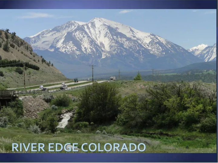
BOARD OF COUNTY COMMISSIONERS HEARING November 21, 2011 North Eastbank Commercial Center Evergreen Commercial Center H Lazy F Mobile Home Park Van Rand Commercial Park Fyrwald / Glendale Property Mountain Meadows Court
North
Mobile Home Park West
East
(CR 113 Commercial (BP)
South
Neighborhood Center Garden Homes Garden Homes 13 Affordable units
ATTACHED Homes TOWN Lots Park
TOWN Lots VILLAGE Lots ATTACHED Homes
GARDEN Homes – 28 Affordable Units
TOWN Lots TOWN Lots VILLAGE Lot
TOWN Lots VILLAGE Lots
GARDEN Homes
PARK
EMERGENCY VEHICLE ACCESS
Garden Homes 14 affordable units
TOWN Lots
Estate Lots
VILLAGE Lots
Water & Wastewater Utility
Park Executive Lot
TOWN Lots
public hearing before the Planning Commission and Board of County Commissioners shall be conditions of approval, unless specifically altered by the Board of County Commissioners.
be 366 dwelling units.
updated based upon the approval granted by the Board of County Commissioners and copies provided to Building & Planning. These documents shall be attached to the resolutions associated with these applications.
County Attorney Office and Board of County Commissioner comments and shall be recorded in conjunction with the resolution (s) associated with these applications.
activity related to Phase 0;
until such time as a State Highway Access Permit (SHAP) and Notice to Proceed has been issued by the Colorado Department of Transportation (CDOT); 7. Vegetation
shall come first, the Applicant shall provide a management plan for noxious weeds on REC property well as on the Conservation Easement parcel if agreed to by the Roaring Fork Conservancy;
requirement prior to treatment of noxious weeds as State statute requires that state listed A and B species must be eradicated when detected with which the County concurs regarding all noxious weeds.
calculation of revegetation security.
The Applicant shall comply with the recommendations contained within the Geotechnical Engineering Report submitted for the project, as such recommendations may be amended through further geotechnical investigations, including the items listed
recommendations provided by the Colorado Geological Survey.
a. Detailed geotechnical investigations shall be provided as part of the final design submitted for each final plat and prior to the commencement of construction on the site; provided, however, that detailed geotechnical investigations for pre-development reclamation (Phase 0) activities, which activities shall be conducted as part of obtaining the required grading permit. Detailed cost estimates shall be included for mitigation done as part of the public improvements. b. Specific foundation designs for buildings shall be prepared by a professional engineer licensed in the State of Colorado and submitted at building permit. c. Subsidence and sinkholes are considered a potential risk across the site. The Applicant shall provide necessary mitigation where further geotechnical investigations reveal that the soil and bedrock conditions below critical road sections may lead to failure. Mitigation may include providing plans for alternate temporary access. “Critical road sections” are those road sections which if damaged by subsidence would eliminate access to lots within the REC project. d. If an agreement is reached with the Roaring Fork Conservancy to stabilize the base of steep escarpments, a maintenance easement and plan shall be provided to the County. e. An underdrain system shall be provided to protect below-grade construction such as retaining walls, deep crawlspace and basement areas. The drain shall be placed at each level of excavation and at least
f. Post reclamation (Phase 0) or post overlot/mass grading, as applicable, cut depths for buildings,
structures or roadways shall not exceed 15 feet and fills should be limited to 10” in depth and not placed on steep downhill slope areas. Permanent unretained cut and fill slopes shall be graded at 2 horizontal to 1 vertical or flatter and protected against erosion by revegetation or rock riprap. g. The grading plan shall consider runoff from uphill basins that drain through the project and at individual sites and water shall not be permitted to pond which could impact slope stability and foundations. h. Infiltration shall be limited into the bearing soils next to buildings by required exterior backfill to be well compacted and have a positive slope away from the building for a distance of at least 10 feet. i. Roof downspouts and drains will be discharged a minimum of ten feet beyond the limits of all
system standards submitted with the PUD Application to ensure water application rated to not generally exceed evapotransporation rates. j. A detailed pavement design shall be provided in conjunction with submittal of each final plat - to determine if fine-grained soils exist that need to be removed. Where fill placement will occur as part of road construction activities in association with nay final plat as part of the subdivision improvements rather than in advance of the final plat application as part of reclamation (Phase 0)
review prior to paving; such report shall demonstrate that the fill will achieve the pavement design
k. The soils type results in a requirement for concrete exposed to on-site soils contain Type I/II portland cement (less than 5% tri-calcium aluminate).
Wildlife The Applicant shall comply with the recommendations contained within the reports
following:
a. Lighting of open space areas, including indirect lighting and transient lighting from roads and homes, is not recommended. Street lighting shall generally conform to the lighting plan submitted as part of the PUD Application. Lighting of open spaces except that required around building in accordance with safety requirements is not
roadsides in areas where headlights from vehicles illuminate open space areas. b. Fences along roads should not be permitted exclusive of the elk fence along SH 82, cut and/or fill slopes along roads should be designed to facilitate wildlife movement except where retaining walls are utilized; this includes using native plant materials that mimic local native vegetation species and distribution in general conformance with the landscape plan submitted with the PUD Application. c. Trails within REC and continuous open space areas shall be closed by the Property Owners Association during sensitive deer and elk winter seasons. Dogs, outside of yards or dog parks, should be on a leash year-round. d. Wildlife friendly fences should be required in the Cattle Creek and Roaring Fork River corridors.
Wildlife (continued) The Applicant shall comply with the recommendations contained within the reports
following:
e. Open Space Tracts are used as winter range; therefore, reclamation will need to occur using appropriate native plant species and vegetation profiles in general conformance with the specifications in the Reclamation Plan and landscape plans submitted with the PUD Application. Revegetation should occur as soon as possible. Noxious weeds should be treated bi-annually to minimize spread and impact on winter range. f. Dog and cat restrictions should include limitation of one dog and/or cat per unit (plus young up to 3 months); dogs must be leashed when outside of fenced yards during the winter months; loose or uncontrollable dogs and contractor dogs should be prohibited. g. Development of the REC project shall generally comply with the Erosion Control and Sediment Control Plan submitted for the project, and as more specifically detailed with each final plat, in order to reduce the likelihood of pollutants and sediment form developed areas from reaching Cattle Creek and the Roaring Fork River. Runoff should be filtered before running into the river or caught and used for irrigation purposes. h. All utilities shall be buried.
shall be submitted first, the Applicant shall submit a Crossing License from the Colorado Public Utilities Commission (PUC), if required by state law. If PUC review and approval of the crossing is not required the Applicant shall provide a letter from the PUC to that effect. b. Prior to issuance of a grading permit or submittal of the first Final Plat, whichever shall be submitted first, the Applicant shall provide documentation from Roaring Fork Transit Authority (RFTA) regarding the acceptance of construction to grade separate the Rio Grande Trail in the vicinity of the project entrance. If construction collateral is not required by RFTA then collateral for this improvement shall be included in a County Improvements Agreement. c. The REC alley design must include a design vehicle minimum of either an emergency response vehicle or a garbage truck
a. Prior to issuance of a grading permit or submittal of the first Final Plat, whichever shall be submitted first, the Applicant shall provide a copy of the signed District Court, Water Division 5 Decrees in Case No. 07CW164 and Case No. 08CW198. b. Prior to issuance of a grading permit or submittal of the first Final Plat, whichever shall be submitted first, the Applicant shall provide a copy of the executed pre- inclusion agreement related to the provision of water and wastewater service to the River Edge Colorado development.
The Applicant shall comply with the following final plat requirements in addition to those requirements contained within the Garfield County Unified Land use Resolution of 2008, as amended (ULUR).
requirements with the first final plat application: i. An Improvements Agreement; ii. Demonstration of formation of the Property Owner’s Association;
from the Applicant to the POA;
development.
i. Engineered foundations shall be required for all buildings within the
engineer licensed in the State of Colorado or a letter stamped by a qualified geotechnical engineer stating that no special foundation design is necessary.
the subdivision so that calculation of the amount of the fee-in-lieu payment of school land dedication for the subdivision can be calculated. Payment of the fee- in lieu will be required prior to approval of the first final plat for the subdivision.
required to comply with Resolution 2008-05, the required residential impact fee
Payment of this fee shall occur prior to approval of the first final plat for the subdivision.
This provision has been removed from the PUD Guide. Staff would recommend that this condition be changed to “The development phasing plan shall be included in the PUD Guide detailing the order of the development and timeframe in which the filings will be platted.”