blvd 0 7 miles
play

Blvd. (0.7 miles) Group 5: Lori Palaio, Abhay Wakankar, Shashank - PowerPoint PPT Presentation

Segment 2: West Sligh Ave from N. Rome Ave to N. River Blvd. (0.7 miles) Group 5: Lori Palaio, Abhay Wakankar, Shashank Sudarshan Reddy University of South Florida CGN 6933: Sustainable Transportation Department of Civil and Environmental


  1. Segment 2: West Sligh Ave from N. Rome Ave to N. River Blvd. (0.7 miles) Group 5: Lori Palaio, Abhay Wakankar, Shashank Sudarshan Reddy University of South Florida CGN 6933: Sustainable Transportation Department of Civil and Environmental Engineering Spring 2019: Thursday April 18, 2019

  2. Segment Overview (North Rome to North River) I-75 to the right Group 5, West Sligh Ave from North Rome to North River 2

  3. West Sligh Avenue: Goals and Objectives Goal 1: Provide safer travel patterns for all 1. Reduce collisions at intersections by 20 percent to maximize road safety (Vision Zero). 2. Implement traffic calming to encourage driver awareness and reduce speeds by 5 mph. Goal 2: Provide complete streets 1. Enhance pedestrian and bicycle facilities- Continuous sidewalks and bicycle lanes; two crosswalks every mile. 2. Have three bus stops every mile to encourage the use of public transit. Goal 3: Provide better use of the available land space 1. Create multi-level parking facilities to increase available land space by 15 percent- more space for residential areas, stores, restaurants, parklets etc. 2. Establish a 15 percent shift towards more mixed-use commercial and residential spaces that fits the resident’s needs. Group 5, West Sligh Ave from North Rome to North River 3

  4. West Sligh Avenue Almanac ▪ Corridor name, limits, lengths • Corridor Name: West Sligh Ave from North Rome to North River • Speed Limits: Residential: 25 mph Main Road: 35 mph Crest(bridge): 30 mph • Lengths: ◦ Length of Road: 0.7 miles ◦ Width of Road: Residential: 17.63 feet Main Road: 40.7 feet Crest(bridge): 41.47 feet ◦ Width of Sidewalk: Residential: 6 feet Main Road: 5-foot sidewalk, 2.52-foot median Crest(bridge): 5.04 feet ◦ **Note : On West Sligh, wherever turning lanes are provided, road width is 54.87 feet ▪ Safety • Years: 2013-2017 • Number of PDO: 62 • Number of Possible Injuries: 24 • Number of Injury Crashes: 12 ▪ Mobility • Transit: HART Route Stop 45 Average Headway: 15 minutes • 
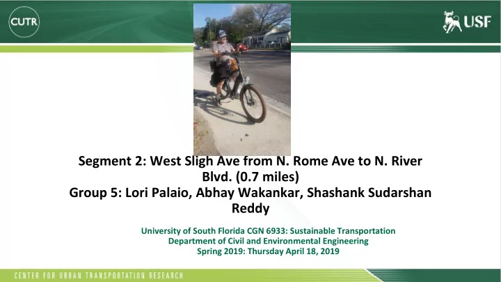
Bicycle: No bike lanes • Pedestrian: Sidewalks, but not continuous Group 5, West Sligh Ave from North Rome to North River 4

  5. Existing Cross Section: Main Road Group 5, West Sligh Ave from North Rome to North River 5

  6. Existing Cross Section: Turn Lanes Group 5, West Sligh Ave from North Rome to North River 6

  7. Existing: Bike and Pedestrian Connections Group 5, West Sligh Ave from North Rome to North River 7

  8. Existing: West Sligh Walk Score 1314 West Sligh Avenue has a Walk Score of 58 out of 100. This location is Somewhat Walkable so some errands can be accomplished on foot. Nearby parks include Lowry Park, Epps Park and Playground. Group 5, West Sligh Ave from North Rome to North River 8

  9. Existing: HART Transit Connection Route 45: Stops on segment Routes 1, 9, 12, 14, 36: Go through Sligh Ave. but not our segment Group 5, West Sligh Ave from North Rome to North River 9

  10. AADT Formulation (Hillsborough County) 2025 AADT: approximately 37,000 2014 AADT: 25,015 2040 AADT: approximately 65,000 2018 AADT: 28,749 Calculating Percent (Straight-Line) Growth Rates: Group 5, West Sligh Ave from North Rome to North River 10

  11. 2025 Design Concept Group 5, West Sligh Ave from North Rome to North River 11

  12. 2025 Design Concept Group 5, West Sligh Ave from North Rome to North River 12

  13. 2025 Aerial View Group 5, West Sligh Ave from North Rome to North River 13

  14. 2025 Aerial View (Turn Lanes) Group 5, West Sligh Ave from North Rome to North River 14

  15. 2025 Activity Centers: Private Parking BEFORE AFTER ● Get rid of small parking facilities; too close to road ● Increases available land use ● Incorporate one giant parking garage ● Wayfinding signs, bike racks Group 5, West Sligh Ave from North Rome to North River 15

  16. Total Crashes: 2013-2017 Group 5, West Sligh Ave from North Rome to North River 16

  17. 2025 Traffic Calming Measures: Bollards ● N. Rome ● N. Orleans ● N. Willow ● N. Boulevard Group 5, West Sligh Ave from North Rome to North River 17

  18. 2025 Bus Stops and Bus Shelters ▪ 3 bus stops every mile ▪ Solar Power ▪ Comfort/Weather Protection https://www.pinterest.com/pin/648799890037560188/ Group 5, West Sligh Ave from North Rome to North River 18

  19. 2025 Bus Stops and Bus Shelters Add Route 45 to: - N. Rome - N. Willow - N. River Solar Power Shelters Group 5, West Sligh Ave from North Rome to North River 19

  20. 2025 Cross Walks ▪ Easily Accessible Crosswalk Buttons • Mounting Height: The centerline of the push button shall be mounted 42 inches (1070mm) above the clear ground space for approach • Close to Crosswalk: The push button shall be mounted no further than 5 feet (1.5m) from the extension of the crosswalk lines, and within 10 feet https://www.access-board.gov/guidelines-and-standards/streets-sidewalks/public-rights-of-way/ background/access-advisory-committee-final-report/x02-5-pedestrian-street-crossings Group 5, West Sligh Ave from North Rome to North River 20

  21. 2040 BUS RAPID TRANSIT (BRT) ❖ Future of sustainable public transit ❖ Dedicated bus lanes - lowered costs, more efficient ❖ Implementation means redesigning the landscape to accommodate other vehicle types ex- bicycles, pedestrians ❖ Ideally designed to relocate bicycle lanes to a parallel street Group 5, West Sligh Ave from North Rome to North River 21

  22. 2040 Design Concept Group 5, West Sligh Ave from North Rome to North River 22

  23. 2040 Design Concept (Turn Lanes) Group 5, West Sligh Ave from North Rome to North River 23

  24. 2040 Aerial Views Group 5, West Sligh Ave from North Rome to North River 24

  25. 2040 Aerial Views (Turn Lanes) Group 5, West Sligh Ave from North Rome to North River 25

  26. 2040 Activity Centers: Lowry Park Zoo Before: After: ● Geometrical Parking ● Offers 60 percent more space than regular parking ● More efficient ● Forces a one way flow of traffic ● Easier to get in and out of space https://www.reddit.com/r/od dlysatisfying/comments/arpp wx/frankfurt_germany_stunn ing_geometrical_parking/ Group 5, West Sligh Ave from North Rome to North River 26

  27. 2040 Bus Stops and Bus Shelters THE TUBO Brazil’s already -installed bus stops do not have solar panels or electronic displays, but they do provide maximum shelter from the wind and rain. Each “ tubo ” is made of a metal frame and curved glass – simple, elegant, and low-tech. Group 5, West Sligh Ave from North Rome to North River 27

  28. WALKING ENERGY BUS STOP Industrial designer, Laurence Kemball-Cook ideated converting the energy of walking people for a green charge. When people walk over these power generating slabs known as “Pavegen,” the energy generated is converted into a small amount of electricity which will be used by the bus stop to glow at night. Group 5, West Sligh Ave from North Rome to North River 28

  29. THE EYE STOP This bus stop concept was proposed by a group of researchers at MIT to be installed next year in Florence, Italy. The EyeStop features touch-screens as well as LEDs that provide Web access, tools for planning a best route, and getting directions. You can choose to have your local EyeStop to sync with your phone to get latest updates about your frequent buses. Group 5, West Sligh Ave from North Rome to North River 29

  30. 2040 Bridge Design 1. Make a seperate bicycle and pedestrian lane 2. Create a barrier between bicyclists/pedestrians and cars https://www.thepetitionsite.com/356/138/724/bridge-the-gap-build-a-bicyclepedestrian- bridge-connecting-west-alameda-and-downtown-oakland/ Group 5, West Sligh Ave from North Rome to North River 30

  31. 2040 Crosswalks HOLOGRAPHIC CROSSWALK ● A new way to think about traffic lights of the future ● Small, barely noticeable, three-light setups replaced by a very modern, highly visible hologram system ● Based on plasma laser beam technology that uses an array of lasers projecting 10ft tall virtual wall across the street with beams forming silhouettes of crossing pedestrians This concept is based on the increasing pedestrian deaths that occur at pedestrian crosswalks every year in Korea. The designer says that traditional traffic lights are overshadowed by large electronic ad signs, and the focus is lost at these intersections due to less visibility. This design would be impossible to miss due to its size, and wall-like appearance. Group 5, West Sligh Ave from North Rome to North River 31

  32. THE STARLING CROSSING STARLING - STigmergic Adaptive Responsive LearnING.” ● Based on machine learning ● Cameras on each end of the street that monitor vehicle type by calculating the speed and trajectory ● Generates LED-lit patterns that stop traffic, highlight where bikes should wait, and help pedestrians cross ● Lights are embedded in high-impact plastic strong enough to handle the weight of cars ● Over time, the system learns the shortcuts people take across the street, and reshapes the crossing to fit those natural paths ● Based on BIOMIMICRY - inspired by ants, which leave a path of pheromones for other ants. ● System can also learn where crossing is safest, and guide pedestrians to those locations Group 5, West Sligh Ave from North Rome to North River 32

  33. Group 5, West Sligh Ave from North Rome to North River 33

Download Presentation
Download Policy: The content available on the website is offered to you 'AS IS' for your personal information and use only. It cannot be commercialized, licensed, or distributed on other websites without prior consent from the author. To download a presentation, simply click this link. If you encounter any difficulties during the download process, it's possible that the publisher has removed the file from their server.

Recommend


More recommend