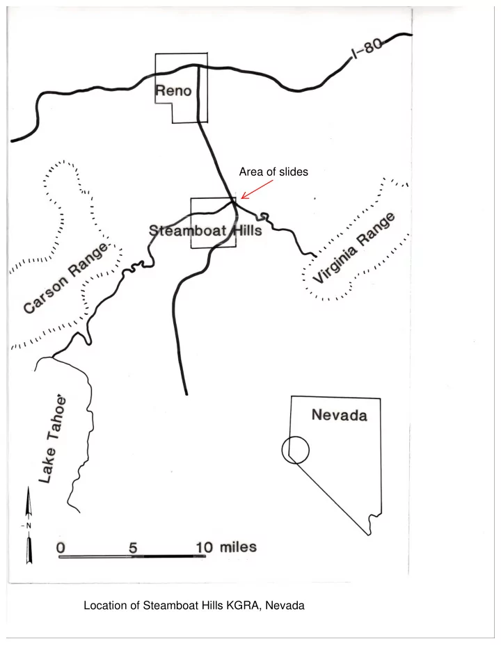
SLIDE 1
Location of Steamboat Hills KGRA, Nevada Area of slides
SLIDE 2
Generalized geologic map of the Steamboat Hills area
SLIDE 3
Magnetic data acquired by INPUT system
SLIDE 4
Nested INPUT profiles - Channel 6 - depth penetration <150m; Ch6 is deepest-looking channel Lowest resistivity is in the NE area of survey (largest amplitudes along flight lines)
SLIDE 5
J-value telluric survey - lower resistivities are lower values. The ration is Ar - the roving station, compared to Ab - base station on Steamboat Hills. Lowest resistivities trend N-S
SLIDE 6
Location map for telluric profiles, 300m dipoles. Data were filtered to > .03Hz, depth of investigation = several kilometers
SLIDE 7
Telluric profile results - relative voltage along the profiles (equivalent to sq. root of resistivity). Lower values are equivalent to lower resistivity. Red dashed lines mark higher gradient, and possible faults
SLIDE 8
Self-potential profile results, relative to a base station; 20mv contours; highs to east and NE related to geothermal activity
SLIDE 9
Audio-magnetotelluric results, @27 Hz, averaged for NS and EW directions. Values of resistivity in ohm-m. Lows possibly assoc w/ geothermal activity/alteration and depth of sediments in valley
SLIDE 10
Audio-magnetotelluric results @7.5 Hz, averaged for NS and EW directions. Values of resistivity in ohh-m Skin depth ~600m
SLIDE 11
Airborne INPUT results. Ration of Ch6/Ch3. Higher values = lower resistivity to deeper depths. Lows are associated w/surface manifestations, and probably alteration The INPUT data are much higher density in coverage that the other ground geophysical techniques and appears to be very useful for mapping geothermal areas, possible faults, etc.