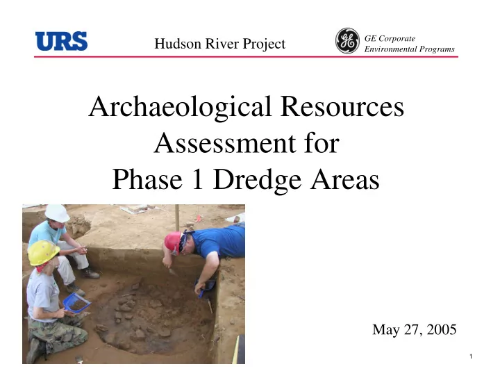

GE Corporate Hudson River Project Environmental Programs Archaeological Resources Assessment for Phase 1 Dredge Areas May 27, 2005 1
GE Corporate Hudson River Project Environmental Programs Who are we? • The archaeological studies are being conducted for GE by URS Corporation • The URS team is directed by Dr. Daniel Cassedy, a senior archaeologist with over 20 years of experience in the Northeastern United States – Went to graduate school at the State University of New York at Binghamton – Dissertation research on the prehistory of the Hudson Valley 2
GE Corporate Hudson River Project Environmental Programs What are we looking for ? • GE is identifying archaeological resources within the Hudson River and its immediate river banks that might be impacted by the remedial dredging program. • These resources are in two main categories: – Submerged historic objects and structures, such as boats, piers, canal features, etc. – Submerged or buried archaeological sites, such as Native American camps or historic structure foundations (in river or in adjacent river banks) 3
GE Corporate Hudson River Project Environmental Programs Outline of the Overall Process • Do our homework first (review existing data sources) • Identify areas of potential archaeological sensitivity • See how areas of potential sensitivity match up with areas to be dredged • Where dredge areas correlate with sensitive areas, do field surveys to see if archaeological sites are actually there • If we find significant sites in dredge areas, design and implement mitigation measures 4
GE Corporate Hudson River Project Environmental Programs Schedule of the Program TIME FRAME TASKS Done Do our homework first (review existing data sources) Done Identify areas of potential archaeological sensitivity (where are sites likely to be located) Ph 1 dredge areas See how areas of potential sensitivity match up with areas to (done) be dredged Ph 2 dredge areas (pending) Ph 1 dredge areas Where dredge areas correlate with sensitive areas, do field (June/July 2005) surveys to see if archaeological sites are actually there Ph 2 dredge areas (pending) Pending If we find significant sites in dredge areas, design and implement mitigation measures (may include recovery) 5
GE Corporate Hudson River Project Environmental Programs What did our homework include? • Talk to Knowledgeable Local Experts • Review NY State Site Files, Published Sources, and Old Maps • Look for Evidence in the Sediment Coring Data • Review Underwater Remote Sensing Results • Analyze Environmental Features of Project Area 6
GE Corporate Hudson River Project Environmental Programs Interaction With Local Experts Local archaeologists, historians, librarians, and public officials were contacted. A partial list includes: • Members of the Town of Fort Edward Cultural Resource Advisory Board • The Rogers Island Visitors Center • Washington and Saratoga County Historians • Department of Anthropology at Skidmore • NY State Office of Parks, Recreation, and Historic Preservation • New York State Museum 7
GE Corporate Hudson River Project Environmental Programs 18 th Century Maps Are Important 8
GE Corporate Hudson River Project Environmental Programs More Recent Historic Maps Show Changes Along the River 1897 U.S. Geological Survey map of Ft. Edward area 9
GE Corporate Hudson River Project Environmental Programs Artifacts from Sediment Coring Program 10
GE Corporate Hudson River Project Environmental Programs Artifacts from Sediment Coring Program recovered 291 artifacts in 149 cores (out of approximately 5,000 total cores taken – about 2%) – 261 pieces of modified wood (have cut marks or saw marks) – 30 miscellaneous artifacts from a variety of time periods, including: • pieces of coal, slag, and cement • brick fragments • glass bottle fragments • earthenware pottery Most artifacts are rounded and smoothed, which suggests they have been transported some distance in the river from their original sources No evidence of intact sites within the river bottom found in coring program 11
GE Corporate Hudson River Project Environmental Programs Underwater Remote Sensing • Analysis of sonar data has identified potential shipwreck locations • Other remote sensing studies and diving are planned 12
GE Corporate Hudson River Project Environmental Programs Archaeological Sensitivity Maps • Data on known historic and prehistoric resources was entered into the project GIS database for analysis and display • Combined with environmental data such as soils types and landforms, this allowed us to develop archaeological sensitivity maps 13
GE Corporate Hudson River Project Environmental Programs What’s Next? Terrestrial Studies • Sensitive riverbank areas will first have a reconnaissance to assess their condition. Archaeologists will conduct a thorough inspection of the riverbank (on foot and/or by boat). • Some areas will then get a systematic archaeological field survey. This generally includes systematic shovel test pits (similar to fence-post holes, and the soil is screened through wire mesh). • These studies will identify the locations of sites, if present, and provide preliminary data on significance. • Following agency review of the survey data, additional field studies may be needed. 14
GE Corporate Hudson River Project Environmental Programs What’s Next? Underwater Studies • Additional remote sensing surveys -magnetometer (a sophisticated metal detector) -sub bottom profiling survey (ground penetrating radar) -multibeam bathymetry (map bottom contours) • Diver verification surveys in selected areas 15
GE Corporate Hudson River Project Environmental Programs What Happens if We Find Important Sites? • A variety of mitigation measures are possible, depending on the nature and location of the sites – Avoidance through dredge redesign – Documentation and recovery of significant information prior to dredging – Implementation of public education programs 16
Recommend
More recommend