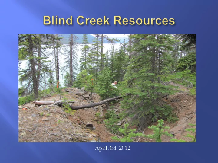
SLIDE 1
April 3rd, 2012
SLIDE 2
Andrew H. Rees B.Com Thomas J Kennedy B.Com, LLB Craig D. Thomas, LLB Director Director Director Director
Jovi Hsieh CA. Nicholas Clive Aspinall P.Geo. Clifford H Frame P. Eng CEO CFO Project Geologist Advisor
SLIDE 3 Blende Project Yukon Territory – Silver-Lead-Zinc Blende-Ocelot Project Yukon Territory – Silver-Lead Zinc Kino Silver Project Yukon Territory- Silver, Gold Carlin Gold Yukon Territory- Copper, Gold Wann River Project NW British Columbia – Gold, Silver, Copper, Lead and Zinc Kaza - Northstar Project
- N. Central BC – Silver, Copper, Gold
SLIDE 4
SLIDE 5
Technical information in this presentation relating to the Company’s Blende Property contained in this presentation is derived from, and in some instances is an extract from, the technical report, entitled “Technical Report Blende Project” dated March 7, 2011 which was prepared by Barry Price of BJ Price Geological Consultants Inc. and Christopher Gallagher who are independent qualified persons (the “Blende Report”). The Blende Report was prepared in accordance with NI 43-101.
SLIDE 6
Large and growing land position in the Tintina Gold Belt, Yukon Territory Contiguous to RAU gold discovery ground (owned by ATAC Resources “ATC”: TSX-V) Ground work initiated for gold exploration within geological belt Assaying for gold in current resource 43-101 Ag, Pb, Zn inferred resource 10 km north of RAU Diamond drill exploration program planned for 2012 New gold claims staked adjacent to the west end of ATAC’s “Carlin Trend” New silver-gold claims staked east of Keno Hill near Bellekino high-grade silver mine
SLIDE 7
SLIDE 8
5,392.2 hectare land tenure and growing. 100% Blind Creek Over $11,000,000 spent on exploration by Blind Creek and previous operators (Billiton) Total of 25,200 m drilling in 132 holes completed to date Data from drill holes will be used to complete new NI43-101 compliant resource Exploration program for 2012 to substantiate and expand mineralization along strike Prospective claim extension 372 Pb-Zn-Ag claims staked between Blende and ATAC’s “Ocelot” Pb-Zn-Ag discovery
SLIDE 9 The tonnage and grade estimates were prepared by Billiton Canada Explorations Inc., a large integrated international company prior to the introduction of National Instrument 43-101. The term “reserves” may have complied with CIM categories at the time of the estimate, but does not comply with the definitions currently accepted by CIM as economic viability at present conditions has not been demonstrated; there is no current feasibility or pre-feasibility study and the estimate extended outside the pit design. A qualified person has not done sufficient work to classify the historical estimate as current mineral resources or mineral reserves, the issuer is not treating the historical estimate as current mineral resources or mineral reserves and the historical estimate should not to be relied upon. In addition to the open pit tonnage and grade estimate noted above, Billiton Canada Inc. in 1991 also estimated what were termed “reserves” for an underground mineralized body at the East Zone.
Zone Tonnes Zinc % Lead % Silver (grams/tonne) West Zone 15,300,000 3.04 3.23 67.5 East Zone 4,300,000 3.05 1.31 15.1 Totals 19,600,000 3.04 2.80 56.0
SLIDE 10
Block Section Thick Area Tonnag e Pb Zn Ag
Pb+Zn
No No. m. M2 metric % % (opt)
(%)
48ddh 48 blocks 50 m 4,318,89 6 1.31 3.05 0.44
4.37 The tonnage and grade estimates were prepared by Billiton Canada Explorations Inc., a large integrated international company prior to the introduction of National Instrument 43-101. The term “reserves” may have complied with CIM categories at the time of the estimate, but does not comply with the definitions currently accepted by CIM as economic viability at present conditions has not been demonstrated; there is no current feasibility or pre-feasibility study and the estimate extended outside the pit design. A qualified person has not done sufficient work to classify the historical estimate as current mineral resources or mineral reserves, the issuer is not treating the historical estimate as current mineral resources or mineral reserves and the historical estimate should not to be relied upon.
SLIDE 11 Historic Resource Historic Resource Zinc 1,307,200,000 lbs Historic Resource Lead 1,204,000,000 lbs Historic Resource Silver 38,710,000 oz
The estimates above are based on historically reported tonnages that are not NI 43-101 compliant. The tonnages are a calculation derived from Bruce Price P. Geo March 7th 2011 NI 43-101 Technical Report.
SLIDE 12 Strata bound carbonate hosted Zn-Pb-Ag deposit Epigenetic, consisting of sphalerite, galena, smithsonite and minor chalcopyrite Known mineralization extends 8 km along a structural zone and is
Reserves based on open pit mining method Oxide mineralization not included in Biliton resource calculation Potential to increase grade and tonnage by 50% with oxides
SLIDE 13
SLIDE 14
Technical information in this presentation relating to the Company’s Wann River Property contained in this presentation is derived from, and in some instances is an extract from, the technical report, entitled “Technical Report on the Wann River Project within the Tagish Lake Group” dated August 30, 2010 which was prepared by Jean Paulter of JP Exploration Services Inc. who is independent qualified person (the “Wann River Report”). The Wann River Report was prepared in accordance with NI 43-101.
SLIDE 15
SLIDE 16
SLIDE 17 Sampling returned up to:
- 8.46 oz/t Gold
- 43.4 oz/t Silver
- 4.15% Copper
- 4.75% Lead
- 1.94% Zinc
SLIDE 18 Best Analysis Assays/Analyses Rock smpls collectd Returns Au Au Au Ag Ag Cu Pb Zn Mo
Sample ID ppb (g/t)
(g/t)
(%) (%) (%) (%) Location E 83351 >1000 263 8.46 1350 43.4 4.15 3.46 Lum#2 Tr.dmp E 83352 >1000 259 8.33 1065 34.24 2.75 4.45 1.36 Lum#2 Tr.dmp E 83353 >1000 25.5 0.82 149 4.79 Lum#2 Tr.dmp E 83355 >1000 149.5 4.81 639 20.54 2.91 4.75 1.94 Lum#2 Tr.dmp E 83356 >1000 55 1.77 381 12.25 2.65 1.74 Lum#2 Tr.dmp E 83358 >1000 52.1 1.68 788 25.33 1.79 5.76 1.04 Lum#1 Tr.dmp E 83359 >1000 8.29 0.27 448 14.4 Trail Vn float E 83362 >1000 30.3 0.97 3010 96.77 3.35 3.79 Trail Vn float E 83363 0.00 55.5 1.784 1.19 Trail Vn float E 83365 >1000 2.5 0.08 62.3 2.003 Brown Adit grab E83370 415 0.00 126 4.051 River Vn, f/wall E 83373 >1000 3.2 0.10 Lum#1 Tr.dmp E83384 >1000 3.4 0.11 320 10.29 Dutch vn chip/80 cm E83386 >1000 1.2 0.04 184 5.916 Trail Vn chip/80 cm E83395 >1000 15.9 0.51 440 14.15 1.04 Newfie Vn Grab E83396 >1000 5.2 0.17 116 3.729 Newfie Vn grab 65154 135 0.00 18.8 0.604 0.3 Lum#1 grab 65157 >1000 20.3 0.65 Lum#1 grab 65171 >1000 17.2 0.55 Trail grab
- z/t = Troy Oz per metric tonne
conversion @ 0.03215
SLIDE 19
800 metre by 180 prospective corridor – open to the SE Poly-metallic, epigenetic system related to a major fault zone - Llewellyn Fault Zone 4 km south of historic Engineer Gold Mine. Lake access to established roads and railway. At least two quartz vein systems and a quartz mineralized shear zone discovered to date, with further potential for extensions
SLIDE 20
Late Fall of 2009, discovered high grade gold-silver rock float on lake shore 2010 season follow-up defined 800x180m Corridor with 7 old trenches/showings (100+ years?) Spring 2011; Reconnaissance drilled 3,300m. Encountered multiple quartz stock works and quartz veins, returning up to 11.3 g/t Au and 226 g/t Ag within 1m quartz sections, hosted in highly altered Cretaceous diorite-granodiorite. Spring 2012: follow-up reconnaissance drilling planned to commence.
SLIDE 21 Similar adit geology to the NW indicates a possible disseminated shear quartz zone 2m thick 130m long Samples returned*:
- 15.9 g/t gold
- 440 g/t silver
*Jean Pautler, August 30, 2010
SLIDE 22
SLIDE 23
SLIDE 24
Technical information in this presentation relating to the Company’s Kaza- Northstar Project contained in this presentation is derived from, and in some instances is an extract from, the technical report, entitled “NI-43-101 Compliant Report year-2005 Results from Diamond Drilling and Surface Exploration On the Northstar and Henry Lee Creek Project Areas, Kaza- Northstar Project Northern Hemisphere Development Corporation” dated April 7, 2006 which was prepared by Carl Schulze, BSc, PGeo of All-Terrane Mineral Exploration Services who is an independent qualified person for the (“Northstar Report”). The Northstar Report was prepared in accordance with NI 43-101.
SLIDE 25
Kaza showing Northstar showing
SLIDE 26
Drill hole NS-04-01: 138 meters of 0.55% Copper, 1.6 g/t Silver including: 25.9 meters 1.17% copper, 4.2 g/t silver 14.4 meters 0.60% copper, 2.5 g/t silver 26.5 meters 0.52% copper, 1.1 g/t silver 21.7 meters 0.91% copper, 2.0 g/t silver Drill hole NS-04-04: 87.2 meters of 0.51% Copper, 1.2 g/t Silver including: 46.5 meters 0.78% copper, 1.9 g/t silver 19.4 meters 1.14% copper, 2.4 g/t silver
SLIDE 27
DDH Width Cu % 5 44’ 1.38 10 48’ 1.68 21 40’ 1.14 22 16’ 1.97 27 26’ 2.79
Trench Width Cu %
1 26’ 2.94 2 20’ 13.25
SLIDE 28
Zone Width Cu % Au g/t Ag g/t MAIN 10m 0.99 1.57 29.1 SOUTH 10m 0.95 0.81 17.1 NORTH 10m 0.46 4.69 7.0 NORTH 10m 1.50 4.77 17.0 NORTH 10m 0.98 3.70 11.7 NORTH 5m 3.10 1.86 30.0
North Zone Main Zone
showings/ trenches 50m
South Zone
SLIDE 29
Issued and Outstanding 52,967,740 Warrants ($0.35, $0.50) 11,020,642 Options 5,178,032 Totally F/D Shares 69,166,414
Current
SLIDE 30
Frank Callaghan 1 (604) 551-7685 fcallaghan@rogers.blackberry..net Sean Callaghan 1(604) 562-7254 scallaghan @blindcreek.ca Fraser Fleming 1 (604) 669-6463 ffleming @ blindcreek.ca
SLIDE 31 Blind Creek Resources Ltd. is a private British Columbia company. No regulatory authority has approved or disapproved the information contained in this presentation. This presentation includes certain statements that may be deemed “forward-looking statements”. All statements in the presentation, other than statements of historical facts, that address future production, reserve potential, exploration drilling, exploitation activities and event of developments that the Company expects are forward-looking statements. Information concerning mineral reserve and resource estimates also may be deemed to be forward-looking information in that it reflects a prediction of the mineralization that would be encountered if a mineral deposit were developed and mined. For any forward looking information given, management has assumed that the assay results it has received are reliable, and has applied geological interpretation methodologies which are consistent with industry standards. Forward-looking information involves various risks and uncertainties. Although the Company believes the expectations expressed in such forward-looking statements are based on reasonable assumptions, statements are not guarantees of future performance and actual results or developments may differ materially from the forward-looking statements. Factors that could cause actual results to differ materially from those in forward-looking statements include market prices, exploitation and exploration successes, continued availability of capital and financing, general economic, market or business conditions. Investors should be cautious that any such statements are not guarantees of future performance and that actual results or developments may differ materially from those projected in the forward-looking statements. New factors emerge from time to time and it is not possible for management to predict all such factors, and to assess in advance the impact of such factor on the Company’s business or the extent to which any factor, or combination of factors, may cause actual results to differ from those contained in any forward looking statements or information. The forward-looking information in this presentation is based on management’s current expectations and the Company assumes no obligations to update such information to reflect later events or developments, except as required by law.
SLIDE 32 Cautionary Note Concerning Resource Estimates
- The terms “Measured resource”, “Indicated resource” and “Inferred resource” used in this presentation are Canadian
mining terms as define din National Instrument 43-101 and CIM Standards on Mineral Resources and Mineral Reserves. Mineral resources that are not mineral reserves have not been demonstrated to be economically and legally extractable. Mineral resource estimates do not account for mineability, selectivity, mining loss and dilution. It should not be assumed that all or any part of a resource will ever be converted to a reserve. The mineral resource estimates presented herein include Inferred mineral resources that are normally considered too speculative geologically to have economic considerations applied to them that would enable them to be categorized as mineral reserves. There is also no certainty that these Interred resources will be converted to Measured and Indicated resource categories through further drilling, or into mineral reserves once economic and legal feasibility. It cannot be assumed that all or any part of a Measured, Indicated or Interred resource will ever be upgraded to a higher category. Investors are cautioned not to assume that any part or all of an inferred mineral resource exists, or is economically or legally mineable. Investors are also cautioned not to assume that any part or all of the mineral deposits in the Measured resource or Indicated resource categories will ever be converted into reserves.
- We advise US Investors that while the terms “Measured resource”, “Indicated resource” and “Inferred resource” are
recognized and required to be reported by Canadian regulations, the U.S. Securities and Exchange Commission (the “SEC”) does not recognize these terms and does not normally permit such terms to be used in reports and registration statements filed with the SEC. As such, Information contained in this document concerning descriptions of mineralization and resources under Canadian standards may not be comparable to similar information made public by U.S. companies subject to the reporting and disclosure requirements of the SEC.
SLIDE 33 National Instrument 43-101 Non-Compliance
- The reader is cautioned that certain resource estimates quoted herein are based on data and reports obtained and
prepared by previous operators. The Company has not completed the work necessary to independently verify the classification of the mineral resource estimates and is not treating the mineral resource estimates as National Instrument 43-101 defined resources verified by a qualified person. The Company has no reason to believe that the historic estimates are unreliable and, while the Company believes that the historic estimates are relevant, they should not be relied upon. The Company’s projects will require further evaluation, which the Company’s management and consultants are in the process