
SLIDE 1
1
April 3, 2018 Valle Vista Tentative Subdivision Map 1 Vicinity - - PowerPoint PPT Presentation
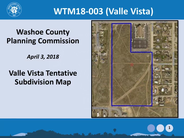
WTM18-003 (Valle Vista) Washoe County Planning Commission April 3, 2018 Valle Vista Tentative Subdivision Map 1 Vicinity Map 15 acre site is located at 550 East 4 th Avenue at the southeast corner of East 4 th Avenue and Subject Lupin
1
2
Subject Site
3
4
5
Lupin ROW
Gepford Pkwy emergency access
RV Storage
LDS Church
Garden
Common Area
6
7
8
9
10
11
12
13
Project site
14
15
16
17