
SLIDE 1
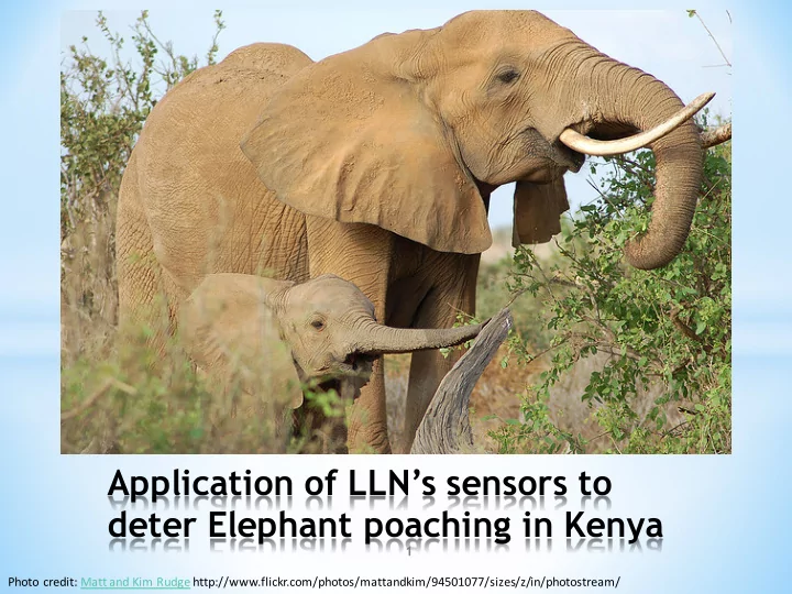
Application of LLN’s sensors to deter Elephant poaching in Kenya
Photo credit: Matt and Kim Rudge http://www.flickr.com/photos/mattandkim/94501077/sizes/z/in/photostream/ 1
Application of LLNs sensors to deter Elephant poaching in Kenya 1 - - PowerPoint PPT Presentation
Application of LLNs sensors to deter Elephant poaching in Kenya 1 Photo credit: Matt and Kim Rudge http://www.flickr.com/photos/mattandkim/94501077/sizes/z/in/photostream/ AGENDA * COUNTRYS FAST FACT . * POACHING IN KENYA * CRISIS IN
Photo credit: Matt and Kim Rudge http://www.flickr.com/photos/mattandkim/94501077/sizes/z/in/photostream/ 1
2
https://www.gfmag.com/global-data/country-data/kenya-g dp-c ountry-report+&cd=1&hl=en&c t=clnk&gl=it
http://www.cnbcafrica.com /news/east-africa/2014/09/09/kenya-leads-internet/
http://www.bloomberg .com/news/articles/2015-03-05/world-bank -raises-kenya-s-economic-growth-forecast-to-6-percent
3
http://www.kenyalogy.com/eng /parques/parques.html
**Illegal hunting or trapping of wildlife for food or profit
5
By Dr. Iain Douglas- Hamilton
http://kron4.com/2014/08/18/poachers-kill-100k-elephants-in-africa/ http://wildnet.org/wildlife-programs/elephant
6
http://www.itv.com/news/2016-03-14/the-decline-in-rhino-num bers/
7
8
Kenyan President Uhuru Kenyatta boosts the international fight against poaching on Tuesday 3rd March 2015 – World wildlife day https://www.youtube.com/watch?v=J84nWN2lUGU
9
[1] Kenyan President Uhuru Kenyatta boosts the international fight against poaching on Tuesday 3rd March 2015 – World wildlife day https://www.youtube.com/watch?v=J84nWN2lUGU
10
KWS and IFAW (International Fund for Animal Welfare ) using GPS collars to track the movement
Tsavo East National Park region via the internet.
http://www.justgpstracking.com/blog/2011/03/gps-collars-prevent-elephant-poaching-in-kenya/#sthash.hLGcW6IC.dpuf Last Updated 24 March 2011
11
KWS and Amboseli Trust for Elephants (ATE) have continuously monitored the Amboseli elephant population. In 2002, researchers used the GPS points, satellite imagery, and Esri software to perform GIS analysis. ~35,000 Elephants
http://www.esri.com/esri-news/arcnews/summer15articles/mapping-a-future-for-kenyas-amboseli-elephants Last Updated 24 March 2011
12
http://africa.clintonfoundation.org/elephants/#!/
Last Updated 17 March 2015
13
Lewa wildlife conservancy rangers used the GPS points, satellite imagery , and mobile radios to keep track of the Elephants where bouts.
https://www.youtube.com/watch?v=pSAkG27WM4E&feature=youtu.be Last Updated 24 March 2011
14
The cloud storage service e.g. ubidots forwards the message to the mobile phone ranger in the field or command center READ A border router is configured to forward data from the mote to the cloud storage service. Elephant in the park is fitted with a mote sensor an configured with an IPv6 address for internet routing Mobile phone receives the triggered message that would require their action to visit the site SEND VISUALIZE
16
17
Website: http://www.nacosti.go.ke Contact: +254 733 997 189 and cyrus.kamau@nacosti.go.ke