
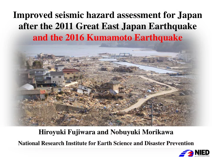
SLIDE 1
Hiroyuki Fujiwara and Nobuyuki Morikawa
National Research Institute for Earth Science and Disaster Prevention
after the 2011 Great East Japan Earthquake and the 2016 Kumamoto - - PowerPoint PPT Presentation
Improved seismic hazard assessment for Japan after the 2011 Great East Japan Earthquake and the 2016 Kumamoto Earthquake Hiroyuki Fujiwara and Nobuyuki Morikawa National Research Institute for Earth Science and Disaster Prevention National
Hiroyuki Fujiwara and Nobuyuki Morikawa
National Research Institute for Earth Science and Disaster Prevention
Long term evaluation
Probability of occurrence, magnitude, location
Strong-motion evaluation
Strong-motion, underground structure
Probabilistic Seismic Hazard Maps
・Showing the strong-motion intensity with a given probability, or the probability with a given intensity. ・Considering all possible earthquakes.
Scenario Earthquake Shaking Maps
・Showing the strong-motion intensity around the fault for a specified earthquake.
Recipe for strong motion prediction
In order to promote the use of the national seismic hazard maps, an engineering application committee (Chairman: Prof. H. Kameda) was established by NIED. Under the committee guidance, we developed an open web system to provide information interactively, and named this system as Japan Seismic Hazard Information Station, J-SHIS. Our products are aimed to meet multi-purpose needs in engineering fields by providing information
The shaking maps are evaluated for 490 scenario earthquakes
Selection of a specified scenario is essential to make a shaking map. The basic policy of the selection of a scenario earthquake is that we choose the most probable case. For treatment of uncertainties, we assume several cases of source model and compare the results of them to show deviation of strong-motion evaluation due to uncertainties.
Low frequency range High frequency range
deterministic Stochastic Finite Difference Method Stochastic Green’s function method Superposition Low frequency range High frequency range
Matching filter The technical details on the hybrid method are summarized as the ‘Recipe for strong-motion evaluation’, which are published by the earthquake research committee of Japan.
Complicated source model
The complicated source model is simplified by the characteristic source model for strong-motion prediction. Characterized source models are composed of asperities and a background slip area surrounding the asperities. Asperities are the main rupture areas in the fault zone. Source parameters required to evaluate strong-motions by using the characterized source model are classified into three parts. The first part is the set of outer parameters that show the magnitude and the fault shape of the earthquake. The second part is the set of the parameters that describe the degree of fault heterogeneity. The third part is the set of the parameters to define the characteristics of the rupture propagation.
Distribution of JMA seismic intensity by SIP real-time damage estimation system
2016/04/14 21:26 Mj6.5 (Mw6.1) 2016/04/16 1:25 Mj7.3 (Mw7.0)
Active faults in kyushu Futagawa fault zone and Hinagu fault zone Headquarters for Earthquake Research Promotion of Japan
Long-term evaluation for Futagawa fault zone and Hinagu fault zone (2013) Futagawa fault zone Hinagu fault zone
Segment Length Magnitude Probability (30 year) Futagawa About 19km About Mj7.0 0~0.9 % Uto About 20km About Mj7.0
Uto Peninsula More than about 27km More than about Mj7.2
Length Magnitude Probability (30 year) Takano-Shirahata About 16km About Mj6.8
About 40km About Mj7.5 0~6% Yatsushiro Sea About 30km About Mj7.3 0~16%
Scenario earthquake shaking maps for Futagawa fault zone (Mw6.5) (HERP, 2014; Fujiwara et al., 2015) case-1 case-2 Comparison of observation (○) and simulation (background)
Mw6.9 Mw7.0 Mw6.7 Mw6.8 Mw7.0 Mw7.0 Scaling relation(Irikura and Miyake,2001)
The length and width of the fault model was underestimated for the model based on the long-term evaluation. The seismic moment was larger than the average value of the "recipe". By using a source model that seismic moment has been properly set, ground motion distribution of wide area can be reproduced. Large amplitude records observed in the vicinity of the source fault can not be reproduced.
Evaluation of occurrence probability of earthquakes by ERCJ, HERP
Modeling of seismic activity Evaluation of an EQ occurrence probability P(Ei) Evaluation of probabilistic seismic hazard for each earthquake P(Yi > y)= P(Ei) P(Yi > y|Ei) Evaluation of probabilistic seismic hazard for all earthquakes P(Y > y)=1-Π[1- P(Yi > y)] Probabilistic evaluation of an intensity level P(Yi > y|Ei)
Modeling of seismic activity
Site amplification (Wakamatsu & Matsuoka 2008, Matsuoka & Wakamatsu2008, Fujimoto & Midorikawa 2006)
PV on the engineering bedrock PGV JMA seismic intensity
Empirical relation (Fujimoto & Midorikawa 2005
Midorikawa et al., 1999) GMPE (Si & Midorikawa 1999)
Probability in 30 years. (≧JMA Seismic Intensity 6-) Seismic Intensity with 3% probability of exceedance in 30 year.
The 2011 Tohoku earthquake (M9.0)
Comparison between the hazard maps and observed strong motions
Seismic Intensity with 2% probability
7 6+ 6- 5+ 5- 4 3 or less
seismic intensity
Comparison between the observed seismic intensities (○:K-NET, △:KiK-net)of the Tohoku earthquake and seismic intensity distribution for 2% probability of exceedance in 50 years, which is one of the probabilistic seismic hazard map. As you can see from this comparison, predicted ground motion level in the probabilistic seismic hazard map was clearly underestimated in Fukushima Prefecture and the northern part of Ibaraki Prefecture for the Tohoku earthquake (M9.0).
Model 1 (Traditional model based on the long-term evaluation)
A model created by conventional methods based on the long-term
evaluation for comparison with the improved model.
Model 2 (Improved model that takes into account the lessons of 311)
A model that incorporates a new way of thinking and is improved by
taking into account the uncertainty, based on the experience of the Tohoku Earthquake.
Model 3 (Reference model using the G-R law)
A model on the basis of G-R law as a reference for checking the validity
Seismic activity models for reconsideration
PSHM taking into account the Tohoku earthquake (M9)
■Setting conditions for the Tohoku EQ ・Source area: Aftershock area ・The origin of the time:01/01/2011 ・Average interval: 600 years ・Latest activity period: 15th century ・Occurrence probability in 30 years: 15.4% (01/01/2011) 0.0% (01/01/2012) ・Ground-motion equation: Si and Midorikawa(1999) (Saturated with Mw8.3)
PSHMs considering the Tohoku type earthquake (a) PSHM2011 (b) PSHM2011+TohokuM9
日向灘 南海 東南海 東海 重み (暫定) Mw
深さ
1 地 震
0.0125
8.9 A
0.0125
9.0*1 B
0.0125
9.0 C
0.0125
9.1*2 D ×
0.1625
8.8 A ×
0.1625
9.0 C ×
0.0125
8.9 A ×
0.0125
9.0 C × ×
0.025
8.8 A × ×
0.025
8.9 C × ×
0.05
8.4 E 2 地 震
0.05
8.7, 8.4 A ×
0.325
8.6, 8.4 A ×
0.025
8.7, 8.3 A × ×
0.1
8.6, 8.3 A 0.15 1.0 1.0 0.75
1.0
Occurrence probability in 30 years 66.5% (Time Predictable Model)
Earthquake models with diversity
Interval of occurrence Probability of occurrence within 30 years
Max M for background earthquakes
annual ratio for background earthquakes
PSHMs for 2013 Model 1 Model 2 Model 3 Uncertainty increases.
2014 version 2010 version 2014ver.-2010ver. (new model) (old model)
The hazard level in a new (2014) version of probabilistic seismic hazard map is higher than that in
with low-frequency earthquakes are considered in the revised 2014 version.
Probability in 30 years. (≧JMA Seismic Intensity 6-)
HERP (2014)
Based on the averaged long-term seismic hazard assessment, evaluating strong-motion level for 10,000 ~100,000 years return period, we should prepare the maps that show the distribution of strong-motion level, which represent effect of major earthquakes on active faults and subduction zone earthquakes with low-probability. Regarding the seismic hazard assessment for low probability, at present, it is insufficient to evaluate the uncertainty for low probability M8 class earthquakes and it is necessary to improve techniques for them. 1,000 year 10,000 year 100,000 year