SLIDE 1
15/4/2014 1
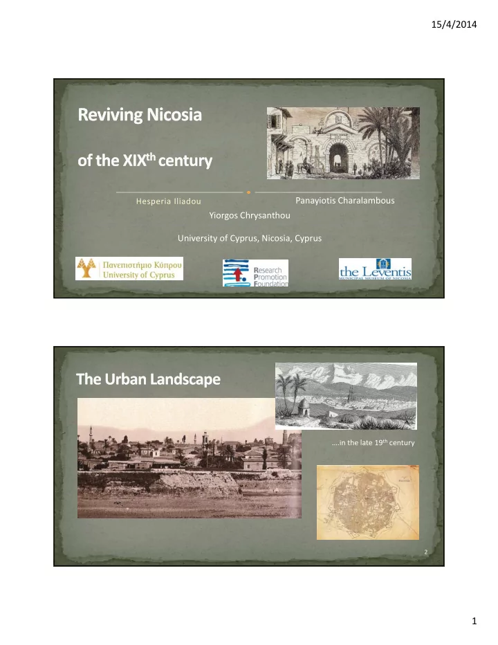
Hesperia Iliadou
Panayiotis Charalambous Yiorgos Chrysanthou University of Cyprus, Nicosia, Cyprus
….in the late 19th century
2
SLIDE 2
15/4/2014 2
3
Data Collection 3D Virtual Reconstruction Crowd Simulation
4
SLIDE 3
15/4/2014 3
A Vi t l t f th 19th t it
5
A Virtual tour of the 19th century city‐ An application for the Leventis Museum of the city of Nicosia.
‐ Recreation of a walk‐ through 3D urban environment of certain areas of interest ‐ Videos depicting everyday activities
Data collection from:
Maps Land Registry by Kitchener (1878) Images Written documents
3D Urban Reconstruction using the
data and architectural rules
6
Crowd simulation system
developed independently
SLIDE 4
15/4/2014 4
7
Kitchener’s map from 1880 2D Map of the Taht el Kale mahalla in Nicosia (H.Iliadou 2008)
8
SLIDE 5 15/4/2014 5
Village or Town and No. (registration number) Locality and Reference to map, sheet/plan and Plot Boundaries (the adjacent properties are listed under the name
Property (refers to all that lie upon the land in question, built Upper part of 10
- pe ty ( e e s to a t at e upo t e a d
quest o , bu t spaces, trees, water supply, any rights of passage, and the area in sq. feet) Category (1) Property (built) and (2)Grounds (land) (refers to the ownership category according Ottoman Land Code, this may differ in either case) Upper part of a Land Registry document as seen to the right whole
SLIDE 6
15/4/2014 6
11
The city will be fully reconstructed using a procedural approach Given:
A digitized 2D annotated map of the city (at the time), a set of rules that define building patterns and a series of building elements (such as walls, doors, roofs, wells, etc)
12
Early reconstructions of a building block using Esri’s CityEngine
SLIDE 7
15/4/2014 7
Construction of the 2D annotated map of Nicosia
Original maps are scanned Building limits and roads are identified and marked Using the Land Registry data,
each inhabitant of the city is assigned to a building each inhabitant of the city is assigned to a building
A dedicated software tool is being developed Archival data is sometimes incomplete and ambiguous Post processing is done by the members of the team
13
a collection of basic ‘3D building’ rules governing the creation of houses during the XIXth century g y
These relate to,
Ground Plans; Architectural Typology of recorded building elevations, and, Facades; Architectural Morphology rules
Based on,
Previous on site documentations of historic buildings (D. Demi 1996, H. Iliadou 2008 and others) Ottoman Land Code Related immovable property regulatory system and social norms of the time
14
SLIDE 8 15/4/2014 8 ‘3D building’ basic rules
Ground Plans;
Architectural Typology of recorded building elevations,
Facades;
Architectural Morphology rules
15
Previous on site documentations of historic buildings (
16
Early reconstructions of a building block using Esri’s CityEngine
SLIDE 9 15/4/2014 9
The urban landscape is made up by building blocks Every building block in the city consists a set of buildings For more realism in building appearance, textures are applied
to portray age, conservation state and quality of construction
17
Important buildings stand out from the rest in degree of detailing Reconstructed by 3D artists
18
Agia Sophia The walls of Nicosia
SLIDE 10 15/4/2014 10
The process by which groups of real life people are reconstructed
in a computer simulation p
Crowd Inhabitants of XIXth century Nicosia Greek Orthodox, Turkish Ottomans Men, women, children Common people, policemen, farmers, foreign officials etc. Challenges: Different appearance (period clothing) and
behavior/ habits in everyday activities
19
Based on archival images
to create realistic looking 3D characters resembling people of the era
20
Images courtesy of the Leventis Municipal Museum of Nicosia Cypriot Dancer
SLIDE 11 15/4/2014 11
We divide the behavior in two categories:
High level social behaviors: talking, male/female interactions, group formations etc Low level steering behaviors: steer away from collisions with other people and static
To simulate high level behavior, information from textbooks will be used For low level behavior, we will record real life people walking and avoiding each other
For low level behavior, we will record real life people walking and avoiding each other to train our own data‐ driven system This will capture subtle behaviors that can’t be easily programmed providing more realism
21
Languages: C, C++, Python Large portion is written as a set of libraries
This will allow the simulator to be added in new systems without rewriting everything from
scratch Performance is a challenge, since we want to be able to simulate a large number of
l i l ti people in real time
An option to run the crowd simulation on a separate machine is being considered:
one machine will be responsible for the rendering of the city and the virtual characters another machine will be responsible for simulating their behavior
22
SLIDE 12 15/4/2014 12
3D reconstruction:
Esri CityEngine
3D Modeling:
Autodesk 3DS Max/Maya
Crowd Simulation:
23
C, C++, Python
Full System:
Unity 3D
24
For historians, urban regeneration and architectural conservation professionals…
The That el Kale urban regeneration Project area (2011 Europa Nostra award)
SLIDE 13 15/4/2014 13
And, an educational tool for future generations…
25
‘ Life can only be understood backwards, but it must be lived forwards’
School visits at the Leventis Municipal Museum of Nicosia
26
SLIDE 14 15/4/2014 14
….today
27
This work was partially funded by the Cyprus Research Promotion Foundation and the European Structural Funds under contract p ΑΝΘΡΩΠΙΣΤΙΚΕΣ/ΑΝΘΡΩ/03011(ΒΙΕ)/08.
30/8/2012 Reviving Nicosia of the XIXth Century
28