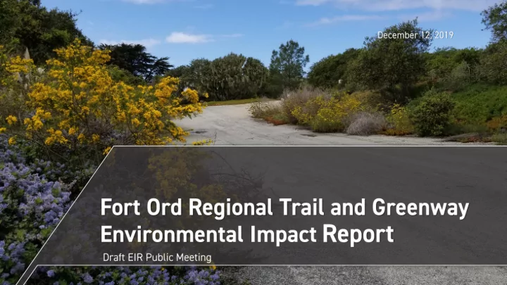
12 18 201
play

12/18/201 9 Rich Deal Transportation Agency for Monterey County - PowerPoint PPT Presentation

12/18/201 9 Rich Deal Transportation Agency for Monterey County (Lead Agency) Stefania Castillo Transportation Agency for Monterey County Greg Maher Alta Planning + Design Megan Jones Rincon Consultants Kate


  1. 12/18/201 9

  2. ▪ Rich Deal – Transportation Agency for Monterey County (Lead Agency) ▪ Stefania Castillo – Transportation Agency for Monterey County ▪ Greg Maher – Alta Planning + Design ▪ Megan Jones – Rincon Consultants ▪ Kate Giberson – Harris & Associates ▪ Kari Zajac – Rincon Consultants Fort Ord Regional Trail and Greenway Project EIR 3

  3. ▪ Project Overview ▪ Environmental Review Process ▪ Summary of Draft EIR ▪ Public Comments on Draft EIR ▪ Open House Forum • Questions & Answers • Formal Comment Fort Ord Regional Trail and Greenway Project EIR 4

  4. 12/18/201 5 9

  5. ▪ 28-mile multi-use trail • Safe, accessible, and separated alternative to cars • Connect people to open space and recreation • Enhance connections between communities • Function as habitat corridor • Complement the built environment Fort Ord Regional Trail and Greenway Project EIR 6

  6. GREENWAY 2’ 8’ - 12’ GREENWAY 2’ (up to 150’) (up to 150’) 16’ max Fort Ord Regional Trail and Greenway Project EIR 7

  7. 12/18/201 8 9

  8. ▪ CEQA = California Environmental Quality Act ▪ Inform decision making ▪ Disclose potentially significant environmental impacts ▪ Identify mitigation measures ▪ Consider alternatives ▪ Foster public participation and interagency coordination Fort Ord Regional Trail and Greenway Project EIR 9

  9. TAMC SOLICITS INPUT ON SCOPE NOTICE OF PREPARATION FOR EIR OF DRAFT EIR WE ARE HERE TAMC SOLICITS COMMENTS DRAFT EIR ON THE DRAFT EIR FINAL EIR PUBLIC HEARINGS EIR CERTIFICATION & DECISION ON THE PROJECT Fort Ord Regional Trail and Greenway Project EIR 10

  10. ▪ CEQA process overview ▪ Summarize Draft EIR findings ▪ Accept comments • Environmental issues • EIR adequacy Fort Ord Regional Trail and Greenway Project EIR 11

  11. 12/18/201 12 9

  12. ▪ Aesthetics ▪ Hydrology & Water Quality ▪ Agricultural Resources ▪ Land Use & Planning ▪ Air Quality ▪ Noise ▪ Biological Resources ▪ Public Safety & Services ▪ Cultural Resources ▪ Recreation ▪ Energy ▪ Traffic ▪ Geology and Soils ▪ Tribal Cultural Resources ▪ Greenhouse Gas Emissions ▪ Utilities & Service Systems ▪ Hazards & Hazardous Materials ▪ Wildfire Fort Ord Regional Trail and Greenway Project EIR 13

  13. ▪ Impacts identified per CEQA Guidelines and regulations ▪ Mitigation measure(s) avoid or Significant Impact reduce impacts to below Threshold of Significance Project thresholds Impact Project ▪ Impact determinations: Less-than-Significant Impact Impact • Less than significant Baseline Conditions • Less than significant with mitigation • Significant and unavoidable Fort Ord Regional Trail and Greenway Project EIR 14

  14. ▪ Draft EIR Table ES-1 ▪ 63 impacts identified • 38 less than significant • 25 less than significant with mitigation • 0 significant and unavoidable Fort Ord Regional Trail and Greenway Project EIR 15

  15. ▪ Aesthetics ▪ Agricultural Resources ▪ Biological Resources ▪ Cultural Resources ▪ Hazards & Hazardous Materials ▪ Public Safety & Services Fort Ord Regional Trail and Greenway Project EIR 16

  16. ▪ Scenic vistas, visual character, and night lighting • Structure design • Amenity design • Dark sky-compliant lighting Fort Ord Regional Trail and Greenway Project EIR 17

  17. ▪ Farmland and agricultural conflicts • Land conservation • Reduce construction-related conflicts • Fencing and signage • Solid waste and litter removal Fort Ord Regional Trail and Greenway Project EIR 18

  18. ▪ Sensitive habitat ▪ Special status species ▪ Avoidance ▪ Pre-construction surveys ▪ Mitigation and monitoring plan ▪ Avoidance, minimization, and ▪ Construction best mitigation ▪ Habitat mitigation and monitoring management practices ▪ Invasive weed prevention and plan ▪ Compensatory mitigation management ▪ Worker environmental awareness program ▪ Biological monitoring Fort Ord Regional Trail and Greenway Project EIR 19

  19. ▪ Wetlands • Jurisdictional Delineation • Restoration • General avoidance and minimization Fort Ord Regional Trail and Greenway Project EIR 20

  20. ▪ Archaeological resources • Construction monitoring Fort Ord Regional Trail and Greenway Project EIR 21

  21. ▪ Soil contaminants Design • Soil sampling and remediation Options • Soils management plan ▪ Airport hazards • Noticing/signage FORTAG Marina • Fencing Airport Fort Ord Regional Trail and Greenway Project EIR 22

  22. ▪ Calls for police protection • Safety provisions determined by law enforcement • Safety patrols • Protocols for illegal camping • Monitoring and reporting • Adaptive management ▪ Solid waste • Litter removal Fort Ord Regional Trail and Greenway Project EIR 23

  23. Evaluated in EIR Rejected from Further Consideration 1. No Project SR 218 Alternative 2. Increase Use of Existing Roadways SR 218 Overcrossing 3. Substitute Crossings Widening South Boundary Road 4. Frog Pond Wetland Preserve Bicycles Excluded in Frog Pond Northerly Alignment Fort Ord Regional Trail and Greenway EIR 24

  24. 1. No Project No new trail Follow existing roads. No trail through Del 2. Increase Use of Rey Oaks, Frog Pond, or to Ryan Ranch Existing Roadways No overcrossings, alternative South 3. Substitute Crossings Boundary Road crossing 4. Frog Pond Wetland Preserve Realigned to follow existing trail in northern portion of preserve Northerly Alignment Fort Ord Regional Trail and Greenway Project EIR 25

  25. Fort Ord Regional Trail and Greenway Project EIR 26

  26. Alt 4 Proposed Fort Ord Regional Trail and Greenway Project EIR 27

  27. SR 218 Alternative Safety risks, lose ATP funding, would not meet objectives Footprint would encroach into Frog Pond, SR 218 Overcrossing extensive grading, utility conflicts Realignment of roadway with similar trail Widening South Boundary Road already planned, would not meet objectives Would not meet project objectives, safety Bicycles Excluded in Frog Pond risks for bicyclists Fort Ord Regional Trail and Greenway Project EIR 28

  28. Environmentally 1. No Project Reduced impact for all issues, would Superior not meet objectives 2. Increase Use of Reduced impact for most issues, meets Existing Roadways most objectives 3. Substitute Crossings Impacts comparable to project 4. Frog Pond Wetland Preserve Reduced biological impacts at Frog Pond Northerly Alignment 29 Fort Ord Regional Trail and Greenway Project EIR

  29. ▪ Deadline for comments on Draft EIR: January 3, 2020 ▪ Final EIR (Response to Comments): Spring 2020 ▪ Certification of Final EIR: Spring 2020 ▪ Decision on Project: Spring 2020 Fort Ord Regional Trail and Greenway Project EIR 30

  30. ▪ Focus: Environmental issues and EIR adequacy ▪ Submit written comments to: Transportation Agency for Monterey County 55 B Plaza Circle Salinas, California 93901 Attn: Rich Deal, PE, TE, PTOE rich@tamcmonterey.org ▪ Deadline: Friday, January 3, 2020 @ 5:00 PM Fort Ord Regional Trail and Greenway Project EIR 31

  31. Questions and Answers Formal Comment

  32. Northern Marina Waste Management Segment District Alternative at- Alternative grade crossing for Marina Alignment proposed bridge Station No objects are proposed along Proposed the trail within FORTAG Alignment Airport Safety Marina Zones Airport Connection to Alternative future at-grade crossing development

  33. Reservation Rd and Inter-Garrison Proposed Alternative FORTAG at-grade Alignment crossing Alternative Alignment

  34. Cal State University Monterey Bay (CSUMB) Alternative Alignment The Alternative Alternative at-grade crossings Crossing Dunes Proposed Main FORTAG Gate Alignment Campus Town

  35. CSUMB - Marina Neighborhood Connection Proposed FORTAG Alignment

  36. National Monument Segment Proposed FORTAG Proposed Alignment FORTAG Alignment Alternative Alignment

  37. Connections to: 01 | Hilby Avenue 02 | Broadway Avenue 03 | San Pablo Avenue

  38. Alternative Alignment to Angelus Way Plumas Ave (PG&E Easement) PG&E easement - ● recapture backyard right-of-way Alternative Tunnel effect behind Alignment ● Plumas Ave homes vs. user safety Missed opportunity to ● connect parks Roundabout at S Boundary Rd (planned) Proposed FORTAG Alignment

  39. Frog Pond Northern Alternative Northern Alignment Northern Alignment Alternative Alternative Avoids impacts to wetland • Opportunities for removal of • invasive plants and restoration of habitat Better separation of bike trail • from walking path Proposed Proposed Wildlife FORTAG FORTAG Corridor Wildlife Alignment Alignment Corridor Bike/Ped Undercrossing (proposed)

  40. At-Grade Crossing Alternative to Tunnel Carlton Drive / SR 218 Eliminates tunnel • Requires crosswalk • warning system Traffic signal not • warranted

  41. Laguna Grande Regional Park Alternative Alignment Proposed FORTAG Alignment Existing North Fremont Multi-Modal Corridor

  42. Ryan Ranch Segment Alternative Alignment Proposed FORTAG Alignment Roundabout at S Boundary Rd (planned) Wildlife Shark Fin Corridor Parcel S Boundary Rd cycletrack (planned) Ryan Ranch Business Park

Download Presentation
Download Policy: The content available on the website is offered to you 'AS IS' for your personal information and use only. It cannot be commercialized, licensed, or distributed on other websites without prior consent from the author. To download a presentation, simply click this link. If you encounter any difficulties during the download process, it's possible that the publisher has removed the file from their server.

Recommend


More recommend