SLIDE 1
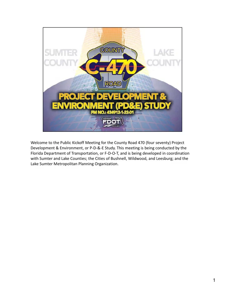
Welcome to the Public Kickoff Meeting for the County Road 470 (four seventy) Project Development & Environment, or P‐D‐&‐E Study. This meeting is being conducted by the Florida Department of Transportation, or F‐D‐O‐T, and is being developed in coordination with Sumter and Lake Counties; the Cities of Bushnell, Wildwood, and Leesburg; and the Lake Sumter Metropolitan Planning Organization.
1
SLIDE 2
This brief presentation is intended to provide an overview of the project and the key issues to be considered during the P‐D‐&‐E Study. Over the next few minutes, you will learn more about the County Road 470 (four seventy) corridor and the critical role that this east/west transportation corridor plays. Presented will be a detailed look at the future needs within the study area due to anticipated growth, as well as a projection of what could happen if nothing is done to improve the roadway. Next, we will review the project history and study process, followed by an overview of how public outreach will be conducted during the P‐D‐&‐E Study. Contact information for the study team is provided at the end of the presentation. We are here tonight to help answer your questions and we encourage your participation. The Study Team looks forward to speaking with you this evening.
2
SLIDE 3
This project is being conducted without regard to race, color, national origin, age, sex, religion, disability or family status. Persons wishing to express their concerns relative to F‐ D‐O‐T compliance with Title 6 may do so by contacting Jennifer Smith, the F‐D‐O‐T District Five Title 6 Coordinator by mail at 7‐1‐9 South Woodland Boulevard, DeLand, Florida, 3‐2‐7‐ 2‐0, by phone at 3‐8‐6‐9‐4‐3‐5‐3‐6‐7, or by email at Jennifer‐dot‐smith‐2‐at‐D‐O‐T‐dot‐ state‐dot‐F‐L‐dot‐U‐S. Or contact Jacqueline Paramore, the F‐D‐O‐T State Title VI Coordinator, by mail at 6‐0‐5 Suwannee Street, Mail Station 6‐5, Tallahassee, Florida, 3‐2‐3‐ 9‐9‐dash‐0‐4‐5‐0, by phone at 8‐5‐0‐4‐1‐4‐4‐7‐5‐3, or by email at Jacqueline‐dot‐paramore‐ at‐d‐o‐t‐dot‐state‐dot‐f‐l‐dot‐u‐s. All inquiries or complaints will be handled according to F‐ D‐O‐T procedure and in a prompt and courteous manner.
3
SLIDE 4
The limits of the P‐D‐&‐E Study are County Road 470 (four seventy) from County Road 527 (Five Twenty Seven) to Florida’s Turnpike, including a segment of US 301 (three‐oh‐one) that connects the east and west legs of County Road 470 (four seventy). The project length is approximately 10.6 (ten point six) miles. In addition to serving as a major connection between the Florida’s Turnpike and Interstate 75 (seventy five), or I 75 (seventy five), the existing corridor currently provides the most direct connections to these two facilities for the community of Sumterville.
4
SLIDE 5
Taking a regional look at our study corridor, we can see upcoming roadway improvements and planned developments. County Road 468 (four sixty eight) is currently being widened to 4 lanes from US 301 (three‐oh‐one) to State Road 44 (forty four). US 301 (three‐oh‐one) and County Road 501 (five‐oh‐one) are currently in Preliminary Engineering, or P‐E, study phases similar to this P‐D‐&‐E study to determine the corridor’s future needs and develop an action plan. Most of these future needs are driven by changes in future land use and planned development. This includes new residential, retail, office, and other additions to the area. This exhibit is also on display at tonight’s meeting.
5
SLIDE 6 T his re pre se nts the c urre nt situatio n o n Co unty Ro ad 470 (fo ur seve nty). T
- day in 2015, this c o rrido r is o pe rating at an ac c e ptable le vel o f se rvic e,
with minimal c o nge stio n. *Clic k* With the future re gio nal gro wth, additio nal c ars will ne e d to ac c e ss tho se planne d deve lo pme nts. T he se c ars will utilize d the e xisting ro adways, adding mo re traffic than yo u are c urre ntly use d to . With this additio nal traffic , the Co unty Ro ad 470 (fo ur se vently) c o rrido r is pro je c te d to o pe rate at a failing le vel o f se rvic e , whic h will re sult in inc re ase d trave l time and de lay o n lo c al ro ads.
6
SLIDE 7 What is level of service? These figures illustrate the traffic served under conditions ranging from level of service A to level of service F. Similar to grades in school, a roadway that performs at level of service A is not congested and supports free‐flowing travel. A roadway that receives a failing grade experiences heavy congestion and significant delays as depicted in the level of service F exhibit. F‐D‐O‐T and other agencies monitor traffic demands throughout the transportation network, and have established adopted level of service standards that are used to identify needs and prioritize funding for capacity
- improvements. The adopted standard for County Road 470 (four seventy) within the study
corridor is level of service C.
7
SLIDE 8 As we examine the existing operations along County Road 470 (four seventy), we see that the corridor currently provides acceptable levels of service. Both the eastern and western segments of County Road 470 (four seventy) operate at level of service B, and the segment
- f US 301 (three‐oh‐one) between the offset intersections provides level of service C
- perations.
These results are based on total traffic volumes served on an average day. When considering the operational performance of individual intersections, it is the traffic served within the Peak Hour, or rush hour, that is considered. Taking a closer look at the intersections within the central portion of the project, we see the peak hour conditions at both of the signalized intersections between County Road 470 (four seventy) and US 301 (three‐oh‐one) operate at level of service B, and the unsignalized intersection with State Road 471 (four seventy‐one) operates at level of service C. The proportion of heavy truck traffic can also have a significant influence on traffic
- perations within a corridor. The daily traffic along County Road 470 (four seventy) is
currently comprised of more than 20% heavy trucks. This proportion is even higher along State Road 471 (four seventy‐one), with daily truck volumes that exceed 36%, or more than
- ne third of the traffic mix.
8
SLIDE 9 To forecast what traffic will look like in the future, a number of factors are examined including population projections, historical traffic growth, and travel demand from planned
- developments. For this particular study, traffic projections anticipate year 2040 conditions.
The western portion of County Road 470 (four seventy) is projected to operate at level of service C. However, both US 301 (three‐oh‐one) and County Road 470 (four seventy) east are projected to experience failing conditions. The study area intersections are also anticipated to fail in 2040 if no improvements are made. As the study progresses, alternatives to improve these conditions will be developed and evaluated.
9
SLIDE 10 When considering the US 301 (three‐oh‐one) portion of the study area, this small segment is currently supporting through traffic from both US 301 (three‐oh‐one) and County Road 470 (four seventy). This overlapping of two facilities results in a substantial amount of left turns from County Road 470 (four seventy) onto US 301 (three‐oh‐one) as well as right turns from US 301 (three‐oh‐one) to County Road 470 (four seventy). Between the two offset intersections, State Road 471 (four seventy one) connects to US 301 (three‐oh‐one) within a curved section that can be challenging for drivers to negotiate, especially under heavier traffic conditions. The study will also be looking to identify improvements to the State Road 471 (four seventy one) intersection that will enhance
- perations for all users, with particular emphasis on larger trucks that are anticipated to
continue utilizing this intersection the future years.
10
SLIDE 11
Connecting County Road 470 (four seventy) and US 301 (three‐oh‐one) at a single intersection eliminates the need for County Road 470 (four seventy) through traffic to use US 301 (three‐oh‐one), removes an intersection on US 301 (three‐oh‐one), improves safety by eliminating conflict points, reduces the number left and right turns at the intersections, and alleviates congestion on US 301 (three‐oh‐one).
11
SLIDE 12 To summarize the challenges: Planned growth within the region will see an evolution with some of the rural undeveloped areas transitioning to a more urbanized or suburban
- character. Within the immediate region surrounding County Road 470 (four seventy), plans
for future development include approximately 31,000 (thirty one thousand) added residential dwelling units, 3.3 (three point three) million square feet of commercial space, as well as recreational areas, retirement housing, hotels, and civic space. Accommodating the travel demands and associated traffic planned future growth will generate requires a comprehensive approach as the Study Team looks to develop and evaluate alternatives. This includes understanding the future needs for all modes of transportation and providing for the mobility needs of cars and trucks, as well as other users such as bicycles, pedestrians, and transit.
12
SLIDE 13 As mentioned previously, both US 301 (three‐oh‐one) and County Road 470 (four seventy) are each being evaluated for future widening as part of two separate P‐D‐&‐E Studies that are running concurrently. Traffic forecasts for each project and others within the region has involved a coordinated effort that considers the interactions between the two facilities and
- thers within surrounding network. Based on the latest projections, continuing to rely on
US 301 (three‐oh‐one) to carry the east/west through traffic from County Road 470 (four seventy) may not be viable in the long term. Therefore, it may be necessary to consider alternatives that address the overlapping facilities. As County Road 470 (four seventy) is evaluated for future widening, an Access Management Plan will also be developed to establish the appropriate connection spacing and enhance safety characteristics. This will include designating locations for full and directional median opening locations, as well as signalized intersections.
13
SLIDE 14
With a more‐complete understanding of the challenges within the study corridor, the next step is to begin identifying transportation solutions that accommodate the current and future needs of the area.
14
SLIDE 15 Fortunately, this corridor was previously evaluated by Sumter County as part of the Preliminary Engineering Study that completed in early 2011. This project evaluated a series
- f alternatives that are already helping to inform the alternatives that will be considered as
part of the current P‐D‐&‐E study. Of the seven options considered during the preceding efforts by Sumter County, four of the alignment options were utilized in the environmental screening process that is developed by F‐D‐O‐T to initiate agency coordination for the P‐D‐ &‐E Study.
15
SLIDE 16
Since the Sumter County Preliminary Engineering Study completed in 2011, the county and F‐D‐OT have discussed a jurisdictional transfer, or “road swap” of State Road 48 (forty eight) in Bushnell for this section of County Road 470 (four seventy). More specifically, Sumter County would take over State Road 48 (forty eight) in Bushnell from I‐75 (eye seventy five) to Main Street in exchange for F‐D‐O‐T accepting County Road 470 (four seventy) between I‐75 (eye seventy five) and Florida’s Turnpike. The timing of this transfer will follow completion of the upcoming widening of State Road 48 (forty eight), currently anticipated in late 2017. To support this transfer, the current P‐D‐&‐E study will incorporate state standards into the recommended improvements. This P‐D‐&‐E Study began in May of this year and is anticipated to complete in approximately 3 years.
16
SLIDE 17 The P‐D‐&‐E study process involves a blending of engineering, planning, environmental analysis, and public involvement to identify improvements that are technically sound, economically feasible, environmentally sensitive, and publicly acceptable. The key elements
- f the P‐D‐&‐E process include data collection, engineering analyses, environmental
evaluations, and public and agency involvement. The alternatives evaluation process includes the no build (or do nothing) alternative and results in the selection of a recommended alternative to be carried forward into the next phase of project development.
17
SLIDE 18 Central to the P‐D‐&‐E Study process is understanding the purpose and need for the
- project. Reflecting on the understanding of the key challenges identified earlier; the
purpose of this study is to enhance local and regional mobility through improving corridor
- perations, enhancing access and safety characteristics, and providing direct connectivity
between I‐75 (eye seventy five) and Florida’s Turnpike. Enhancing this regionally‐significant corridor is necessary to meet the long‐term transportation needs created by planned growth in land use, population, and travel demand, and to enhance system continuity. This PD&E Study is focused on developing a plan for future transportation improvements that satisfy the purpose and need, and meet future mobility needs of County Road 470 within the study area.
18
SLIDE 19
After the study is complete the resulting recommendations will be advanced into the design phase, which is currently funded for fiscal year 2020. Following the design phase, if needed we have the right‐of‐way acquisition phase, followed by construction. The entire process can take several years, depending on the nature of the improvement recommendations and available funding. At this time, the only phases currently funded are the P‐D‐&‐E and Design phases. As this project progresses, F‐D‐O‐T will be working with agency partners to identify potential funding sources to advance the project to future phases.
19
SLIDE 20
Tonight’s public kickoff meeting is the first of three public meetings that will be held during the P‐D‐&‐E study. The purpose of tonight’s meeting is to introduce the P‐D‐&‐E study and provide an opportunity for the public to interact with the project team. We are very interested in hearing your suggestions and look forward to receiving this input. The next event will be the alternatives public meeting to present the options being evaluated and receive your feedback. Following the alternatives public meeting, the project team will identify a preferred alternative to be further evaluated and presented at a public hearing. This will be the third and final event. You may also request a small group meeting or presentation at anytime during the P‐D‐&‐E Study, by contacting one of the study team members listed at the end of this presentation.
20
SLIDE 21
The proposed schedule for this study is approximately 38 months. The study started in May 2015, and is anticipated to be completed in July 2018. This schedule illustrates some of the key milestones for the study process, and the level of progress to date. Since the study began in May, the study team has focused on collecting data, analyzing traffic, examining the existing conditions of the study area, and meeting with various stakeholders, including community leaders and agency partners. These efforts have provided a better understanding of the key issues surrounding this study. The alternatives public meeting is anticipated for the spring of 2016.
21
SLIDE 22 We value your input and welcome your involvement in the P‐D‐&‐E Study process. We encourage you to engage in conversation with study team staff during tonight’s meeting to discuss your issues or concerns. We also have comment forms available at the sign in table. This is an excellent way to communicate your thoughts, concerns, and ideas to the study
- team. Please fill out a comment form and leave it in the comment’s box, or mail it to the
address on the back by October 9, 2015. We also welcome your feedback on the quality and format of tonight’s meeting. You are encouraged to participate in an electronic tablet survey available from the staff members.
22
SLIDE 23 Thank you for attending tonight’s meeting for the County Road 470 (four seventy) P‐D‐&‐E
- study. You can also visit our project website for project updates and study related materials
at www.c‐470study.com. (w‐w‐w‐dot‐c‐dash‐four‐seventy‐study‐dot‐com) If you need more information about the study, you may contact Mary McGehee, FDOT Project Manager, by mail at 7‐1‐9 South Woodland Boulevard, DeLand, Florida, 3‐2‐7‐2‐0, by phone at 3‐8‐6‐9‐4‐3‐5‐0‐6‐3, or by email at mary‐dot‐mcgehee‐at‐d‐o‐t‐dot‐state‐dot‐f‐ l‐dot‐u‐s. Or Greg Moore, the study team project manager, by mail at 2‐2‐5 East Robinson Street, Suite 300, Orlando, Florida, 3‐2‐8‐0‐1, by phone at 4‐0‐7‐8‐3‐9‐4‐0‐0‐6, or by email at g‐a‐moore‐at‐v‐h‐b‐dot‐com. This contact information is also provided on the handout you received tonight.
23