
SLIDE 1
08\15\85-37 PH 9 Date: June 13, 2006 Page 1 of 10
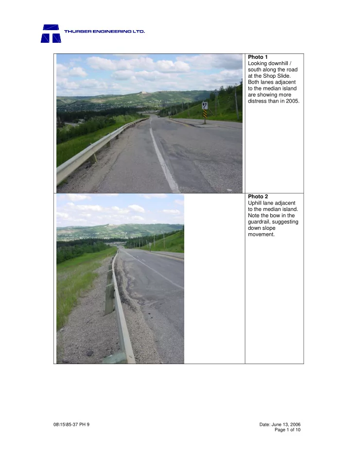
Photo 1 Looking downhill / south along the road at the Shop Slide. Both lanes adjacent to the median island are showing more distress than in 2005. Photo 2 Uphill lane adjacent to the median island. Note the bow in the guardrail, suggesting down slope movement.