
SLIDE 1
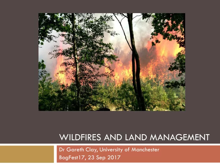
WILDFIRES AND LAND MANAGEMENT
Dr Gareth Clay, University of Manchester BogFest17, 23 Sep 2017
WILDFIRES AND LAND MANAGEMENT Dr Gareth Clay, University of - - PowerPoint PPT Presentation
WILDFIRES AND LAND MANAGEMENT Dr Gareth Clay, University of Manchester BogFest17, 23 Sep 2017 Fire is an interdisciplinary issue Fire as part of the Earth system Coupled with climate and biogeochemistry Climate Fire Fire behaviour
Dr Gareth Clay, University of Manchester BogFest17, 23 Sep 2017
Fire as part of the Earth system Coupled with climate and biogeochemistry Fire is also a socio-ecological system Hard to uncouple people from fire
Fire behaviour triangle
Climate Vegetation People
a.k.a wildland fires, bushfires, scrubland fires Any unplanned and/or uncontrolled vegetation fire
Moorland fire in Northumberland National Park Canyon fire in Mediterranean vegetation
“Any uncontrolled vegetation fire which requires a
Wild used to refer to wildland location e.g. Great
Now tends to refer to out of control behaviour –
Characteristics of an area’s fire history WHAT Causes – human/natural Type – surface, crown, soil Size – burnt area WHERE Fuel type Spatial location WHEN Fire season - which month Frequency of occurrence (number / year) Return period (e.g. 1 in 50 year event)
Source: USDA Fire Science Laboratory, Rocky Mountain Research Station
Climate
Principal control
Direct control on fire weather Indirectly via fuel (i.e. vegetation)
Temporal variation to consider
Daily, seasonal, decadal Humans
Direct via ignition sources Indirect via fuel (management, fire suppression)
Management fires for ecological or other reasons Over-suppression, can allow fuel to accumulate mega-
Fire size is inversely related to fire frequency Smaller, less damaging fire more common Use as a management strategy? Over suppression larger fires more likely =
fire paradox
Fire regimes are dynamic and change with
“Fire’s removal in places that have long known it
may be as ecologically damaging as its introduction to places to which it is alien” Pyne (2012)
Most fires in seasonally wet-dry climates: seasonally
Followed by grassland and scrubland, then temperate
Harrison et al. (2010)
Are there any clear global
It depends on scale and
Up to 2000, increases seen
Recent syntheses suggest this
Data from USA suggest
Doerr and Santin (2016) Millennium Ecosystem Assessment (2005)
Recent analysis of 478 extreme wildfires, 2002 -
114 economically or socially disastrous Suburban (wildland-urban interface) in western USA
Bowman et al. (2017): Red triangles = disaster, blue circles = not disasters
Seasonal cycles
Two seasons
April/May July/August
Combination of
Bank Holidays School Holidays Day of the week Spatial patterns
Towns Footpaths, car parks
Albertson et al. (2010)
Between 2009/10 and
210,000 vegetation fire
Rural-urban interface Nearly 50% are <5m2 Large fires are few, but
Resources Environmental and social
English vegetation fires for one year, FY 2011/12. From Gazzard et al. (2016)
Courtesy of Julia McMorrow Source: BBC Source: MODIS
Mon 2nd May High temp, wind, low humidity Fire escalated quickly Multiple fire fronts Moved quickly – 7 ha in 20 minutes Jumped fire breaks 12 day incident led by RBFRS
300 + fire fighters from multiple
FRS
One of largest fire incidents
Courtesy of Rob Gazzard (Forestry Commission)
Crowthorne village Transport Research Laboratory Broadmoor High Security Hospital
Preparation for civil emergencies Damage to human welfare Damage to environment War or terrorism affecting security of UK What other hazards are on the risk register? Pandemic influenza Coastal flooding Terrorist attacks Volcanic eruptions abroad (e.g. Eyjafjallajökull 2010) In 2013, ‘severe wildfire’ was added to the register
Amount: biomass Manage with fire, grazing,
Type: size, especially fine
Manage species composition Continuity Horizontal: fire breaks Vertical: thin out ladder fuels
Forest management plans
Consider risk of wildfire, in
Is there a history of wildfire in the
Is there vegetation with high fuel
Draw up a wildfire management
Monitor changing fuel load
City of Hobart, Tasmania
Over 100 urban fuel breaks Periodically assessed and updated Included as part of planning process for new houses
Canada
Forest Fire Danger Rating System Fire modelling Prescribed burning
Fire risk warnings
Public access, CRoW
Education programmes
School-aged children
Planning system
Rural-urban house building
Areas of high arson ignitions
e.g. South Wales (Jollands et al., 2011)
Time of high risk
E.g. school holidays
Press releases Websites
Peak District “Be Fire Aware”
Project Bernie (South Wales)
Flames Aren’t Games (Staffordshire Fire and Rescue Service)
Used to highlight periods of high fire risk Allows for closure of open access land in extreme situations Met Office Fire Severity Index http://www.metoffice.gov.uk/public/weather/fire-severity-
11 April 2015 22 Sep 2017
Firewise communities
Local solutions Engaging homeowners to
Invest $2/capita into action
Cash, time, in-kind services
First UK Firewise community
Evolution of community-based cross-sector working over
Bottom-up diffusion to national levels
Fire groups (e.g. PDNP FOG)
Sharing knowledge & collaboration on equipment Varied expertise across the country
Northumberland: back burning; PDNP: helicopter suppression Many different expectations for land
Multiple ecosystem services for multiple groups Can lead to tension and disagreement Wildfire prevention a uniting boundary concept
For a history and more detailed discussion see Gazzard et al. (2016)
National level groups
Scottish Wildfire Forum (SWF) England and Wales Wildfire Forum
Chief Fire Officers Association Wildfire
Knowledge Exchange
FireBeaters FIRES seminars Knowledge for Wildfire (KfWf)
Knowledge for Wildfire: www.kfwf.org.uk EWWF:
Gazzard et al. (2016) – Open Access
Key research gaps
Link between fire severity and fire history (i.e. PB and WF) Trade-offs between prescribed burns and wildfires (all ecosystem services) Some social science in UK fire science, but limited
Opportunities
Lots of data (IRS, National Park Rangers, Forestry Commission etc.) need to
archive and join up
Combine data on prescribed fire and wildfire
Better understand the fire regime
Practitioner science
Gather data to increase number, type and geographic coverage of fires recorded
Research synergies should support ‘fire resilient landscape design’
Opportunities to build on partnership working
Some outcomes from Workshop at Kings College London, June 2017. Full details at www.kfwf.org.uk
Ecosystem response to fires Carbon dynamics Water quality Heavy metal release Spatial mapping of wildfires Understanding their role in the UK Knowledge Exchange (www.kfwf.org.uk) Dialogue between academics and
Service, local and central government, and land managers
Theme: Wildfire resilience in a UK context 7 – 8 November Royal Bath Hotel in Bournemouth https://www.dorsetforyou.gov.uk/uk-wildfire-
Albertson, K., Aylen, J., Cavan, G., McMorrow, J. (2010) Climate change and future
45:105-118 [Open Access]
Bowman, D.M.J.S, Williamson, G.J., Abatzoglou, J.T., Kolden, C.A., Cochrane, M.A., Smith, A.M.S. (2017) Human exposure and sensitivity to globally extreme wildfire events Nature Ecology & Evolution 1: 0058
Doerr, S.H., & Santin, C. (2016) Global trends in wildfire and its impacts: perceptions versus realities in a changing world Philosophical Transactions of the Royal Society B 371: 20150345
Forestry Commission (2014) Building wildfire resilience into forest management
Gazzard, R., McMorrow, J., Aylen, J. (2016) Wildfire policy and management in England: an evolving response from Fire and Rescue Services, forestry and cross- sector groups. Philosophical Transactions of the Royal Society B 371: 20150341 [Open Access]
Harrison, S.R., Marlon, J.R., & Bartlein, P.J. (2010) Fire in the Earth System. In Dodson, J. (ed) Changing Climates, Earth Systems and Society. Netherlands; Springer Science & Business