
SLIDE 1
WEATHER FRONTS
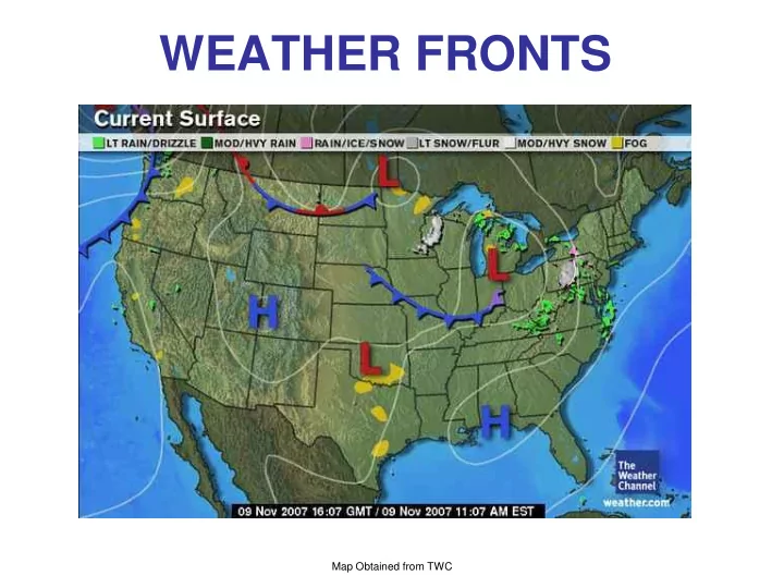
Map Obtained from TWC
WEATHER FRONTS Map Obtained from TWC COLD FRONTS We already have - - PowerPoint PPT Presentation
WEATHER FRONTS Map Obtained from TWC COLD FRONTS We already have stated that a cold front is a boundary separating two air masses (a cold air mass and a warm air mass) The cold air is found behind the cold front and it advances towards the
Map Obtained from TWC
We already have stated that a cold front is a boundary separating two air masses (a cold air mass and a warm air mass) The cold air is found behind the cold front and it advances towards the warm air
SURFACE COLD, DENSER AIR WARM, LIGHTER AIR COLD FRONT Cold air undercuts warm air. Warm air is pushed upwards, thus clouds form and precipitation occurs. This often happens ahead of cold fronts. The greater the temp difference between cold and warm air the greater the upward motion – CUMULUS clouds
USA SLP Map Obtained from AMS Datastreme
USA Temp Map Obtained from AMS Datastreme
USA SLP Map Obtained from AMS Datastreme
USA Map Obtained from AMS Datastreme
USA SLP Map Obtained from AMS Datastreme
All fronts occur at the boundaries of two (or more) air masses
COLD AIR WARM AIR
Animation courtesy of Dr. Joby Hilliker
Northeast winds over New England
Storm Track Southeast winds becoming Northeast over New England
Northeast winds over New England
Storm Track Very strong cold front
ahead of it Heavy Snow - North Side of the storm track (~North winds – cold air – upwards motion) 17” record snowfall Birmingham AL 4” snowfall Atlanta GA 2ºF Birmingham AL
Storm Track Storm tracked too close to RI resulting in many hours of south winds and lots of rainfall before the changeover to snow NOT A RECORD STORM FOR RI!