Water Quality Monitoring Program Collect water quality information - - PowerPoint PPT Presentation

water quality monitoring program
SMART_READER_LITE
LIVE PREVIEW

Water Quality Monitoring Program Collect water quality information - - PowerPoint PPT Presentation

Water Quality Monitoring Program Collect water quality information from tributaries to the Huron River to evaluate sources of problems and measure the degree of management success Cara Spindler, Dannielle Foreman, & Bill Lee at South Ore


slide-1
SLIDE 1

Water Quality Monitoring Program

Collect water quality information from tributaries to the Huron River to evaluate sources of problems and measure the degree of management success

Supported by:

  • Middle Huron Partners and Stormwater Advisory Group
  • Alliance of Downriver Watersheds – Lower Huron, Ecorse Creek, Combined Downriver
  • Livingston Watershed Advisory Group
  • Michigan Department of Environmental Quality

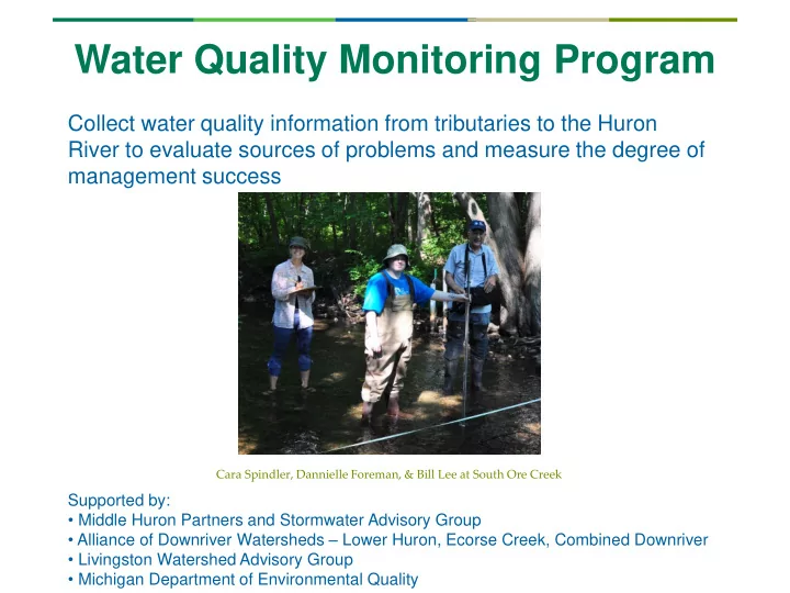
Cara Spindler, Dannielle Foreman, & Bill Lee at South Ore Creek

slide-2
SLIDE 2

Outline

  • What was measured
  • Where
  • Important results
  • How are the results being used
  • What’s next

Bill Lee and Cara Spindler at South Ore Creek

slide-3
SLIDE 3

What was measured in 2016?

  • 12 volunteers; 108 hours – THANKS!
  • 63 sample sets collected
  • Nutrients (Phosphorus)
  • Sediments (Total Suspended Solids)
  • Other (Dissolved Oxygen, pH, Temperature,

Conductivity)

  • 20 flow measures
  • 28 investigative samples
  • 7 sample weeks
slide-4
SLIDE 4

2016 Chain of Lakes Monitoring

  • Livingston County
  • 9 sites
  • 7 creeks, 2 river sites
  • 4 investigative sites
slide-5
SLIDE 5

0.00 0.05 0.10 0.15 0.20 0.25 0.30 2008 2009 2010 2011 2012 2013 2014 2015 2016 Total Phosphorus (mg/l)

Phosphorus (TP) in Livingston County

Target Trend

slide-6
SLIDE 6

Phosphorus (TP) in Livingston County

slide-7
SLIDE 7

Phosphorus (TP) in Livingston County

slide-8
SLIDE 8

Phosphorus (TP) in Livingston County

Investigative Sites

slide-9
SLIDE 9

Total Suspended Solids (TSS) in Livingston County

0.00 5.00 10.00 15.00 20.00 25.00 30.00 35.00 40.00 45.00

2008 2009 2010 2011 2012 2013 2014 2015 2016 Total Suspended Solids (mg/l)

Target: < 80 mg/l following storms

slide-10
SLIDE 10

TSS in Livingston County

slide-11
SLIDE 11

TSS in Livingston County

slide-12
SLIDE 12

TSS in Livingston County

Investigative Sites

slide-13
SLIDE 13

Conductivity in Livingston County

(by year)

500 1000 1500 2000 2500 3000

2008 2009 2010 2011 2012 2013 2014 2015 2016

Conductivity (µS)

slide-14
SLIDE 14

Conductivity in Livingston County

(by site)

slide-15
SLIDE 15

Other Parameters

  • DO: All sites within normal, healthy range
  • pH: no acid/base balance issues
  • Temperature: within acceptable range for warm water streams

(< 29°C / 84°F). Huron River @ Kent Lake pushes the limit in August sometimes, though.

slide-16
SLIDE 16

Summary of Results

  • Only 3.5 months monitored in 2016
  • Livingston streams and river in the Huron watershed remain

reasonably healthy

  • Little evidence of erosion
  • Woodruff, Horseshoe, and S. Ore Creeks showing issues with

TP and conductivity – bears further study

  • Brighton Lake may be releasing phosphorus
  • Samples should be measured for bacteria at some point
  • 2017 sites?
slide-17
SLIDE 17

How does our sampling get used?

Raw sampling data analyzed and reported out

  • Share results and analysis with municipalities
  • Follow up on key findings, actions prioritized
  • Implementation of ideas to address problems

Cara and Dannielle at Davis Creek