
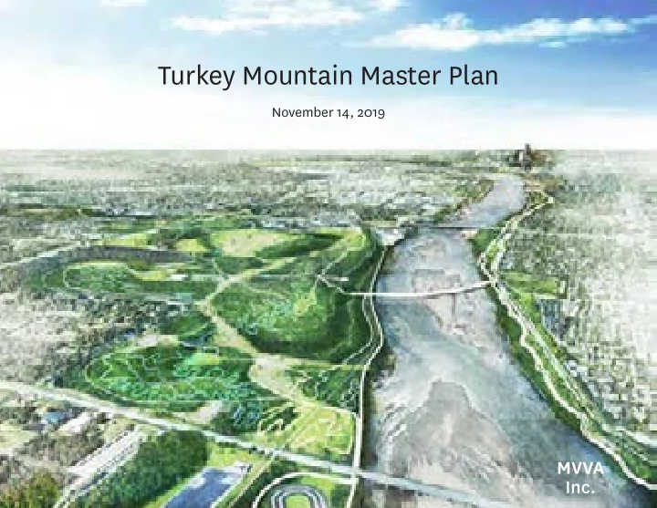
SLIDE 1
Turkey Mountain Master Plan
November 14, 2019
MVVA Inc.
Turkey Mountain Master Plan November 14, 2019 MVVA Inc. TULSA - - PowerPoint PPT Presentation
Turkey Mountain Master Plan November 14, 2019 MVVA Inc. TULSA MIDWESTERN PRAIRIES OZARK NATIONAL FOREST Where Midwestern Prairie and Ozark Forest Meet Around Tulsa, grasslands mix with post oak-hickory forest, creating a rich mosaic of
November 14, 2019
MVVA Inc.
Around Tulsa, grasslands mix with post oak-hickory forest, creating a rich mosaic of prairies, savannas, woodlands, and forests known as the Cross Timbers.
Where Midwestern Prairie and Ozark Forest Meet
TULSA
OZARK NATIONAL FOREST MIDWESTERN PRAIRIES
50 Years Ago Today
TULSA
50,000,000 acres of Midwest oak savanna once extended in a continuous band from Minnesota to Texas. Today, only 30,000 acres remain in degraded patches of 100 acres and less—a “globally imperiled” landscape.
At 600 acres, and with a high point that is 300 feet above the elevation of the Arkansas River, Turkey Mountain is one of Tulsa’s largest undeveloped spaces and its most visible natural landmark.
Downtown Tulsa Turkey Mountain
We used fitness app data from Strava to to see where users are biking and running. If you’re an outdoors enthusiast in Tulsa, this is your #1 destination.
Turkey Mountain is positioned to be a defining part of Tulsa’s identity.
Urban Wilderness Within the City Limits
This is a special place that could offer outdoors experiences on par with some of our most popular national parks.
Turkey Mountain belongs to Tulsa, and it offers both the space and resources to serve the entire community.
Trails were made by users and though they are well-loved, they are not sustainably constructed. As Turkey Mountain gains in popularity, it runs the risk of being loved to death.
Users widen or cut new trails to avoid wet areas, causing furher damage to the surrounding landscape and the trails themselves.
Natural disturbances such as grazing and frequent fires that once kept this Cross TImbers landscape healthy are no longer present, which has allowed the understory to become so thick it’s choking out the big trees, and it’s easy to get lost.
The large, open-grown oaks of the Cross Timbers’s post-oak-hickory savanna are adapted to grow best when spread out. Invasives and the dense unmanaged understory are crowded these large trees out.
We hiked the creek in waders with our wetlands restoration experts from Inter-Fluve, and there is great potential to restore the creek as animal habitat and for recreation, but currently it is inaccessible.
Turkey Mountain Users are currently parking or trespassing on private property in order to get into the wilderness from the north. A new entrance for users approaching form the north would solve this problem.
MVVA and GKFF have hosted public meetings to bring the community together to craft a vision for the future of Turkey Mountain.
Adding new territory to the Turkey Mountain Urban Wilderness will improve access and enable Tulsans to enjoy new programs, while preserving the area’s wild character.
BIG IDEA: Added Sites Allow Places for Improved Access and New Experiences
US-75 I-44 W 61st St W 71st St S Elwood Ave Riverside Dr
Johnson Park Core Site Bike Park Northeast Access Water Tank Trails Hinterlands
Existing Proposed
We visited The Knoxville Urban Wilderness, which was created using easements though state, city and private property.
Turkey Mountain used to have a range of prairie to forest that is typical of the Cross Timbers ecoregion. Current practices and a fundamental lack of care have resulted in a uniformly dense forest.
Prescribed burning is a practice that European settlers learned from Native Americans. Periodic fire is an important contributor to maintaining the partially dense/partially open mosaic of the Cross Timbers landscape.
Without Fire Management With Fire Management
Lack of fire management allows fuels to accumulate, creating a real risk of wildfires. Reinstituing regular controlled burns that benefit the ecology will also reduce reduce these risks.
Practicing Fire Manager, Prescribed Fire Researcher and Educator
John Weir, OSU Natural Resources and Environmental Management
Do we burn in Oklahoma?
Prescribed Fire
specific conditions to achieve specific goals and objectives
experience
From Guyette et al. Ecosystems 2012
Benefits of Fire
Burn units, the amount of land burned at a time, utilize existing trails and other natural fire breaks as boundaries. The plan begins with many smaller units to safely burn high fuel loads accumulated over year of fire suppression.
By year 5 burn units would begin to shift, using newly constructed trails as fire breaks, and coul begin to be grouped into larger units as fuel loads decrease.
By year 10 the burn crews conducting burns will shift from restoring the landscape to a maintaining it. Larger burn units means fewer burns need to be conducted each year, further lowering the cost and labor associated with maintenance.
Mooser Creek is dangerous and inaccessible today, but it’s ideally positioned to provid e northeast access to Turkey Mountain. Reintroducing the creek’s meander and stabilizing its eroding banks facilitates fishing and interacting with the water.
Mooser Creek Today Restored Creek Channel Precedent
Founding Principal and Fisheries Biologist
Greg Koonce, Inter-Fluve Wetlands Restoration and Bioengineering
The new channel flows along a natural meandering path with pools and riffles.
Squalicum Creek - Bellingham, Washington
BEFORE - 2014
The new channel flows along a natural meandering path with pools and riffles.
Squalicum Creek - Bellingham, Washington
PHASE I - 2019
The wood adjacent to the floodplain supports riparian forest and wetland.
Squalicum Creek - Bellingham, Washington
The restored channel flows along a walking path (right), and interstate highway (left).
Squalicum Creek - Bellingham, Washington
The existing riverbed was dry with stagnant pooling water most of the year and occasional flooding.
Milo McIver State Park - Calackamas River, Oregon
BEFORE
The channel bed was lowered to create a low-flowing stream to provide cold-water rearing and refuge habitat for coho, Chinook, and steelhead.
Milo McIver State Park - Calackamas River, Oregon
AFTER (+4 Years)
During loods, submerged log jams help slow down water, reducing erosive forces on the landscape.
Milo McIver State Park - Calackamas River, Oregon
AFTER (At Time of Construction)
During loods, submerged log jams help slow down water, reducing erosive forces on the landscape.
Milo McIver State Park - Calackamas River, Oregon
AFTER (+4 Years)
Improving bike and pedestrian connectivity between urban and wild means crossing creeks, rivers, and highways. These bridges will help increase daily use, and be features themselves.
Mooser Bridge
Precedent: Jarrold Bridge - Norwich, England
Johnson Bridge
Precedent: American River Bicycle Trail - Sacramento, CA
Bales Bridge
Precedent: Wing Tip Bridge at Summit Bechtel Reserve - Glen Jean, WV
Hinterlands Bridge
Precedent: Log Bridge at Summit Bechtel Reserve - Glen Jean, WV
Johnson Bridge Mooser Bridge Bales Bridge Hinterlands Bridge
Johnson Bridge Mooser Bridge Bales Bridge Hinterlands Bridge
120 150
Existing Spaces
Today Turkey Mountain is only accessible from two parking lots at its southwestern edge.
S Elwood Drive is a dangerous cut through that disconnects property on either side.
Additional parking will be necessary as Turkey Mountain attracts more users, but by grouping the parking along the edges, the wild and remote character of Turkey Mountain will be preserved.
120 120 420 170 160 120 150 130 400 90 130
Proposed Spaces
By strategically connecting to large existing parking lots in Bales and Johnson Parks, and carefully placed new parking lots, Turkey Mountain users will be able to park closer to where they’re headed.
The curving park drives break with Tulsa’s street grid, signaling entry into Turkey Mountain.
Access to all the same parking lots is maintained but there is no access to thru traffic.
A National Park-Inspired Drive
Gravel drives in keeping with Turkey Mountain’s wilderness allow those who don’t hike or bike to experience the rugged landscape.
Some uses combine easily for shared multi-use trails. Other special types of trails must be kept separate so they can be enjoyed without undue risk. Hiking Horseback Riding Adaptive Sports / Hand Cycling Trail Running Shared Multi-Use ADA Accessible Biking Technical / Rock Garden Contour Flow
A Range of Trail Types so Everyone’s Included
Turkey Mountain needs more trails for beginners, but just because they’re easier doesn’t mean they have to be dull.
Most expert trails in Turkey Mountain today get their difficulty from the technical, rocky terrain. Other types
Accessible and adaptive users also benefit from a range of difficulties and trail types.
The erosion and drainage issues Turkey Mountain’s trails show are a result of where and how they have been cut. We can’t put a band-aid on the problem, it requires a fundamental fix.
Many of the existing trails in Turkey Mountain will need to be rebuilt in order to prevent erosion and improve overall trail conditions, but the plan proposes to add XX miles of trail to the existing system.
Existing trails may need to be widened and realigned to prevent erosion. They will be connected to new trails to create an intuitive system of loops that always bring you back to a parking lot.
Many existing trails will be restored and extended into added sites to extend the trails available to everyone.
Two-directional trails that are optimized for bikes, but are also designed with trail runners in mind connect to the major trails and expand the system of sustainable trails.
One-directional dirt trails, downhill, and contour flow create an unprecedented density of bikes only trails for riders that do not conflict with other uses.
Jason Stouder
Vice President
Joel McCourt
Creative Director
Trail Alignment on “Fall Line” example of severe erosion due to unsustainable trail alignment.
Trail Alignment on “Fall Line” trail will continue to erode and cup even with water bars and short reroutes
Sustainable Trail Alignment example of proper trail grade on side slope
Sustainable Trail Alignment trail is build into the existing environment and natural features while maintaining grade
Multi-Use Trails example of a decomposed granite surface trail - appropriate for shallow grades and wide trail
Rock Armoring rock is used for interface between hard and soft surface trails, armoring berms and wet trail locations to minimize maintenance
The Turkey Mountain Core
Forest
US-75 S Elwood Ave R i v e r s i d e D r S P e
i a A v e W 61st St E 61st St I-44
The Turkey Mountain Core
Forest Woodland Savanna Prairie Riparian Lowlands Multi-Use Dirt Trails Regional Ashpalt Trail US-75 US-75 I-44 W 61st St E 61st St S Elwood Ave Riverside Dr S Peoria Ave
The Turkey Mountain Core
Forest Woodland Savanna Prairie Riparian Lowlands Multi-Use Dirt Trails Regional Ashpalt Trail US-75 US-75 I-44 W 61st St E 61st St S Elwood Ave Riverside Dr S Peoria Ave
Forest
The Turkey Mountain Core
Forest Woodland Savanna Prairie Riparian Lowlands Multi-Use Dirt Trails Regional Ashpalt Trail US-75 US-75 I-44 W 61st St E 61st St S Elwood Ave Riverside Dr S Peoria Ave
Woodland
The Turkey Mountain Core
Forest Woodland Savanna Prairie Riparian Lowlands Multi-Use Dirt Trails Regional Ashpalt Trail US-75 US-75 I-44 W 61st St E 61st St S Elwood Ave Riverside Dr S Peoria Ave
Savanna
The Turkey Mountain Core
Forest Woodland Savanna Prairie Riparian Lowlands Multi-Use Dirt Trails Regional Ashpalt Trail US-75 US-75 I-44 W 61st St E 61st St S Elwood Ave Riverside Dr S Peoria Ave
Prairie
The Turkey Mountain Core
Forest Woodland Savanna Prairie Riparian Lowlands Multi-Use Dirt Trails Regional Ashpalt Trail US-75 US-75 I-44 W 61st St E 61st St S Elwood Ave Riverside Dr S Peoria Ave
Restored Trails
The Turkey Mountain Core
Forest Woodland Savanna Prairie Riparian Lowlands Multi-Use Dirt Trails Regional Ashpalt Trail US-75 US-75 I-44 W 61st St E 61st St S Elwood Ave Riverside Dr S Peoria Ave
Prairie Savanna Forest Woodland Restored Trails
Looking South from Pepsi Lake
Turkey Mountain Peak Water Tank Powerline Easement Pepsi Lake
Prairie Savanna Sustainable Trails Forest Woodland Lowlands
Northeast Access + Mooser Creek
I-44 I-44 W S k e l l y D r US-75
Northeast Access + Mooser Creek
US-75 I-44 W Skelly Dr I-44
Parking Lot
Northeast Access + Mooser Creek
US-75 I-44 W Skelly Dr I-44
New Entrance Under Rail
Northeast Access + Mooser Creek
US-75 I-44 W Skelly Dr I-44
Big Stairs
Northeast Access + Mooser Creek
US-75 I-44 W Skelly Dr I-44
Existing Shale Escarpment
Northeast Access + Mooser Creek
US-75 I-44 W Skelly Dr I-44
Restored Riparian Corridor
Northeast Access + Mooser Creek
US-75 I-44 W Skelly Dr
Re-Introduced Creek Meander
Northeast Access + Mooser Creek
US-75 I-44 W Skelly Dr
Regional Trail Connection
Northeast Access + Mooser Creek
US-75 I-44 W Skelly Dr I-44
Family Picknicking
Northeast Access + Mooser Creek
US-75 I-44 W Skelly Dr I-44
Boardwalk Islands
Northeast Access + Mooser Creek
US-75 I-44 W Skelly Dr I-44
Re-Introduced Creek Meander Regional Trail Connection Boardwalk Islands Family Picknicking New Entrance Under Rail Restored Riparian Corridor Big Stairs Existing Shale Escarpment
Looking Southwest from I-44 Bridge
I-44 Pepsi Bottling Plant Pepsi Lake
Bridge Over Mooser Creek Northeast Access New Entrance Under Rail Regional Path Connection North Access Along Rail New Parking Lot Existing Shale Escarpment
Looking Southwest from W Skelly Drive
Rail Bridge Over Mooser Creek Turkey Mountain
Lowland Habitat Bridge Over Mooser Creek New Entrance Under Rail Existing Shale Escarpment Regional Path Connection Re-Meandered Creek Bed
Boardwalk Overlook and Johnson Park
E 61st St Riverside Dr
Upper Parking Lot Johnson Park Arkansas River
Boardwalk Overlook and Johnson Park
Riverside Dr E 61st St
Boardwalk Overlook and Johnson Park
Riverside Dr E 61st St
Boardwalks over Ponds
Boardwalk Overlook and Johnson Park
Riverside Dr E 61st St
Overlook to Downtown
Boardwalk Overlook and Johnson Park
Riverside Dr E 61st St
Rock Stair Scramble
Boardwalk Overlook and Johnson Park
Riverside Dr E 61st St
Johnson Bridge Over Arkansas River
Precedent: American River Bicycle Trail - Sacramento, CA
Boardwalk Overlook and Johnson Park
Riverside Dr E 61st St
Overlook to Downtown Johnson Bridge Over Arkansas River Rock Stair Scramble Boardwalks over Ponds
Looking West from Johnson Park
Turkey Mountain Riverside Drive Johnson Park
Overlook New Parking Lot Restored Trails Johnson Bridge Rock Stair Scramble Potential Sports Park
Bike Park + Water Tank Trails
71st St Bridge W 71st St S Elwood Ave R i v e r s i d e D r US-75
Bike Park + Water Tank Trails
US-75 R i v e r s i d e D r W 71st St
Bike Park + Water Tank Trails
US-75 R i v e r s i d e D r W 71st St
Bike-Specific Trails
Bike Park + Water Tank Trails
US-75 R i v e r s i d e D r W 71st St
Downhill Bike Trails
Bike Park + Water Tank Trails
US-75 R i v e r s i d e D r W 71st St
Contour Flow Trail
Bike Park + Water Tank Trails
US-75 R i v e r s i d e D r W 71st St
North Shore Trails
Bike Park + Water Tank Trails
US-75 R i v e r s i d e D r W 71st St
Skills Park
Bike Park + Water Tank Trails
US-75 R i v e r s i d e D r W 71st St
Jumps Park
Bike Park + Water Tank Trails
US-75 R i v e r s i d e D r W 71st St
Outdoor Velodrome
Bike Park + Water Tank Trails
US-75 R i v e r s i d e D r W 71st St
Spectator Pavilion
Bike Park + Water Tank Trails
US-75 R i v e r s i d e D r W 71st St
Jumps Park Outdoor Velodrome Contour Flow Trail North Shore Trails Skills Park Spectator Pavilion Bike-Specific Trails Downhill Bike Trails
Looking North from the Red Trail
Peak of Turkey Mountain Downtown Tulsa Existing Asphalt Path
Jumps Park Contour Flow Trail North Shore Trail Spectator Pavilion Downhill Bike Trails Existing Path
Bales Park
S U n i
A v e U S
5
Bales Park
US-75 US-75 S Union Ave S Union Ave
Bales Park
US-75 US-75 S Union Ave S Union Ave
Event Space
Bales Park
US-75 US-75 S Union Ave S Union Ave
Gathering Lawn
Bales Park
US-75 US-75 S Union Ave S Union Ave
Swimming Hole
Bales Park
US-75 US-75 S Union Ave S Union Ave
Tree House Village
Bales Park
US-75 US-75 S Union Ave S Union Ave
Archery Range
Bales Park
US-75 US-75 S Union Ave S Union Ave
Group Picknicking
Bales Park
US-75 US-75 S Union Ave S Union Ave
Gathering Lawn Event Space Swimming Hole Tree House Village Archery Range Large Pavilion Group Picknicking
The Hinterlands
I-44 S U n i
A v e S 30th W Ave Lubell Park Remington School
The Hinterlands
I-44
W Skelly Dr W 53rd St S 30th W Ave S Union Ave
Group Camping
The Hinterlands
I-44
W Skelly Dr W 53rd St S 30th W Ave S Union Ave
Aerial Adventure
The Hinterlands
I-44
W Skelly Dr W 53rd St S 30th W Ave S Union Ave
Agility Course
The Hinterlands
I-44
W Skelly Dr W 53rd St S 30th W Ave S Union Ave
Youth Equestrian Co-Op
The Hinterlands
I-44
W Skelly Dr W 53rd St S 30th W Ave S Union Ave
Maker Space
The Hinterlands
I-44
W Skelly Dr W 53rd St S 30th W Ave S Union Ave
Beginner Bike Trails
The Hinterlands
I-44
W Skelly Dr W 53rd St S 30th W Ave S Union Ave
Youth Equestrian Co-Op Maker Space Agility Course Aerial Adventure Beginner Bike Trails Group Camping
Looking East from Remington School
Turkey Mountain Bales Park US-75
Aerial Adventure Bike Trails Group Camping Bridge Over Creek Treehouse Village Bales Park Bridge Gathering Lawn Event Space Picnic Pavilions
Taken together, the multiple elements that go into the Plan for Turkey Mountain (for instance, the creation of the longest downhill mountain bike trail in Oklahoma) can help increase the Wilderness Area’s role as a destination for Tulsans as well as outside visitors.
A destination for nature recreation to draw outdoors enthusiasts to Tulsa and promote community health.
Restored Nature Can Stimulate Tulsa’s Growth
A Plan to Protect and Preserve Turkey Mountain For Generations to Come.
Turkey Mountain Master Plan