
SLIDE 1
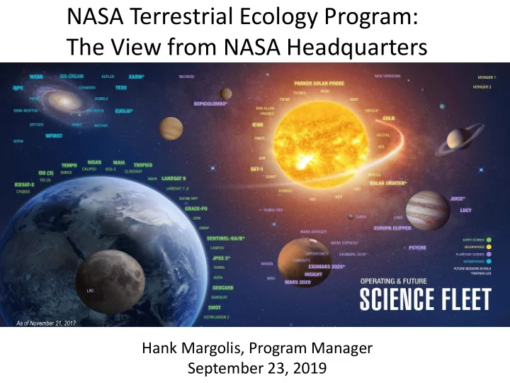
As of November 21, 2017
The View from NASA Headquarters As of November 21, 2017 Hank - - PowerPoint PPT Presentation
NASA Terrestrial Ecology Program: The View from NASA Headquarters As of November 21, 2017 Hank Margolis, Program Manager September 23, 2019 NASA Terrestrial Ecology Program: Background NASA Science Mission Directorate (SMD) Top-Level Goals
As of November 21, 2017
5
CALIPSO >2022 CYGNSS (8) 2020 PACE 2022 TEMPO 2022 MAIA 2022 TROPICS (6) 2020 NISAR 2022 LANDSAT-9 2020 SENTINEL-6A/B 2020, 2025 SWOT 2021 GEOCARB 2022 ICESAT-2 2021 OCO-2 >2022 CLOUDSAT 2021 AQUA >2022 LANDSAT 7 (USGS) ~2022 SUOMI NPP (NOAA) >2022 GRACE-FO (2) 2023 SMAP >2022 GPM >2022 TERRA >2021 AURA >2022 NISTAR, EPIC (DSCOVR/NOAA) 2020 SORCE 2020 OSTM/JASON 2 (NOAA) >2022
09.10.19
OPERATING & FUTURE THROUGH 2023
(PRE) FORMULATION IMPLEMENTATON PRIMARY OPS EXTENDED OPS
ISS INSTRUMENTS
EMIT 2021 CLARREO-PF 2020 GEDI 2020 SAGE III 2020 OCO-3 2022 TSIS-1 2023 ECOSTRESS 2020 LIS 2020
INVEST/CUBESATS
RAVAN 2016 RainCube 2018 CSIM 2018 CubeRRT 2018 TEMPEST-D 2018 CIRiS 2019 HARP 2019 CTIM* HyTI* SNoOPI* NACHOS*
* Launch date TBD
PREFIRE (2) 2022 LANDSAT 8 (USGS) >2022 GLIMR ~2026 TSIS-2 2020
JPSS-2, 3 & 4 INSTRUMENTS
OMPS-Limb
6 6
EARTH SCIENCE OPERATING MISSIONS
ELC- 2 AM S ESP- 3 ELC- 4 Columbus EF JEMEF ELC-1 ELC- 3 External Logistics Carriers: ELC-1, ELC-2, ELC-3 External Stowage Platforms: ESP-3 Alpha Magnetic Spectrometer Columbus External Payload Facility Kibo External Payload Facility
SAGE III (2020) OCO-3 (2022) GEDI (2020) ECOSTRESS (2020) LIS (2020) CLARREO-PF (2020) TSIS-1 (2023)
EMIT (2021)
(PRE) FORMULATION IMPLEMENTATON PRIMARY OPS EXTENDED OPS 09.10.19
How are ecosystems changing in response to environmental change and human actions? How will they change in the future? How do changes to ecosystems impact the other components of the Earth system? How can carbon cycle and ecosystem science improve our capacity for mitigation and adaption to environmental change?
Terrestrial Ecology is the largest program in the Research & Analysis section of NASA’s Earth Science Division
❑ Focuses on utilizing existing satellite data and developing new capabilities for space-based
global observations of carbon stocks, primary productivity, vegetation composition, physiology, phenology, successional processes, biodiversity, and the biophysics of remote sensing these phenomena.
❑ Uses spatial information from remote sensing data to scale up site-based measurements to
regional and global scales
❑ Analyzes time series remote sensing data records to document and understand variability
and changes over time in ecosystems and carbon cycling
❑ Conducts calibration/validation of satellite data; algorithm development; field campaigns;
process investigations; and data analysis/integration/assimilation
❑ Develops and exercises advanced, quantitative carbon and ecosystems models, data
assimilation models, and coupled land-ocean-atmosphere models
❑ Cooperates with NASA Applied Sciences to transition innovative uses and practical benefits
❑ Cooperates with ESTO to advance the development and demonstration of
technologies that enable improved future capability for the nation
❑ Phenology ❑ Vegetation structure ❑ Ecosystem services ❑ Nutrient and biogeochemical cycling ❑ Productivity ❑ Stress ❑ Disturbance and extreme events ❑ Drought impacts and feedbacks ❑ Permafrost dynamics ❑ Disease outbreaks ❑ Ecosystem physiology ❑ Mapping ecosystem properties ❑ Modeling and data assimilation
EVS (Suborbital) EVM (Missions) EVI (Instruments) EVC (Continuity)
13
Mississippi River Delta
15
OCO-3 ECOSTRESS GEDI HISUI
GLIMR observes coastal waters that provide critical economic and ecosystem services that are increasingly pressured by population growth and a changing climate. GLIMR fills this need using a hyperspectral ocean color radiometer capable of delivery high- frequency, high spatial and spectral resolution data from geostationary orbit. GLIMR will address fundamental science: How do physical processes that vary at timescales from hours to days impact the rates and fluxes of materials within and between aquatic coastal ecosystems? How do fluxes and rates within and between aquatic coastal ecosystems affect the formation, magnitude and trajectory of phytoplankton (including HABs) that impact ecosystem and human health?
Slide 16
An Anthropog
ic sou
are con
n small ll ar areas rela elativ ive to
natural l pr processes, whi which ma makes the them even har harder to
detect and and dif differentiate fr from
biogenic emis emissio ions wi with cur urrent ob
rvin ing g systems.