
SLIDE 1
TOPTUNG LIMITED
ABN 12 118 788 846
Mike Skinner
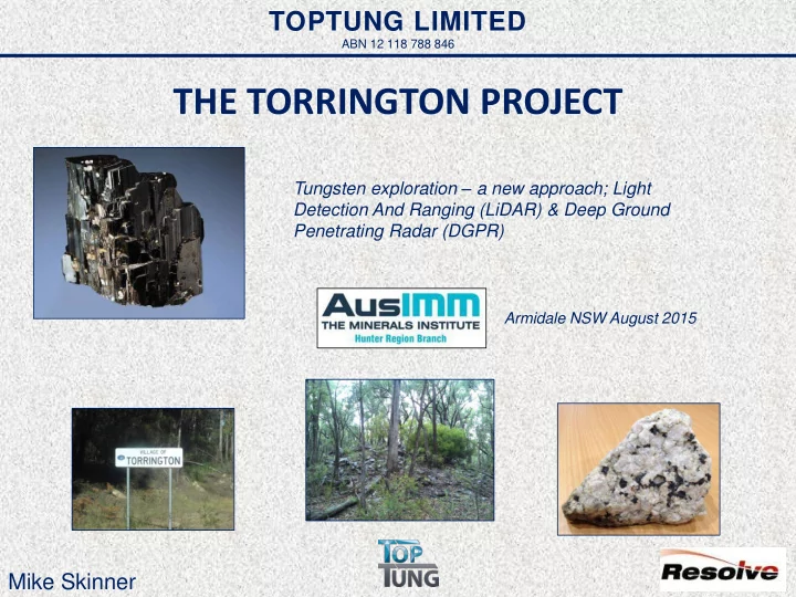
THE TORRINGTON PROJECT
Tungsten exploration – a new approach; Light Detection And Ranging (LiDAR) & Deep Ground Penetrating Radar (DGPR)
Armidale NSW August 2015
THE TORRINGTON PROJECT Tungsten exploration a new approach; Light - - PowerPoint PPT Presentation
TOPTUNG LIMITED ABN 12 118 788 846 THE TORRINGTON PROJECT Tungsten exploration a new approach; Light Detection And Ranging (LiDAR) & Deep Ground Penetrating Radar (DGPR) Armidale NSW August 2015 Mike Skinner Torrington Project Location
ABN 12 118 788 846
Tungsten exploration – a new approach; Light Detection And Ranging (LiDAR) & Deep Ground Penetrating Radar (DGPR)
Armidale NSW August 2015
2
The Torrington Project lies within the Late Permian Mole Granite and covers the Torrington Pendant, an elliptical body of Carboniferous- Early Permian metasediments which is the remnant roof of the Mole Granite.
Intrusive type with a saccharoidal texture that forms sills and dykes in the granite and in the metasediment cap (Torrington Pendant). Metasomatic type which displays relict granitic texture and forms prominent
the outer edges of the Torrington Pendant. Silexite genesis is somewhat complex with two silexite types being evidenced in the field
5
More than 60 silexite occurrences known to date within the Torrington Project
History
Resource Definition
Successive price crashes, poor recoveries, small scale mining
artisanal Chinese production – Mine closed
Rockvale Wolfram Company tramway Hawkins quarry, Torrington circa 1911 Torrington Wolfram Proprietary’s Krupp ball mill & concentration plant circa 1911 Rockvale Wolfram Company’s battery & concentration plant circa 1911
Historic Workings Wild Kate Deposit Typical Silexite Body (Mt Everard) – Mined 1979-81
Numerous small
10
Very Hard: Strongest of all metals - three times harder than chrome and titanium Very Dense: Greater density than lead or uranium Very Heat Resistant: 3400°C highest of all metals Environmentally Friendly: Very resistant to corrosion & completely non-toxic Uses: > 60% in tungsten carbide for cutting tools, as an additive in the production of specialist steel; filament wire for lighting and increasingly in specialty uses - mobile phone handsets, military, ballistics and aerospace
Ferberite Crystals (iron end member of wolframite)
12
High Electrical Resistance: Has highest Hall effect of any metal (greatest increase in electrical resistance when placed in a magnetic field) Low Conductivity: Lower than any metal except mercury Environmentally Friendly: Non-toxic and increasingly used as a replacement for lead Main Uses: Fire detectors & extinguishers, electrical fuses, solders, medicines, cosmetics, specialist low-melting alloys and in the automotive industry
Bismuth Crystals
13
Torrington topaz refractory products
conventional Al2O3/SiO2 of 3/2
scavenges free silica from matrix and may replace fluorspar as a source of fluorine compounds
temperatures than conventional mullite - forming a product with higher (ca.30%) thermal and physical shock resistance
applications
from scavenging fluorine compounds – significantly
Topaz (Al2SiO4(F,OH)2 can be converted to mullite – an important aluminosilicate ceramic also known as porcelainite (3Al2O3SiO2)
CSIRO Refractory Test: Performed to Australian standard for pyrometric cone test Left to right: Orton Reference Cone 39 (1865 degrees c), Torrington Mullite, a Japanese sintered mullite, an English mullite and a German fused mullite. Torrington mullite, a superior product
The LiDAR survey was flown on the 12th and 15th March 2015 comprising 15 parallel runs in an east-west direction spaced at 500m intervals at an altitude of approximately 1,000m above ground level. The total survey area was approximately 53km2. The LiDAR system defined the terrain surface, including in areas of dense vegetation, to an accuracy of 6 cm.
EL8258 EL8258 EL8258 EL8355
Bathymetry was acquired during early May 2015 with handheld bathymetric sounding equipment. Data points were acquired at a density of approximately 1 point per 4 square metre, which, in conjunction with previous pit cross sections, allowed contoured surfaces for the pit floors below the water.
Detail historic tramway to workings Detail historic alluvial workings
Original JORC Resource Estimates*
Orebody Silexite >0.05 % W(1) Grade (%) W Tungsten (t) Wild Kate (exc. Indicated) 941,789 0.17 1,568 Wild Kate East (Lower) 56,093 0.20 93 Sub Total (all Wild Kate) 997,882 1,661 Fielders Hill North 134,232 0.21 287 Fielders Hill South 343,596 0.21 736 Burnt Hut 192,393 0.17 336 Mt Everard 55,572 0.16 89 Total (rounded) 1,724,000 0.18 3,110 Orebody Classification Silexite (t) Grade (%) W Tungsten (t) Indicated 192,000 0.17 330 Wild Kate Inferred 770,000 0.14 1,100 Total 962,000 1,430
New JORC Inferred Resource Estimates*
Orebody Silexite (t) >0.05 % W(1) Grade (%) W Tungsten (t) Wild Kate 151,310 0.17 257 Wild Kate South 67,126 0.32 215 Wild Kate East (Upper) 77,474 0.20 154 Sub Total 295,910 626 Mt Everard 126,457 0.16 202 Total (rounded) 422,000 0.20 827
New JORC Indicated Resource Estimates* ***As reported to the ASX 12/08/2015
Burnt Hut Wild Kate Mt Everard Historic Tailings
Detail DGPR ground traces
Again the red patches (below the blue) are broadly correlative to the modelled orebodies but show that the models need refining after further drilling and correlation to DGPR. The DGPR does seem to illustrate a silling emplacement which reflects our assumptions and those of previous work by Pacific Copper. The DGPR also detected what could be new previously unknown silexite which will need to be confirmed by drilling.
I, Gordon Saul, confirm that I am the Competent Person for the Report and:
Exploration Results, Mineral Resources and Ore Reserves (JORC Code, 2012 Edition).
to the style of mineralisation and type of deposit described in the Report, and to the activity for which I am accepting responsibility.
I am a consultant and shareholder working for Resolve Geo Pty Ltd, and have been engaged by Krucible Metals to prepare the documentation for the Torrington tungsten and topaz deposit on which the Report is based, for the period ended 31 July 2015. I have disclosed to the reporting company the full nature of the relationship between myself and the company, including any issue that could be perceived by investors as a conflict of interest. Resolve Geo are the previous holders of the tenements prior to acquisition by Krucible and have been retained in a consultant capacity. Resolve Geo Pty Ltd maintain a 15 % shareholding in the tenements at the time of reporting. I verify that the Report is based on and fairly and accurately reflects in the form and context in which it appears, and the information in my supporting documentation relating to Exploration Targets, Exploration Results & Mineral Resources. I consent to the release of the Report and this Consent Statement by the directors of Krucible Metals Ltd.
Brisbane, QLD