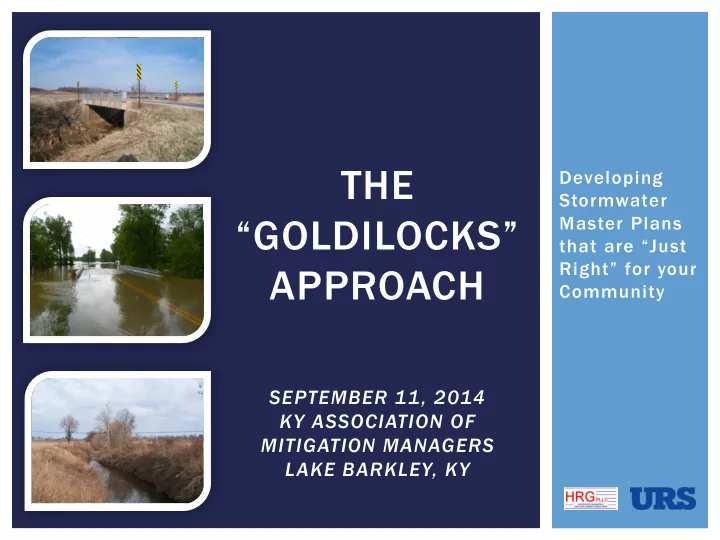
the
play

THE Developing Stormwater GOLDILOCKS Master Plans that are Just - PowerPoint PPT Presentation

THE Developing Stormwater GOLDILOCKS Master Plans that are Just Right for your APPROACH Community SEPTEMBER 11, 2014 KY ASSOCIATION OF MITIGATION MANAGERS LAKE BARKLEY, KY GOLDILOCKS AND STORMWATER The Story of the


  1. THE Developing Stormwater “GOLDILOCKS” Master Plans that are “Just Right” for your APPROACH Community SEPTEMBER 11, 2014 KY ASSOCIATION OF MITIGATION MANAGERS LAKE BARKLEY, KY

  2. GOLDILOCKS AND STORMWATER  “The Story of the Three Bears”  Wanders into the home of Papa Bear, Mama Bear, and Baby Bear  Tries their soup… one is too hot, another too cold, one is just right  Tries out a chair, and one is just right  At some point, decides she needs some rest, and finds a bed that is just right… only to be discovered, asleep when the bears come home  So… how does this relate to stormwater master planning?

  3. EVERY COMMUNITY IS DIFFERENT  Political  Economic What does a  Physiographic stormwater plan look like that is “just right”  Topography for my community?  Stormwater System  Severity of flooding

  4. OVERVIEW  Project Background  Study Purpose  Study Area  Project Approach/Methods  Scoping  Data Collection  Baseline Modeling  Goals Assessment  Alternatives Analysis  Lessons Learned/Conclusions

  5. PROJECT BACKGROUND Purpose and Study Area

  6. STUDY AREA Owensboro

  7. HISTORIC FLOODING

  8. STUDY STREAMS

  9. Our Study PROJECT APPROACH and the Methods We Used

  10. DEFINING THE SCOPE  What question(s) do we want to answer?  What is the appropriate level of detail?  What methods will this require?

  11. THE LOCAL ADVANTAGE  Local officials: Manage your consultant!  Express your concerns  Be satisfied with the project goals – if not, let it be known  Stakeholders  Local Partner – Jim Riney, HRG PLLC  County Officials  Drainage Advisory Committee  Public Meeting

  12. DATA COLLECTION  Find the low- hanging fruit  Studies done locally  State GIS data  LiDAR  KYTC Record Drawings  Data from Federal Agencies  FEMA studies  USGS gages

  13. BASELINE STUDIES  Steady-State  9 of the 12 study streams  Unsteady-State  Panther Creek system (Panther, NF, SF)  Understand combination of backwater and headwater effects

  14. BASELINE STUDIES  Begin with the end in mind  Models can be built upon if more detailed studies are needed in the future  Models can be leveraged in future FEMA floodplain mapping efforts  Modeling of historic flood events  Calibration/verification (NEXRAD, USGS, HWM)  Communicates in terms of a flood locals know  Can be used for “what if” scenarios

  15. STUDY AREA Owensboro

  16. ANIMATION

  17. GOALS ASSESSMENT  Alternatives  Pilot study to test initial project goals  Roadway serviceability  2 streams  Raising of roadway  2 Events (2 yr, 100 yr) profile  Roadway serviceability  Bridge replacement  All roads?  Floodplain  Or just major roads? Reduction  Floodplain Reduction  Detention  0%  Levees  25%  50%

  18. GOALS ASSESSMENT Coun unty ty-wide ide Cost st Estimat mate e using ing Det etentio ion  Model & 100-yr spreadsheet 2-yr calculations to obtain quantities  Amount of detention  Miles of roadway Cost raised, average height  # of Bridge Replacements  Performed cost estimates 0% 10% 20% 30% 40% 50% 60% Percent ntage age of Floodplain ain Reduc uction on  Selected final goals

  19. ROADWAY MODIFICATIONS  Roadway KYTC Functional Classes Functional Modifications Description Class Rural Interstate 1  Modeled WSEL Urban Interstate 1  LiDAR bridge/roadway Rural Principal Arterial 2 Urban Freeways & Expressways 2 elevations Urban Principal Arterial 3 Rural Minor Arterial 4  KYTC Bridge Plans Urban Minor Arterial Street 4 Rural Major Collector 5  KYTC Functional Urban Collector Street 5 Classification System Rural Minor Collector 6 Rural Local Road 7 Urban Local Road 7

  20. ROADWAY MODIFICATIONS

  21. ALTERNATIVES ANALYSIS  Alternatives  Apply goals to all  Roadway study streams serviceability  12 streams  Raising of roadway  5 Events (2, 10, 25, profile 50, 100 yr)  Bridge replacement  Roadway serviceability  Floodplain Reduction  Major roads only (based on KYTC functional  Detention classification)  Levees  Floodplain Reduction  Channelization  30% reduction goal  Straightening

  22. ALTERNATIVES ANALYSIS Cost vs Flood d Event nt (All l St Streams) ams) llars 100 yr in Doll n Cost, in 50 yr 25 yr truction Constructio 10 yr 2 yr 0 20 40 60 80 100 120 Recurre urrence nce In Interval al of Flo lood d Eve vent nt, in in Year ars

  23. What are CONCLUSIONS the key lessons?

  24. CONCLUSIONS  Overall  Establish a level of detail that is appropriate to the question being asked  Manage the consultant – be happy with the result of the scoping process  Find methods that are appropriate to the scale of the problem at hand  Stakeholder involvement  Technical  Finding low hanging fruit: Leveraging existing data  LiDAR, KYTC Bridge Plans, FEMA studies, Previous Studies  Begin with the end in mind: Create models that can be used later  Can be built upon if more detailed studies are needed  Can be leveraged for more FEMA floodplain mapping  Model historic events: A number of benefits  Model calibration, public outreach, “what - if” scenarios

  25. THANKS!  Thanks to Mark Brasher, County Judge Executive Al Mattingly, Commissioners George Wathen, Charlie Castlen, and Jim Lambert, and the Daviess County Drainage Advisory Committee!  Thanks to Jim Riney, HRG

Download Presentation
Download Policy: The content available on the website is offered to you 'AS IS' for your personal information and use only. It cannot be commercialized, licensed, or distributed on other websites without prior consent from the author. To download a presentation, simply click this link. If you encounter any difficulties during the download process, it's possible that the publisher has removed the file from their server.

Recommend


More recommend