SLIDE 14 ISN on Pg 5, set-up for Cornell Notes & textbook p.355-359 Essential Question: How did the geography of Greece impact their government and culture?
Cue: Problems Notes: Solutions
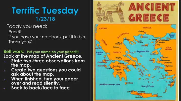
How does a mountain range affect a country’s agriculture? How does a mountain range limit government’s control? How did the citizens utilize the surrounding seas? How did the seas promote their economy? How did trade influence Greek culture?
Land was very rocky making agriculture difficult. Used seas as highways to link cities & regions for new ideas; fishing
Used seas as trade routes to get materials from others; trading introduced alphabet, coins, and products
Each city-state had their own culture based on their surroundings. Through trade, Greeks gained needed products and gained knowledge of an ABCs and use of coins.
21
Mountains made it hard to unify Greece under a single government so each city-state governed themselves.