SLIDE 1
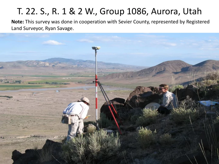
- T. 22. S., R. 1 & 2 W., Group 1086, Aurora, Utah
Note: This survey was done in cooperation with Sevier County, represented by Registered Land Surveyor, Ryan Savage.
SLIDE 2
Mogo survey – 1856 T 22 S, R 1 W
SLIDE 3
Mogo survey – 1856 T 22 S, R 2 W
SLIDE 4
SLIDE 5
Ferron survey – 1878 T 22 S, R 1 W
SLIDE 6
Breckon resurvey – 1896 T 22 S, R 2 W
SLIDE 7
Page & Swan survey and resurvey – 1897 T 22 S, R 1 W
SLIDE 8
Sylvester resurvey – 1967 T 22 S, R 2 W
SLIDE 9
SLIDE 10
SLIDE 11
SLIDE 12
Manual of Surveying Instructions 2009 Principles of Resurveys
5-6. Cragin v. Powell, 128 U.S. 691 (1888) - Upon the issuance of a patent for land by the Federal Government, it is just as if the monuments, survey plat, field notes, laws, regulations, and rules governing how to survey the land described in the patent, are attached to the face of the patent. The survey rules are spelled out in the manuals, circulars, instructions, and regulations issued by the GLO, and its successor, the BLM. In other words, it can be assumed that patents were issued upon the surveys made under the direction of the U. S. Surveyor General and a reference in a patent to the official plat and survey makes them a fully incorporated part of the patent.
SLIDE 13 Manual of Surveying Instructions 2009 Principles of Resurveys
5-5. The function of county, or other local surveyors, begins when the surveyors undertake the identification of lands that have passed from the Government into private
- wnership, based upon the description derived from the
- riginal survey. Their work should consist largely of
running and marking the subdivision-of-section lines and
- corners. However, by law, weight shall be given to locally
marked boundaries insofar as they are based on good faith reliance on evidence of the original survey and protect bona fide rights as to location of the boundaries of alienated lands.
SLIDE 14
Note: Due to numerous discrepancies between the existing Public Land Survey System records of the original survey and resurveys from 1856 to 1988, it is considered that portions of Tps. 22 S., Rs. 1 & 2 W., are either fictitious, fraudulent, or grossly erroneous beyond any tolerable limit. Local occupational lines, as determined by fences, roads, and other improvements, have been located in good faith by local surveyors and landowners for many years. Therefore, to protect the “bona fide” rights of the landowners by accepting these various lines of occupation as the best available evidence, a double set of corners is created in portions of this township.