SLIDE 2 JAXA’s Satellite pr
am
Targets (JFY) 2014 2015 2016 2017 2018 2019 2020 2021 2022 2023 2024
Disasters & Resources Climate Change & Water Cycle
- Water Cycle
- Climate Change
- GHGs
Technology Demonstration
Communications
Study On o rbit Missio n status:
[L and and disaste r mo nito r ing] [Ve ge tatio n, ae ro so l, c lo ud, SST , o c e an c o lo r] [CO2, Me thane ] [Wind, SST , wate r vapo r, pre c ipitatio n,] [Pre c ipitatio n 3D struc ture ] [CO2, Me thane , CO]
De velo pme nt
ALOS-2 / PALSAR-2 GPM / DPR GCOM-W / AMSR2 GOSAT /FTS, CAI GCOM-C / SGLI EarthCARE / CPR
[CO2
OM C / SG GLI G rth
[C
OM-C / SG Ear ALOS-3 (Optical) ALO A LO AL AL AL AL AL A ALOS-4 (SAR)
[Ve g ge g
GC CO CO C
[
GC G
cle
GC G
e
GP
e
G
e
G
[Clo ud and ae ro so l 3D struc ture ]
[19972015] [2012] GOSAT-2 [2009] GOSAT-3 OS ALO A LO O ALO ALO O ALO O ALO ALO O ALO LO O LO O ALO ALO ALO LO O ALO ALO O ALO LO O ALO O ALO O ALO LO LO LO ALO LO LO LO LO AL AL L AL L AL L AL L AL L AL AL L AL L AL L AL AL L AL L AL L AL A O A SLATS
(Supe r L
e st Sate llite ) (Wideband InterNetworking engineering test and Demonstration Satellite)
E xte nde d L ife Pe rio d
Japanese Data Relay System (JDRS) ETS-9 (Engineering Test Satellite No.9)
e
[1 TRMM / PR WINDS [2008] AMSR2’s successor sensor
GCOM-W (Water) “SHIZUKU”
*Extended Operation
GCOM-C (Climate) ater)
tion
OM-C (Cli “SHIKISAI” HIMAWARI-8 ALOS-2
3
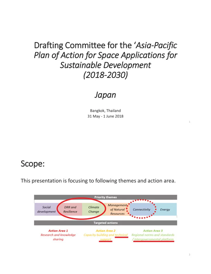
DRR and Resilience
4