
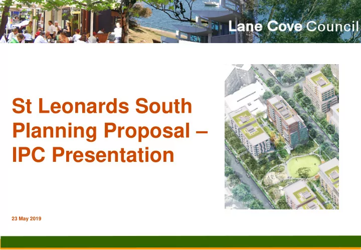
SLIDE 1
St Leonards South Planning Proposal – IPC Presentation
23 May 2019
St Leonards South Planning Proposal IPC Presentation 23 May 2019 - - PowerPoint PPT Presentation
St Leonards South Planning Proposal IPC Presentation 23 May 2019 Context Councils vision for St Leonards South is to create a liveable precinct by ensuring a holistic approach to housing while having regard to urban design, open
23 May 2019
Council’s vision for St Leonards South is to create a liveable precinct by ensuring a holistic approach to housing while having regard to urban design, open space, pedestrian and traffic movements. The St Leonards South precinct includes new open space, multi-purpose facilities, key worker housing, E-W accessible connections to create a vibrant new walkable community focussed on transit-
The precinct will also connect to existing public spaces & new spaces including Council’s over-rail plaza, ‘pilot project’ community benefits – which are delivering a new library, public car park, supermarket and public domain upgrades.
HIGH RISE TRANSITIONAL LOW LEVEL
Colours on buildings represent transitional built form
MEDIUM
KEY WORKER HOUSING
New Road New Local Park (0.38ha) New East-West Pedestrian Links New End-of-street Parks New Pocket Parks
Communal Private Open Space ‘Green Spines’ New Child Care Centre 450m2 & Community Facilities 150m2 New Child Care Centre 450m2 & Community Facilities 150m2
The planning of St Leonards South has been a 7-year journey of detailed, extensive research, workshops & public consultation. Jul 2012 – Mar 2014 – Stage One (Area Analysis) by planning & separate consultation consultants. Mid 2013 - St Leonards East of the Railway Line “3 Pilot Projects” begin Mar 2014 – Dec 2014 – Initiation of Stage Two (Master Plan) by multi-discipline consultant team – Planner, Urban Designer, Architect, including “Enquiry by Design (EBD) Workshop” held at over 3 days, initial community consultation + consultant research. Dec 2014 – Jul 2015 – Draft Master Plan completed and publicly exhibited with two community drop-in
October 2015 – Priority / Planned Precinct commenced by DoPE May 2016 – Sep 2017 – Planning Proposal submitted for Gateway Determination (this was granted in September 2016). Gateway Conditions were addressed and submitted to Department on 29 Sep 2017. Oct 2017 – Jan 2018 – Public exhibition of Planning Proposal & supporting documents. Finalisation deferred pending outcome of St Leonards / Crows Nest 2036. October 2018 – February 2019 – St Leonards / Crows Nest 2036 Plan placed on public exhibition.
A vibrant community” that “protects its past”.
Heritage
Casual surveillance & universal access principles
public and private domain. Heritage Items
A vibrant community” that “protects its past”.
No additional overshadowing
time periods for critical open spaces and surrounding low density residential areas (no shadowing of properties south side of River Rd).
consideration overshadowing and amenity of key public spaces, and opportunity for CBD views”. Consider wind impacts
by a wind impact statement along with Wind Impact Calculation rules and acceptance criteria.
A vibrant community” that “protects its past”.
A vibrant community” that “protects its past”.
The 2036 Plan - Vision St Leonards South Vision “A vibrant community” that “protects its past”.
Area-wide Movement Design Principles Area-wide Movement Design Principles Acknowledge key views & vistas such as key long-distance vistas
Key views and vistas shared where impacted. Enhance important heritage elements. Respects heritage building materials. No additional overshadowing of public open spaces and important places. Objective p49: “Minimise overshadowing of key open spaces, public places and adjoining residential areas.” Overshadowing is ADG-compliant Universal access principles. Accessible east-west pedestrian links and within Green Spines. Consider wind impacts. Draft DCP Wind impacts to be assessed.
An accessible place – An attractive and easy place to walk, cycle and move through, with improved local and regional connections.
An accessible place
lifts, refuge islands, wombat crossings, and pedestrian ramps).
St Leonards east of railway line.
River Rd (Wollstonecraft station) and of Pacific Hwy to Crows Nest station.
buildings.
An accessible place – An attractive and easy place to walk, cycle and move through, with improved local and regional connections.
Traffic Impacts
traffic impacts as ‘moderate’ and determined only minor network modifications would be required.
2036 which recommended “TfNSW and RMS undertake more detailed transport network modelling to analyse the impacts of the proposed land uses and development uplift …”.
included a satisfactory arrangements clause (to be levied on the residential component) that is commensurate with the draft SIC, Roads and Maritime would raise no further objection to the planning proposal proceeding prior to the St Leonards and Crows Nest Planned Precinct being finalised.”
An accessible place – An attractive and easy place to walk, cycle and move through, with improved local and regional connections.
The 2036 Plan - Vision St Leonards South Vision An easy place to move through, with improved local & regional connections. Improved active transport connections. Area-wide Movement Design Principles Area-wide Movement Design Principles Improvement of the walking & cycling network in the area. Facilitates the improvement and expansion of the existing walking & cycling network in the area by providing additional east-west and north-south connections within and surrounding the precinct. Help to connect to wider regional areas. Facilitates improved access to the rail and bus transport network to help to connect to wider regional areas. Identify opportunities to improve safety along existing pedestrian and cycling routes.
islands, wombat crossings, pedestrian ramps, blister islands, signage & signalised crossings).
Encourage use of public transport and reduce the need to use a private car.
north-east to two rail stations.
An accessible place – An attractive and easy place to walk, cycle and move through, with improved local and regional connections.
A home for people of all ages
Dwelling Types
dwellings between 19 and 4 storeys, including “some larger apartments and some ground floor/podium townhouses”, similar to 1- 13 Marshall Avenue.
each development to ensure diversity.
required to be economic, which excluded viability of Medium Density.
housing requirements which cater for older residents and persons with disability, which is in excess of general standards.
precinct.
A home for people of all ages
The 2036 Plan - Vision St Leonards South Vision “A greater mix of homes” for a “diverse range of people”.
Area-wide Movement Design Principles Area-wide Movement Design Principles A range of dwelling types
each development.
suitable for future dwelling diversity. Cater for all life cycles.
accessible, visitable and adaptable housing. requirements into new developments, to cater for older residents and residents with disability living.
facilities/child care in res. precinct. Investigate locations for a new primary & high school.
rounds of planning.. In overview, the Department supports Council's plans and their consistency with NSW policies ” (NSW Education).
A well-designed place – New buildings that model the highest quality design, respecting and enhancing the existing local character of the area.
character by providing ground and upper level setbacks to achieve a human scale at street level. New buildings of quality design
articulation, building width & orientation, solar access, roof gardens, ground floor balconies, etc. This was enhanced by a Design Review Panel investigation in 2018.
Stormwater Management
Respecting and enhancing existing local character
and building transition.
St Leonards / Crows Nest 2036 Transition
400m Walkability
A well-designed place – New buildings that model the highest quality design, respecting and enhancing the existing local character of the area.
character by providing ground and upper level setbacks to achieve a human scale at street level.
Control Provision Notes/Location Setbacks
To Canberra, Marshall, Holdsworth & Berry (1- 19) + east (21-23)
To Park (south)(23)
To Park (north) (21& 22)
River Road (20, 23 and 11) Separation As per ADG / SEPP No 65 Transition
Facing River Rd Facing Park Rd Park Rd Separation
A well-designed place – New buildings that model the highest quality design, respecting and enhancing the existing local character of the area.
character by providing ground and upper level setbacks to achieve a human scale at street level.
The 2036 Plan - Vision St Leonards South Vision New buildings of quality design. DCP addresses architectural features such as setbacks, articulation, building width & orientation, solar access, roof gardens, ground floor balconies, etc, enhanced by a Design Review Panel investigation in 2018.. Respecting and enhancing existing local character in the area. Respects adjacent low-rise development by exceptional setbacks and enhances the existing urban high-rise Pacific Hwy character. Area-wide Movement Design Principles Area-wide Movement Design Principles Cumulative impacts of overshadowing, wind impacts & view loss. Standard practice requires that each impact of the proposed development is assessed against whatever conditions (of solar access, of wind, of views) have accumulated as a result of other developments in the vicinity. In transition areas between low & high-rise developments, new development should consider the prevailing scale & existing character in the design of their interfaces The draft St Leonards South DCP measures ensure a transition to adjacent lower density residential areas along Park Road and along River road (see next slide). New building design should provide high on-site amenity & consider street width & character by providing ground & upper level setbacks & awnings to achieve a human scale at street level. DCP establishes setbacks that soften impacts on the streetscape. A 10-metre ground level setback has been provided for on River Road and majority of Park Road.
A well-designed place – New buildings that model the highest quality design, respecting and enhancing the existing local character of the area.
character by providing ground and upper level setbacks to achieve a human scale at street level.
A greener place
A Greener Place
significantly more public and communal open space than is presently available; existing trees are either preserved or replaced by locally indigenous species.
‘Suburban’ area of the precinct achieves the target of 40% across public and private land. New Street Trees
particularly where currently in poor condition (eg. east side of Park Road, Berry Road, west side of Canberra Ave) in association with the undergrounding of power lines.
A greener place
A Greener Place
Land to ensure maximum preservation of canopy.
setback zones;
development sites.
including the local park and along pedestrian links
including the north-south green links, pocket parks, and along pedestrian links.
A greener place
A place” in which to be “active, creative and enjoy
A greener place
A place” in which to be “active, creative and enjoy
new open space within the SLCN 2036 (1.66ha out of 2.3ha), yet 35% of dwellings.
has 0.19, Epping PP 0.12, Waterloo 0.07
planning seeks 9% of site area, with up to 360 dwellings p/ha.
as open space, with 258 dwellings p/ha.
provide an additional 5,000 m2 of new
OPEN SPACE Status DoP Category Area of Open Space (m2) Precinct Area ha.
Precinct % of Precinct Ha/1,000 population Local - Central Park New Park 3,804 4,800 Pocket Park - Marshall Ave west New Park 424 Pocket Park - Marshall Ave east New Park 1,260 Pocket Park - Holdsworth south end New Urban 1,279 Pocket Park - Berry south end New Urban 1,040 East-west pathway link New Linkage 2,358 Subtotal
10,165 7.48 4,800 14% 0.21
Newlands Park Existing Park 10,120 Duntroon 430 Propsting Park Existing Park 900 Marshall 670 Subtotal
21,185 9.81 5,900 22% 0.36
Gore Hill Oval Existing Park 33,000 Oval Subtotal
54,185 13.11 5,900 41% 0.92
A greener place
A place” in which to be “active, creative and enjoy
communal private open space for each ’pod’.
Spine’ space via reciprocal rights-of-way.
gathering, seating and play areas
commend the plan’s innovative response to ensuring quality public and private open space in what will become a high density residential precinct”.
A greener place
The 2036 Plan - Vision St Leonards South Vision
“A greener place” Increased canopy cover, open space, landscaped pedestrian links & pocket parks. A place” in which to be “active, creative and enjoy” Increased open space
Area-wide Movement Design Principles Area-wide Movement Design Principles
“Incorporate new street trees to improve the overall tree coverage in the area.” Draft Green Plan supports SLS canopy protection enhancement. Most principles specifically relate to areas within North Sydney LGA. Though not directly applicable to SLS, Council’s plans are not inconsistent with achieving these principles.
Canberra Ave to Greenwich Rd: 5,000 dwellings (10,000 residents). Park Rd ultimately selected.
Space), traffic, parking and lack of information.
Privacy
Transition
2016 Growth 2036 Hornsby 170,563 28,350 17% 198,913 Hunters Hill 14,741 1,350 9% 16,091 Ku-ring-gai 122,859 31,000 25% 153,859 Lane Cove 35,959 14,900 41% 50,859 North Sydney 72,618 19,600 27% 92,218 Ryde 117,171 51,700 44% 168,871 Willoughby 76,364 13,300 17% 89,664
at 2.02 p/dwell,(2016 Census), approx. 7376 dwellings.
DoPE forecast is for 2,623 dwellings to be delivered.
target will be a similar scale (1900).
Housing Strategy required by the EP&A Act.
created via planning strategies .. the LGA has the potential to exceed a 6-10 year target .. we recognise the additional capacity .. will be counted towards .. a 10-year target.”
attributes that make local areas suitable for housing supply beyond 10 years. These attributes include proximity to transport interchanges and strategic and local centres.”
conditions for residential development within strategic centres and within walking distance (up to 10 mins)”
the EP&A Act does not provide for an LEP to include timed/staged rezoning.
South Road emanating from the railway line. East West would lead to overshadowing.
Berry Rd to Park Rd in 2015. This boundary could be readjusted, however this would impact:-
buffer to the heritage items; and
facilities and other infrastructure from s7.11 levy.
residents caused by proximity to ongoing construction.
above the current cap (up to $16,300) to fund local infrastructure identified through its studies – this is higher than the SLCN 2036 SIC ($15,100).
confirms that the proposed development levels do not warrant additional regional or district infrastructure as supporting infrastructure is to be provided as part
Feasibility testing report confirms:-
St Leonards South character area were purchased at prices reflective of proposed planning controls … prior to announcement of a proposed SIC.”
announcement of the Study Area as a Planned Precinct”, therefore should not be retrospective.
Item Total Land Acquisition Local Park $30,047,500 New Road ( Park Rd - Berry Rd link) $7,520,460 Sub Total $37,567,960 Works Local Park $2,953,366 Pocket Parks $1,367,206 Fit-out to community facilities $2,808,000 Berry Road $2,793,707 Holdsworth Avenue $2,590,511 New Road $983,991 Canberra Ave and Duntroon Ave works $1,601,520 Park Rd and Marshall Ave works $877,239 Sub Total $15,975,540 Total $53,543,500
(2:1), zoning map will be from R2 to R4, with no change to the height and FSR.
incentive height & FSR for each site, in return for public benefits:- – Settlement Pattern Consolidation – Public Infrastructure (Facilities, paths and Key Worker Housing) – Compliance with Landscape Masterplan incl Green Spines
incentives will be included in Council’s Draft DCP.
amount of key worker housing that can be included while still keeping within Council’s bonus building heights & FSR's (floor space ratios) depicted for nominated sites in the proposed LEP.
dedicated to Council for use in perpetuity.
Frequently Asked Questions
Yes, consideration was given to the whole precinct being rezoned as one of the options. However, there are a number of reasons why the current Master Plan recommended containing development to the eastern part of the precinct:
the area next to the train station specifically between Canberra Avenue and Berry Road (eastern side). The clustering of high densities around railway stations is supported by the State Government and is a key planning principle of NSW Planning & Environment.
houses, reflective of the precinct’s housing typology and not make it a solely high density precinct.
regard to relevant factors.
rezoning – this would result in inequitable sale prices for residents; either do it all at once or don’t do it”. Within the subprecinct being rezoned there will be no separate timeframes set.
around the station. The result may be an oversupply of dwellings released at one time (due to no staging), this may decrease unit
those in Canberra or Holdsworth Avenue area. The frontages are generally 12 metres or less west of Berry Road, compared with 15 metres east of Berry Road. The minimum site area in Lane Cove required for residential flats is 1,500 m2 (or approximately 3 lots of 500 m2 each). Generally the smaller the lots are the more number of properties a potential developer has to amalgamate to achieve the minimum site area for residential flats. In turn, this may affect the potential financial viability and/or timing of any proposed development which goes against the principles of the draft Master Plan. Given the existing subdivision pattern this would also increase the potential for isolated sites to occur.
Frequently Asked Questions
influencing whether to use the road or laneway as the boundary. For example using a lane (Park Lane) as the boundary of high density development is not recommended, having regard to issues of overlooking etc, as it would result in potential blocks of flats (8 storeys tall) close to the rear gardens of low density homes that are not proposed for rezoning, with less separation distance between buildings across Park Lane in contrast to the wider Park Road. If the boundary is Park Road, flats would be facing front gardens and street trees.
access to residents. Potential building construction traffic would significantly impede rear lane access. It would be difficult to sell a lane for a green spine due to the lane’s use for access to other properties.
increase in potential overshadowing to that green space, houses and their rear gardens as well as reduced amenity.
proposed building on the other side will also be set back an additional 4 metres, landscaped and screened with large mature trees, so that a larger separation distance of around 30 metres would be achieved. Additionally any proposed building would need to be carefully articulated.
consideration is to be demonstrated with potential designs.
create the need for one or more new public schools in St Leonards. The draft Master Plan originally considered a possible indicative location for a new public school in the various options within the precinct.
upgrades to Greenwich Public School as part of their strategy to deal with growth.
which is currently being explored as part of the St Leonards/Crows Nest Station Investigation Precinct work.
requested during the informal consultation period), a minimum FSR of 2.5:1 was recommended by the review.
Environmental Planning Policy No. 65 amenity levels. To be eligible for the FSR and height increase each development will need to comply with the preferred land amalgamation pattern and draft Landscape Master Plan (for private and public open space). Further incentives are available to select sites closest to the St Leonards Station if they dedicate public open space, multi-purpose facilities (child- care centres and community halls), key worker housing, and efficient pedestrian and traffic circulation.
Frequently Asked Questions
Frequently Asked Questions
proposed subject to the dwelling numbers being finalised in the Plan.
been independently reviewed by TEF consulting.
subject to traffic measures being undertaken. Any further increase beyond 2,800 new dwellings would require significant traffic and infrastructure upgrades.
Transit-Orientated Development (TOD). Such developments require densification of areas centred on a transit hub (can be train, bus or
while achieving a high level of sustainability and amenity. Examples have been included in the Stage 2 report.
is contained in Council’s Cumulative Transport and Accessibility Study.
Park Road.